Hiking isn’t only about reaching the summit. It’s the walking that matters. The longer you go, the more there is to see: the changing scenery, historical sites, people. Together, they become the story of a journey. This is the charm of walking long trails –– not only along packed dirt and forested paths but also paved roads connecting villages and towns that are a window into a region’s history, culture and way of life. You’ll find plenty to stimulate the senses along the pilgrimage trails, ascetic paths and old trade routes that make up 68 of the long trails around Japan.
HOKKAIDO AREA
Mashu Kussharo Trail (50 km)
Prefecture: Hokkaido
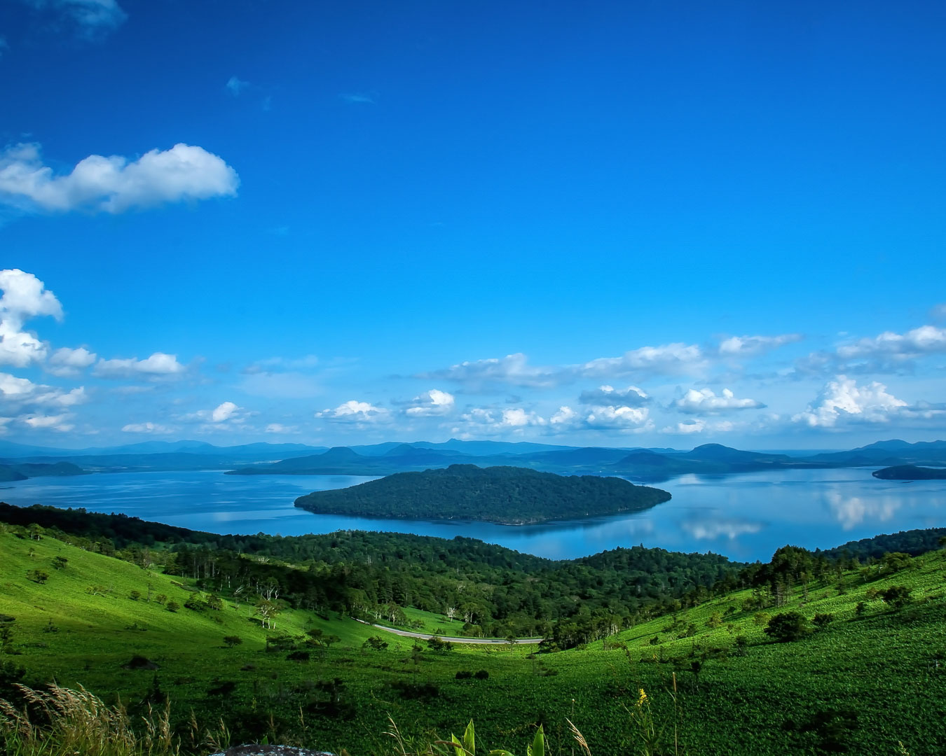
Located in Akan Mashu National Park, on the eastern side of Hokkaido, the Mashu Kussharo Trail winds past two caldera lakes, Lake Mashu and Lake Kussharo. Although scenic Mt. Mokoto and Mt. Mashu are nearby, they are not on this route. Instead, you’re in for a leisurely walk with stunning views of the lakes and lava domes. You’ll come across natural hot springs, lakeside campsites, small towns where you can grab a hot meal and an indigenous Ainu settlement, Kotan village. Be sure to keep an eye for resident birds, from black woodpeckers and long-tailed tits to eastern crowned warblers, as well as Eurasian red squirrels and red foxes. With minimal elevation changes and towns and train stations along the way for restocking supplies, this long trail is ideal for beginners.
The big sky and variable landscapes unique to Hokkaido, combined with an easy-to-walk path that has minimal ups and downs, make this trail a memorable experience. There are so many viewing spots worth stopping for that it’s hard to pick favorites. Camping at the hot sand baths of Sunayu, on the shore of Lake Kussharo, is unforgettable: You dig a hole to make your own natural hot spring or footbath. And at night, the reflection of the stars on the lake will make you feel like you’re in outer space. Nishizawa Shoten, a liquor store in Kawayu Onsen, where we stopped for a cold beer, was an oasis on a hot day. (Yamatomichi HLC Hokkaido Ambassador, Yoshitaka Toge)
Hokkaido Nature Trail (4,286 km)
Prefecture: Hokkaido
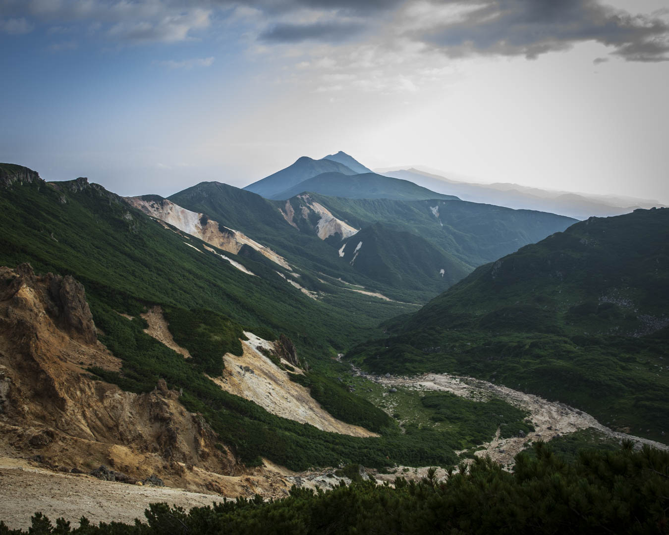
The Hokkaido Nature Trail, under development since 2003, will stretch a total of 4,585 km once it’s completed. The trail consists of 23 segments spread throughout Hokkaido routes, but there is no single, continuous path. While not all routes are currently walkable, the trails that are open wind through Hokkaido’s vast forests, wetlands, farms and meadows. Sightings of brown bears and Asian black bears have been reported in remote and residential areas, and hikers are advised to stay cautious even near roads and towns.
TOHOKU AREA
Michinoku Coastal Trail (1,200 km)
Prefectures: Aomori, Iwate, Miyagi, Fukushima
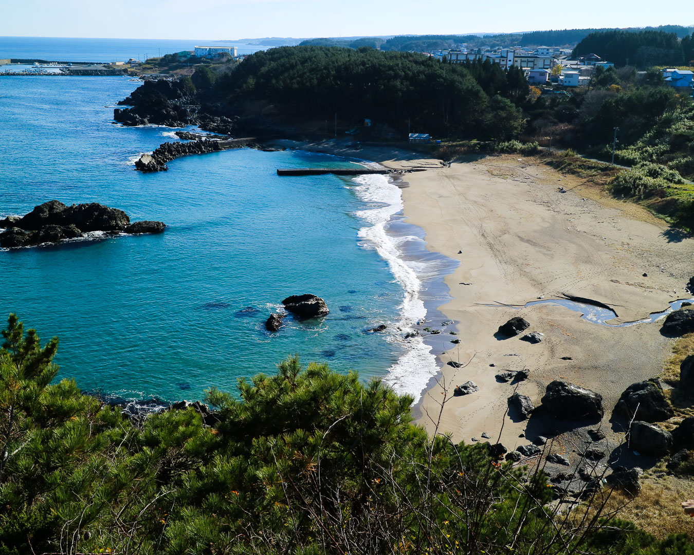
After the Great East Japan Earthquake in March, 2011, the Ministry of the Environment came up with a plan for the Michinoku Coastal Trail, a project designed to help with the region’s recovery. The original route, opened in 2019, extends along the Pacific coast from its northernmost point in Hachinohe city, Aomori prefecture, to its southernmost point in Soma city, Fukushima prefecture. A new section, completed in 2023, adds 200 km of trails in Fukushima prefecture, linking Shinchi town to Iwaki city. Along the trail, hikers get a glimpse of the disaster zone: fishing villages and towns that were devastated by the tremors and tsunami but have since bounced back. The Michinoku Trail Club sells hiking map books and data books covering the trail’s 10 sections and containing information on routes, toilets, water stations, resupply points and restaurants. The club’s website also has online maps and GPX data.
This trail features rural villages and towns where hikers can experience the coastal Sanriku region’s natural beauty. Much of the trail is hilly, traversing the rugged coastline and inhabited wilderness areas (satoyama), and cutting through towns offering accommodations. The Fukushima Coastal Trail overlaps in part with the Michinoku Coastal Trail and isn’t yet covered by the Michinoku Trail Club’s data book –– an opportunity for discovery for adventurous hikers. (Yamatomichi staff, Yuko Tsunoda)
KANTO AREA
Gunma Ridge Trail (100 km)
Prefectures: Gunma
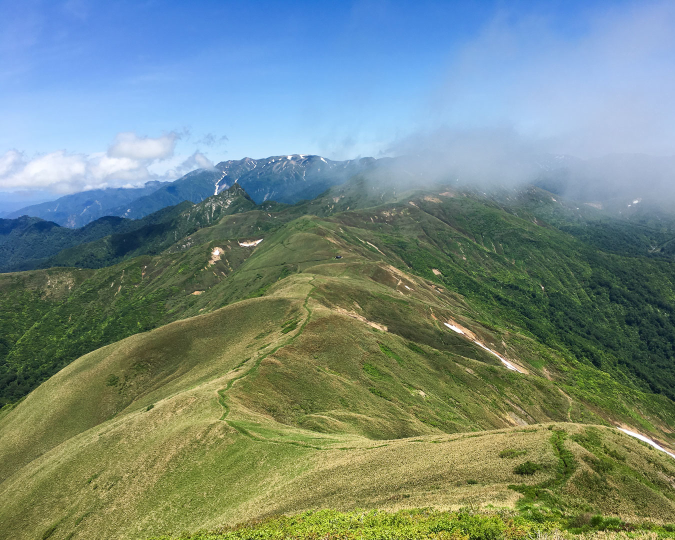
A popular long trail among seasoned hikers, the Gunma Ridge Trail traverses the mountains that border three prefectures: Gunma, Niigata and Nagano. The route –– famous for its long stretches without paved roads –– runs from the Doai area of Minakami town to Torii Pass in Tsumagoi village, over steep mountains 2,000 m high. The trail is divided into five areas: Tanigawa, Mikuni/Shima, Nozori Lake, Kusatsu-Shiga Highlands and Manza/Kazawa. The trail cuts through technically challenging terrain, including on Mt. Tanigawa’s ridge, which requires a high level of experience and endurance to scale. Along some sections, there are no alternate routes, so careful planning and preparation are essential. Near the Kusatsu-Shiga Highlands and Manza-Kazawa areas, you’ll find many hot springs for a long, well-deserved post-hike soak.
Website (only in Japanese)
Hitachinokuni Long Trail (105 km)
Prefectures: Ibaraki
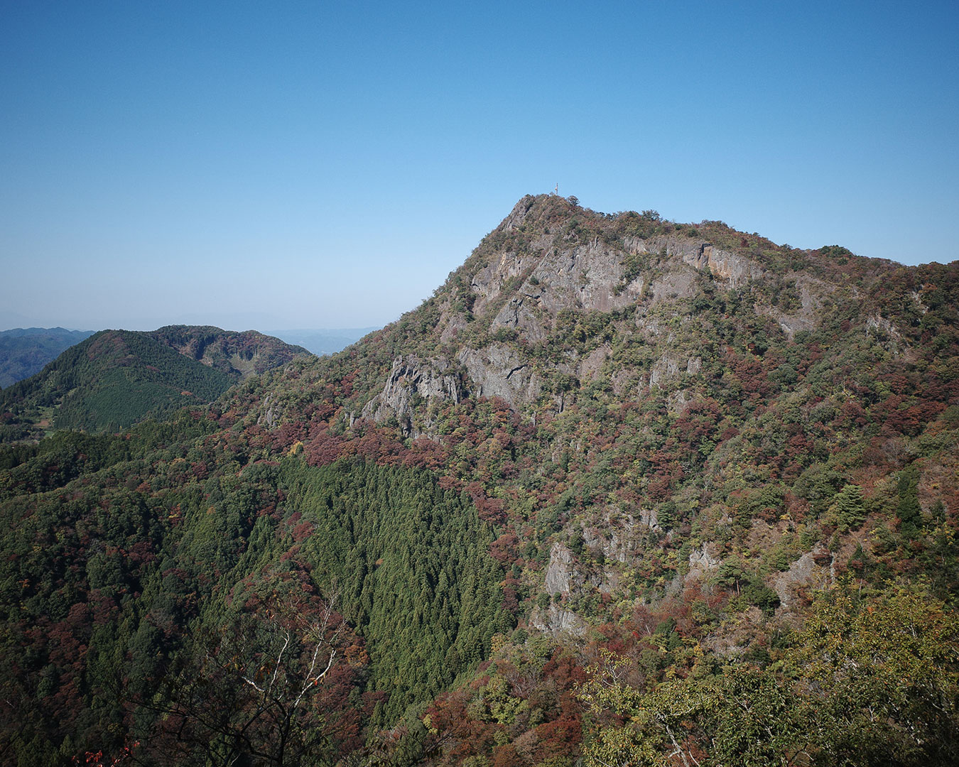
The trail cuts through gorges, foothills, farms and tourist areas in six cities and towns in the northern part of Ibaraki prefecture. Originally opened as the Ibaraki Kenpoku Long Trail, the route has since been renamed and a new extension, now under construction, will triple the length of the route to 320 km by 2026. Ibaraki prefecture bills the trail as a loop through satoyama (rural communities that practice sustainable management of rice paddies, ponds, mountains, woods and meadows) and natural landscapes, and it includes many steep ups and downs. The Ibaraki Kenpoku Long Trail Cooperation Team, an organization of volunteers from local communities, leads trail development, maintenance and preservation.
Although the mountains on this trail are no higher than 500 meters in elevation, the constant ups and downs present a challenge for hikers of all levels. The first sections opened in 2021, winding past waterfalls and coastal vistas. Chance encounters with local residents are a unique feature of the satoyama experience, so don’t be shy! (Yamatomichi Zaimokuza store manager, Hidenori Maehara)
KANTO/CHUBU/KANSAI AREA
Tokai Nature Trail (1,697.2 km)
Prefectures: Tokyo, Osaka, Kyoto, Kanagawa, Yamanashi, Shizuoka, Aichi, Gifu, Mie, Shiga, Nara
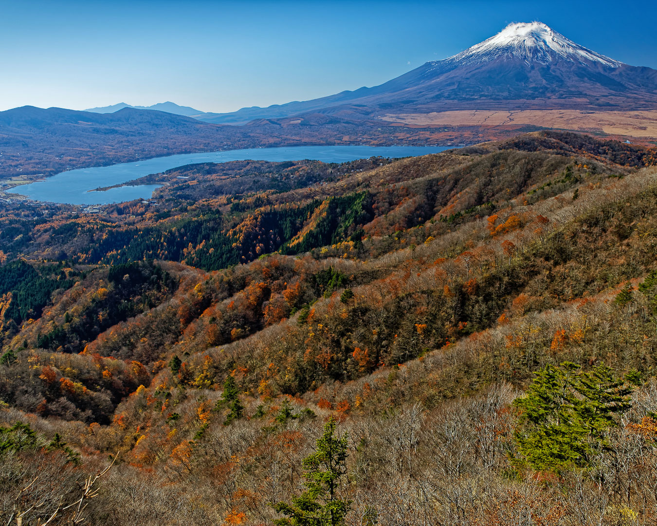
The Tokai Nature Trail –– spanning one metropolis, eight prefectures, and two urban districts –– holds the distinction of being Japan’s first long-distance nature trail. It links two quasi-national parks, Meiji no Mori Takao in Tokyo and Meiji no Mori Mino in Osaka. The idea for the trail dates back more than a half century to 1969, when an official at Japan’s Ministry of Health and Welfare visited the Appalachian Trail in the US and wondered why Japan didn’t have something similar. First developed within the borders of national and quasi-national parks, the trail opened in 1974 and was promoted as the modern equivalent of the medieval Edo Period’s Tokaido 53 Stations, one of five major roads from Edo (now Tokyo) to Kyoto. Though the Tokai Nature Trail is not rooted in history, the route passes close enough to old battlegrounds, landmarks and post towns to make it a worthwhile trek for history aficionados.
For hikers living in the Kanto region, the Tokai Nature Trail is a familiar presence. I often pass by its signposts around Mt. Takao, the Tanzawa mountains and Mt. Fuji. Even when I’m traveling to Kyoto or Mie, I stumble upon the trail’s signs –– a reminder that these faraway places are also on the route! There probably aren’t many hikers who have walked all 1,700 km, but those of us living near the route in the Kanto, Tokai, Chubu and Kansai regions are quite fond of it. On my first visit to the forest in Mino, Osaka prefecture, I felt a sense of awe when I saw the stone pillar marking the starting point of a trail that stretches all the way to Mt. Takao. Someday, I hope to walk the entire trail. (Yamatomichi Lab researcher, Takahiro Watanabe)
CHUBU AREA
Shin-Etsu Trail (110 km)
Prefectures: Nagano, Niigata
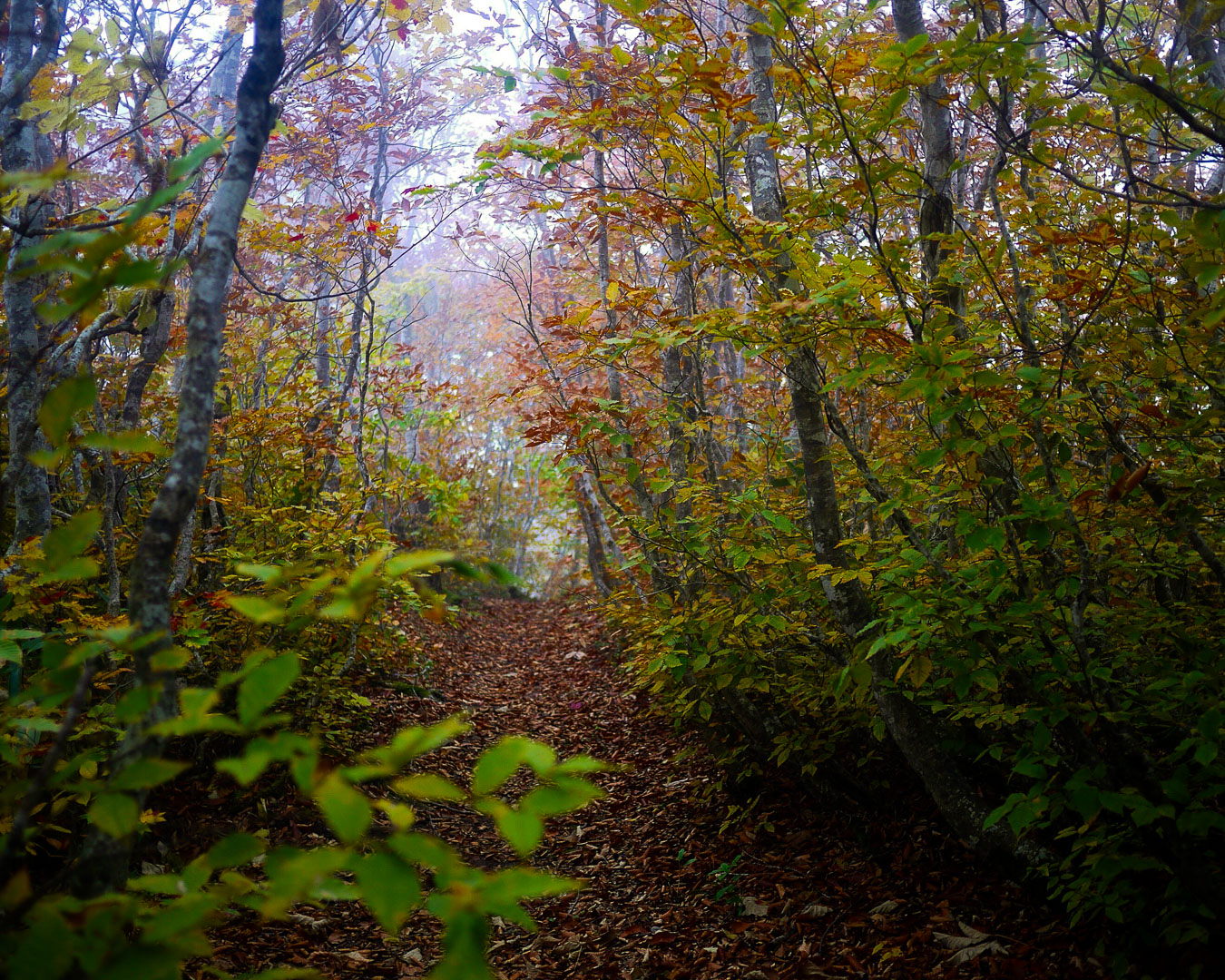
Stretching 110 km from Mt. Madarao in the west to Mt. Naeba in the east, this long trail was spearheaded by Noriyoshi Kato, a pioneer in introducing long trails to Japan. Kato worked tirelessly to open the trail, a model for building a long-distance hiking culture and sustainable management system. The trail features pristine beech forests found in regions with heavy snowfall and the secluded Akiyama-go villages. Its forests, vibrant and green in summer, are a cacophony of reds, oranges and yellows in autumn. Designated campsites are well-maintained, and services like shuttle pickups from partner lodges to trailheads make it easy for hikers to plan their journeys.
I walked the trail 10 years ago, before the extension to Naeba, and again this November, covering one section from Mt. Madarao to Nozomi Lake after reaching it from the Amatomi Trail, starting at Nagano Station. I noticed significant improvements: markers and campsites are well-maintained markers, and the trail website has more comprehensive information. These changes have made the trail much easier to navigate, a testament to the ongoing efforts of the trail’s management organization. Before the extension, the trail felt a bit monotonous with little variation in altitude and scenery. But now, with the addition of sections that pass through the Akiyama-go villages and ascend Mt. Naeba, the trail has become much more appealing. Combined with the Amatomi Trail, which connects to the starting point at Mt. Madarao, the expanded route offers more diverse landscapes and flora, giving it the bona fides of a long trail. (Yamatomichi Journals, editor-in-chief, Masaaki Mita)
Utsukushigahara Kogen Long Trail (45 km –– 90 km, including Shinonome no Michi)
Prefectures: Nagano
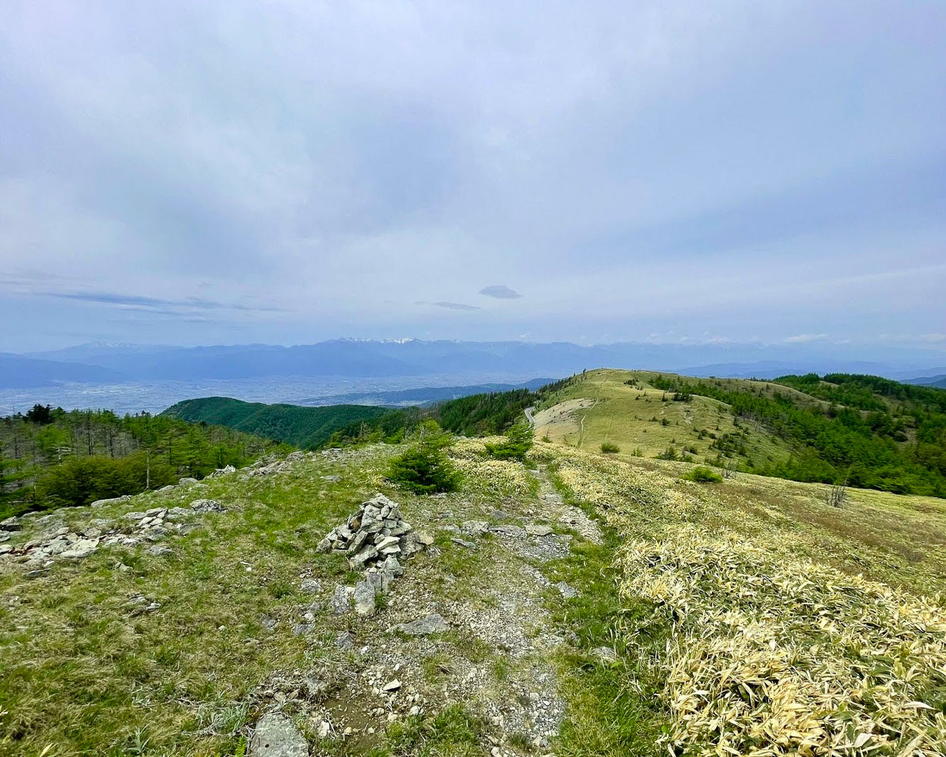
This 45 km trail, which takes its name from the Utsukushigahara highlands (Matsumoto city, Nagano prefecture), features moss-covered forests and ridgelines with panoramic views of Japan’s Alps. Despite its short distance, the mountains of the Yatsugatake Chushin Kogen Quasi-National Park offer challenging ups and downs that make it a rewarding hike. By combining the trail with the Shinonome no Michi route –– which runs between Shiojiri city and Matsumoto city’s east side and connects the trail’s start and end points at the base of the mountains –– you can complete a loop. Starting in the foothills, you’ll soon enter the ridgeline of Utsukushigahara, where you’ll be treated to views of the Northern and Southern Alps, Mt. Fuji and the Yatsugatake Mountains. While access isn’t easy, there are several hot spring towns in the foothills, and Matsumoto is nearby. There are no campsites or lodges along the route, though those sites are expected to be developed at some point. Near the highlands is 38-km Kirigamine-Utsukushigahara Central Watershed Trail, which runs along the ridge between the Utsukushigahara lava plateaus and Mt. Kirigamine –– the watershed divide between the Sea of Japan and the Pacific Ocean. Beyond Mt. Kirigamine, the Yatsugatake mountain range continues, offering the option of a multi-trail journey.
In late July, I walked 52 km over two days, starting from Mugikusa Pass in North Yatsugatake and connecting sections of the Kirigamine-Utsukushigahara Central Watershed Trail. The trail took me past Daimon Pass (near Shirakaba Lake), Yamagahara Marsh, Wada Pass (on the historic Nakasendo route) and Tobira Pass until I arrived at Yamamoto Hut (reservation-only), which overlaps with part of the Utsukushigahara Kogen Long Trail. The route had so many pleasant spots, and the stunning scenery –– particularly the Utsukushigahara highlands –– reminded me of the Alps in Europe. There are no tent sites, so I recommend looking for and staying at campsites that you can only reach by veering off the trail. (Yamatomichi Zaimokuza store staff, Oji Sonoda)
KANSAI AREA
Kumano Kodo (1,000 km)
Prefectures: Wakayama, Mie, Nara
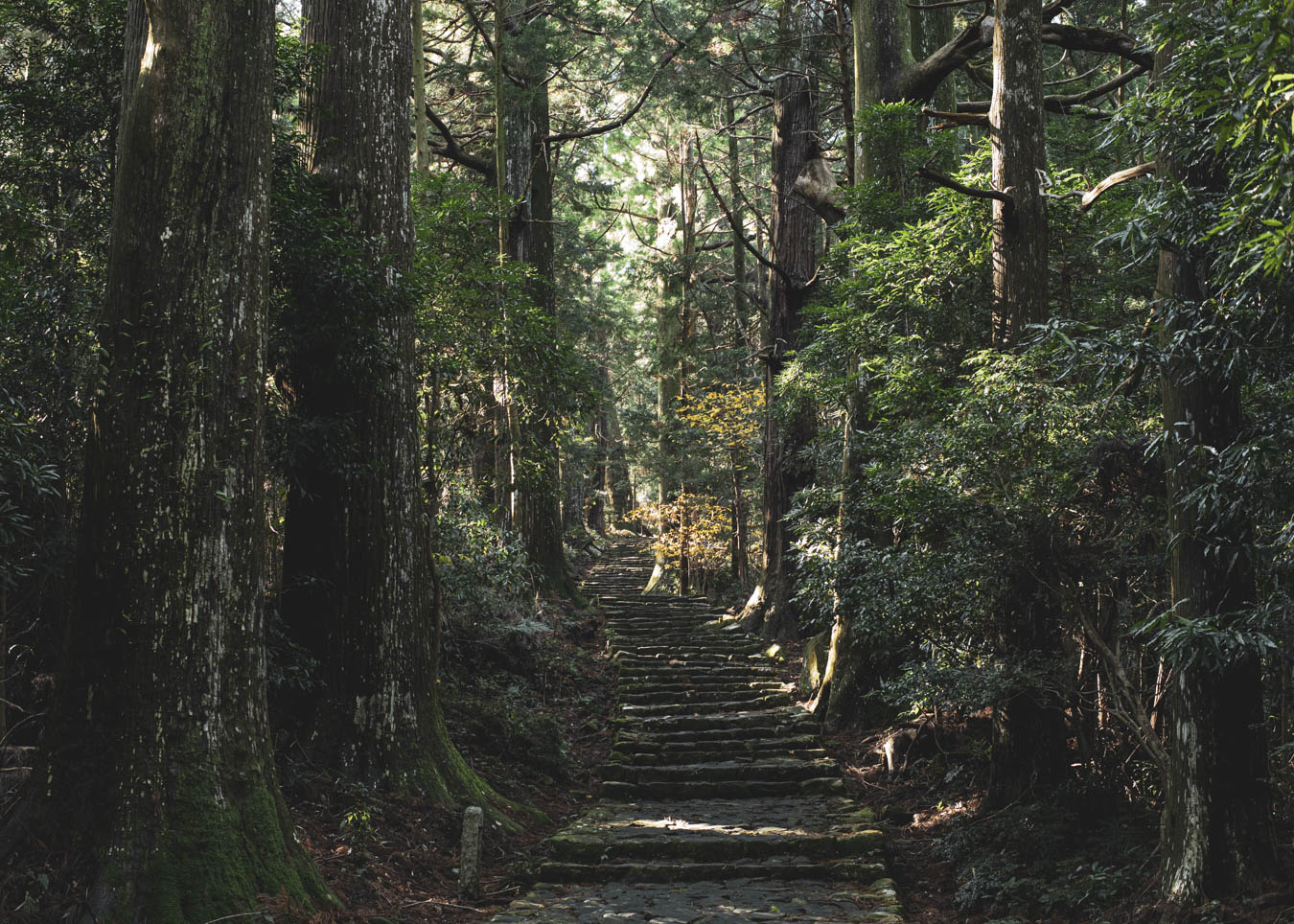
The Kumano Kodo, on the Kii Peninsula, in Wakayama prefecture, is a network of pilgrimage routes connecting the sacred shrines and temples that are known collectively as Kumano Sanzan –– Kumano Hongu Taisha, Kumano Hayatama Taisha and Kumano Nachi Taisha shrines and Seiganto-ji and Fudarakusan-ji temples, all part of a UNESCO World Heritage site. This is a popular long trail, admired for its deep forests and historical significance as a pilgrimage route for believers who fused Shintoism (Japan’s ancient nature worship) and Buddhism. There are six main routes: the Kohechi route that links Koyasan with Kumano Hongu Taisha, the Nakahechi, Ohechi, Iseji, Kiji routes, and the Omine Okugake route, which is a Shugendo (mountain asceticism) path linking the Kumano Sanzan. (There’s debate about whether the Omine Okugake route belongs on this list.) Pilgrims visiting the Kumano Sanzan are known to undertake a journey called Kumano-mode. During the Heian period, lasting from 794 to 1185, many pilgrims spent a month walking the Nakahechi route for the 600-km round trip journey from Kyoto, the capital, to visit the three Kumano Sanzan shrines. Each route has its own charm.
The Kumano Kodo is a captivating walk. The Kohechi route passes over mountains higher than 1,000 m and through many villages. Walking through these settlements feels like stepping back in time. One highlight: the stunning satoyama landscape of Hatenashi village (population: fewer than 20), with its narrow dirt and stone-paved paths, rice paddies and views of the surrounding mountains (hence, its moniker tenkū no sato, or Village in the Sky). The Omine Okugake Trail, known for its role in Shugendo, is rooted in the Shinto-Buddhist tradition. Along this route, I have encountered people in mountain huts offering prayers through Goma, a Buddhist ritual burning signifying ridding oneself of worldly desires and suffering. The Shaka Nyorai statue (made of a single piece of Japanese nutmeg wood) atop Mt. Shakagatake, appearing suddenly above the ridgeline, left me wondering how it was built in such a remote place. And the moss-covered forests around Mt. Omine (also known as Sanjo-gatake, the birthplace of Shugendo, a mountain asceticism practice) took my breath away. Which is to say there are countless sights and sites, not just the Kumano Hongu and Tamaki Shrine, to stop and admire. Near Kumano Hongu, soak in the hot springs at Kawayu Onsen and Yunomine Onsen to ease the fatigue. (Yamatomichi HLC Kansai Ambassador, Yuji Nakagawa)
Kyoto Trail (132.7 km, including the Keihoku course)
Prefecture: Kyoto
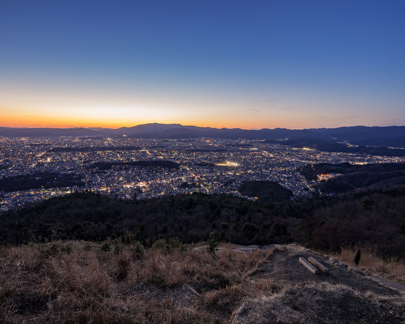
This 132.7-km trail winds through the mountains surrounding Kyoto city. Roughly 84 km of the route covers the trail’s western, northern and eastern sections –– Higashiyama, Northern Higashiyama, Northern Nishiyama and Nishiyama. The remaining 48.7 km is a loop course in the Keihoku region, northwest of the city. The trail passes some of the city’s famed landmarks: Fushimi Inari Taisha, Arashiyama, Saihoji (also known as Kokedera, or Moss Temple), Mt. Hiei, Kurama and Daimonji. The trail’s mountains, forests and streams offer a tranquil backdrop that contrasts with the bustling heart of the city. Trailheads are easily accessible from the city’s edges, and many hikers rely on the city’s public transportation network to combine nature walks with visits to temples and restaurants.
I walked the Kyoto Trail in early summer 2022. It was an ambitious, 150-km round-trip journey, starting from Fushimi-Momoyama station (south of Kyoto Station). I looped east, along the Higashiyama, Kitayama and Nishiyama sections in the scorching heat until I reached Saihoji (Moss Temple), near Kami-Katsura station, before retracing my steps to finish at Fushimi Inari Taisha. The walk, which took about 40 hours, was intense, and I remember every landmark. The trail is well-marked, passing through tourist sites as well as rustic towns and forested areas. The northern sections, where public transportation is limited, offer many hidden gems that can only be reached on foot. (Yamatomichi Lab researcher, Takahiro Watanabe)
Takashima Trail (80 km)
Prefecture: Shiga
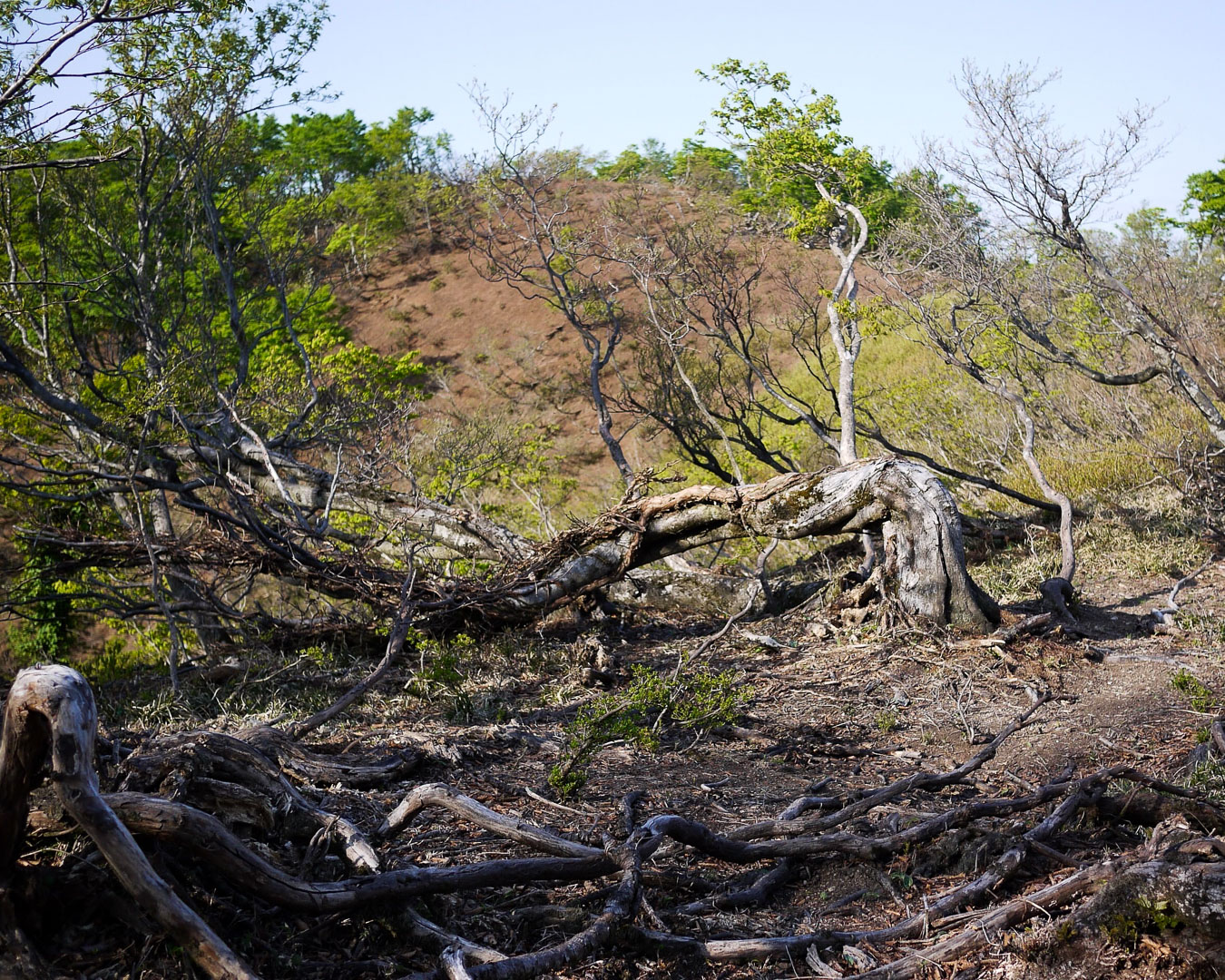
The Takashima Trail, in Takashima, Shiga prefecture, traces part of Japan’s watershed dividing line between the Sea of Japan and the Pacific and includes sections that were once vital for transporting essential goods. Today, the path offers hikers scenic views of Lake Biwa and Wakasa Bay as well as rejuvenating walks through lush forests. Though relatively short, this trail is challenging and should not to be underestimated: roughly 8,000 m of cumulative elevation gain and few spots to fill up on water. There are no designated shelters or tent sites, and anyone planning to camp should use nearby campgrounds or roadside sites. The Takashima Trail intersects with the Saba Kaido (Mackerel Highway), a 70-km path from Fukui to Kyoto that was once a major transport route for seafood from Wakasa Bay to Kyoto.
The Takashima Trail is a popular year-round hiking destination in the Kansai region. From the ridgeline, hikers can take in views of Lake Biwa to the south and the Sea of Japan to the north. Watching the sun rise over Lake Biwa is especially stunning. Casual hikers can tackle the trail in sections. If you’re planning to hike the entire 80-km trail, you will encounter alpine grandeur as well as steep, rugged ascents and descents that will test your strength and endurance. The trail’s rich flora and history made this a memorable hike for me. For anyone who wants to explore more of the country’s watershed ridgeline, the trails to Kyoto and Fukui are a good place to start. (Yamatomichi Kyoto store staff, Akihiro “George” Yamamoto)
CHUGOKU-SHIKOKU AREA
San'in Kaigan Geopark Trail (230.9 km)

Prefectures: Kyoto, Hyogo, Tottori
Sea caves, granite cliffs, sand dunes and rare plants like the aquatic flowering Ranunculus nipponicus are among the defining features of the coastal San’in Kaigan Geopark (designated as a UNESCO site in 2010). The park’s trail is divided into 27 sections, each with a nearby train or bus station for easy access. Other long trails trace the shoreline in Japan, but only the San’in Kaigan Geopark has earned a special designation for its geologically importance. The area’s granite outcrops formed before the archipelago broke off the Asian continent 70 million years ago and the 16-km-long coastal Tottori Sand Dunes are the largest of any on Japan’s coast.
Ishizuchi Long Trail (80 km)

Prefectures: Kyoto, Hyogo, Tottori
Shikoku’s first long trail traverses the mountains along the border of Ehime and Kochi prefectures, over some peaks topping 1,500 m. The landscape morphs as you walk the route from Mt. Higashi-Akaishi to Mt. Sasagamine, Mt. Iyo-Fuji and Mt. Ishizuchi. The trail’s 10 sections showcase the rocky ridges of the Akaishi Mountains, Kamegamori’s dwarf bamboo and the chain climbs of Mt. Ishizuchi, western Japan’s highest peak.
The Ishizuchi Long Trail is a panoramic route extending east to west along Shikoku’s highest ridge. It features rocky ridges, dwarf bamboo fields and beech forests, as well as views of the Seto Inland Sea and Pacific Ocean. The Akaishi mountain range tops my list of personal favorites in Shikoku. Its alpine landscape, stunning views from Mt. Nishi-Akaishi and campsite at the historic Dozan-mine mountain hut combine for an unforgettable experience. Mt. Ishizuchi, spotted from Kamegamori, is a world-class spectacle. (Yamatomichi HLC Shikoku ambassador, Tetsu Kanno)
Shikoku 88 Temple Pilgrimage (1,400 km)
Prefectures: Tokushima, Kochi, Ehime, Kagawa
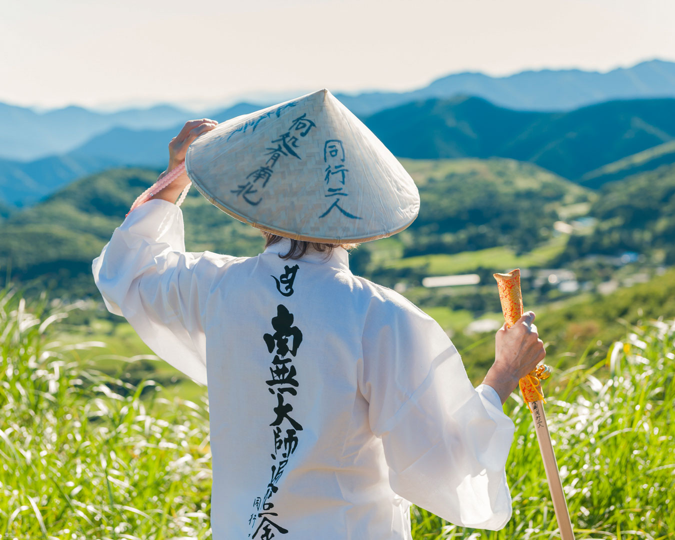
The Ohenro, or Shikoku 88 Temple Pilgrimage, is one of Japan’s best-known sacred walking trails. Its 88 temples reflect the belief that humans have 88 worldly desires –– and that visiting the temples is a way of eliminating these desires and gaining an understanding of oneself. (The Buddhist priest Kukai is thought to have been the first to walk the route, at the age of 42, in 815.) It’s not a conventional long trail but its traditions, preserved for more than a millennium, make walking this a rewarding experience. Completing the pilgrimage as a single, continuous loop –– toshi-uchi –– takes 40 to 50 days. (Walking sections at a time is called kugiri-uchi.) Pilgrims, or ohenro-san, are usually easy to spot: They wear a white robe (hakui), sedge hat (suegasa), stole (wagesa); carry a walking staff (kongozue) and prayer beads (juzu); and recite sutras at each temple while collecting stamps in a book (nokyocho) at each stop. Locals who live along the trail provide food, lodging and other forms of hospitality (osettai) to pilgrims, without expecting anything in return, similar to the deeds performed by trail angels for thru-hikers on long trails in the U.S.
I once walked part of the pilgrimage route for a magazine story. The weather was miserable –– relentlessly rainy. I felt discouraged and worried that this would affect my story. But once I visited several temples and chanted sutras, my thinking changed. I began to accept the rain; embrace it. My frustration vanished and I felt an unexpected calm, as if I could walk endlessly through the downpour. It was then that I realized something: This was a spiritual journey, a form of training, and merely seeking out picturesque views or enjoyable experiences was not the point. That has stayed with me, despite the brevity of my trip. (Yamatomichi Journals, editor-in-chief, Masaaki Mita)
KYUSHU-OKINAWA AREA
Kunisaki Hanto Minemichi Trail (135 km)
Prefectures: Oita
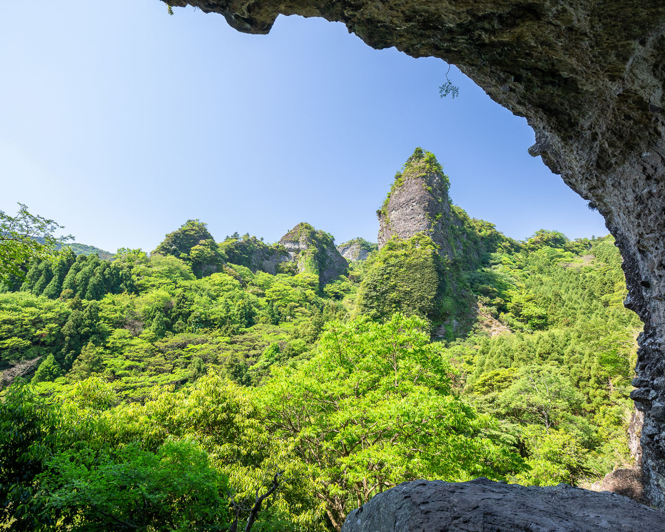
Mine-michi means ridge road but on Kyushu’s Kunisaki Peninsula it also refers to a path of rigorous ascetic practice, known as Rokugo Manzan Mineiri-gyo. (Rokugo Manzan is a 1,300-year-old esoteric religious group that fuses Shinto, Buddhist, Taoist and folk rituals.) For the mineiri-gyo, held once every 10 years, monks traverse 150 km of vertiginous mountains to visit more than 180 sacred sites. The Kunisaki Hanto Minemichi Trail traces this ancient path but with more routes (there are 10 sections) that make it accessible for hikers. Along the way, you come across magaibutsu (Buddhist statues carved into rocks); stone steps said to have been built by demons in a single night; foothills with terraced rice paddies (a landscape that earned the region World Cultural Heritage designation); steep, rocky sections with climbing chains; the Gotsuji Fudo, said to be the secret training site for the Buddhist monk Ninmon Bosatsu, who is thought to have started Rokugo Manzan; and fierce Buddhist guardian Nio statues. There are no campsites or accommodations on the route, so thru-hikers usually stay at nearby campgrounds or inns.
Kyushu Nature Trail (2,931.8 km)
Prefectures: Fukuoka, Saga, Nagasaki, Kumamoto, Kagoshima, Miyazaki, Oita
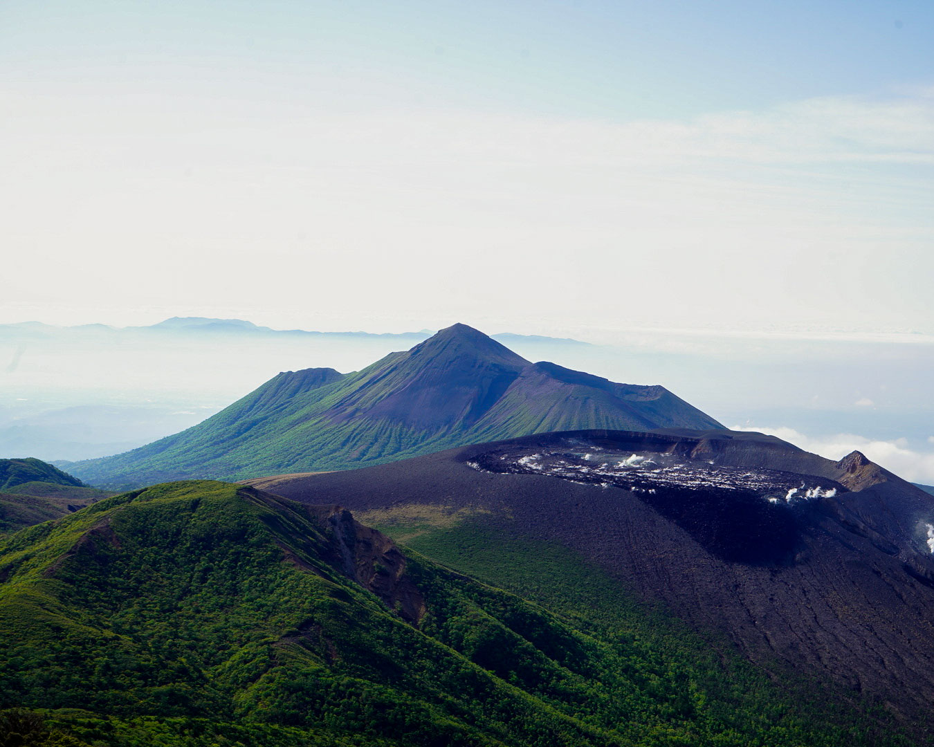
The Kyushu Nature Trail opened in 1980, the second of Japan’s nine long-distance nature trails. Known locally as Yamabiko-san, the route –– divided into western and eastern sections –– loops around seven prefectures on the southwestern island of Kyushu, cutting through four national parks and past the peaks of Mt. Aso, Mt. Kuju and Mt. Kirishima. There’s also a boat ride: a round-trip excursion to the uninhabited island of Nozaki. Occasionally, you come across old signposts and difficult-to-pass sections, but prefectural governments and volunteers have been working to repair and maintain this popular trail. The Kyushu Nature Trail Forum sells patches, pins and certificates to anyone who finishes the route in a prefecture –– a minimum of 161 km –– or thru-hikes the trail.
I walked the trail from Mt. Sarakura, in Fukuoka prefecture, to the Kuju Mountain Range, in Oita prefecture. The route took me over mountains and through touristy hot spring towns but also on rarely used forest paths and paved roads between towns –– an experience unique to long-distance trails that was never boring. My chance encounters with people along the way remain one of the joys of the hike. I was touched by the kindness of so many people who shared snacks and coffee and words of encouragement. Some even invited me to stay in their homes on the coldest nights. Those memories will stay with me longer than the particulars of the trail’s terrain or flora. For anyone wanting to take it slow and savor the journey, the Kyushu Nature Trail is the perfect choice. (Yamatomichi Kyoto store staff, Ayana Nagai)
Amami World Heritage Trail (550 km)

Prefectures: Kagoshima
The Amami World Heritage Trail is not your typical walking path. Opened in 2021, the long trail –– the only island-hopping route of its kind –– stretches across the eight islands of the Amami archipelago: Amami Oshima, Kikai-jima, Tokuno-shima, Okinoerabu-jima, Yoron-jima, Kakeroma-jima, Uke-jima and Yoro-jima. Boats shuttle travelers from one island to the next, and a visit to this biodiversity hotspot –– Amami Oshima and Tokuno-shima are UNESCO World Natural Heritage sites –– is well worth the effort. You will encounter subtropical forests, limestone caves, white-sand beaches, mangrove and banyan trees and coral reefs. On some beaches, visitors can pick any spot and pitch a tent for the night, but on islands inhabited by habu, a venomous pit viper, you’re better off sticking to inns or official campsites.
I spent four days and three nights on Okinoerabu-jima (an island with no recorded habu sightings). Along the coast, outside the small towns of China and Wadomari, the turquoise ocean dominates the view. From a cape, I spotted swimming sea turtles, and at low tide, I waded into coral reefs. At sunset, the horizon turned a band of red. I slept two nights at an uninhabited beach campsite. On the third day, a local couple invited me to go clamming and to stay at their beautiful home, feasting on freshly caught seafood. In the Amami dialect, yoori-yoori means “slowly, slowly” and is the best way to indulge in the island lifestyle –– walking at a leisurely pace, getting to know locals and leaving behind the faster pace of city living. (Yamatomichi Journals editorial staff, Emma Nakajima)
LIST OF LONG TRAILS IN JAPAN
For this article, Yamatomichi’s editorial team researched all available information on long trails around Japan –– newly opened routes, trails under development, historical paths and ancient roads. We were amazed by how many we turned up! You’ll find our comprehensive list below (with some English-language links). We have included only the ancient roads and historical paths that partially overlap with mountain trails. We hope these will inspire your next journey. If we have forgotten any trails that belong here, please let us know!
トレイル名をクリックすると各トレイルのウェブサイトにジャンプします
NATIONAL
Japan Trail (Under development)
HOKKAIDO
Niseko Trail, formerly Niseko Haute Route (Under development)
Kussharo Caldera Outer Rim Trail (Under development)
Tenpoku Trai, formerly Tenpoku Railway track (Planning)
TOHOKU
Fukushima Coastal Trail (220km)
Aizu Trail (166.6km)
Mt. Iwate Hachimantai Appi Trail (50km)
Tohoku Nature Trail (4,369km, New Oku no Hosomichi, partially open)
Yamagata Long Trail (31km, formerly Shirataka Kyūryo Trail, under development)
Zao Quasi-National Park Route (Partially open)
Mutsu ONE Trail (250km, routes)
Ushu Kaido (497km)
Aomori-Matsumae Kaido (120km)
Aizu Ginzan Kaido (72km)
Mt. Kurikoma Area Geotrail (Under development)
Bandai Azuma Adatara Volcano Trail (Under development)
KANTO/CHUBU/KANSAI
Nakasendo (534km)
KANTO
Minami Boso Long Trail (35km, planned extension to 100km)
Tokyo Metropolitan Nature Trail (1,803km)
Oyama Kaido Tamura Route (70km)
Chichibu 34 Kannon Pilgrimage (100km)
CHUBU
Fuji-Hakone Trail (43km)
Mt. Fuji Long Trail (150km)
Chanomichi Long Trail (43km – Up to 100km)
Snow Country Trail (307km)
Amatomi Trail (86km)
Asama-Yatsugatake Panorama Trail (37.8km, planned extension to 120km)
Southern Alps Front Trail (Under development, 70km planned)
Kirigamine-Mt. Utsukushigahara Central Watershed Trail (38km)
Salt Road Trail (120km)
Kanazawa Trail (44.9km, planned extension to 70km)
Fukui Satoyama Trail/Fukui Plains Tour/Sengoku Romance Course (61km)
Shinpi Trail (Planning, 115km)
Natasho Trail (Under development)
Chubu Hokuriku Nature Trail (4,091km)
KANSAI
Osaka Circular Nature Trail (300km)
Diamond Trail (45km)
Biwako Hira Hiei Trail (55km)
Kinki Nature Trail (3,296km)
Saikoku 33 Kannon Pilgrimage (1,000km)
Koza Kaido (80km)
Awaji Island Long Trail (Planning)
Saba Kaido Harihatagoe Route (72km)
CHUGOKU
Houkinokuni Long Trail (65km/35km)
Tottori Traverse Long Trail (144km)
Chugoku Nature Trail (2,295km)
Hiroshima Wangan Trail (293.8km)
Hagi Okan Historic Road (53km)
Daisendo Long Trail (Planning)
SHIKOKU
Shikoku Nature Trail (1,545.6km)


