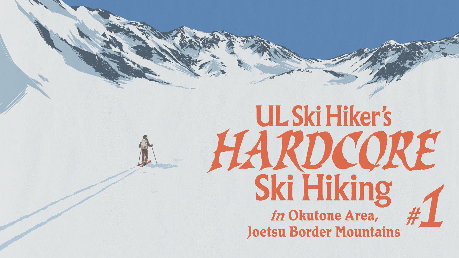
#2 Traversing Japan’s Okutone Mountains
#2 Traversing Japan’s Okutone Mountains
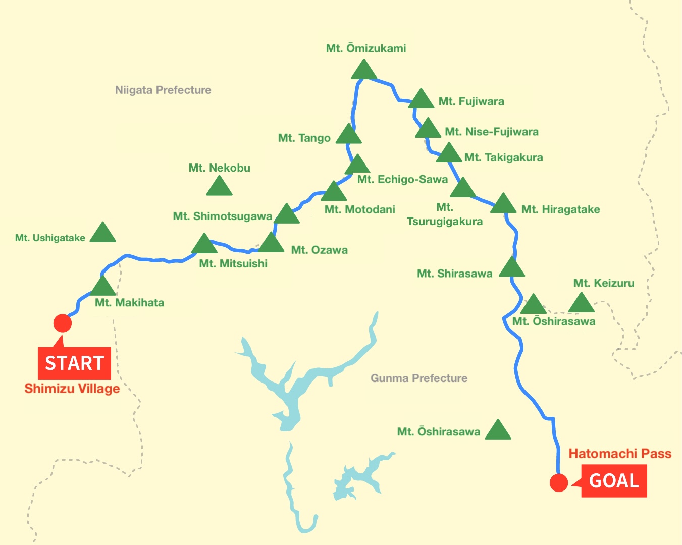
After months of planning and fine-tuning his ultralight system, Kengo Nogami — the “Ski Hiker” — set out on the real test: a full-scale solo traverse of Japan’s Joetsu border and Okutone region. Starting from Mt. Makihata, he aimed to follow a continuous ridgeline all the way to Oze, carrying everything he needed for nearly a week in the snow.
What followed was a raw, demanding journey — storms rolling in without warning, massive cornices breaking away underfoot, and long, exposed ridges stripped of snow. Each day brought new decisions, new calculations, and quiet moments of resolve. Alone in the high country, Nogami kept pushing forward, tracing the delicate line where winter gives way to spring.
This second installment: The traverse, captures the reality of hardcore ski hiking — the exhaustion, the precision, and the quiet satisfaction of moving light and free through Japan’s final snowfields.
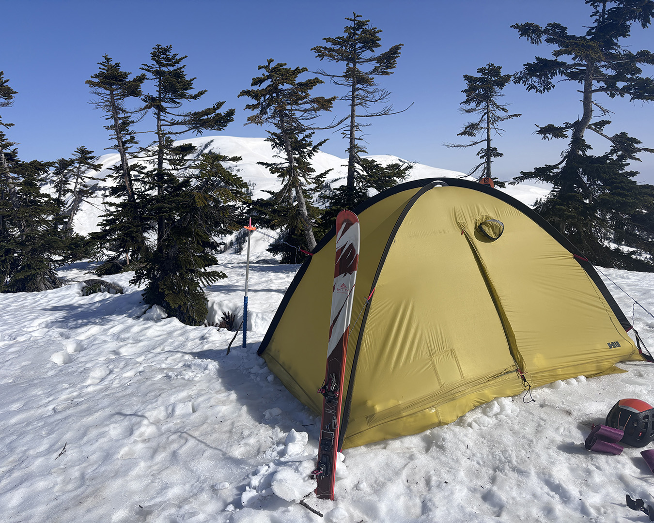
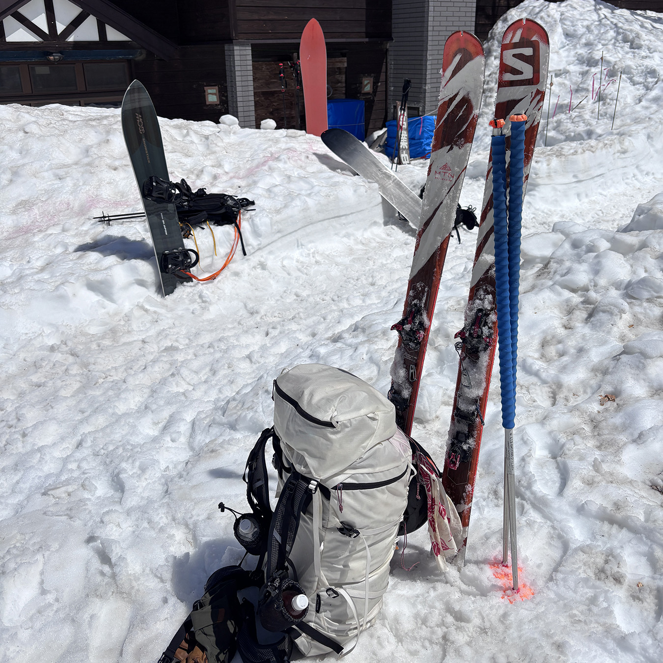
Night before departure
In mid-April, when the ski resort shuts down for the season, I start doing what I wait all winter to do: I disappear into the mountains until Golden Week—the run of national holidays in late April and early May.
That month I’m barely in the office. While my boss and coworkers grind through the lead-up to the holiday rush and shoot me those looks, I stitch a few paid-leave days together and end up with eleven straight days off. The only problem was the forecast—rain and cloud for the first half—so I held back.
Then, the next day, the symbols finally flipped to sun. I went to the supermarket and loaded up on food.
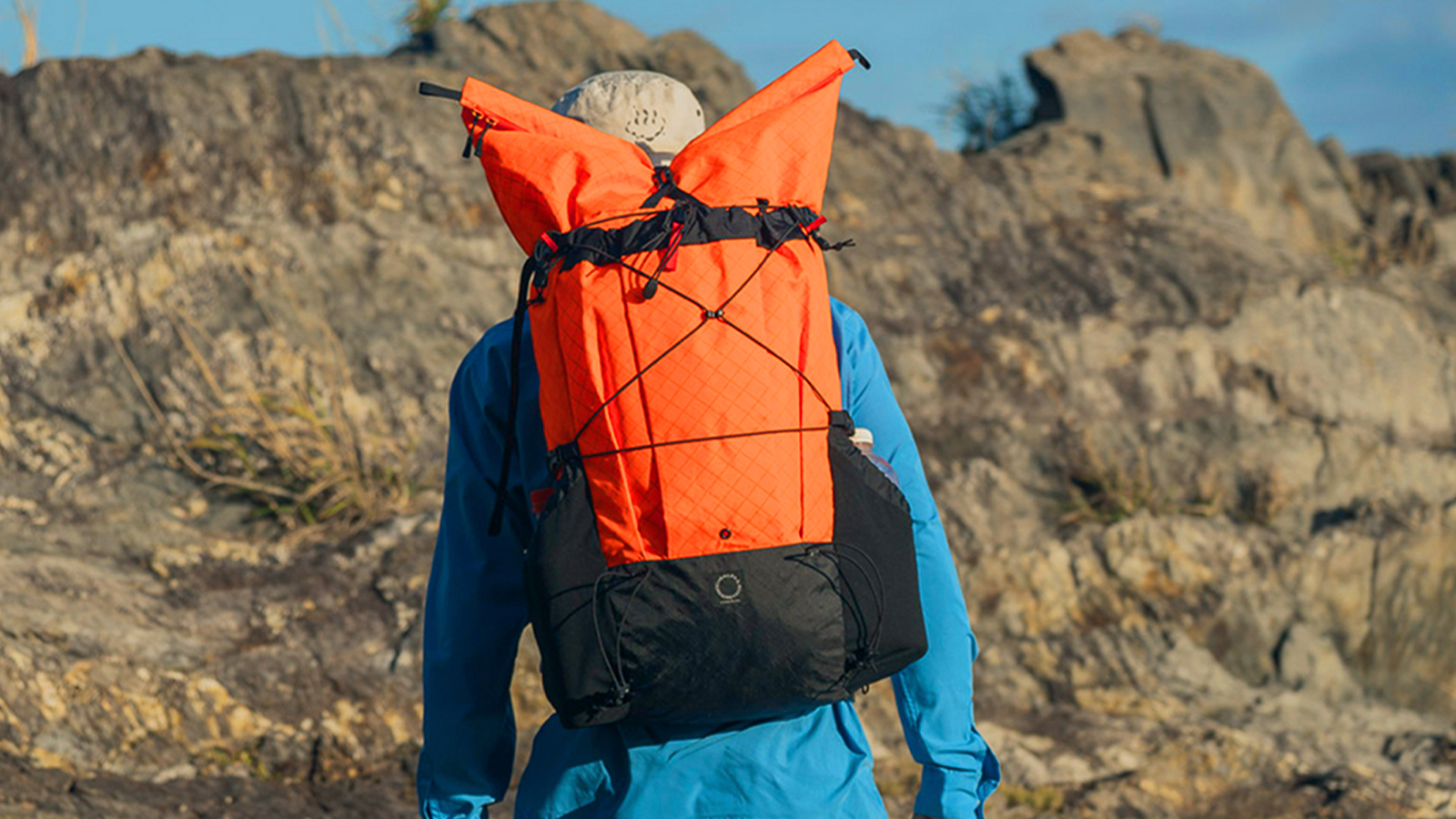
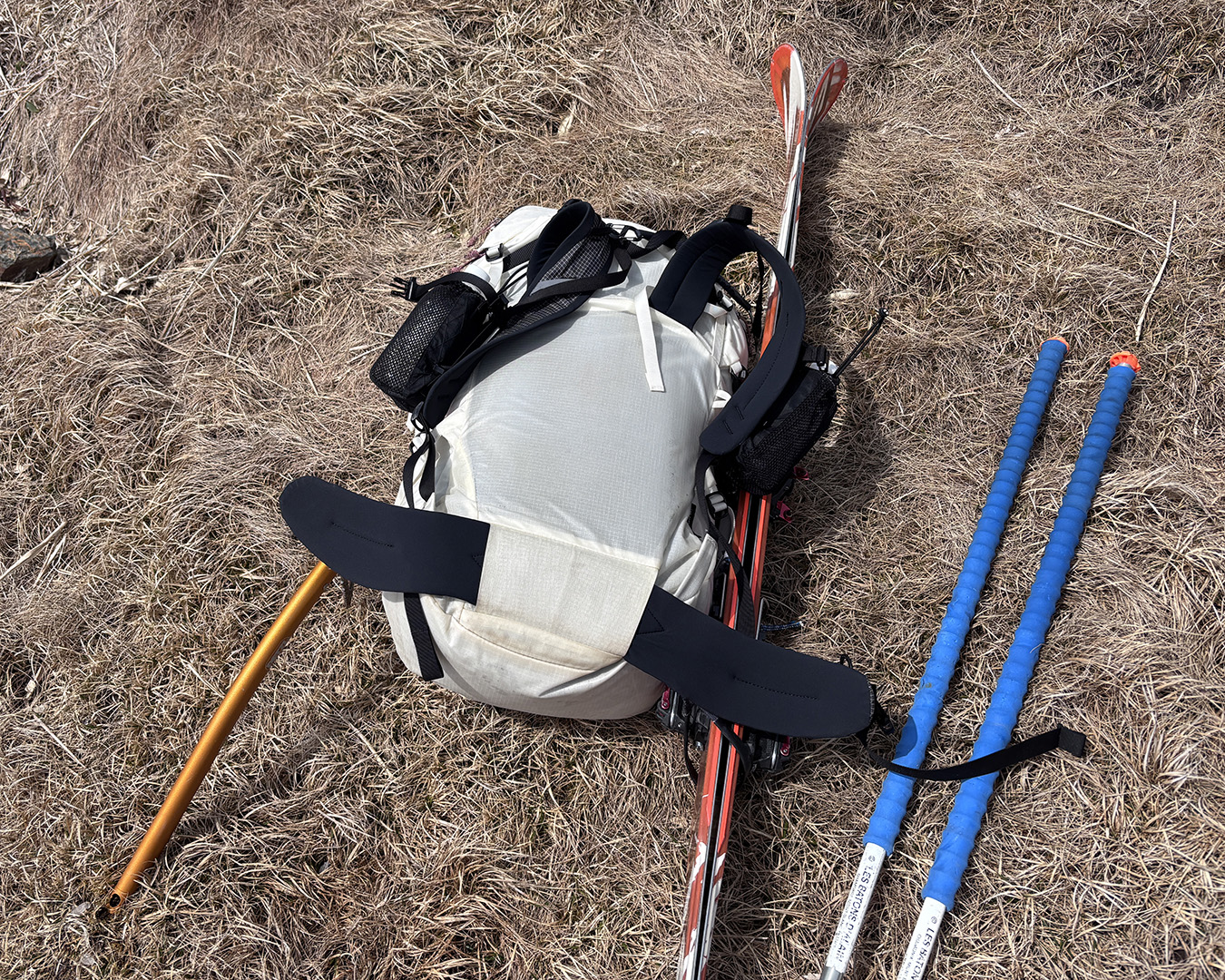
No matter how dialed your kit is, the second you add days’ worth of food, your pack reminds you what weight is. So much for ultralight. I shouldered it, set it down, shouldered it again in my bedroom—like repetition could change the number. Eventually I gave up and went to bed early.
April 16 — Into the storm
The sky was all cloud. I left Shimizu Village at 6:30 a.m. Not long after I started, I caught up to a solo hiker ahead of me. His pack was huge, so I called out.
He told me he was headed for Mt. Tango, and we joked that we’d be walking together for a while. His plan was to drop down over Mt. Nakano to the Mikunigawa Dam—the Mikunigawa Gorge route was said to be dangerous. It was a relief to have someone moving in the same direction.
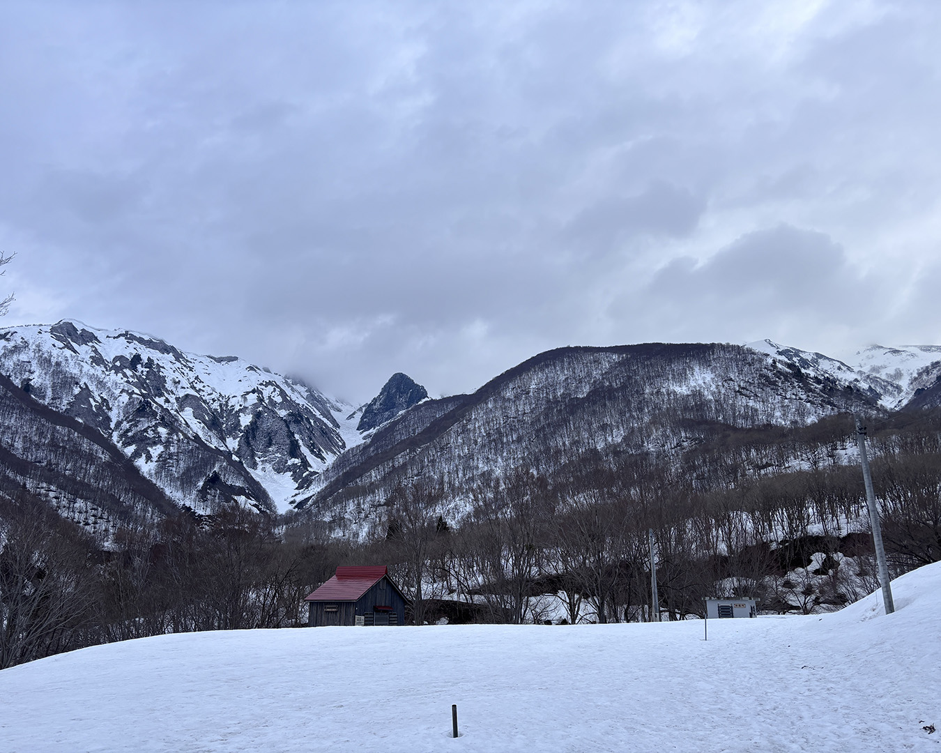
From Shimizu Village to the Sakurazaka trailhead parking lot. I looked up at Mt. Makihata. The sky had that unsettled feel.
Just before Makihata’s famous “Well Wall.” From here, the steep climb begins.
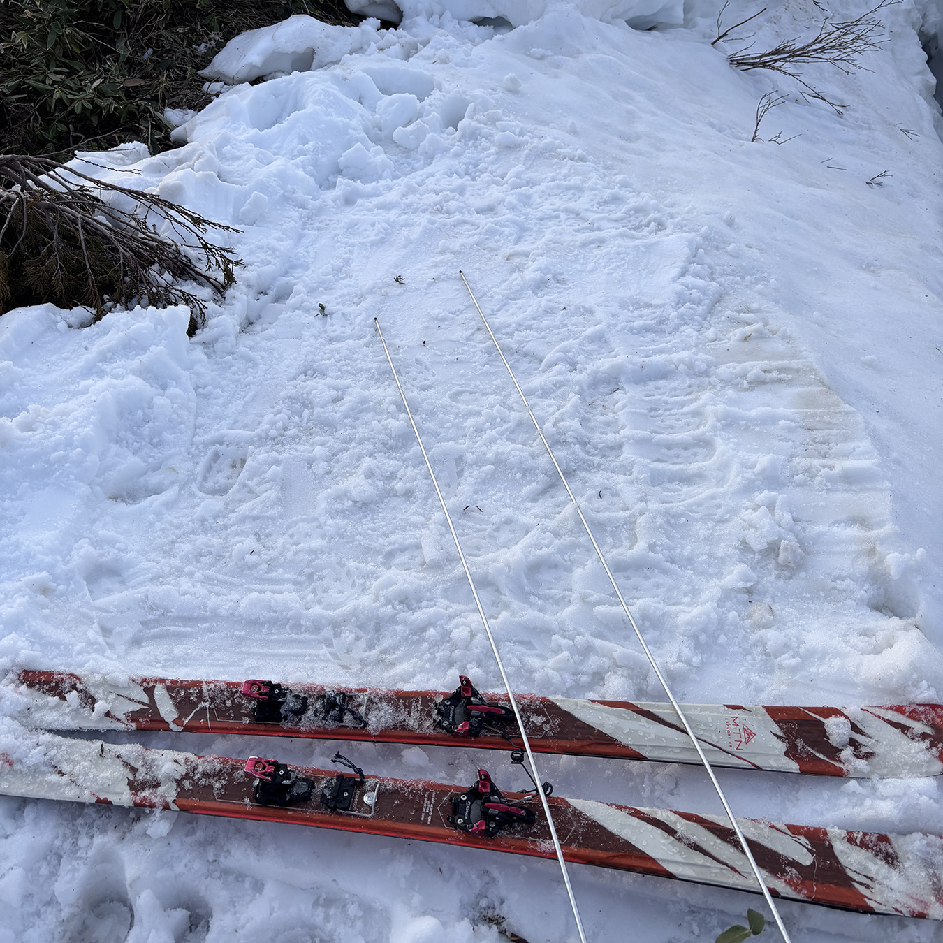
My load was about 13 kilos—no different from my usual ski traverses—yet somehow it felt lighter.
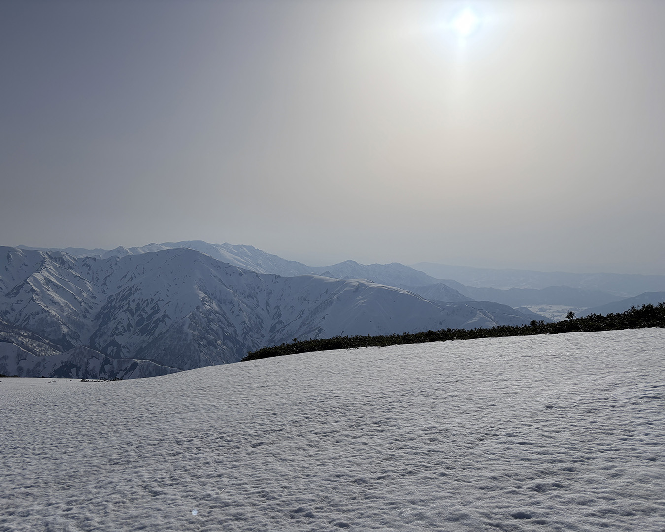
Once I got past Ido-no-Kabe, the rain turned to snow. Near the false summit—“Nise-Maki”—it became a whiteout. The forecast had been all sunshine icons, but cold air from the lingering upper-level cold vortex was still sitting over the range.
The summit of Mt. Makihata—my first peak—was wrapped in fog, and the wind was still strong. The emergency hut was buried under the snow, nowhere to be seen.
Snow, even though the forecast called for clear skies.
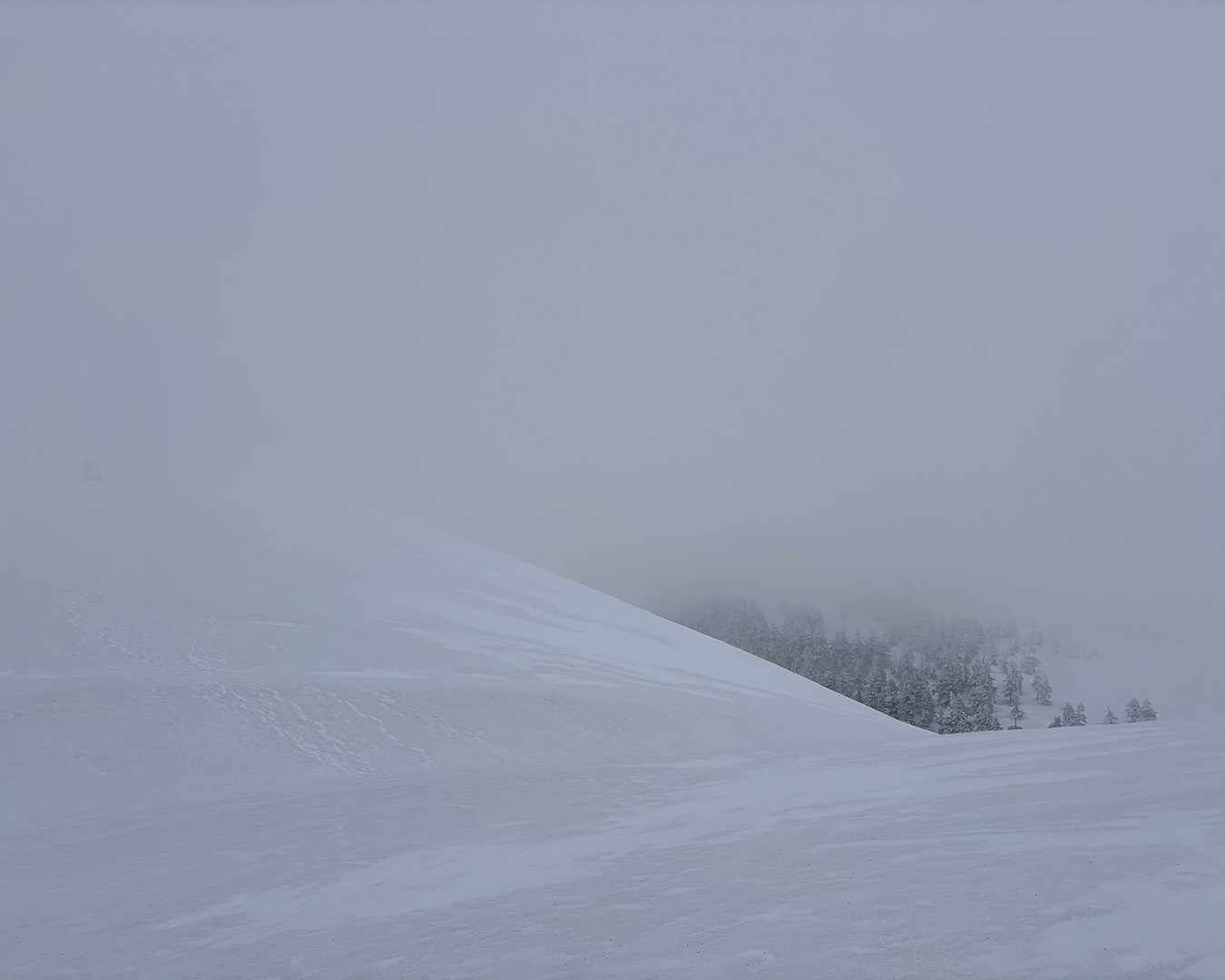
Mt. Makihata’s summit in thick fog, with strong wind.
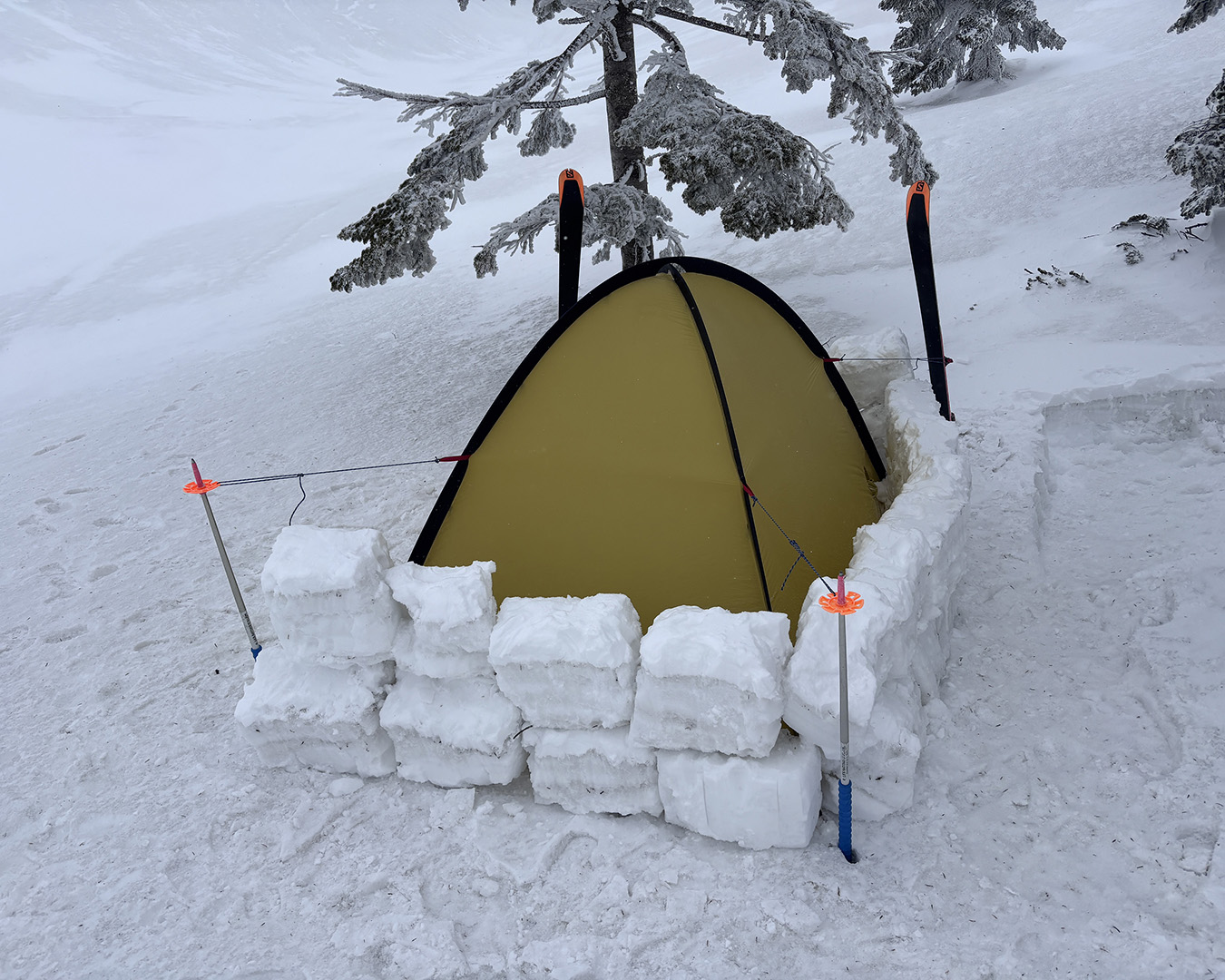
It was still before noon, so I decided to sit it out. Just below the summit, I pitched my tent in the trees, stacked a small wall of snow blocks, and lay down for a nap.
Later, a few ski parties came up and did the same—waiting for the weather to move on. The solo hiker I’d talked to earlier never showed. He must have turned back once the blizzard hit.
Around 4 p.m., the clouds finally split and a patch of blue opened up, but the wind didn’t ease. I found myself wondering which way the ski groups would drop. In the end, I stayed where I was and called it a night. Day one, and the plan was already slipping. The wind kept at it through the dark, and I barely slept.
Stalled on day one. Mountain weather is hard to predict.
April 17 — Holding the line
I woke in the night with a headache—probably from the sudden drop in air pressure. I didn’t feel great, but by morning the wind had eased and the sky had cleared. I got a late start, around 6:30 a.m.
The traverse over Mt. Ushigatake went smoothly. I came across two sets of footprints heading the other way and found myself wondering where they’d started.
For a while I stayed on the left side of the ridge, holding a steady line across. Early on, the skis were doing what they’re meant to do—turning effort into distance.
At the 1,834-meter point, I usually cut left and bypass it, but this time I went straight over. As expected, it felt less safe. Next time, I’d contour around.
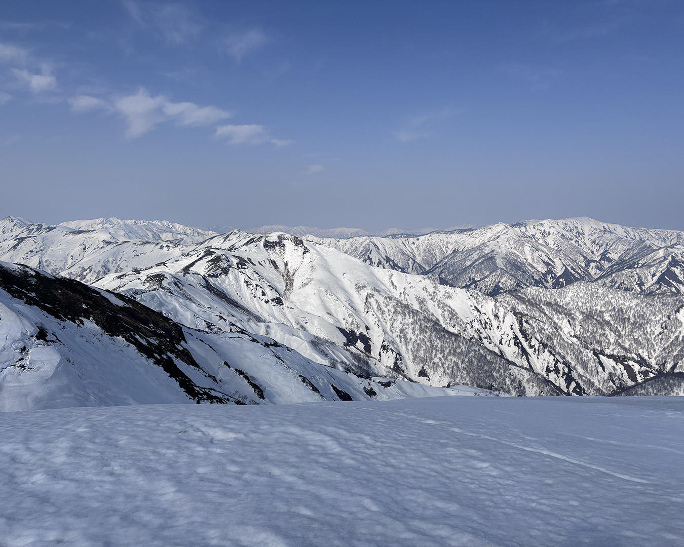
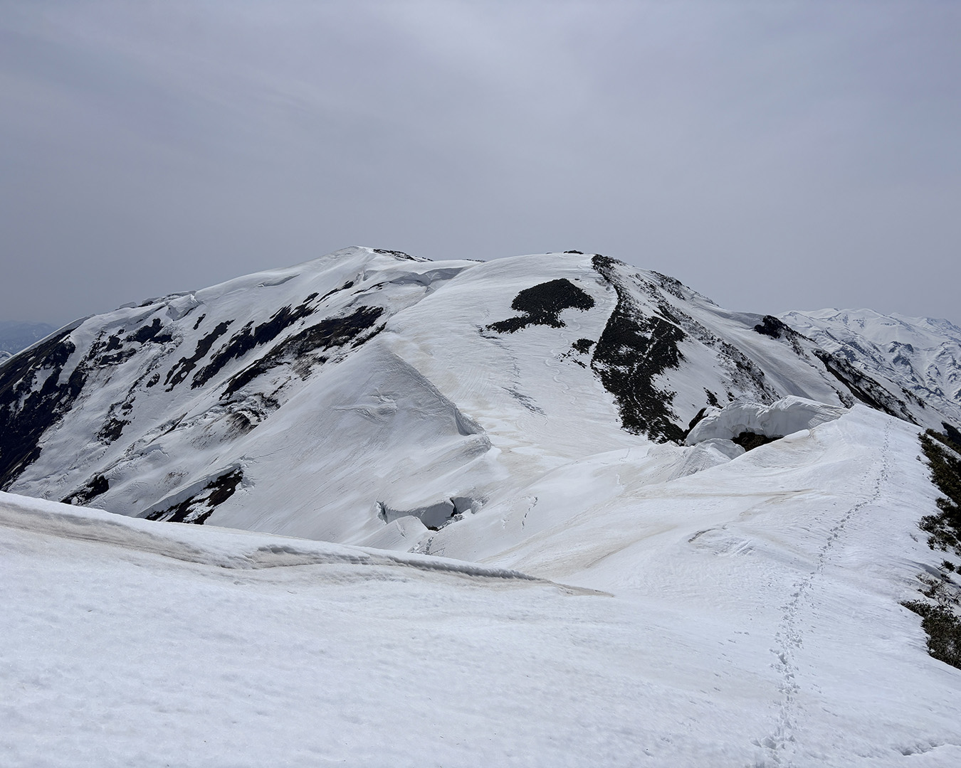
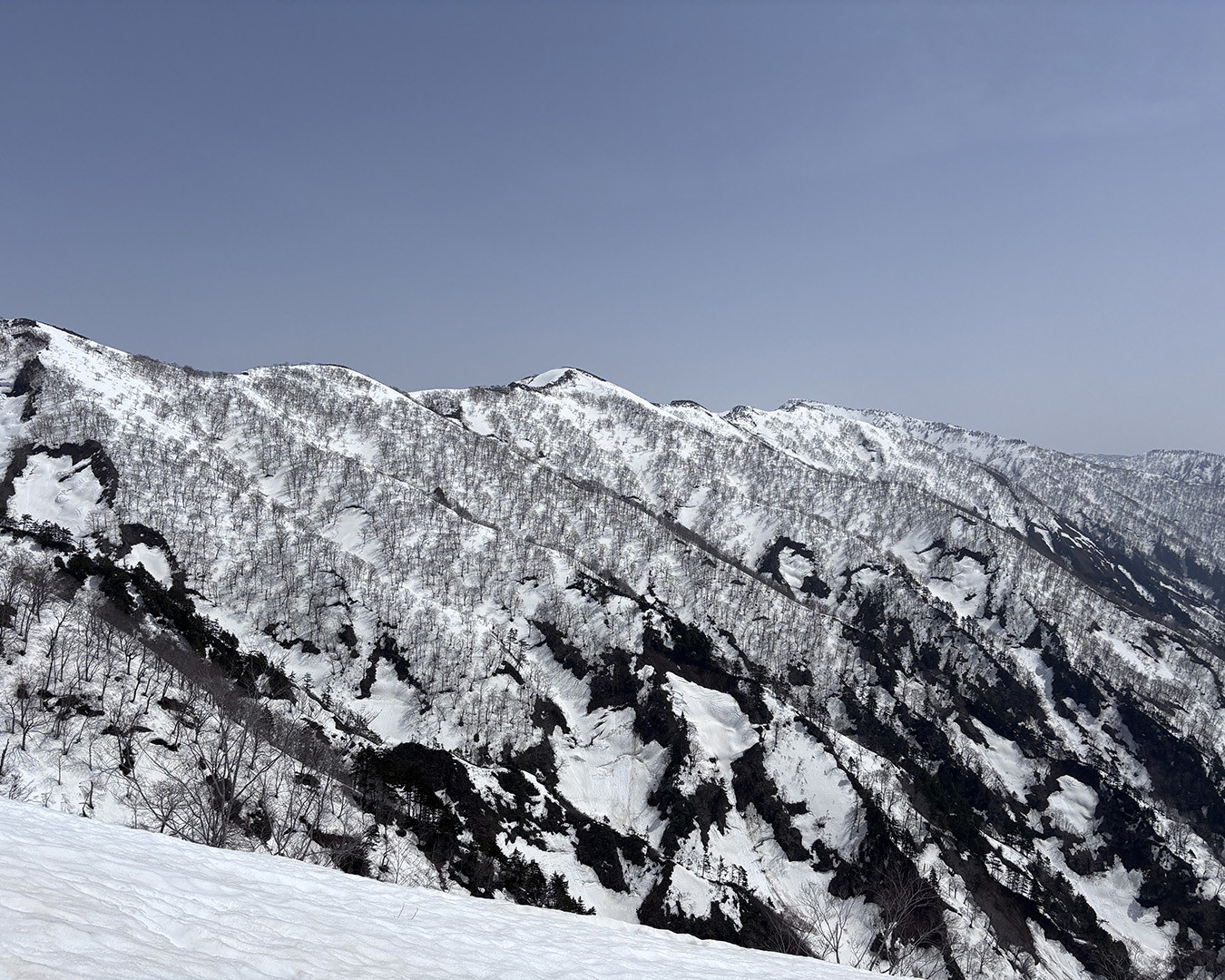
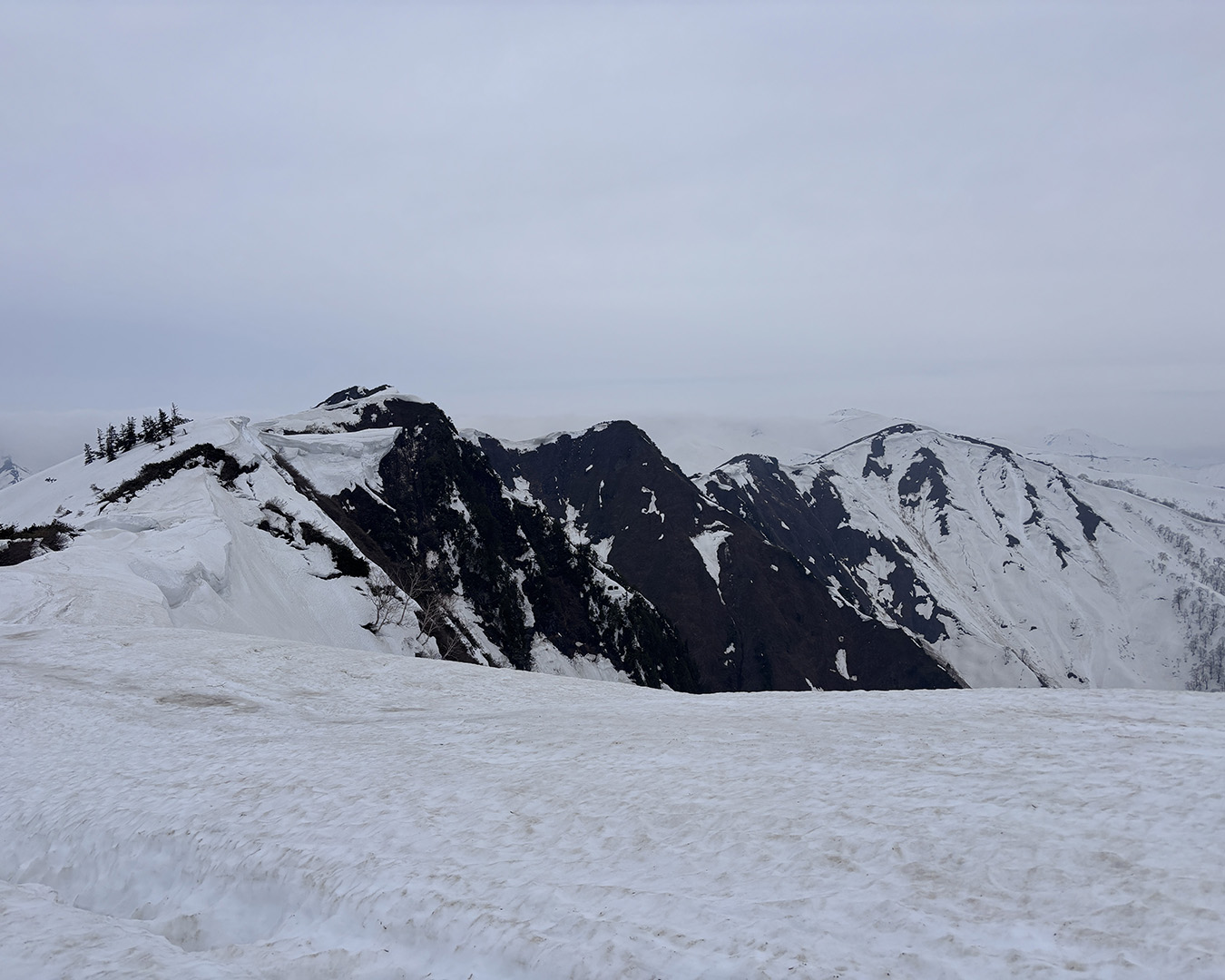
Toward Tanigawa-dake from Mt. Makihata—the border ridge runs in from that direction.
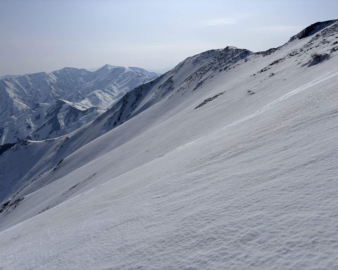
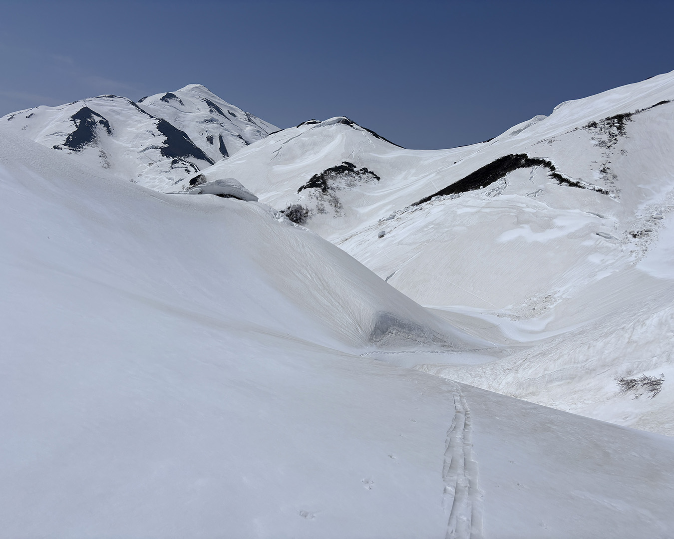
The ridgeline to Mt. Kozawa comes into view. Plenty of snow.
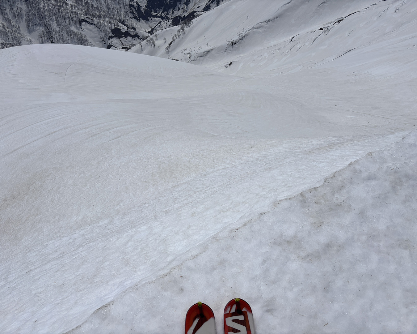
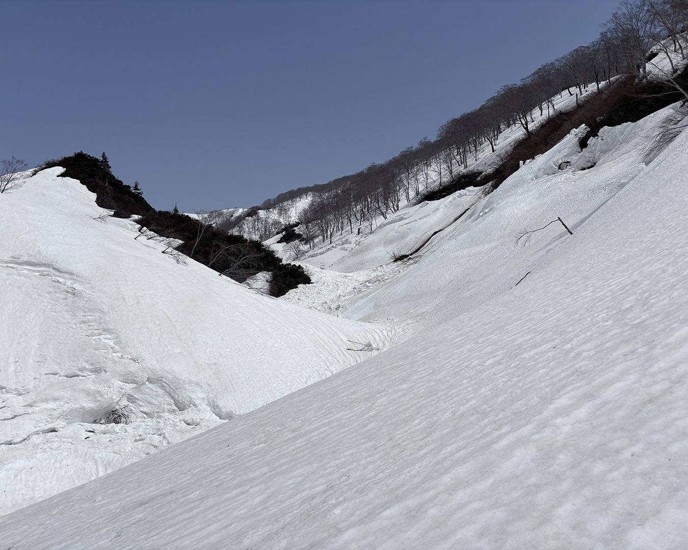
Watching for cracks, I descended to the col — the drop-in point for the Senzawa valley. Whether this valley can be skied depends on the snow conditions each year. This season, the upper section had already slid in a full-depth avalanche, leaving debris all the way down to the valley floor.
I made a wide detour skier’s right and descended in two pitches to the bottom. The north-facing slope was still firm — hard-packed and untouched by thaw. Once I reached the valley floor, though, the air felt warm and springlike.
Senzawa Valley—skiing down around avalanche debris. The slope is firm, and old tracks are faint.
I regained the ridgeline just before Mt. Mitsuishiyama. It’s a little lower here—good camping terrain—but I’d already lost half a day, so I kept moving.
I skirted Mitsuishiyama and traversed a broad slope, threading past old avalanche debris. From there I dropped on a safe line into the headwaters of the Mitsuishizawa valley.
Using the valley as a corridor, I climbed again toward the ridge. That’s the freedom of traveling on skis: you can choose lines like this at will. It’s a different kind of movement entirely from simply staying on a ridgeline on foot.
Headwaters of the Mitsuishizawa—off the ridge and hiking up the valley line. A route choice that only makes sense on skis.
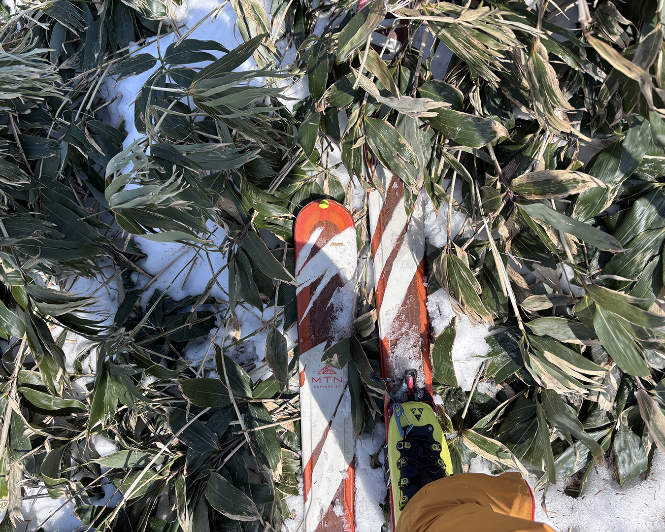
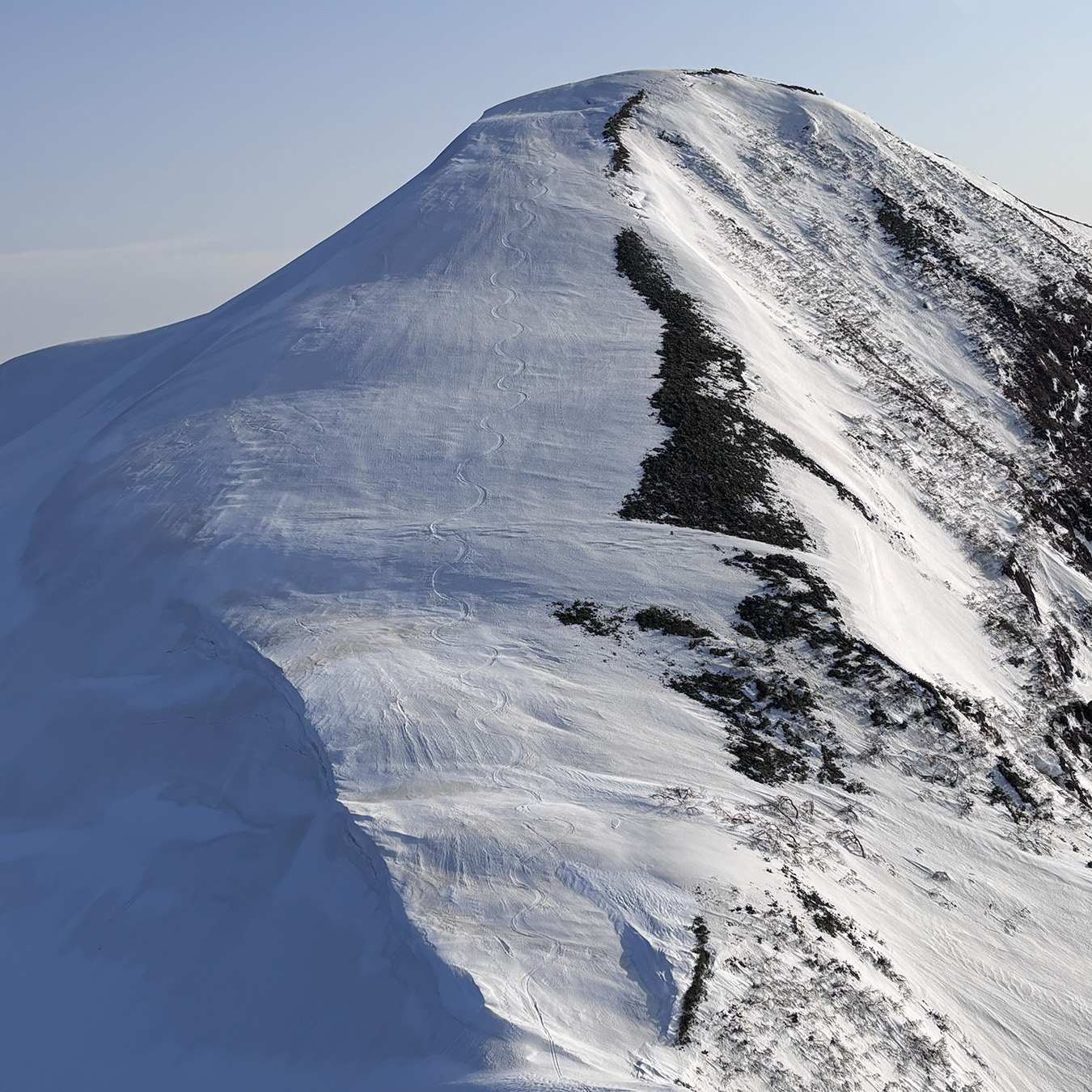
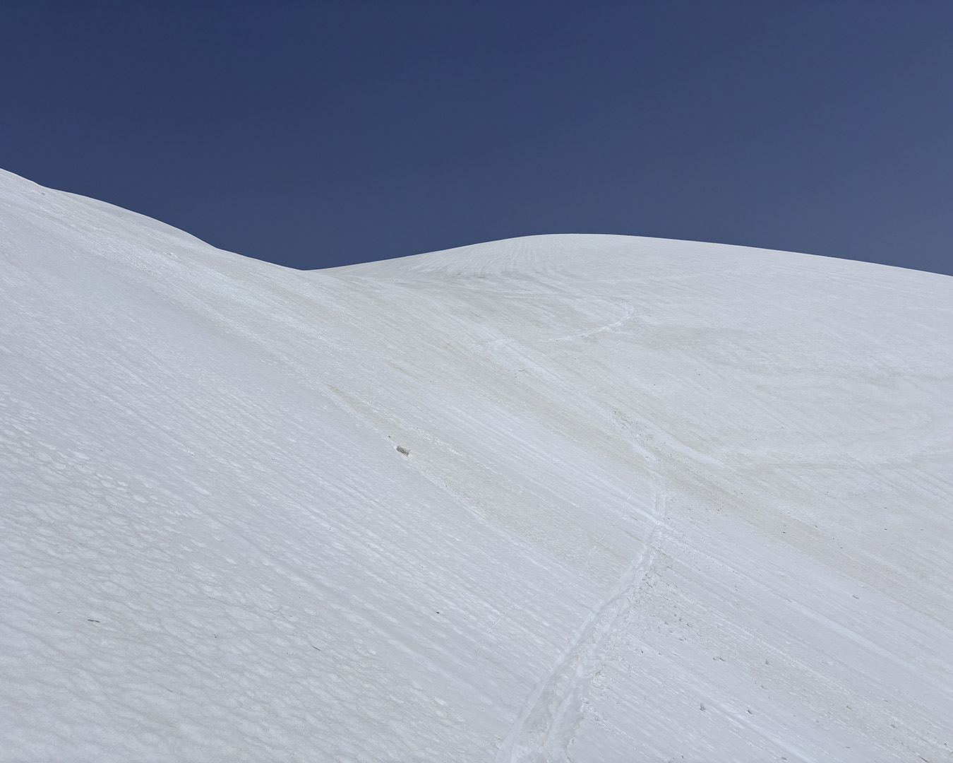
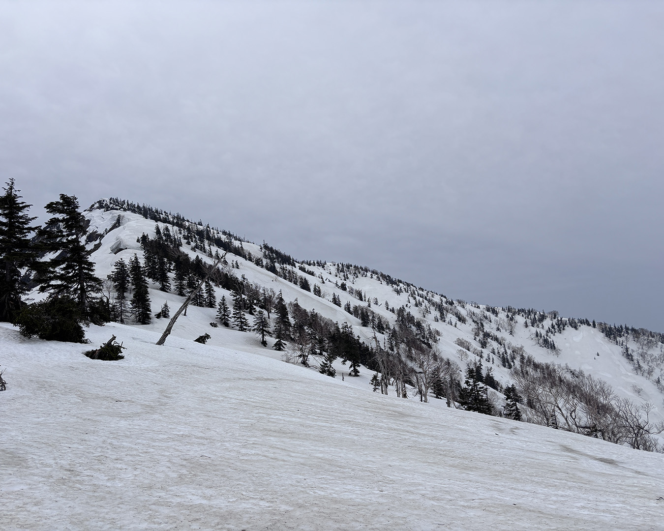
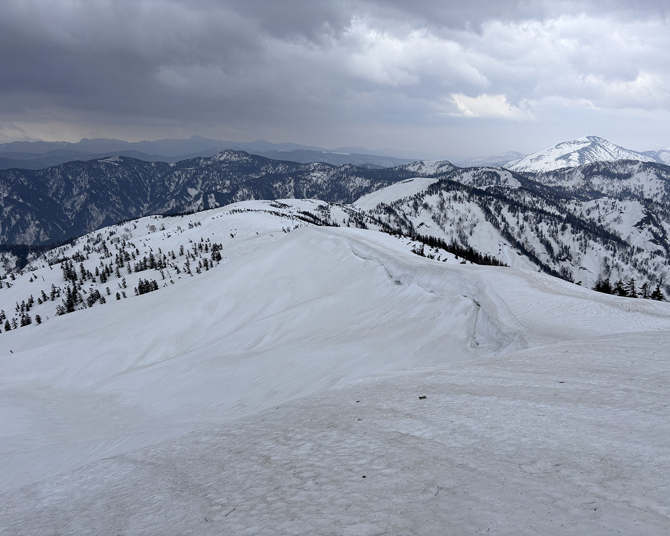
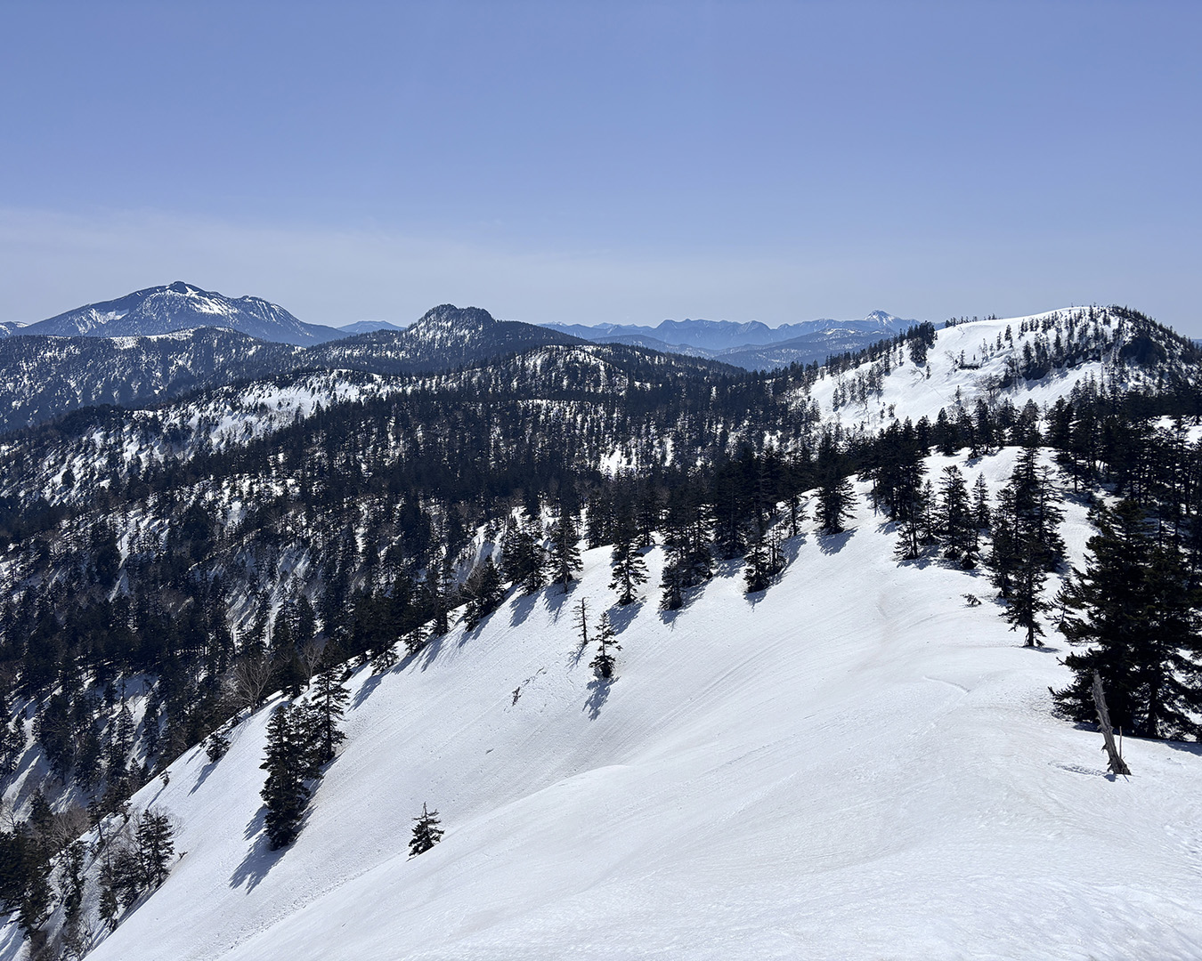
Under clear skies and a light breeze, I set out toward Mt. Ozawadake. The first time I walked this ridgeline, there had been little snow, and I’d had to fight through thick brush for much of the way. This year, with the deep snowpack, I could keep my skis on the whole time and simply enjoy the movement.
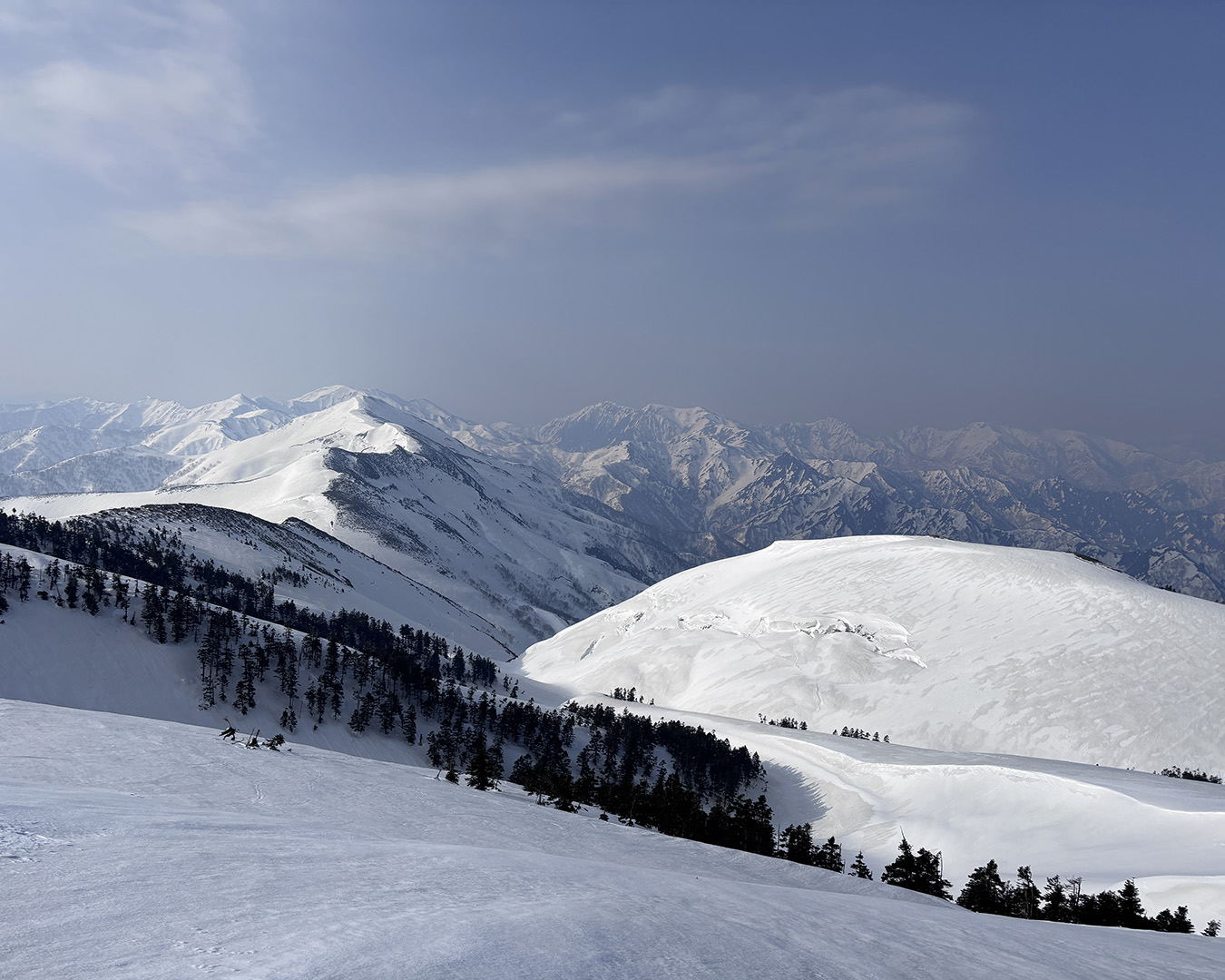
I reached the summit of Ozawadake at 4 p.m. — a full 360-degree panorama. Across the headwaters of the Tone River stood Mt. Shibutsu, right in front of me. From here, the route curves along the prefectural border ridge, leading eventually to my goal: Oze.
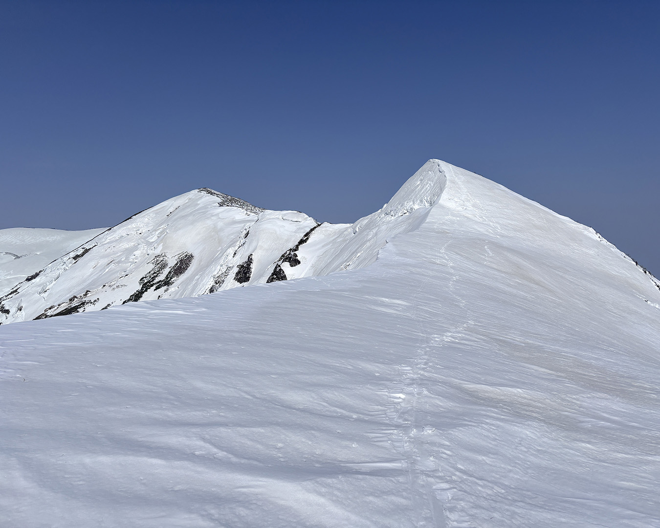
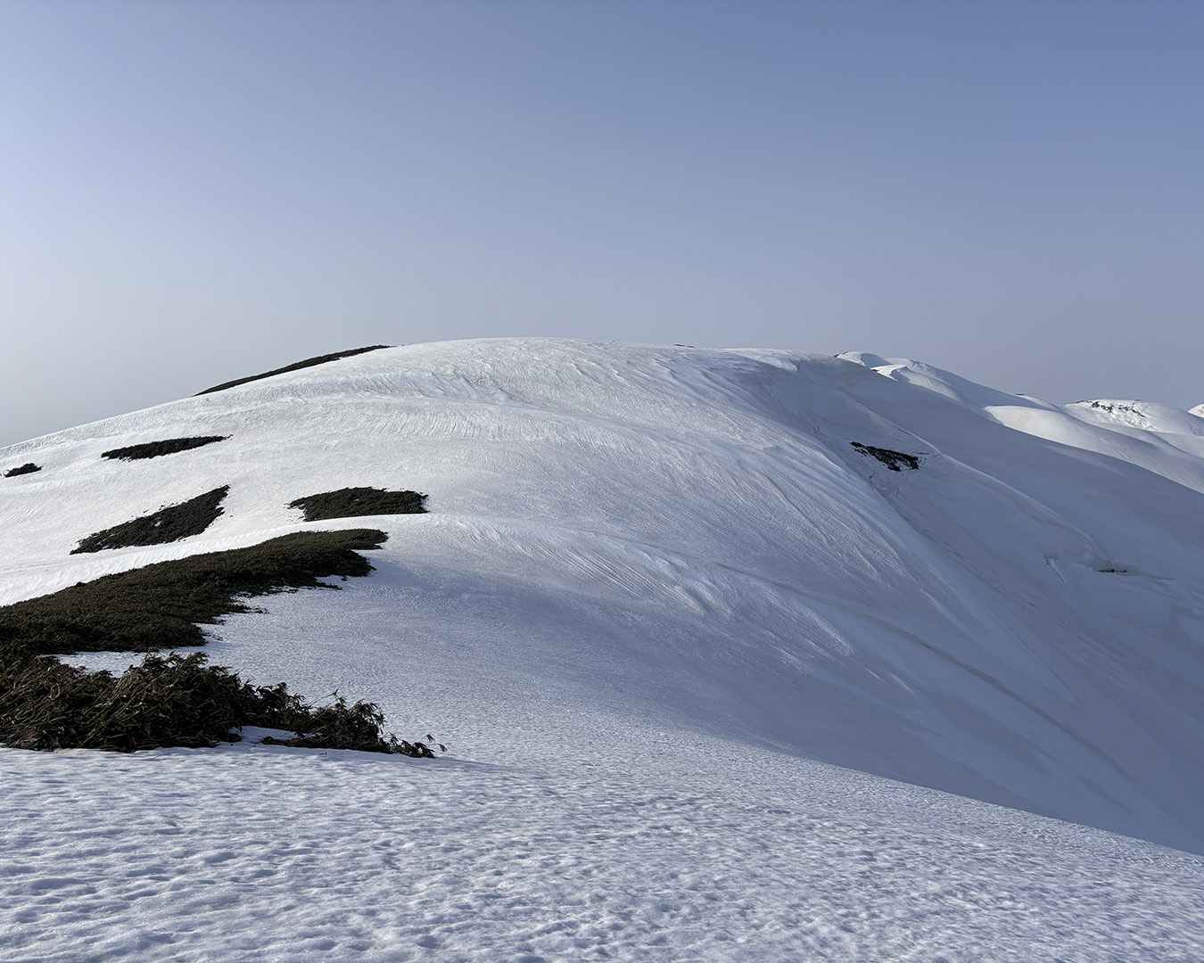
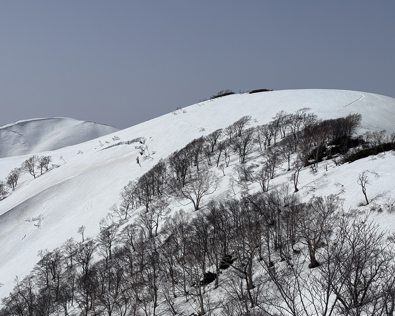
Just before Mt. Kozawa. Even with some brush, I could push through without taking my skis off.
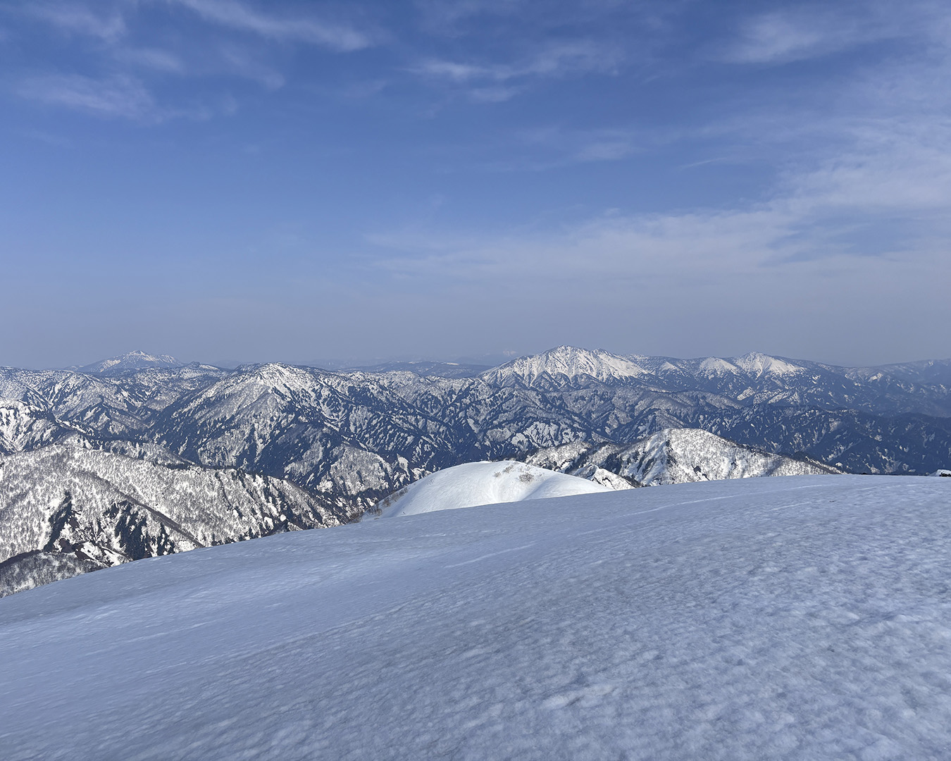
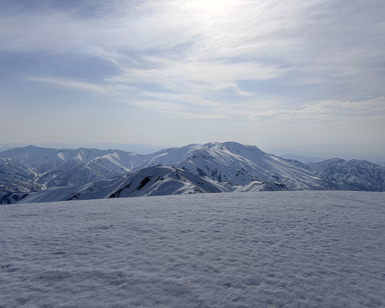
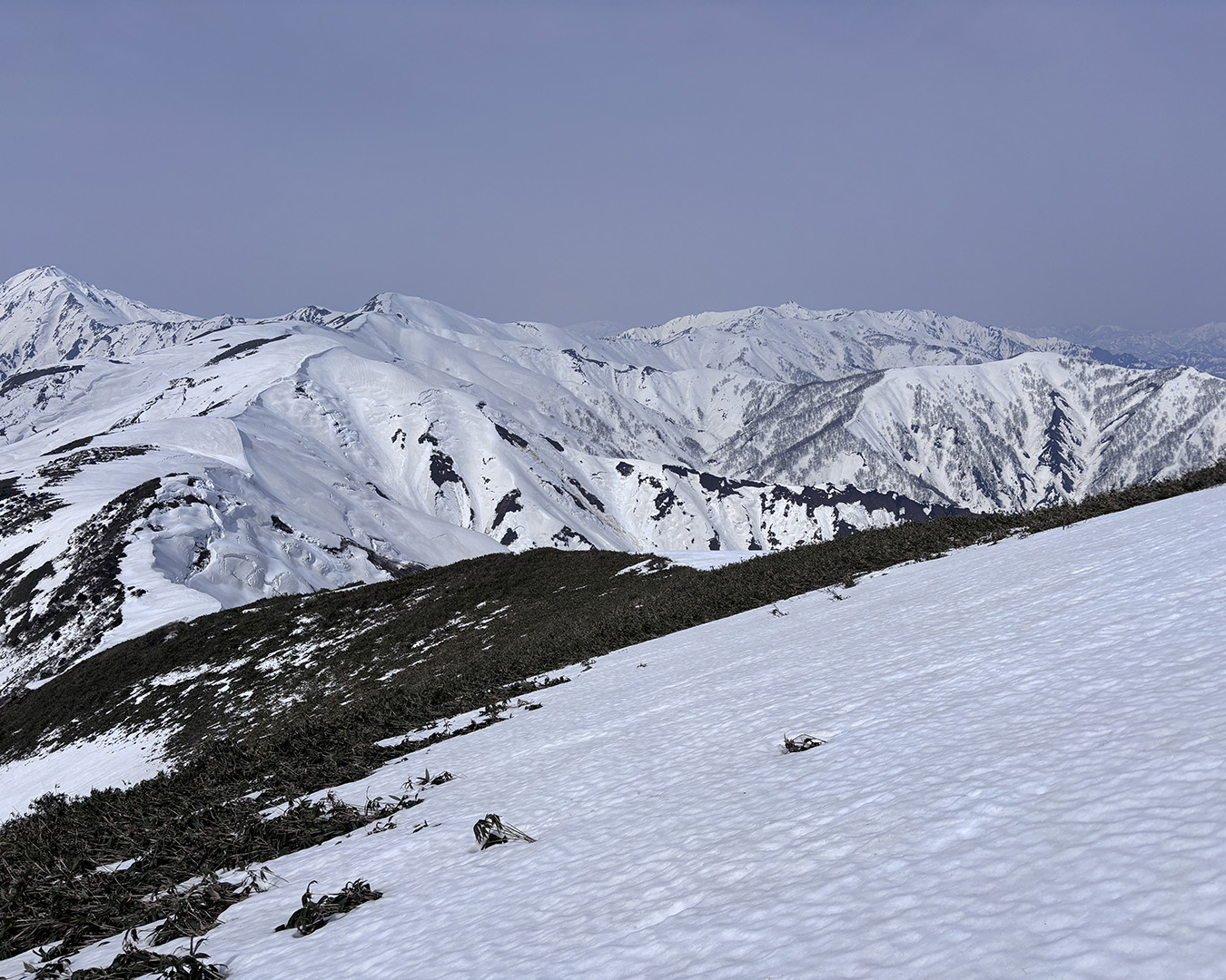
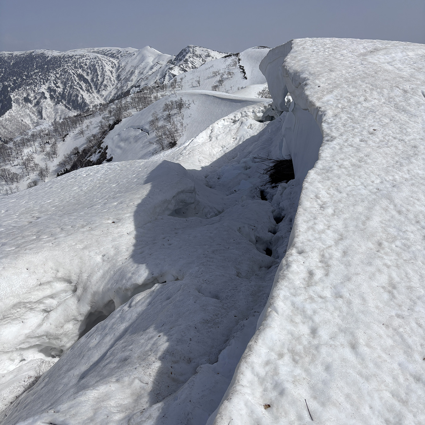
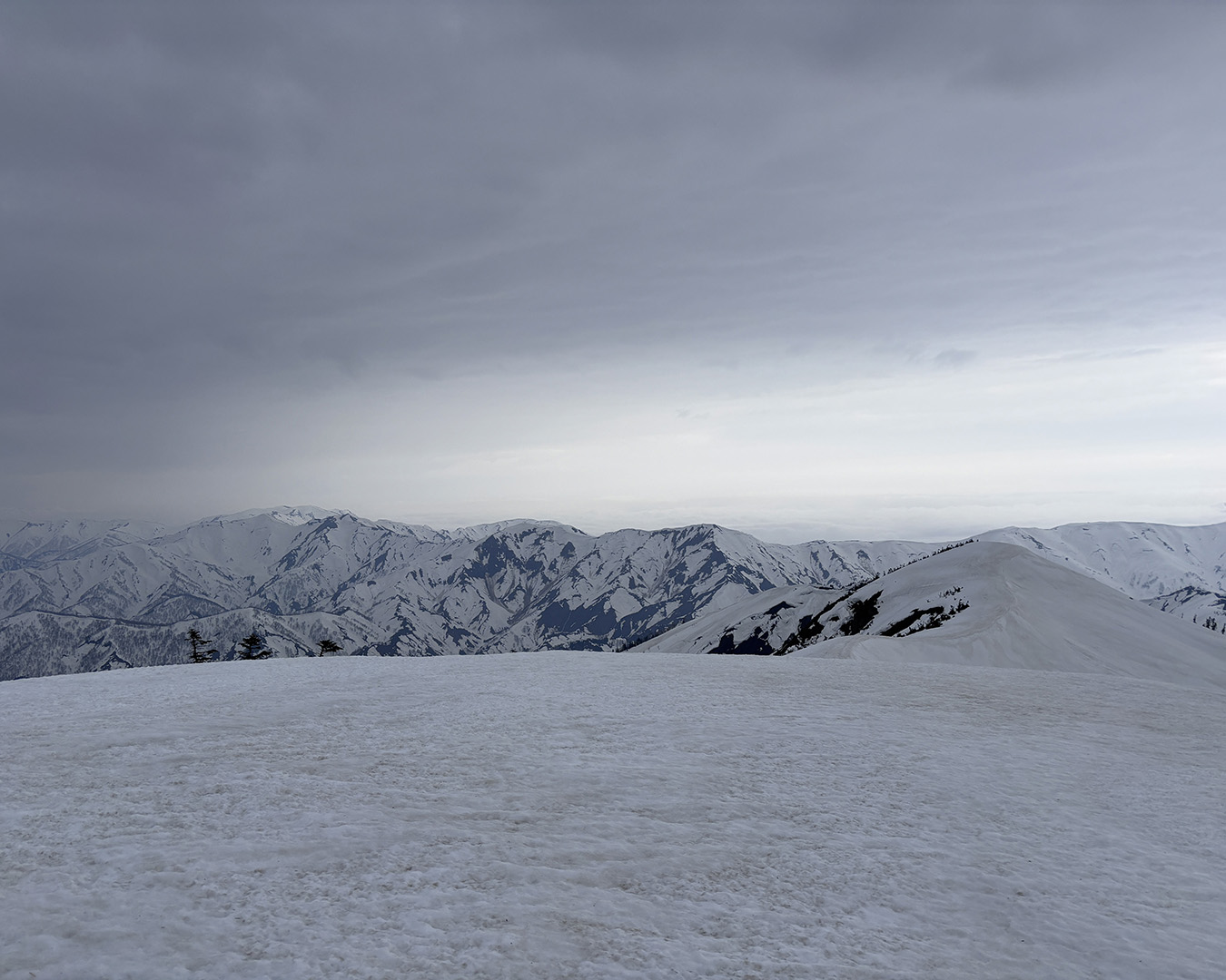
From Mt. Kozawa across Lake Okutone toward Oze—Mt. Shibutsu, Mt. Kasagatake, and Mt. Hiuchigatake in view.
The border ridge I’m about to follow. Across the valley is the ridgeline leading toward Mt. Hiragatake.
I skied down the north face of Mt. Ozawadake and climbed onto the narrow ridge leading to Mt. Shimotsukawayama, the first major crux of the route. There were signs of a previous campsite at the saddle. I strapped my skis to the pack and switched to crampons. In low-snow years this section turns into a full-on bushwhack, but this season the passage was smooth.
I’m not good with heights, so I cursed under my breath while gripping the rocks, inching my way along the knife-edge ridge—half climbing, half crawling my way across.
The narrow ridge from Mt. Kozawa to Mt. Shimotsukawa—crossed in crampons, then looking back at my own tracks.
By the time I reached Mt. Shimotsugawayama, the sun was already low. The tracks I’d been seeing since Mt. Makihata ended here, which meant they’d likely come up from Mt. Nekobuyama.
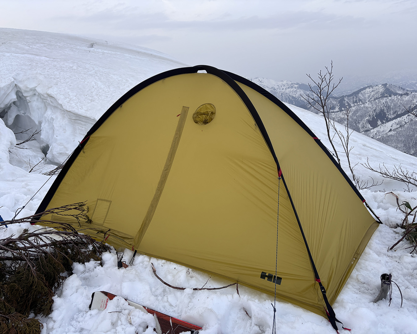
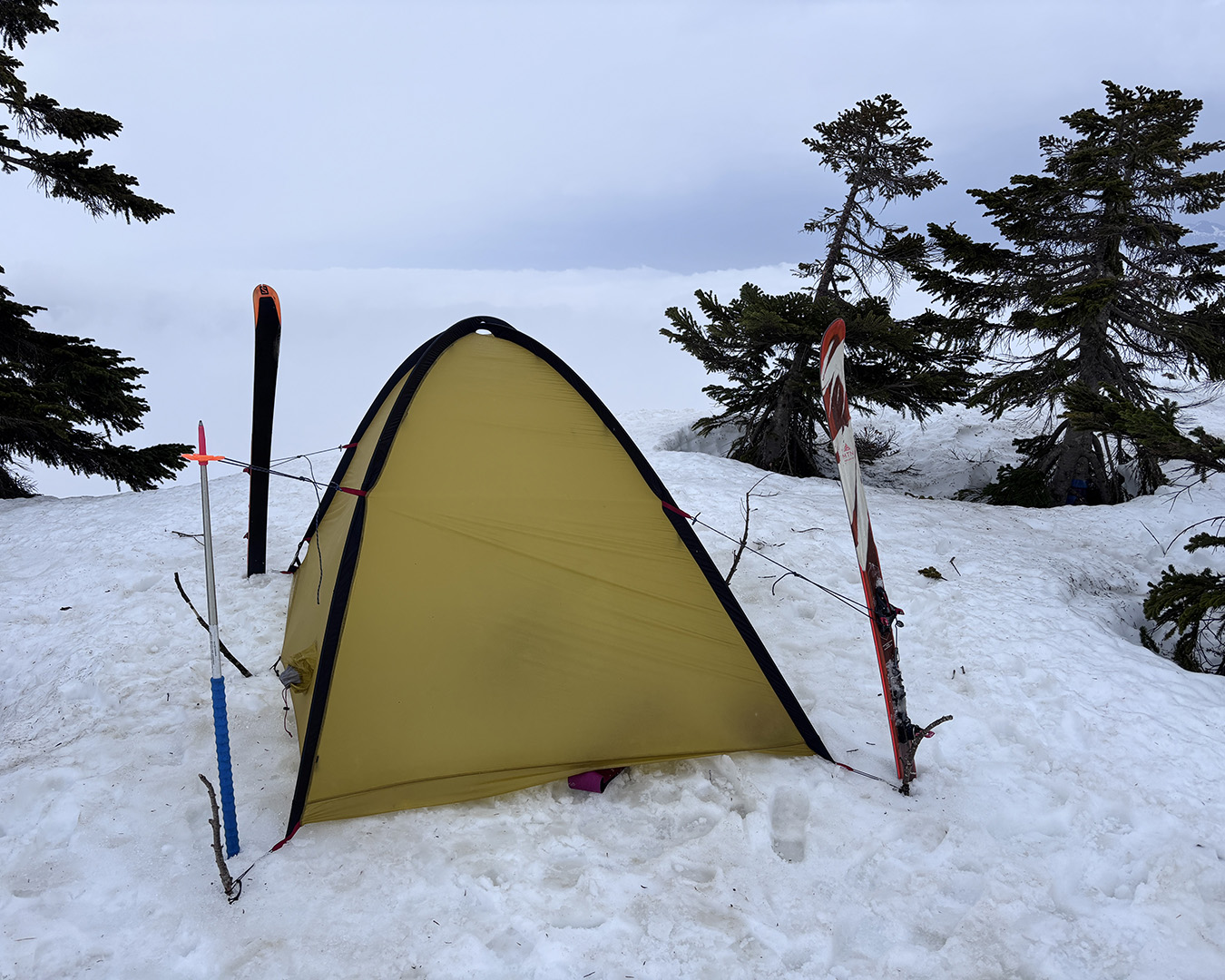
The flat campsite I’d marked near the summit wasn’t there this year—either buried or reshaped by the snowpack—so I dropped a little and found a small level patch along the ridge to pitch my tent.
A downslope wind kept spilling over from above, making everything harder than it needed to be. I stacked the snow blocks high for a windbreak, then, from inside the tent, packed snow around the base to anchor it in place.
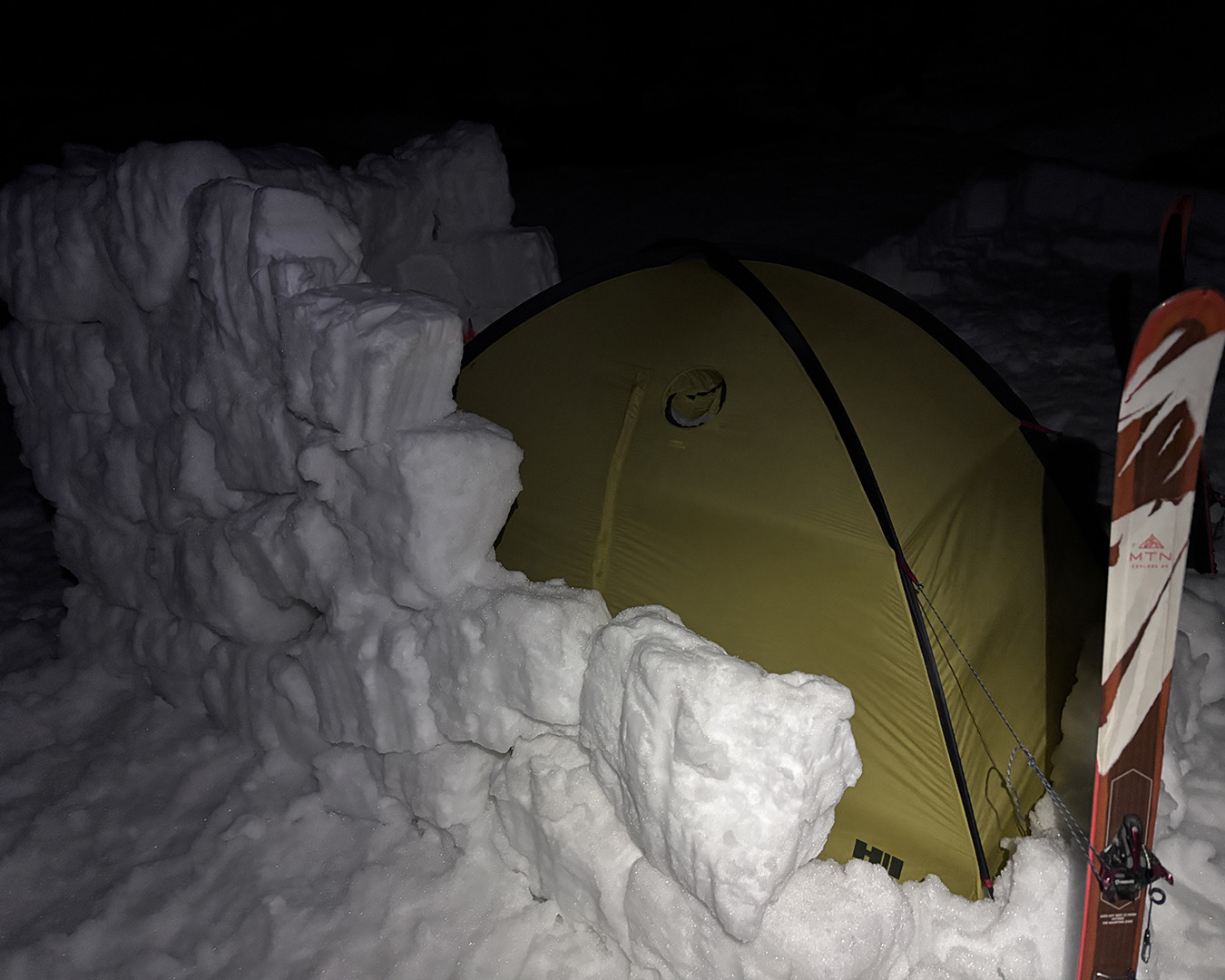
As night fell, the wind rose. Stacking snow blocks—harder than it looks.
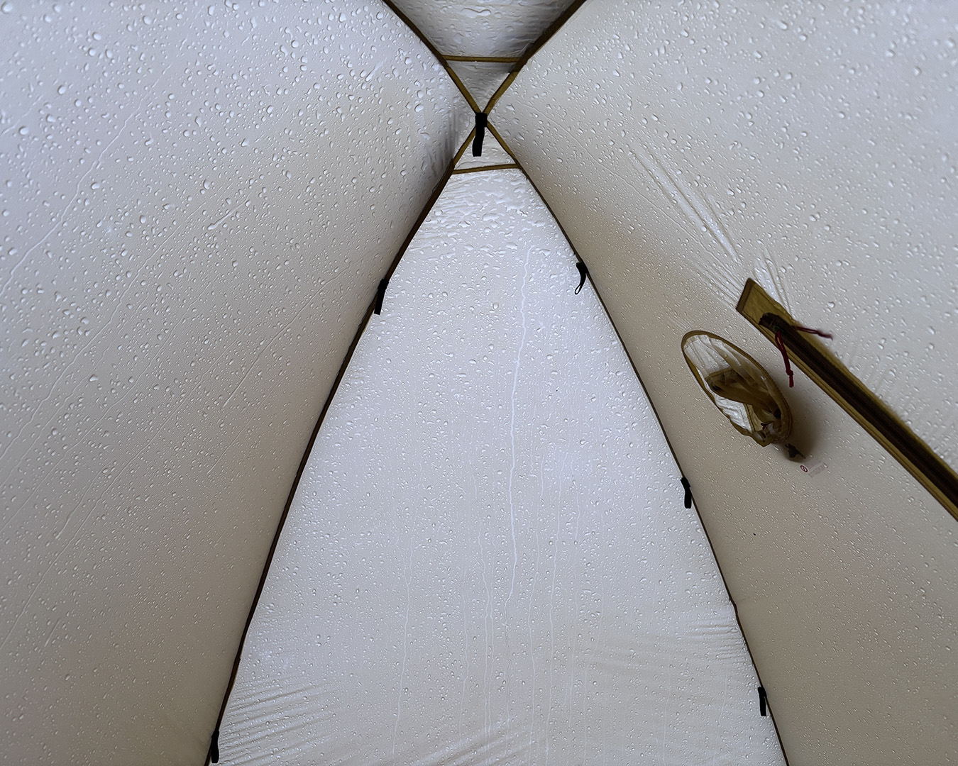
At 7:30 p.m., I finally slipped into the tent in total darkness. By midnight, the wind had eased, and I must have managed to sleep for a while — until the warm southerly wind hit. It softened the snow, and the wall of snow blocks collapsed, striking my face through the tent fabric. One of the tent poles bent slightly. There was no condensation on the tent’s inner wall, but the cover around my sleeping bag was noticeably damp. The moisture must have come from my own breath and body vapor. Without that cover, the condensation would have soaked directly into the bag.
The modified OMM Core Liner I use as a sleeping bag cover worked perfectly. It kept the down bag dry even when the cover itself got wet, and once exposed to the wind, it dried quickly. Thanks to it, my down bag stayed lofty and warm until morning.
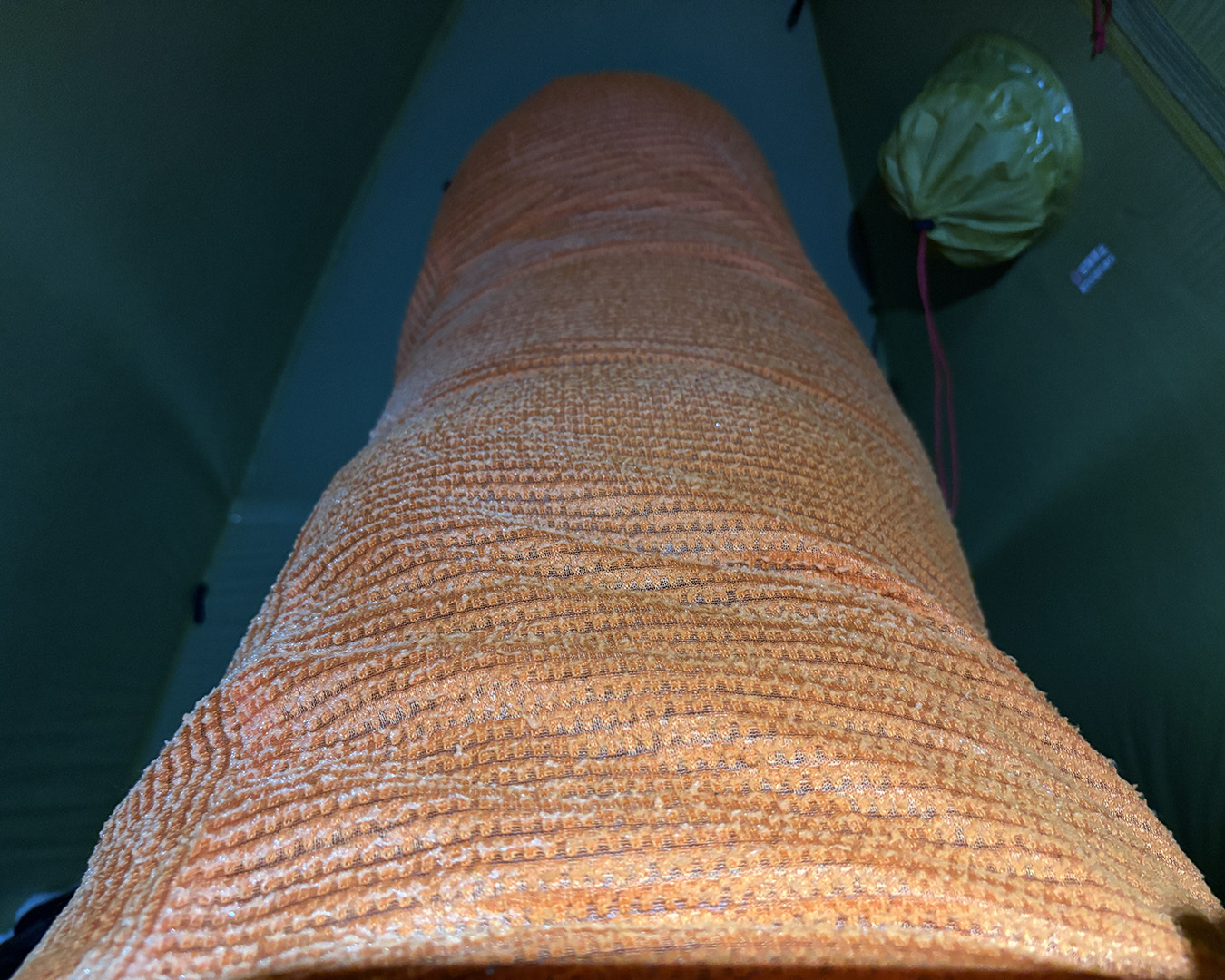
My sleeping bag cover was white with frost—condensation from my own breath and body vapor.
April 18 — The crux
The sky was high and hazy, and the weaker sunlight was a relief. I set out at 7 a.m. From here to Mt. Hontaniyama, the ridgeline narrowed and the snow cover thinned, making it impossible to ski. I switched to crampons and continued slowly on foot.
Worried about breaking through, I moved cautiously, probing ahead with my poles to check for cracks hidden in the snow.
On my last attempt, I’d seen firsthand how poor the snow coverage was along this section — it broke my resolve. I gave up continuing and escaped down to the Mikunigawa Dam via Mt. Nekobuyama. This time, I’d hoped for better snow, but the terrain still wasn’t suited for ski travel.
One idea was to drop east from the summit of Mt. Shimotsukawayama, ski down the Kitazawa Valley, then climb back up to the ridge leading toward Mt. Hontaniyama. But with the snow conditions uncertain, I couldn’t commit. As expected, the south side of Mt. Hontaniyama was lined with collapsed cornices, and I couldn’t bring myself to approach from the planned ridge.
While I was turning over different options in my head, the snow clinging to the summit suddenly gave way with a roar — a massive collapse. After that, I stopped overthinking and simply followed the prefectural border ridge, moving steadily along the sections I could see were safe. Luckily, even with the skis strapped to my pack, the weight didn’t bother me. Unlike last time, when my morale broke, I felt light and steady on my feet.
Just below Mt. Hontaniyama’s summit—a full-depth avalanche released right in front of me.
This time, my focus was on making every mode change possible without taking off my pack — attaching or removing skis, switching to crampons or ski crampons, everything done on the move. I’d set up my system so I could handle these transitions while still wearing the backpack. In the end, that made a huge difference in conserving energy.
At Kohoguchi-no-Kashira, I rejoined the summer trail. The narrow ridgeline was mostly bare of snow, and for the first time in days, I could walk directly on the exposed path. The solid ground underfoot felt reassuring — mountain trails really are a wonderful thing.
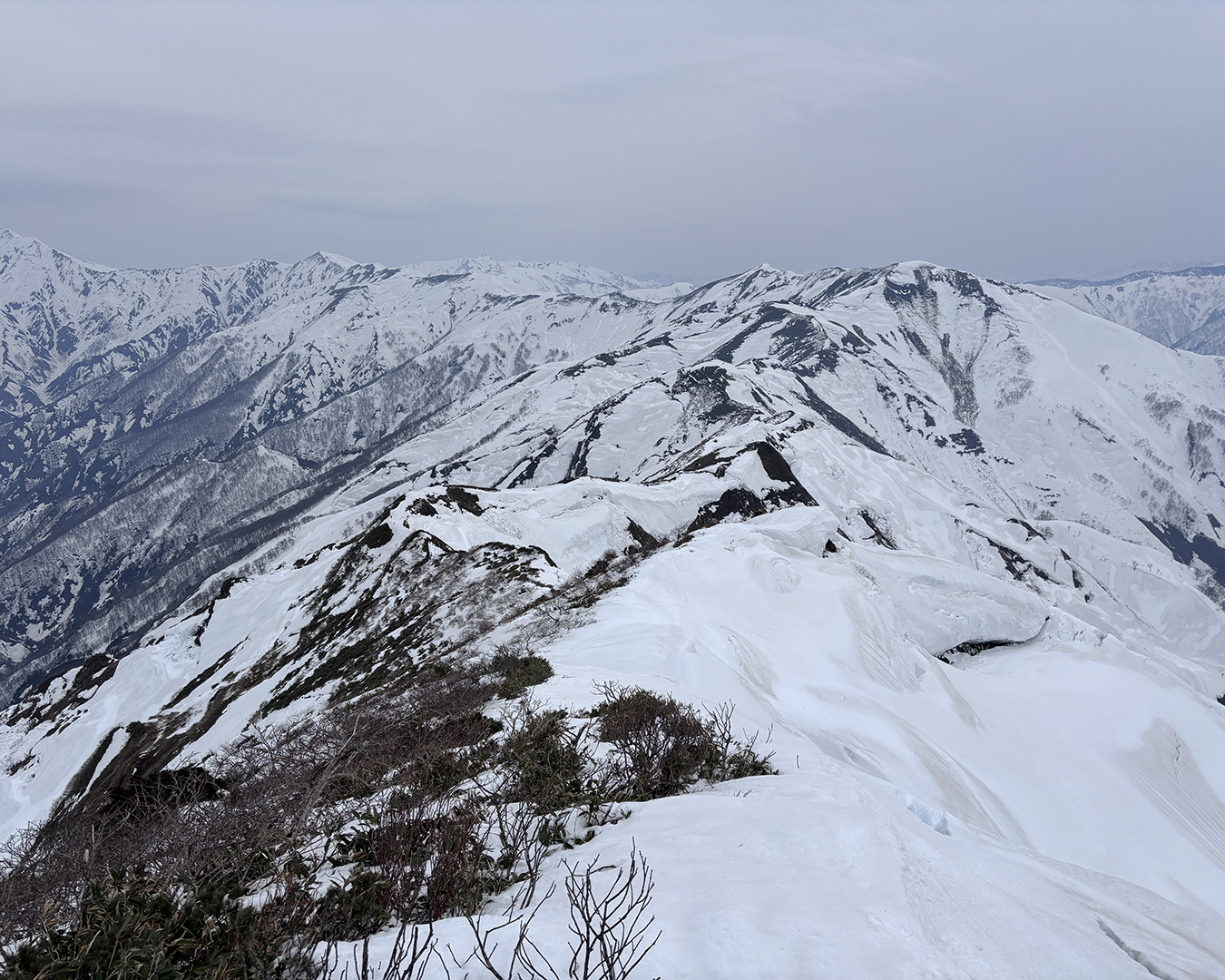
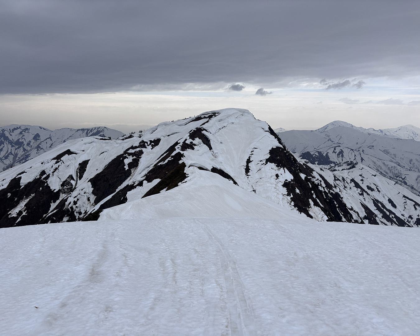
I reached the summit of Mt. Hontaniyama at noon. From there, I could see the entire ridgeline across the valley of the Tone River — the true heart of Okutone.
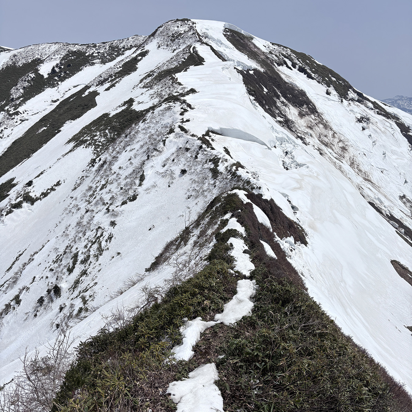
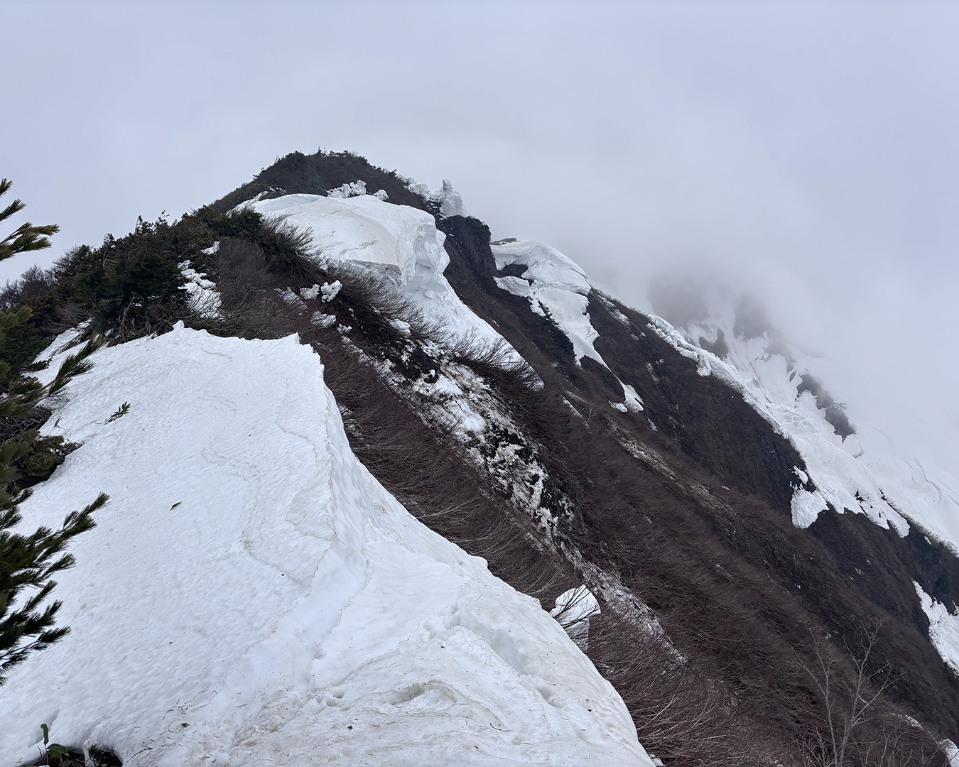
But from Hontaniyama onward toward Mt. Echigosawayama, the terrain grew rough, forcing me to continue on foot with crampons. The approach to Echigosawayama was especially tricky — the snow was patchy, and I had to skirt carefully along the right side of a half-collapsed cornice, searching for a narrow line where the snow still held together.
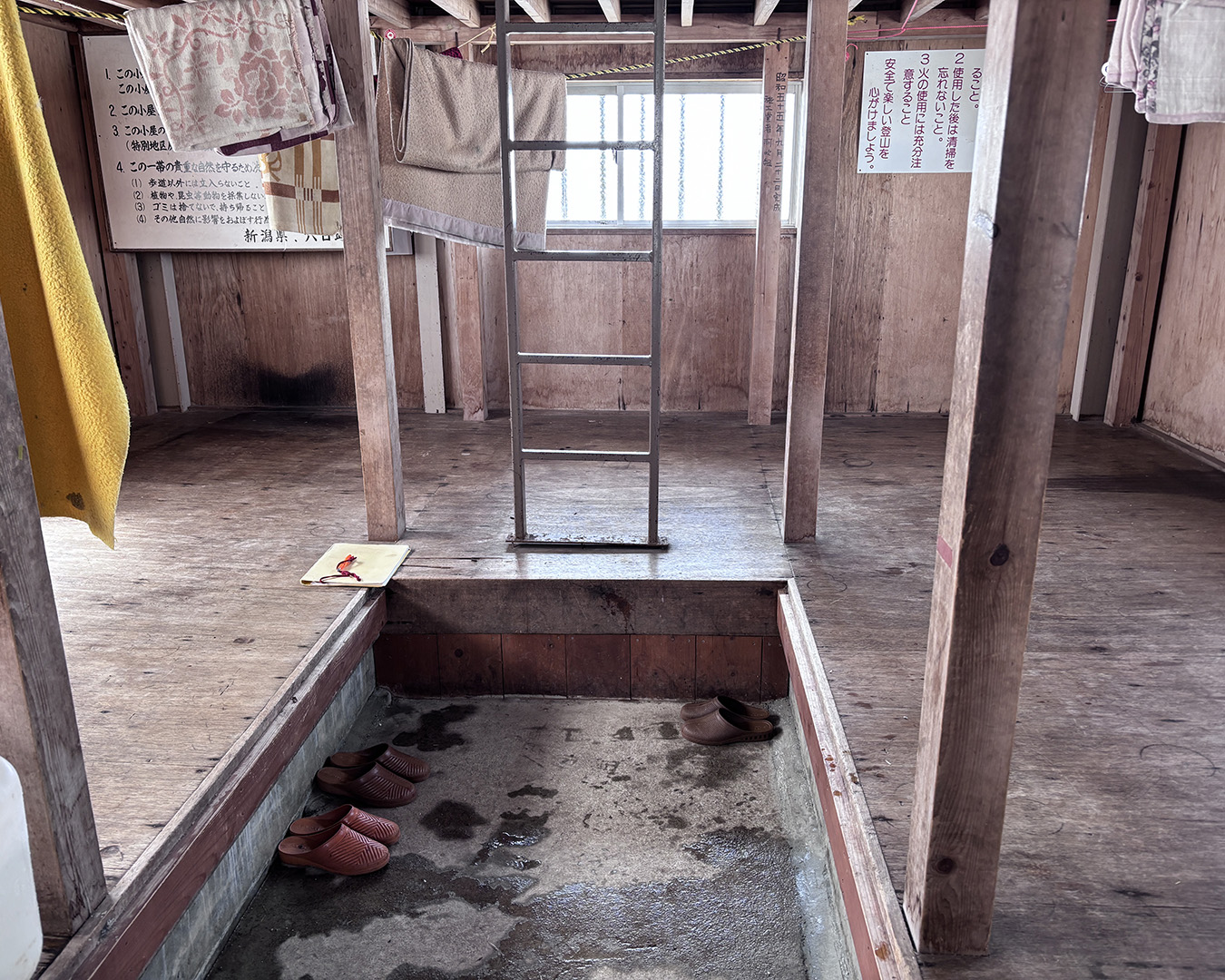
After the 1,710-meter point, the ridge finally eased and opened up. Then I saw it—the triangular roof of the emergency hut on Tangoyama’s broad, flat summit. Relief washed through me all at once.
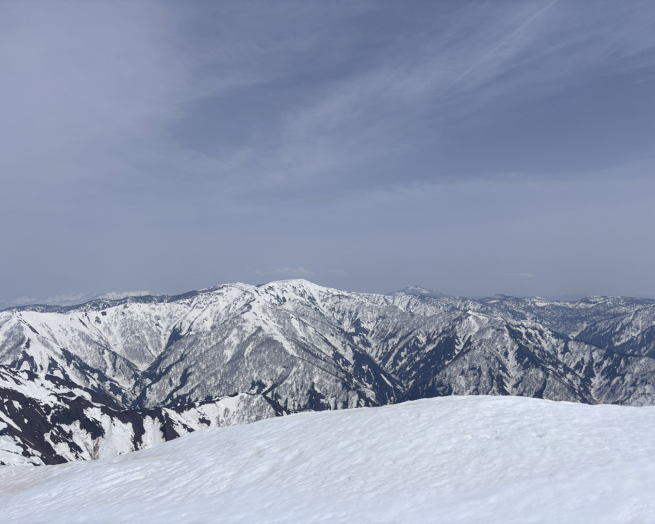
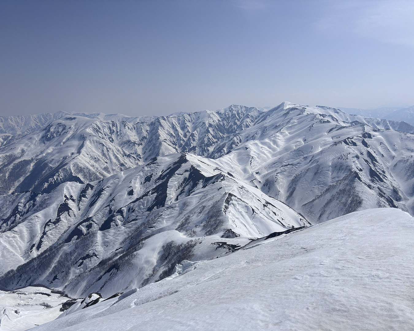
From Mt. Hontaniyama: Mt. Hiragatake across the Tone River; Mt. Hiuchigatake in the distance; Oze off to the right.
Here, my phone finally picked up a signal. I checked the forecast: rain expected from midnight through early morning. That meant wind and fog would likely linger afterward — I was lucky to have reached the emergency hut when I did. I’d probably have to wait out the first half of tomorrow. I called my family to let them know I’d be a day late returning.
I arrived at the hut at 5 p.m. After washing with warm water, I treated my sunburn and rubbed in some pleasantly scented body cream. Inside, it was quiet and warm — pure comfort. I slept soundly.
The Tangoyama emergency hut is one of the best. Because strong north winds blow all winter, snow doesn’t accumulate around it, and by removing the snow-guard planks, you can easily get inside. I signed the visitor’s log and dropped my contribution into the donation box.
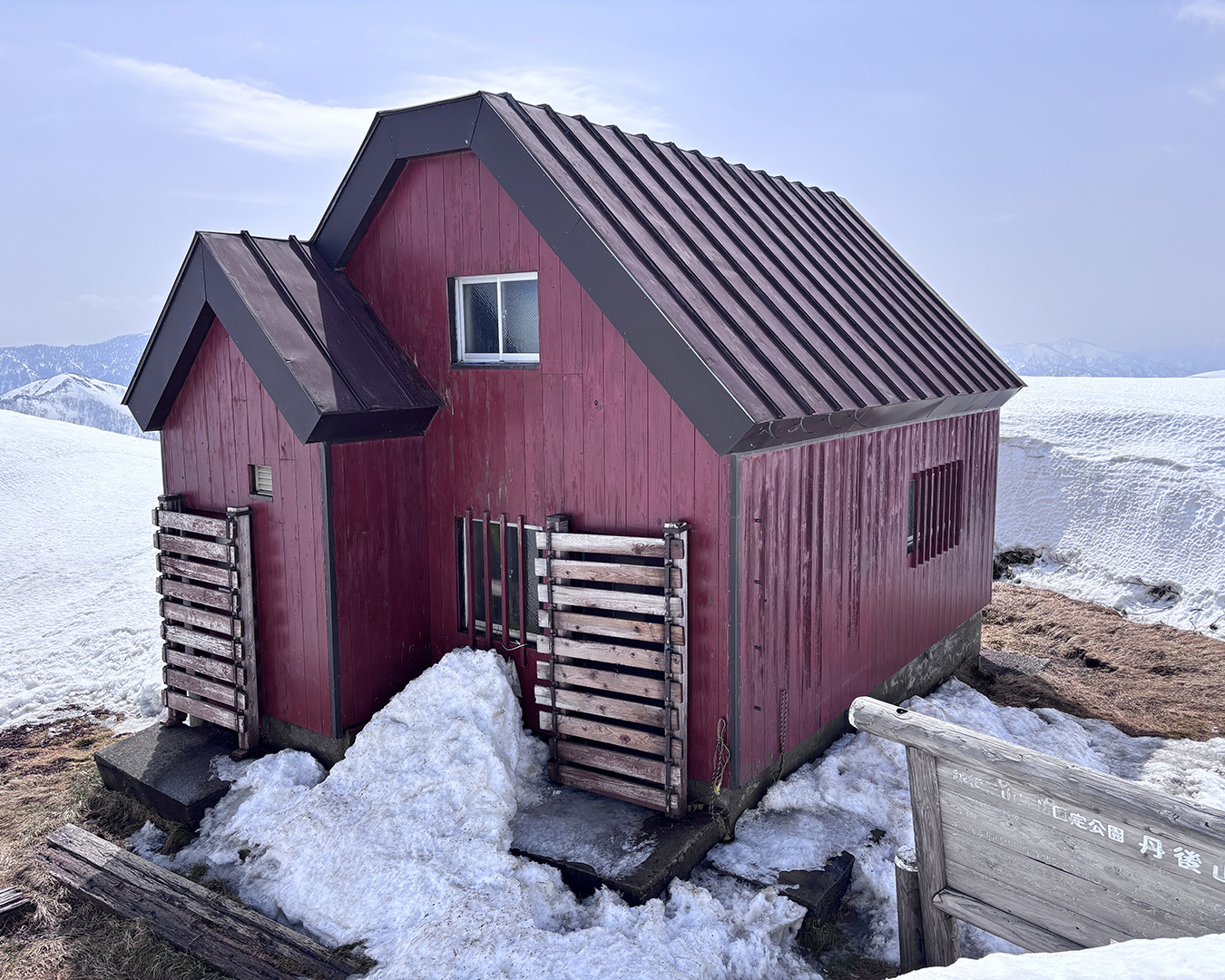
Tangoyama emergency hut. Remove the side snow-guard plank to enter—little snow here is proof of relentless wind.
April 19 — At the watershed
The rain that began overnight stopped by 8 a.m., and by nine, the fog had lifted. The wind calmed, giving way to clear skies and a gentle breeze. After preparing, I left the hut at 10 a.m. If I were to follow the ridgeline precisely, I’d continue from Mt. Omizukamiyama toward Mt. Fujiwarayama, but this time I’d decided instead to cross the headwaters of the Tone River.
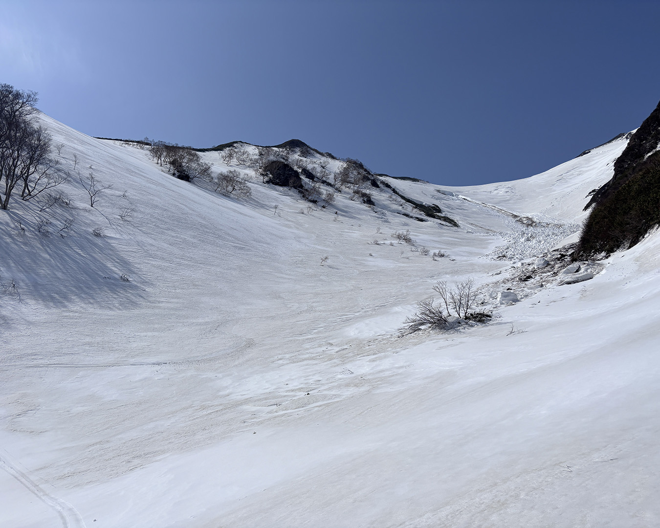
From the Tone River source marker, a broad skiable slope opens below. The upper snow looks good.
Standing on the watershed that divides rainfall between the Sea of Japan and the Pacific Ocean, I dropped in at 10:30 a.m. from the Tone River source marker, along the line I’d scouted the day before, and skied into the Fukasawa Valley — at last, carving turns into the birthplace of the Tone.
Avoiding avalanche debris, I climbed from the valley floor up the opposite ridge. That short climb meant I’d officially crossed the Okutone headwaters. The rain had left most of the slope heavy and slow—sticky stop-snow—but higher up it turned to perfect spring corn, and I got a clean set of tracks right at the river’s beginning.
I stopped in the wrong spot and missed the photo. A shame.
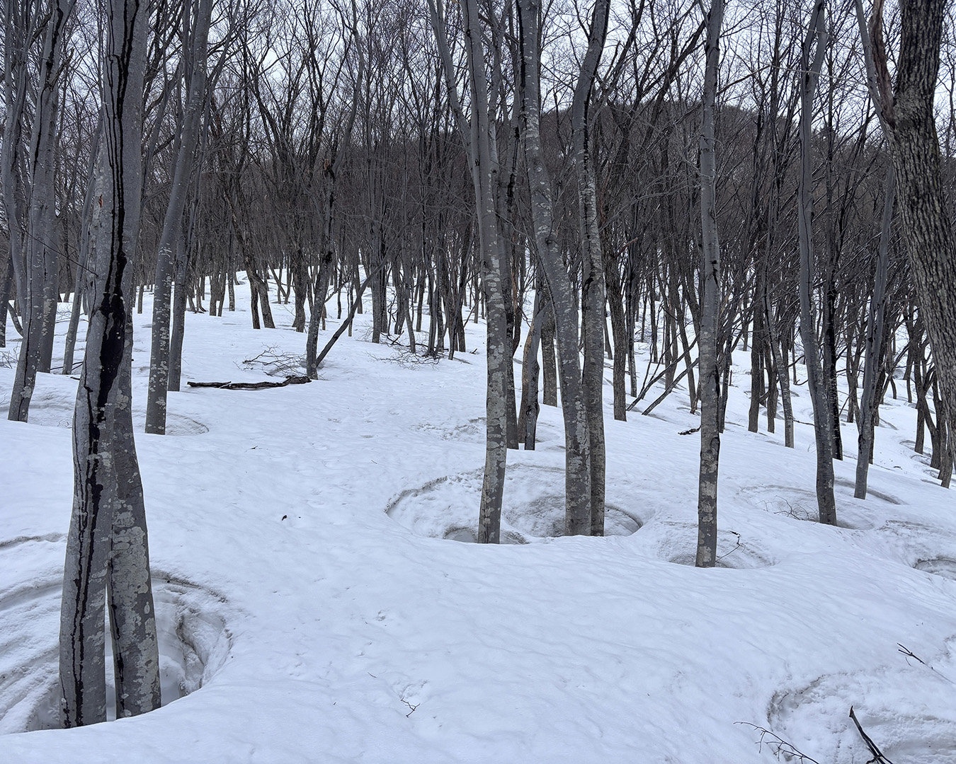
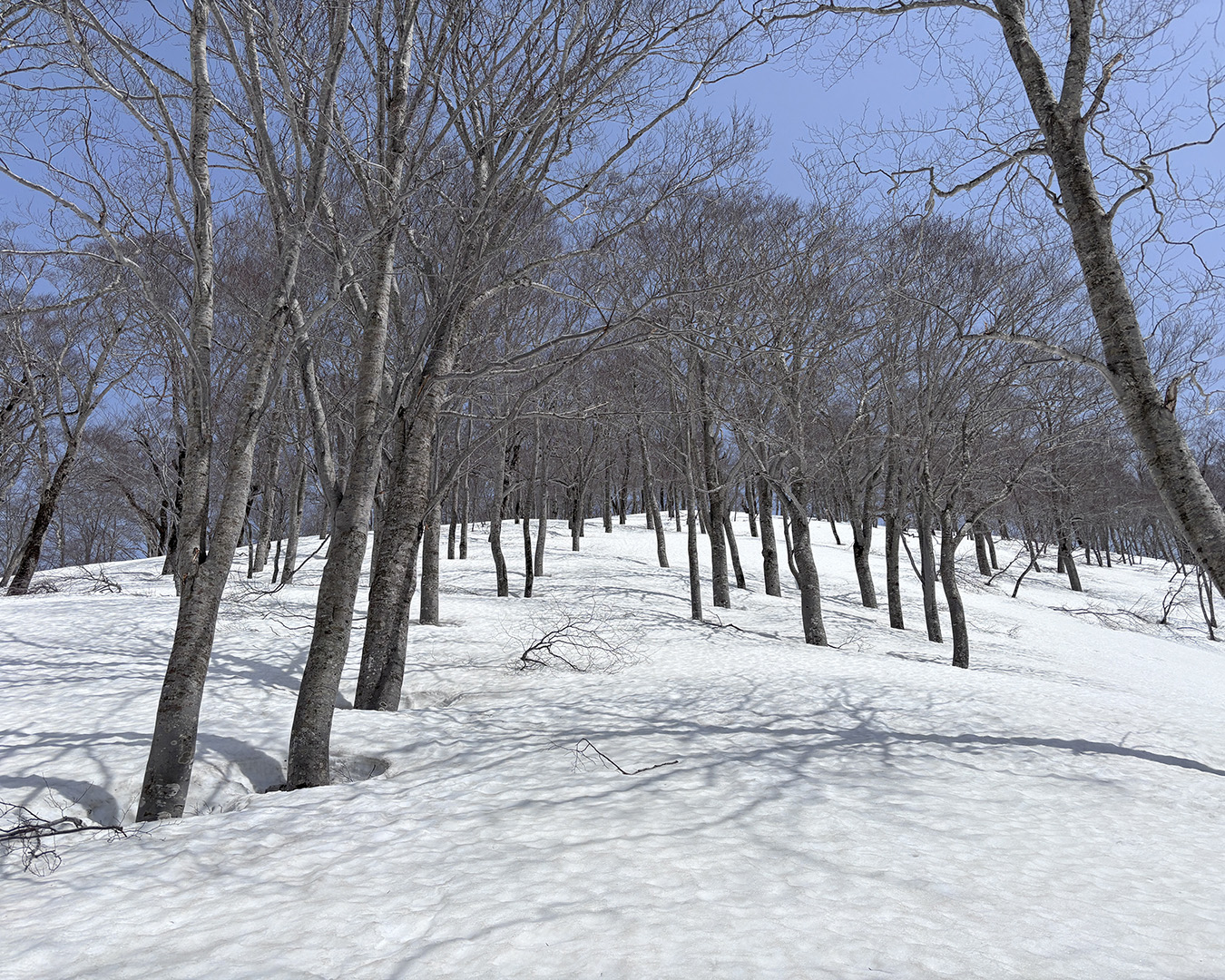
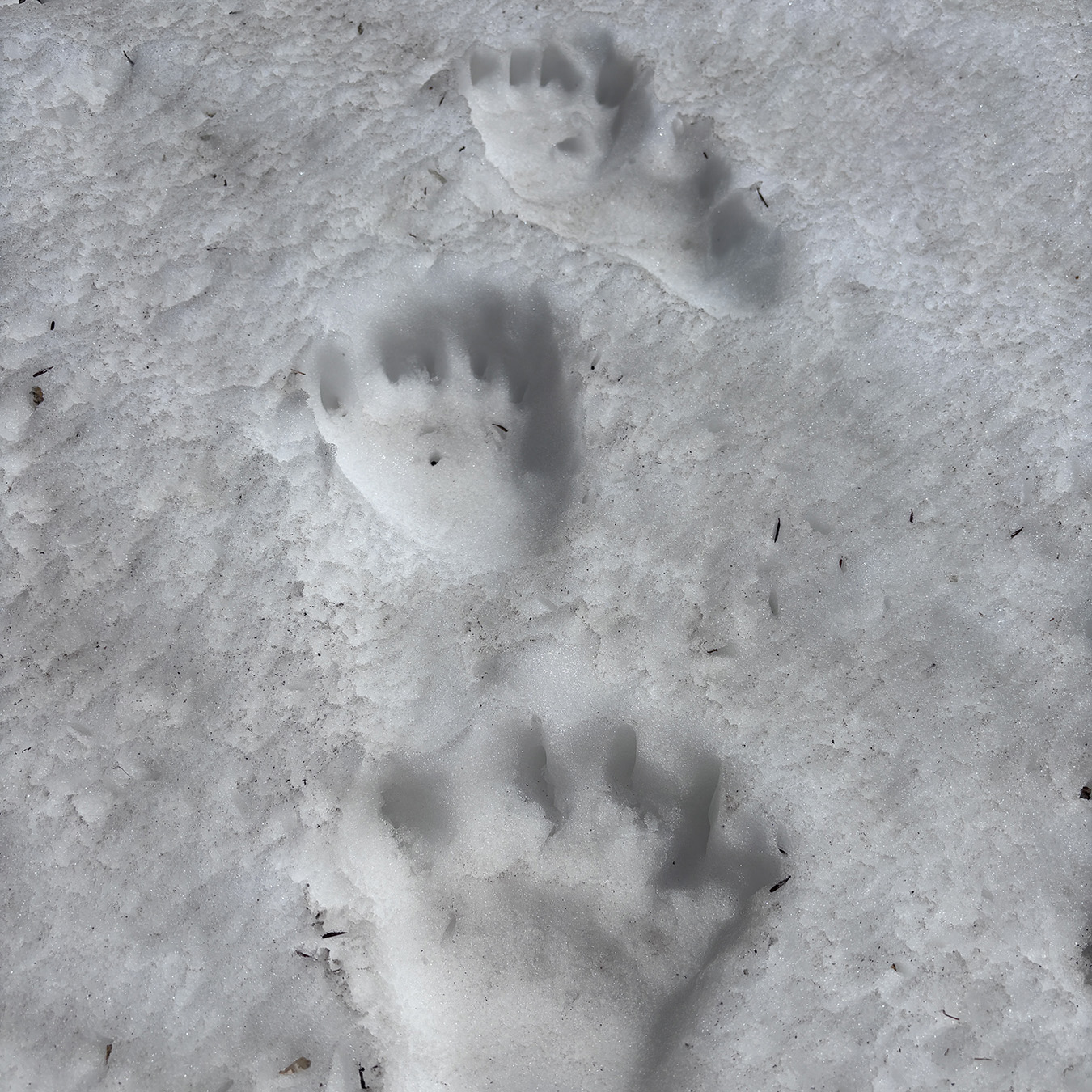
The valley floor was littered with debris from avalanches cascading down both sides, and the air echoed with the rumble of more slides. There seem to be more avalanches in the morning. I quickly found a line to rejoin the ridge and switched back to skins. The terrain there softened into a soothing beech forest. I noticed claw marks from a bear on a young tree — though a bear living this deep in the mountains would never stray into the villages below.
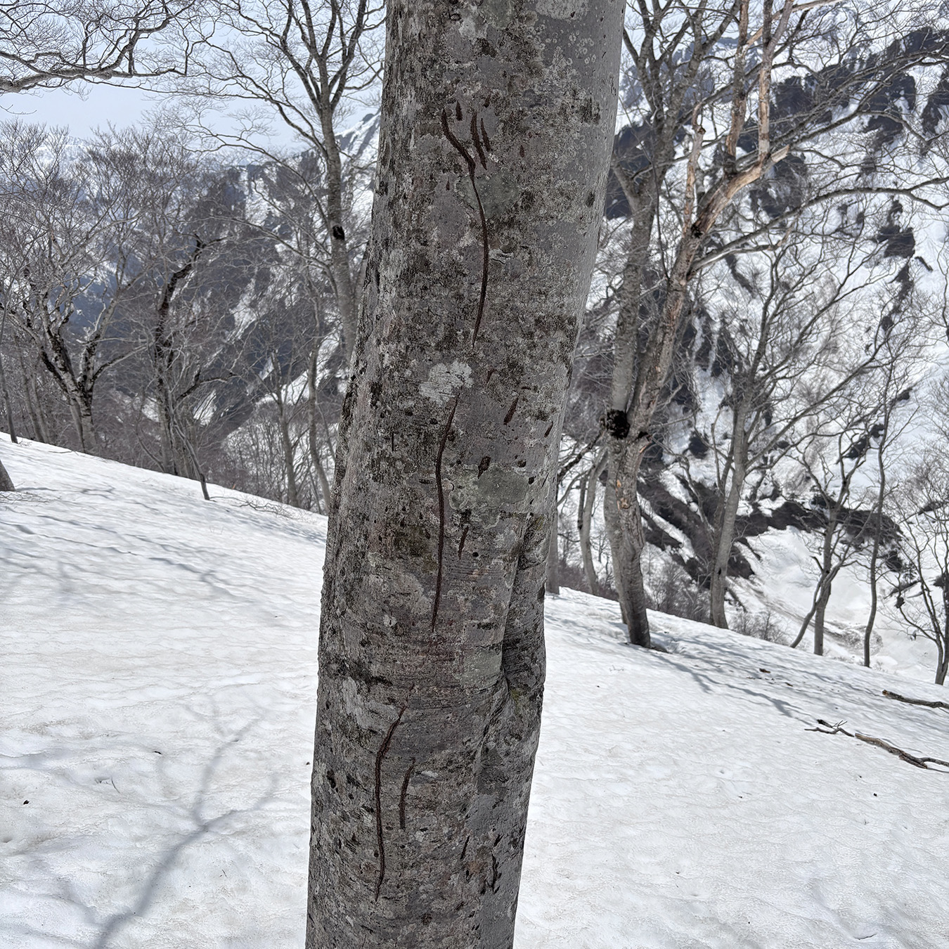
Bear claw marks—scratches left as it slid down after feeding on beech nuts.
The temperature rose to 18°C, and the sun was intense. By the time I climbed back up to the ridge, it was 2 p.m. I saw a single set of footprints coming from the direction of Mt. Hiragatake — I wondered where that person had gone.
Footprints from the Mt. Hiragatake side. If someone made it through from there, it means it’s possible.
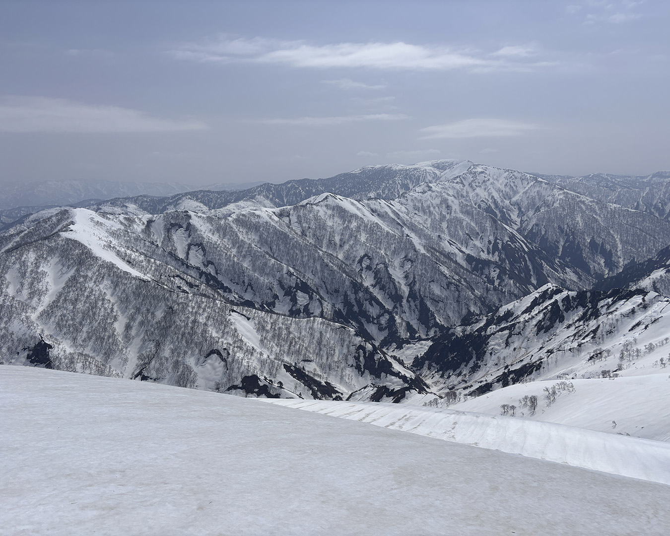
Seeing it in person always makes me smile: the contrast is so stark it’s almost comical. On the Niigata side, across the Tone River, the mountains are wild and steep, their dark faces scarred by avalanches. On the opposite side, around Mt. Hiragatake, the slopes are gentle and broad, draped in beech forest. Beyond, the mountains of Oze and Minamiaizu spread faintly into the distance, carrying a trace of the northern Tohoku character.
I skirted around Mt. Fujiwarayama and continued on. From a distance, I’d thought I could traverse around the slopes below the next peaks — the false Fujiwarayama and Mt. Takigakurayama — on skis, but it wasn’t that easy. I had to switch back and forth between ski and crampon modes several times to get through.
The false Fujiwarayama was particularly troublesome. I climbed along the edge of the ridge where the brush was already poking through, crampons scraping at the soft, melting snow. The warming temperatures made the surface unstable, and even traversing on skis was awkward. I reached the base of Mt. Takigakurayama just as I ran out of time for the day.
At 5 p.m., I finally found a spot suitable for camping and pitched my tent. I’d planned to reach Mt. Tsurugagurayama, but with the late start, I didn’t make it that far. The sun set over the Niigata-side ridgeline I’d been walking the previous days. Tomorrow, I hope to cross Mt. Hiragatake and somehow reach the Oze area.
April 20 — The gentle-ridge illusion
The weather was cloudy. The night had been calm and windless, but I couldn’t sleep well, tense with uncertainty about the conditions ahead.
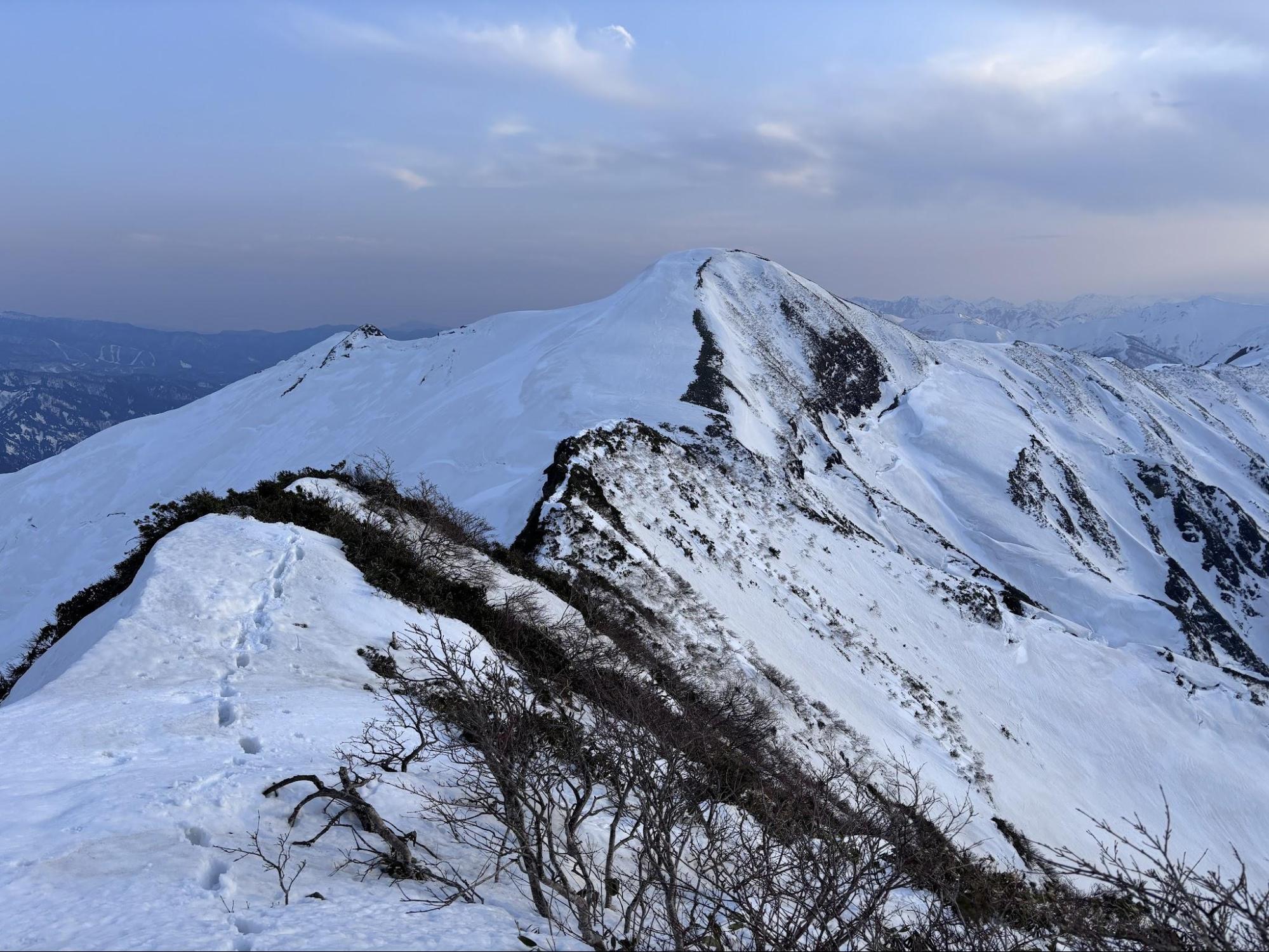
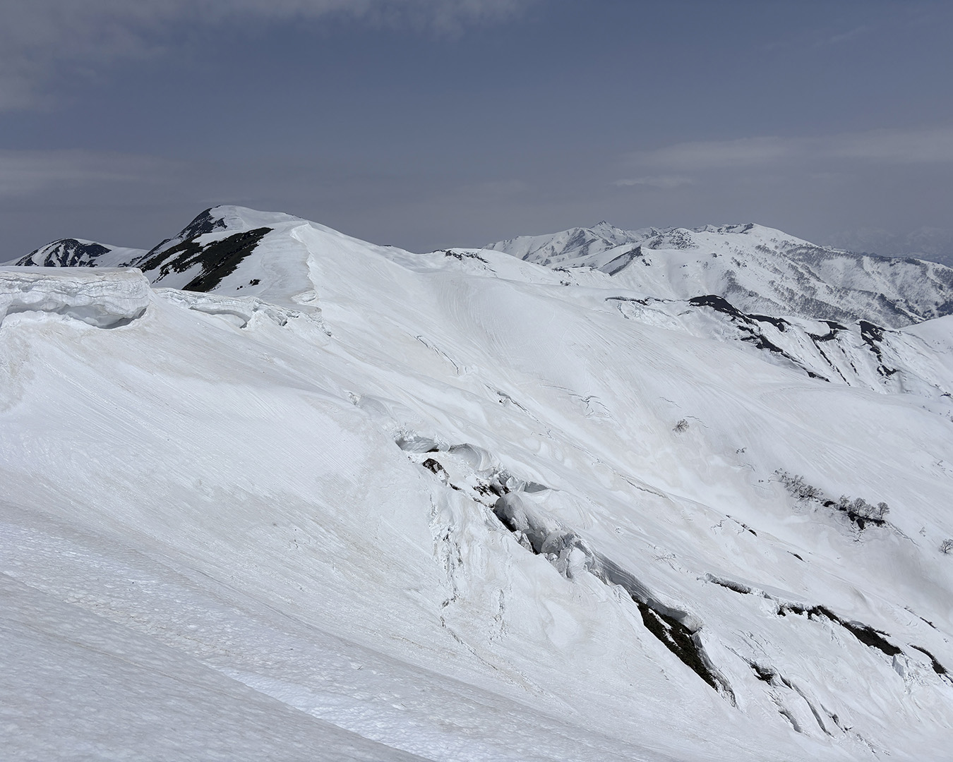
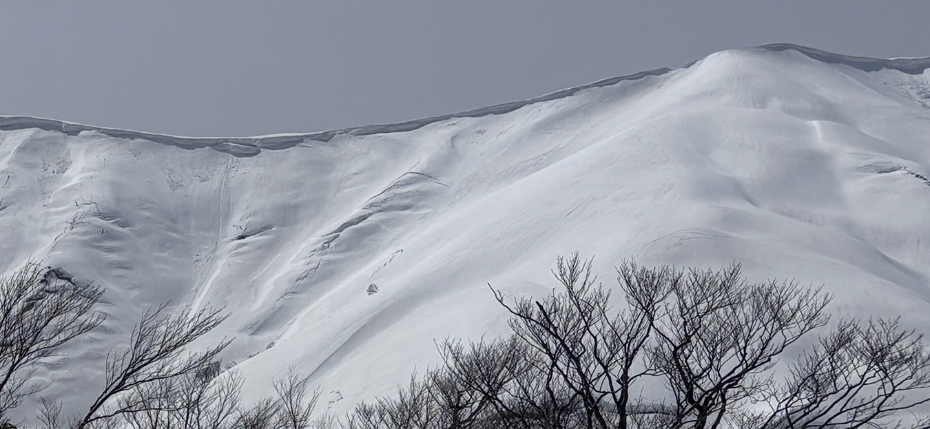
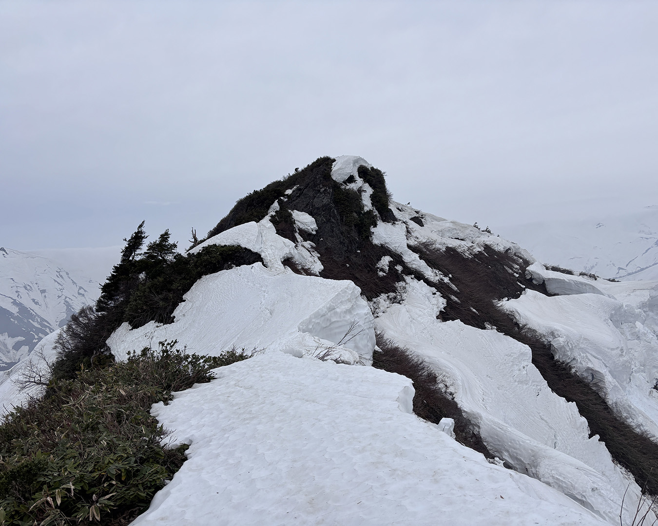
Unlike the day before, the morning was high overcast with a light breeze — a good start, and I didn’t even break a sweat. But crossing the three peaks, including Mt. Takigakurayama, proved far more difficult than expected. I could hardly use my skis and had to continue on crampons. There was no way around; the ridge was a mix of snow and brush. The last climb up Mt. Takigakurayama had rocky sections that kept me on edge. Looking back afterward, the three peaks lined up like a row of bad-tempered dumplings.
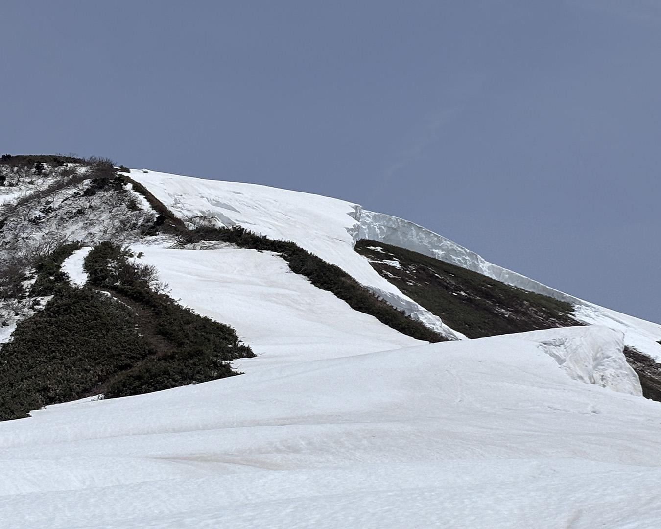
Relieved to have made it through, I began skinning up the graceful slopes of Mt. Tsurugagurayama, guided by a lone serow. But when I reached the top, the view ahead left me stunned.
Beyond Mt. Tsurugagurayama—steeper than it looks. The overhang hides the descent point.
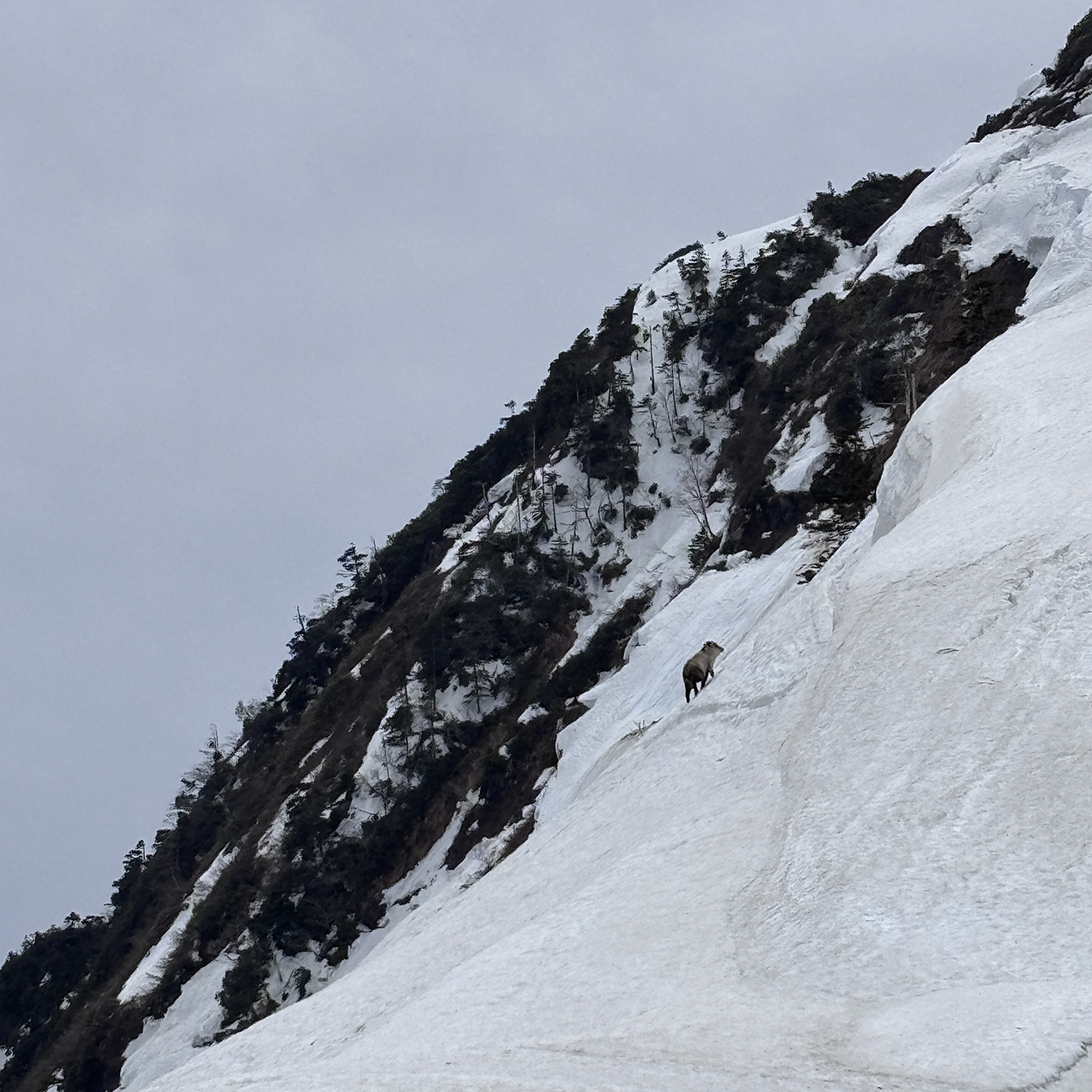
The climb up Mt. Tsurugagurayama came with an unexpected guide: a lone Japanese serow leading the way. One more peak, and Mt. Hiragatake was next.
Steep drops came one after another. Along the narrow ridge, cornices clung on as if by a thread—ready to let go at any moment. From the summit’s huge overhang, I couldn’t even see a safe place to start down.
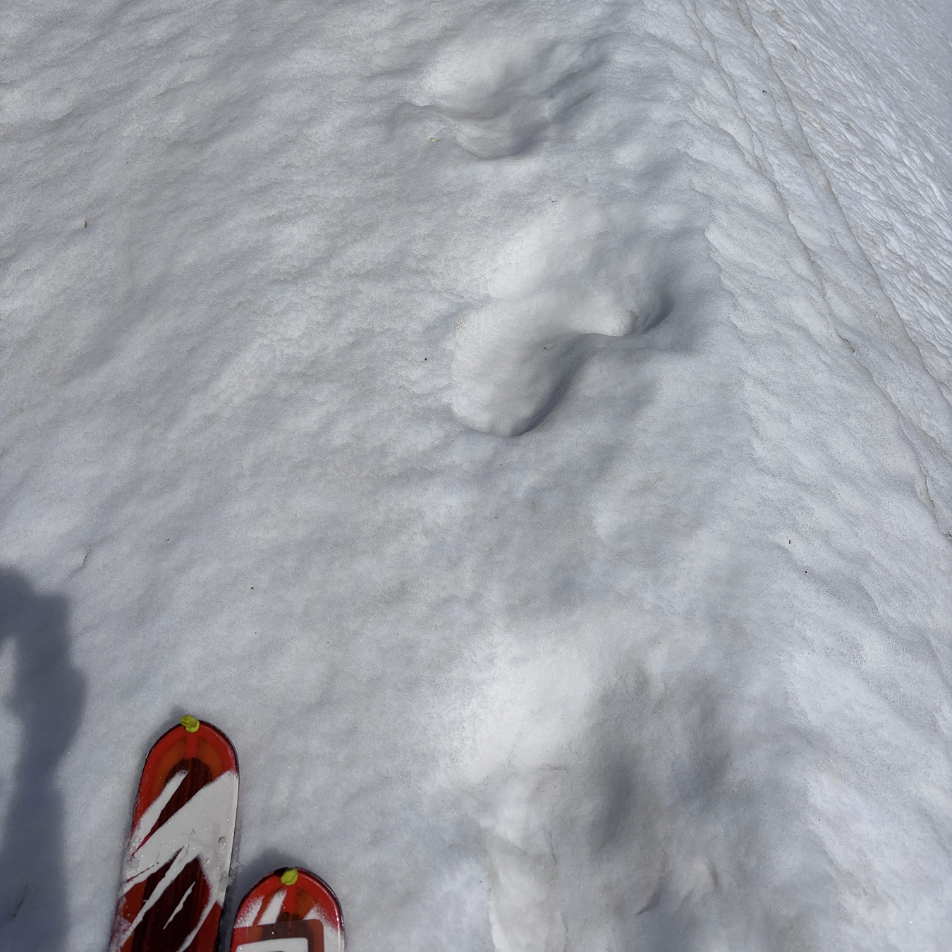
Then, out of nowhere, a serow appeared—quiet, sure-footed, completely at home. It moved on ahead with effortless calm and hopped the cornice as if it weren’t there. I couldn’t follow.
I slowed down and read the terrain, and eventually found a section where the cornice had already broken. From there I made my descent, traversing while gripping bamboo grass, until I finally managed to regain the ridge.
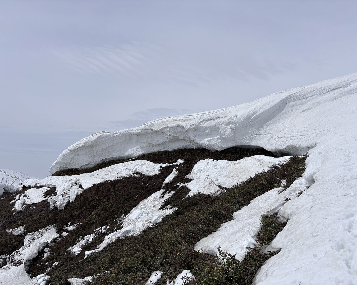
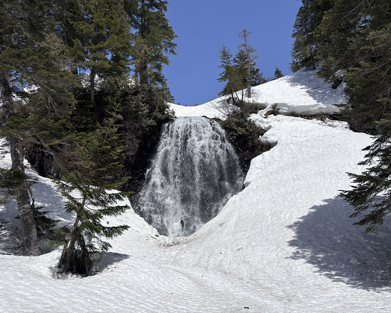
Threading through cracks in the snow cornices that looked ready to give way at any moment, I clung to patches of exposed brush along the ridge and forced my way through. There was no time to look back. Once I climbed onto safer ground, the tension slowly eased, leaving me dazed for a while. When I passed under one of the cornices, meltwater was dripping down, and I managed to refill my Platypus bottle. Once I reached a wide, open ridge blanketed in pure white snow, I switched back to skins and headed for Mt. Hiragatake.
Through the crux and back into safer ground. Looking back at Tsurugagurayama—rain clouds building from the north.
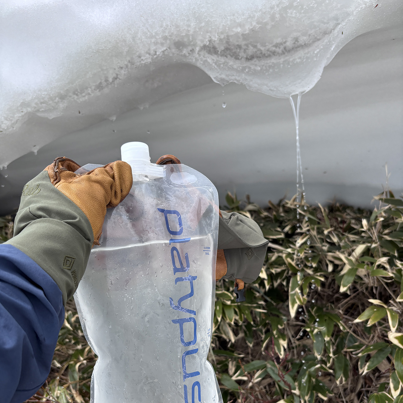
Refilling my Platypus with snowmelt. A quick pause to collect myself.
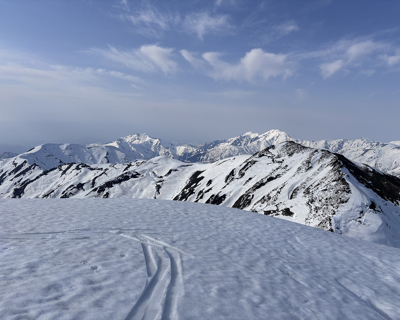
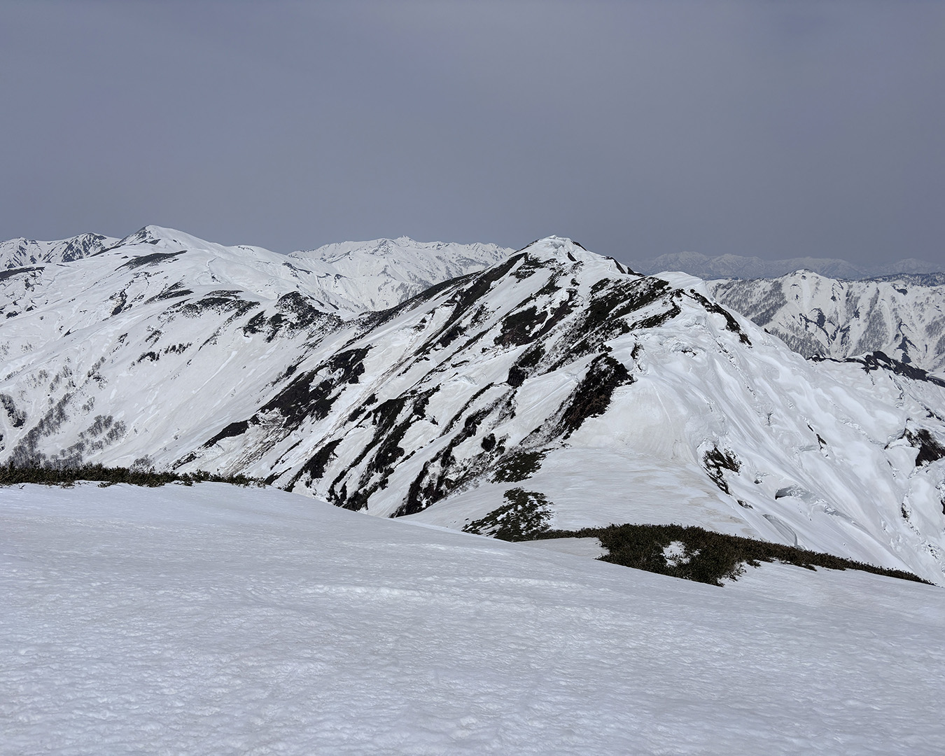
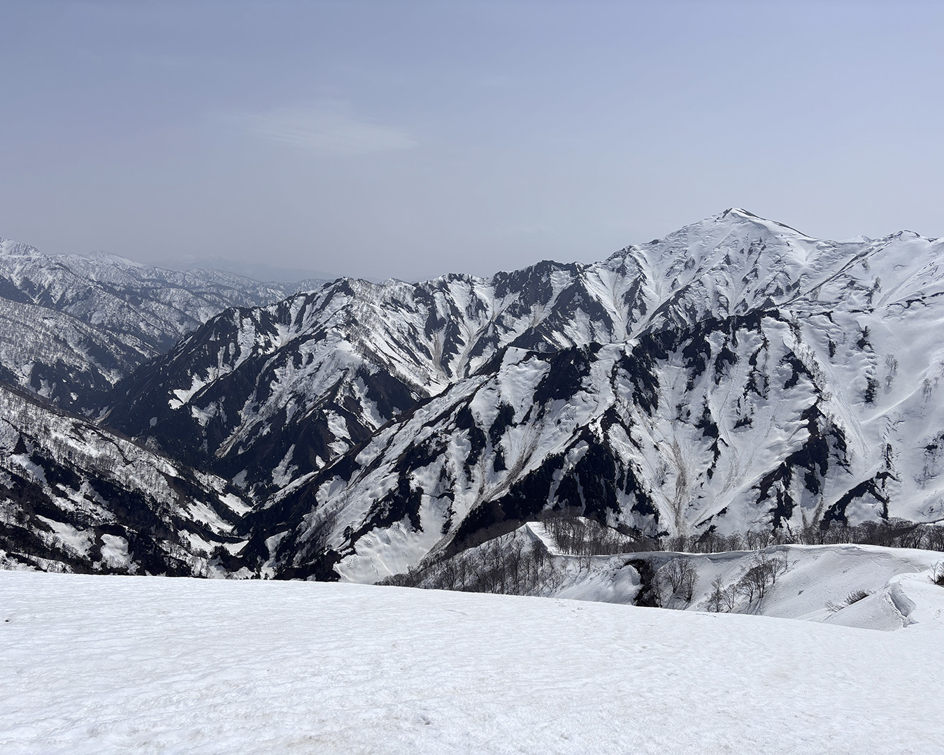
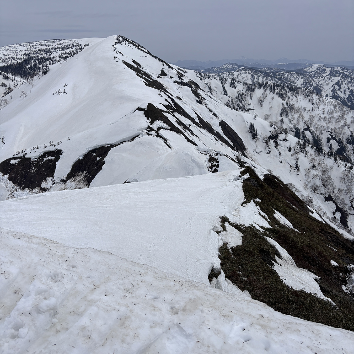
The summit, broad and gentle, offered a full 360-degree panorama — I could see the entire ridgeline I’d been following. I felt a wave of relief to have made it safely. Looking back, the ridge I had walked formed a single thin white line, stretching away into the distance. In that moment, I felt deeply that the mountains and the towns below are connected, unbroken.
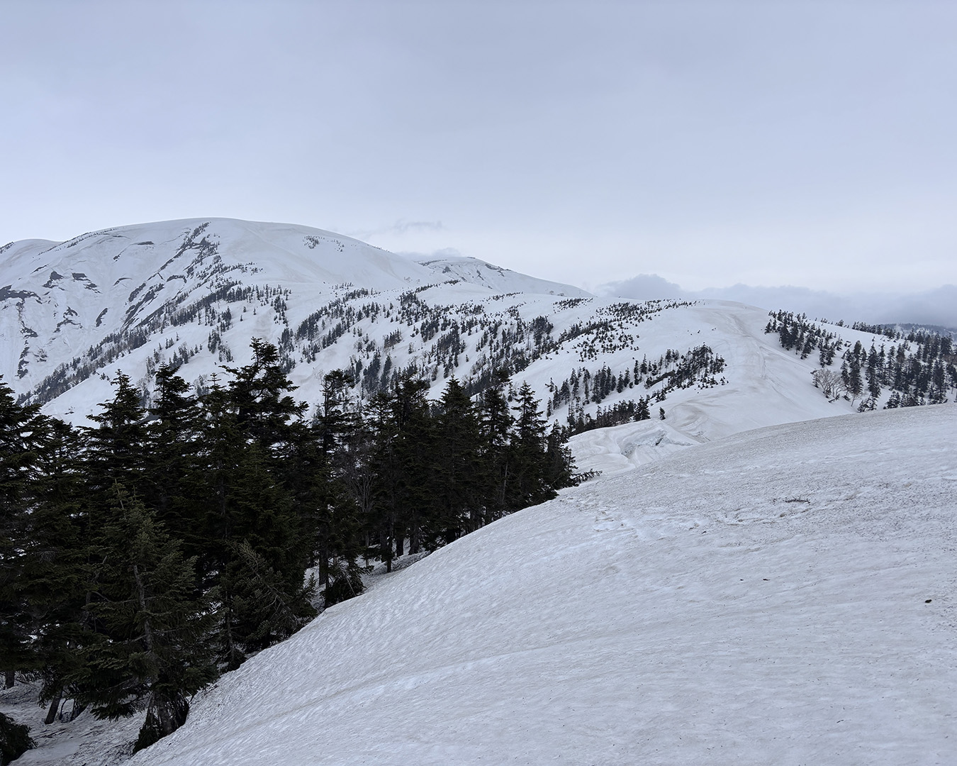
The gentle ridge toward Mt. Hiragatake. Oze is close now.
For hikers coming from the city, the mountains might represent a world apart — something extraordinary. But for me, this snow path is simply an extension of daily life. The ridges that had terrified me now seemed like nothing more than fleeting moments; given time, even fear fades. And so, inevitably, I’ll head back into the mountains again.
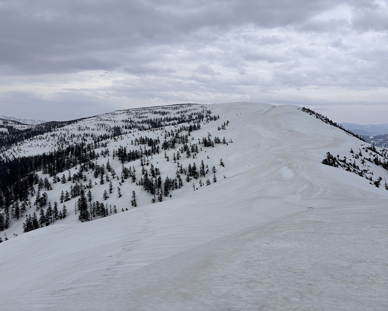
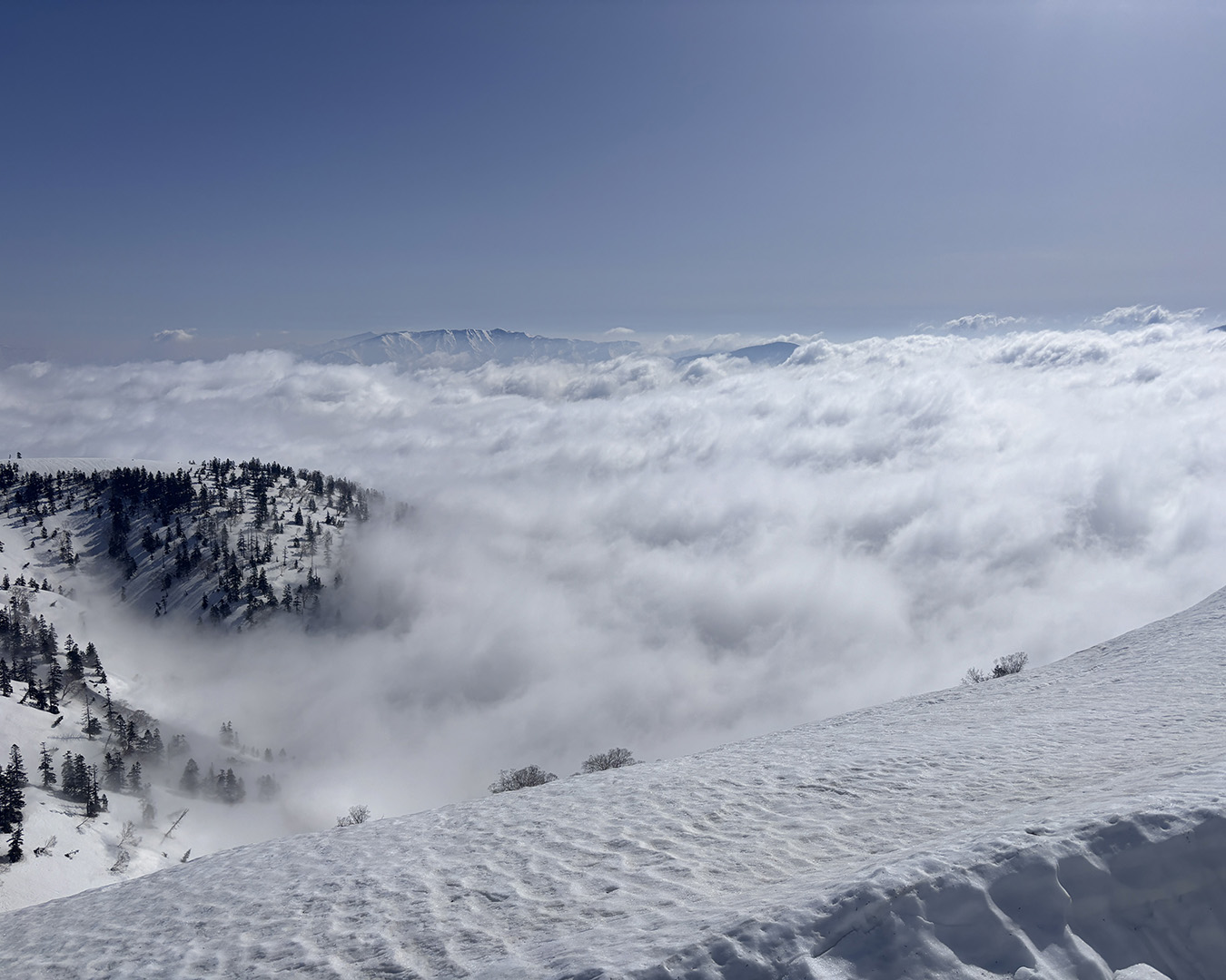
Beyond Mt. Hiragatake, I saw many old ski tracks. The descent was smooth, with a few traverses along the way. When I’d visited Oze in late March, I’d spotted a wind-sheltered campsite in the forest between Mt. Ohshirasawayama and Mt. Keichozan. But just as the forecast had warned, rain began to fall around 4 p.m., so I hurriedly pitched my tent on the summit of Mt. Shirasawayama, using fallen twigs as pegs for the corners.
Rain on Mt. Shirasawayama’s summit. A rushed tent pitch as a sea of clouds drifts in from Okutadami.
The rain soon turned heavy, and with it came strong winds — but having weathered countless storms in Tateyama, I wasn’t too worried. My floorless Crossover Dome tent handled the rain perfectly. I wiped my body clean with a towel soaked in hot water, changed into pajamas, and ate dinner while listening to Korean pop songs sung by a girl group. Since I was now a day behind schedule, I made rice balls with the spare freeze-dried rice I’d packed — easily the best meal of the trip.
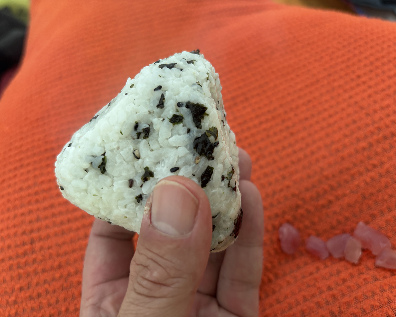
The last supper: freeze-dried rice onigiri.
As forecast, the rain stopped by 8 p.m., but soon after, violent winds struck the tent with Tateyama-level force. Lying inside, I felt a chill on my left side and, shining my headlamp, saw the tent bottom flapping — wind was pouring straight in. The small twig I’d used as a front peg had blown away. I hadn’t expected the wind to get this strong and had neglected my usual precautions.
There had been plenty of sheltered spots just a little lower down — I’d simply let my guard down near the goal. In a hurry, I piled snow along the inner flaps to weigh them down, then went outside to reinforce the four corners with thick branches I found nearby. After tightening the guy lines, I looked up to find a sky filled with stars, bright under the moonlight. In the distance, I could see the artificial glow from Yamanohana and Hatomachi Pass. Thanks to the wind blowing through, the tent fabric had dried completely from the earlier rain. Finally, I could rest easy.
April 21 — Oze, at last
I woke to strong morning sunlight. Outside was a sea of clouds, with the peaks of Mt. Aizukomagatake, Mt. Hiuchigatake, and Mt. Shibutsusan floating above. With the goal so close, there was no need to rush. I laid out my damp gear to dry in the sun. The air was cold, and the snow had hardened under the chill of the clear night.
Mt. Aizukomagatake floating above the sea of clouds.
I packed up and left Mt. Shirasawayama at 9 a.m. Somewhere during the descent, I dropped the ice axe that had been attached to my pack — carelessness born of relief. Fortunately, the terrain ahead was gentle, and neither crampons nor an axe were needed. I kept walking.
From the junction peak before Mt. Ohshirasawayama, the existing tracks veered toward Mt. Susukemine, but this time, I decided to descend straight down the Warusawa Valley, both to explore and to satisfy curiosity. Checking the map as I went, I bypassed a large waterfall. In front of it lay a perfectly round flat clearing — a dream spot for a snow camp. I made a note to come back someday.
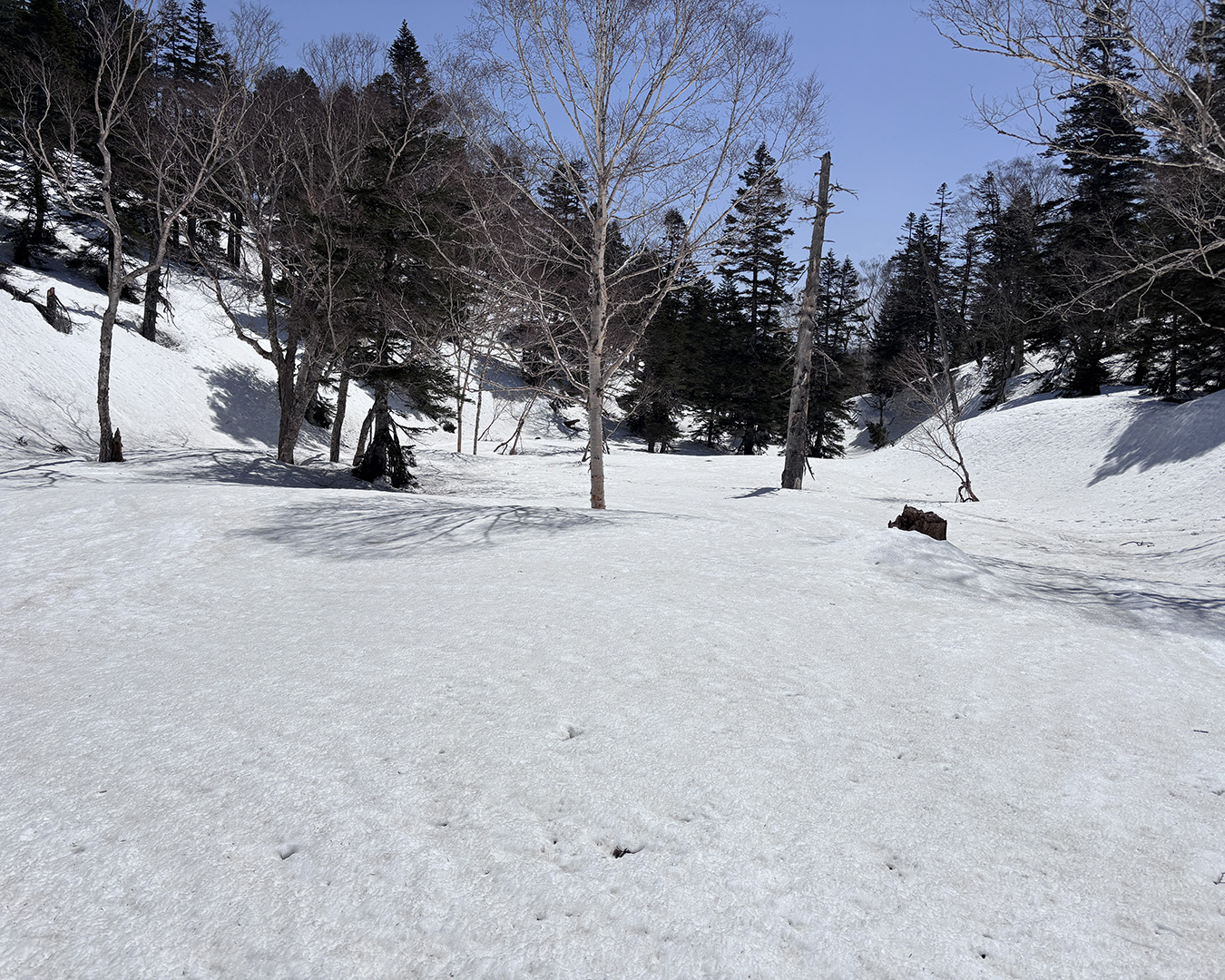
A perfectly flat clearing below the waterfall—my secret dream campsite.
Following the tracks of a bear just out of hibernation, I traversed the mountainside, skied down through the valley, and looped around the second waterfall, where I rejoined the track that had come from Susukemine. It felt good to end the trip this way — a final stretch of pure, personal ski hiking. From there, I glided across the broad riverbed straight toward Yamanohana. Looking up at Mt. Shibutsusan, its slopes were carved with countless ski tracks, like a full-on ski resort.
Out onto the Oze plain. From here, it’s all poling.
Every year around early May, the road from Tokura Gate to Hatomachi Pass opens, and buses begin running into Oze. Mt. Shibutsusan fills with climbers and backcountry skiers.
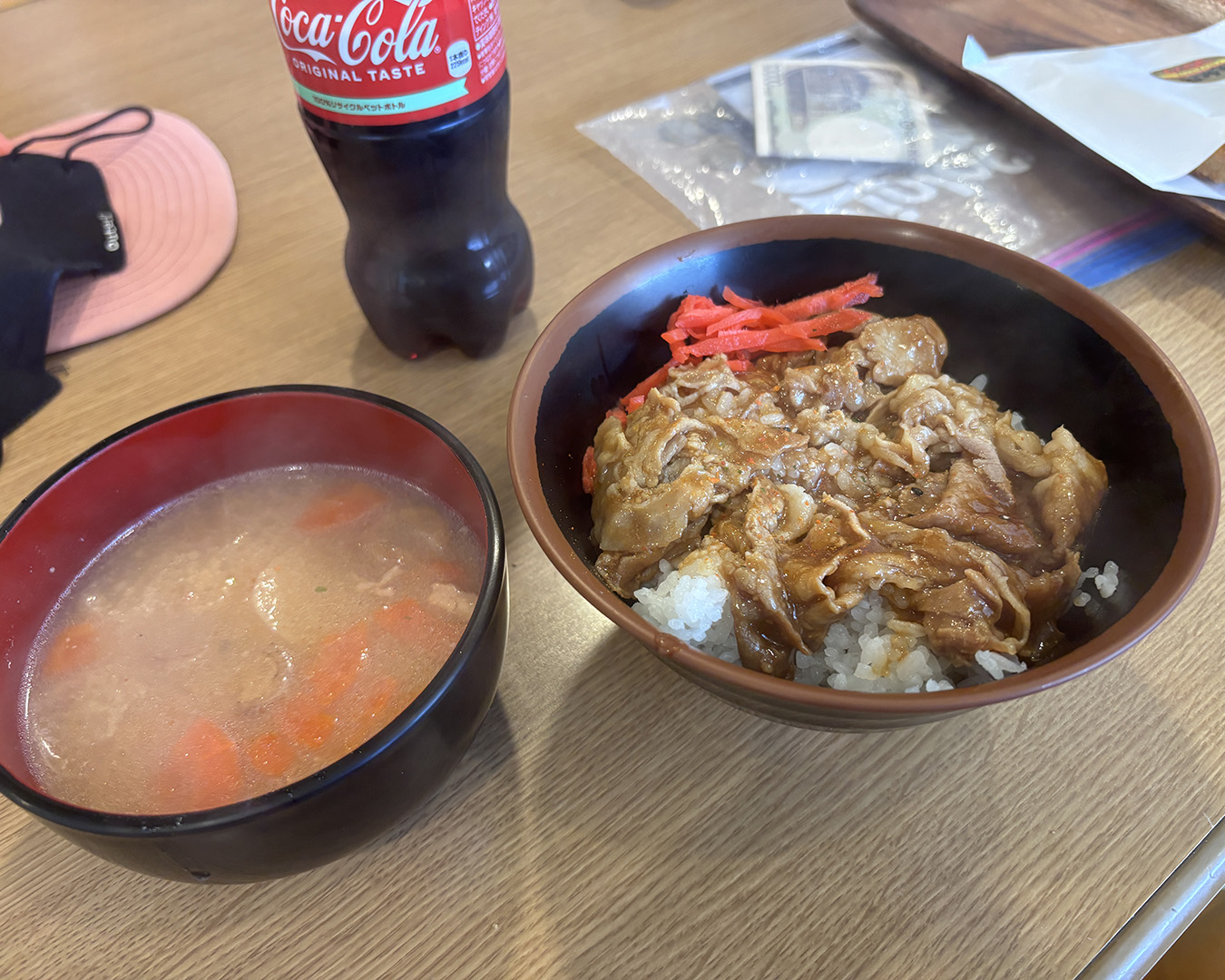
At 1 p.m., I reached Yamanohana. The lodge there was open, and I headed straight for the dining hall. I devoured a bowl of stamina-don just in time to catch the 2:30 p.m. bus from Hatomachi Pass, sprinting past every hiker in sight to make it aboard. Full stomach, rocking bus — sleep hit me hard, but I managed to send my descent report through the Compass app.
The lodge at Yamanohana—my first people in five days.
While waiting for my transfer bus at Tokura, I took off my ski boots and spread my wet gear out on the asphalt to dry. A pleasant fatigue filled my body. Cherry blossoms fluttered on the spring breeze.
It didn’t feel like a finish line — more like a pause. From here, I’d return to town, back to my life shaped by snow. That cycle — between the mountains and daily life — is what keeps me coming back. If I can share even a small sense of that rhythm with others who live in the city and love the outdoors, I’ll be glad.
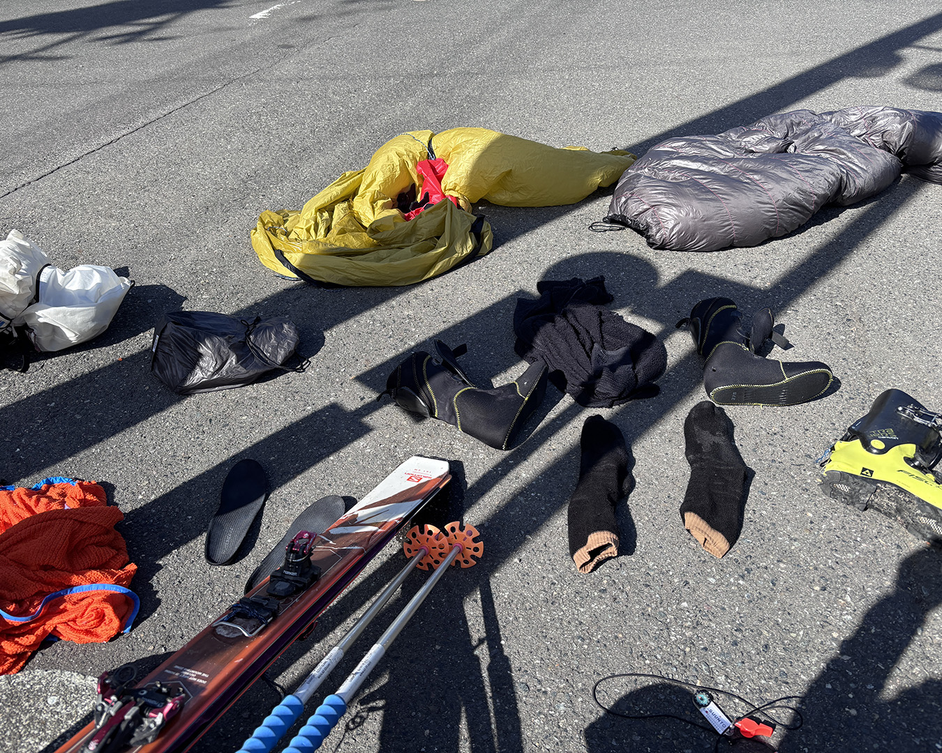
Sun-drying gear at the Tokura bus stop.
Afterword
I hesitated over what to call this trip. More than once along the way, I caught myself muttering, “This isn’t ski hiking anymore.” It felt closer to a full ski-mountaineering traverse. I probably spent about thirty percent of the time on crampons, ice axe in hand. If you asked whether I really made the most of the skis, I’m not sure I could answer with confidence.
But a few days after finishing, I started to feel differently. Yes—this, too, is ski hiking. When I first began calling myself an ultralight ski hiker, I had one rule: no crampons, no ice axe. If I needed them, I told myself I’d gone too far. I didn’t even care much about the skiing. My line was always, “I’m not here to ski.”
Somewhere along the way that changed. Carrying crampons and an ice axe has become normal, and I’ve come to enjoy the skiing just as much as the travel. Maybe that’s age. Maybe it’s just time spent out there. Either way, it feels good—like the world I can move through has gotten a little wider.
This route might be my limit, at least for now. Still, if I can hold onto what I felt in that final stretch into Oze—the lightness, the freedom—while accepting the “hardcore” parts that come with it, that’s the style I want to keep chasing. On the ridge, the border mountains ran out in every direction. I can already feel myself wanting to spread out a map and draw the next line.
Next goal: a job that lets me take a long vacation in March. I want to stay healthy—body and mind—and keep traveling this way for at least another ten years.
Born in 1972. Based in Minamiuonuma City, Niigata Prefecture. Works at Ishiuchi Maruyama Ski Resort.
X account: @greenliftgohttps://note.com/ulskihiker