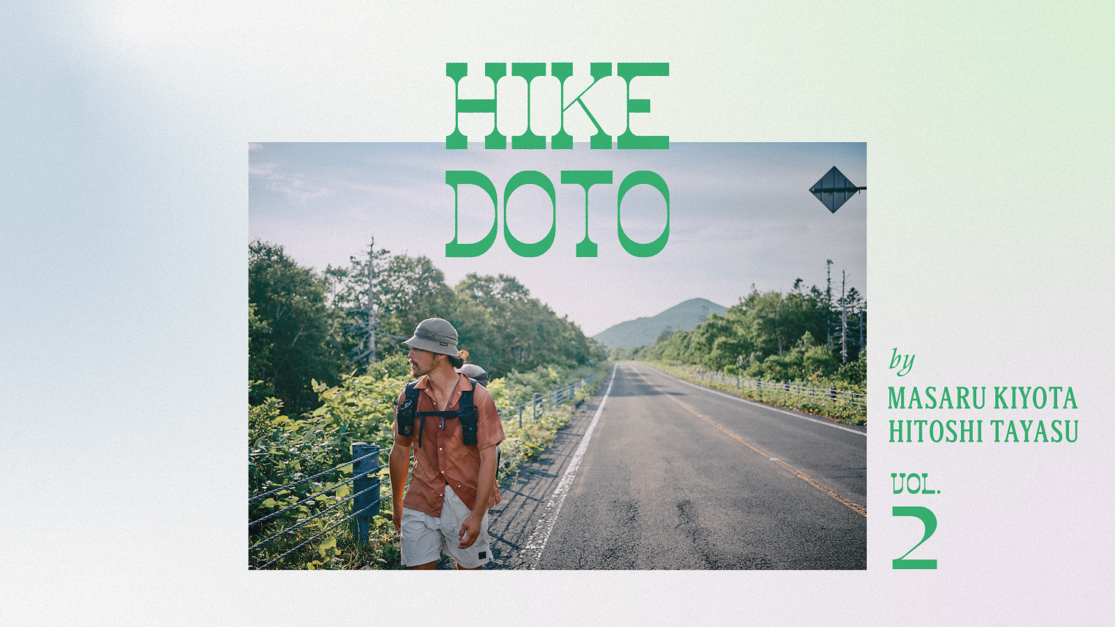


HIKE DOTO: 410 Kilometers on the Hokkaido East Trail, Vol. 1
Photographs by Hitoshi Tayasu
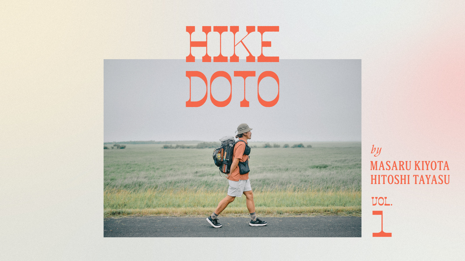
HIKE DOTO: 410 Kilometers on the Hokkaido East Trail, Vol. 1
Photographs by Hitoshi Tayasu
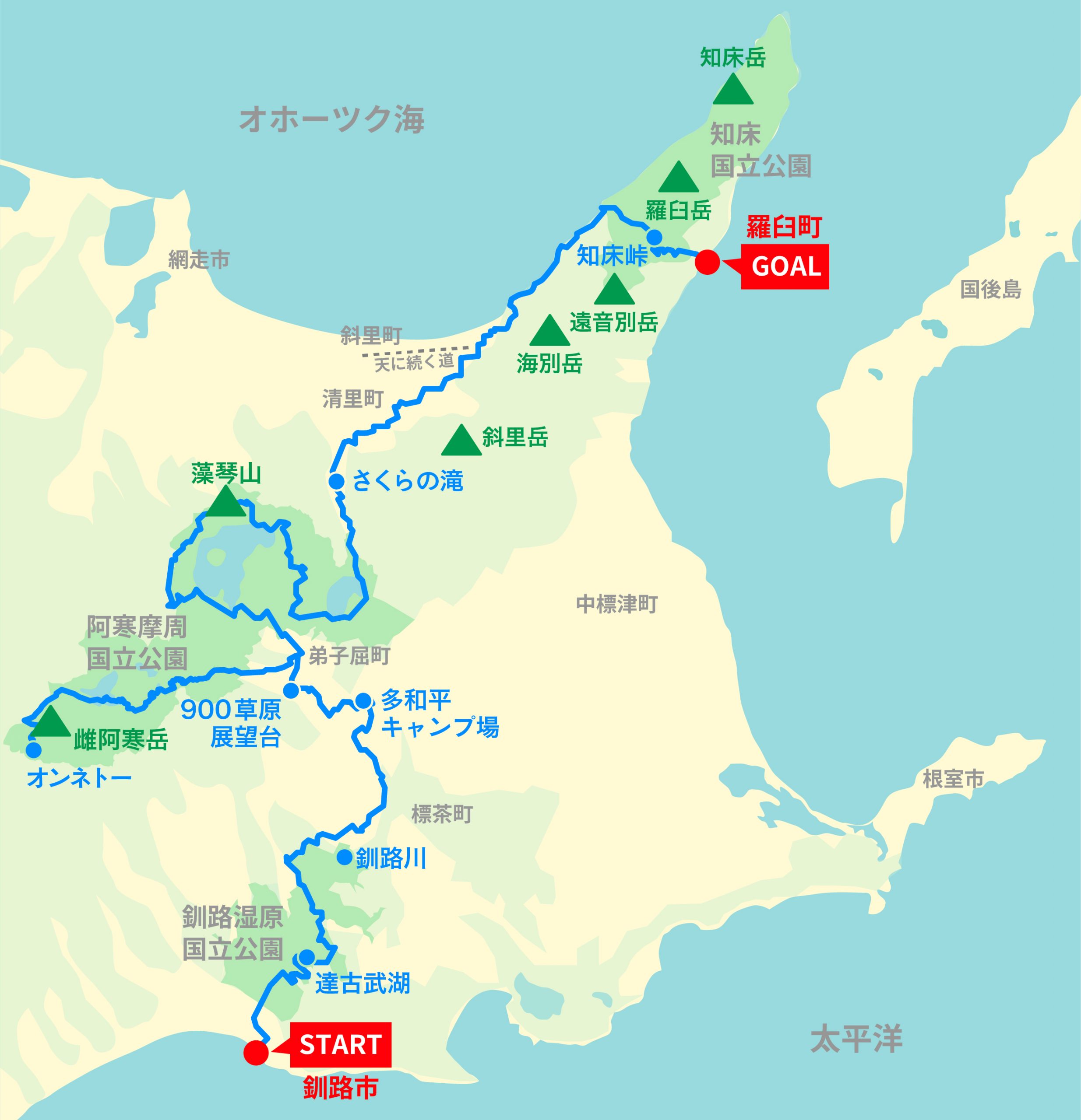
The Hokkaido East Trail opened in 2024 and is the newest of Japan's long-distance walking paths. Connecting three national parks — Kushiro Shitsugen, Akan-Mashu, and Shiretoko — and 14 cities and towns in eastern Hokkaido, the trail stretches 410 kilometers (255 miles), crossing vast wetlands, deep forests, farmland and dairy pastures, and the country's largest caldera.
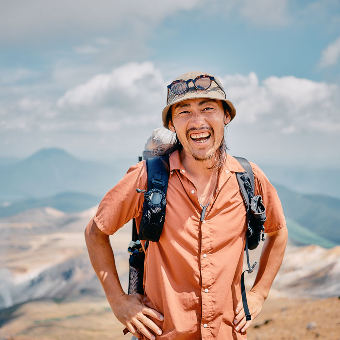
Last summer, long-distance hiker Masaru Kiyota explored the entire route. A frequent contributor to Yamatomichi’s Journal, Masaru has taken readers on his long walks: the Michinoku Coastal Trail, the Amatomi–Shinetsu Trail, the Pacific-to-Sea-of-Japan hike and the Miyazaki section of the Kyushu Nature Trail. This time, accompanied by photographer Hitoshi Tayasu, he heads north from Kushiro, in Hokkaido, toward the remote frontier of Rausu, in Shiretoko. The summer of 2025 brought record-breaking heat to Hokkaido, and the pair endured scorching days, hungry horseflies and the risk of bear encounters along the trail.
Traveling Japan
When I think about traveling in Japan, Hokkaido is at the top of my list. Living in Osaka, I’ve always longed to explore Japan’s northernmost prefecture. The Hokkaido East Trail that we walked this time runs from Kushiro, on the Pacific coast to the east, north to the Shiretoko Pass, and continues on to Rausu, at the northeastern edge of Hokkaido.
Twelve years ago, in the summer of 2013, I rode a touring bicycle around Hokkaido. I’d bought the bike for 100,000 yen (equivalent to $1,025 back then) and loaded it with gear from home-improvement stores and 100-yen shops. At the time, I was 24 years old. It’s been one full cycle of the zodiac since then, and I’m passing through some of the same places I’d visited on two wheels. Walking around Hokkaido was a chance to see a side of Hokkaido I hadn’t known before ー and maybe even to revisit my younger self.
My first solo journey ー summer, 12 years ago.
What's the Hokkaido East Trail?
I first learned about this trail in February 2025, at an event organized by the Trailblaze Hiking Research Institute (Toreken in Japanese). We were there to get updates on a project researching the Tokai Nature Trail and creating map data for it. I had participated as a trail surveyor in 2024 and had been asked to speak at the event.
The venue was lively, with booths representing trails around Japan, including the Michinoku Coastal Trail, Amatomi Trail, Shinetsu Trail and Fukushima Hamakaido Trail. There were flyers, pamphlets and maps, and many knowledgeable hikers were in attendance. Nobody was staffing the Hokkaido East Trail booth ー there was just a TV screen playing a 10-minute promotional video in a loop. I was completely drawn in.
When the video ended, I heard a familiar voice calling me. It was Shin Hasegawa from the Trailblaze Hiking Research Institute. “You might end up walking the Hokkaido East Trail!” he said. He seemed to anticipate what I had only a vague notion of at the time.
The Hokkaido East Trail: alongside the main route connecting Kushiro and Rausu, there is also the Akan Route linking Onneto and Teshikaga.
What is the Hokkaido East Trail?
Its 410 kilometers (255 miles) of trails connect the island’s northeastern and southeastern extremes, Rausu town and Kushiro city, and cut through three national parks ー Shiretoko, Akan-Mashu, and Kushiro Shitsugen. The trail, which officially opened in October 2024, was conceived of and is maintained as a collaborative project: Japan’s Environment Ministry, local governments, private organizations and residents worked together creating a path that explores the landscape and local communities that make Hokkaido special.
The region is a biodiversity hotspot, home to brown bears, red foxes, Ezo deer, black woodpeckers, red-crowned cranes, white-tailed eagles, Steller’s sea eagles and Blakiston’s fish owls, and in waters off the coast of Shiretoko whales and orcas are frequent visitors.
The Miyazaki section of the Kyushu Nature Trail we walked in 2023 was published in Yamatomichi’s Journal as Kyushu Nature Trail: Miyazaki Section (volumes 1 and 2).
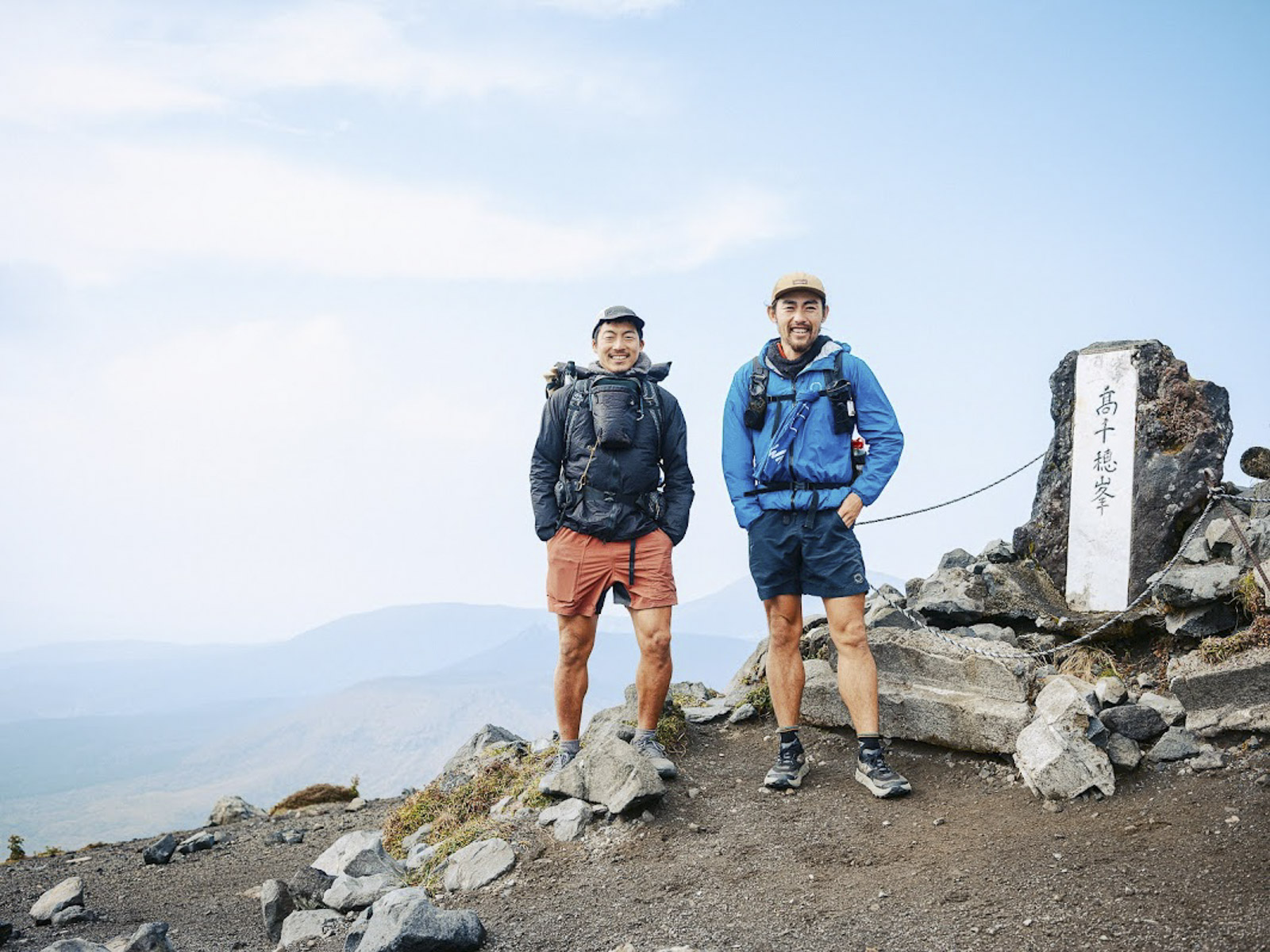
After hearing about the Hokkaido trail, I searched the event venue for the one man whom I’d want as a partner on an epic walking journey: photographer Hitoshi Tayasu. Two years earlier, we walked the Miyazaki section of the Kyushu Nature Trail.
This time, we’d be on a trail that had only recently opened and that few hikers in Japan had even heard about. A photographer would be crucial to getting the word out. Hitoshi is just about the only person I know who has the stamina and the photography chops for this kind of trip. It helps that he’s fun to be around and that I happen to love how he photographs ー travelers and locals looking natural and at ease.
I usually walk long distances alone. But the days I walked with Hitoshi in Miyazaki made me want to find an excuse to invite him on another trip. Back in February, I asked him and he immediately agreed. We set a rough departure date: July.
Away from home
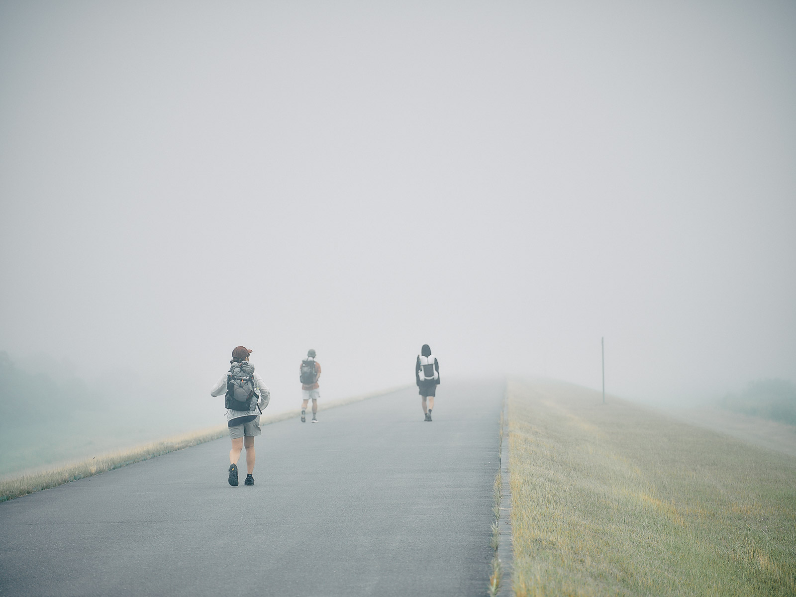
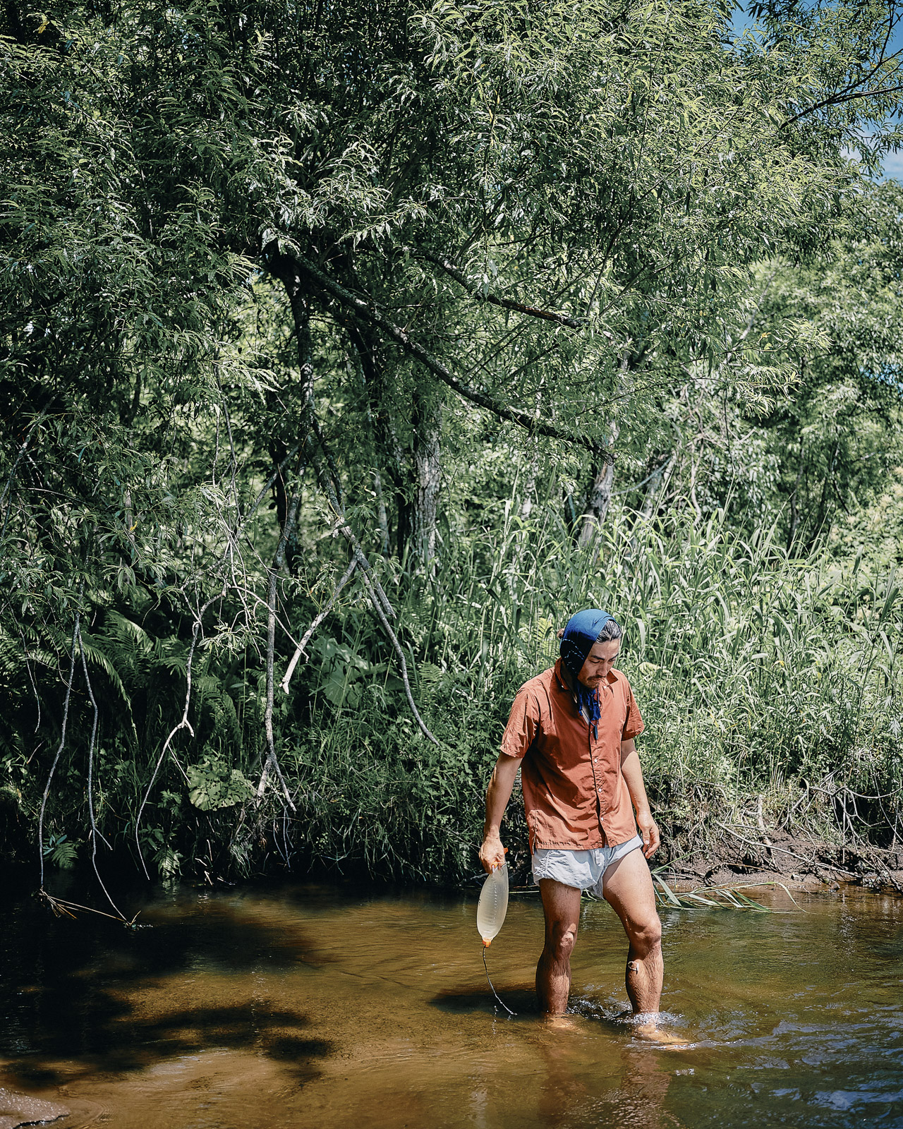
July 16, 2025, Shinkushiro River. We’re enveloped in fog. I remember a similar scene last year. I was in Iceland, where the inland areas were shrouded in a constant drizzle.
Walking along the Shinkushiro River in the fog.
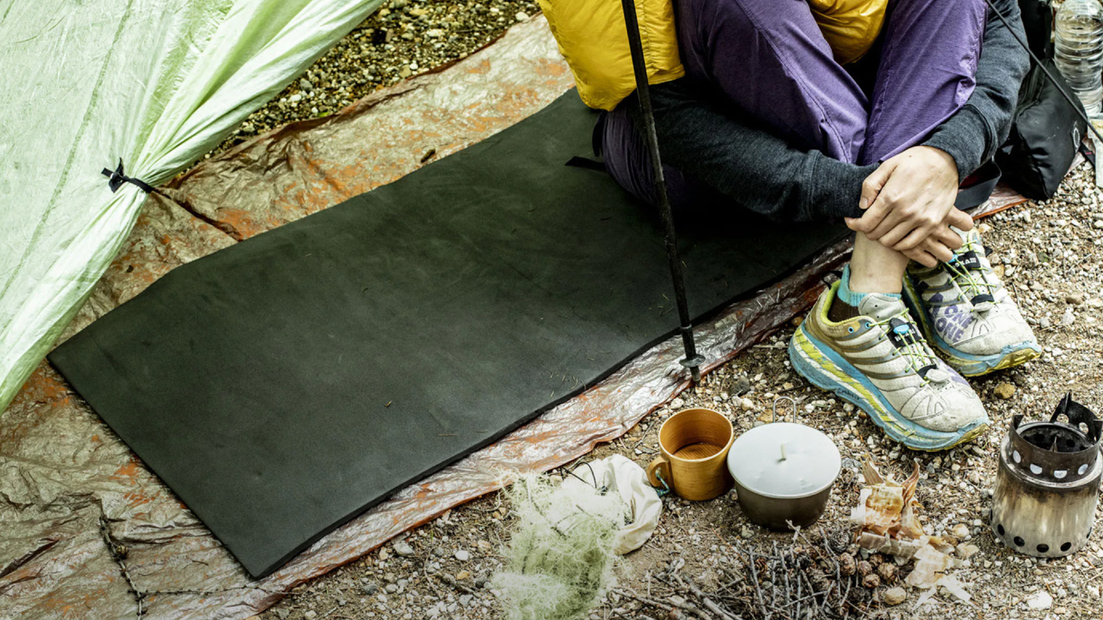
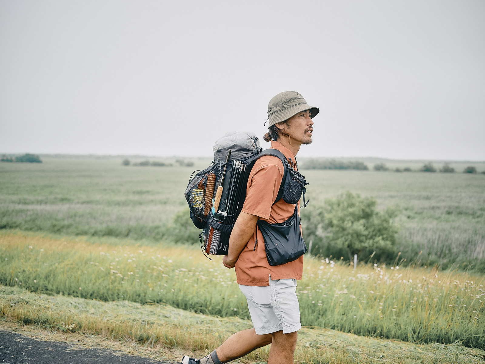
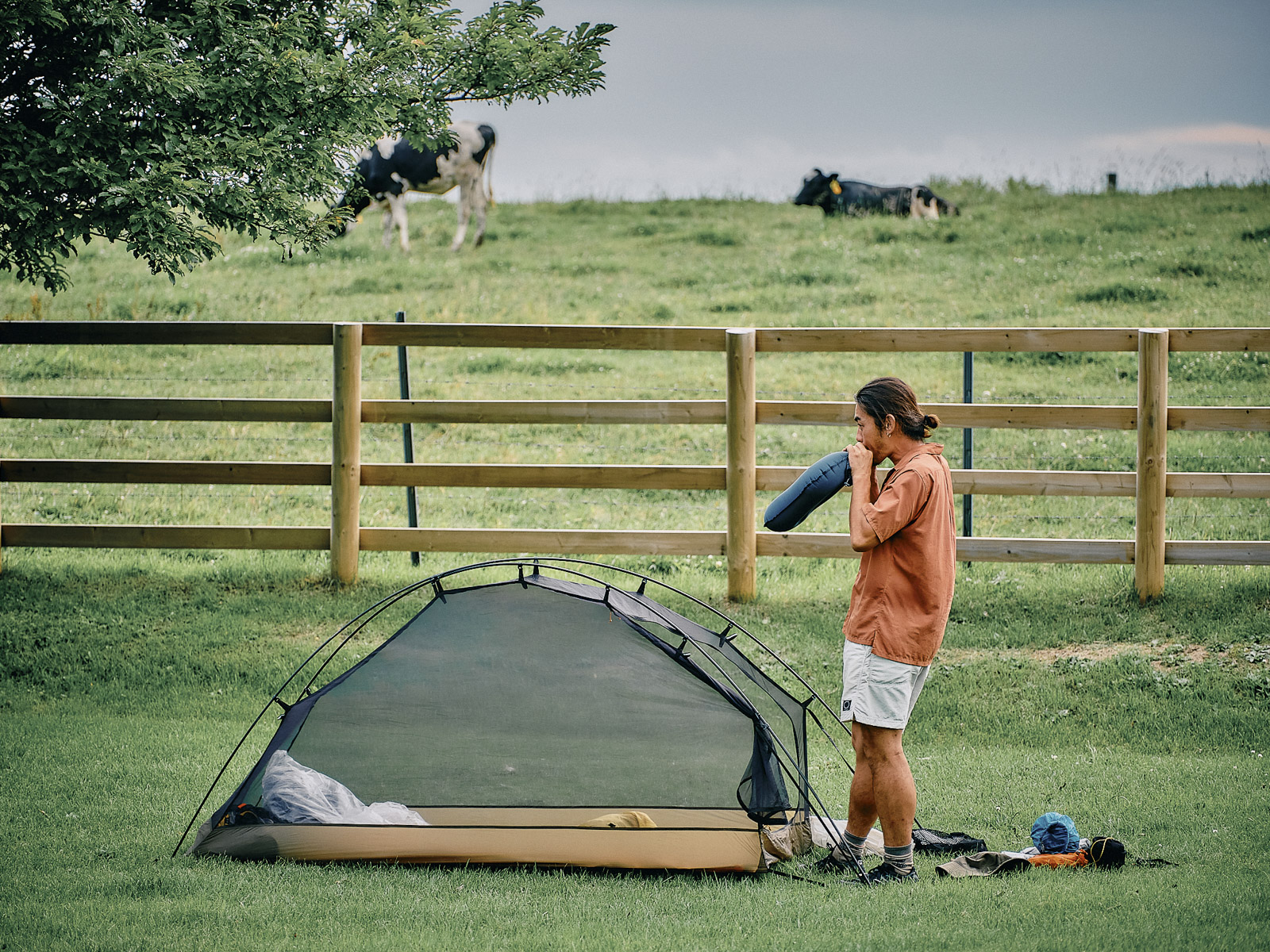
This time, Hitoshi is beside me, carrying not only his travel stuff and camera equipment but also a bear canister to protect our food should we come across a higuma (brown bear). Hokkaido is bear country, home to an estimated 11,000 brown bears, among the world’s largest bear species and second in size to polar bears.
Hitoshi’s pack looked at least twice as heavy as mine, and not only because of the bear canister. He’d recently upgraded his camera gear, opting for a telephoto lens and bigger bag. He assures me that it’s not too heavy.
Hitoshi carrying 20 kilograms of gear.
A couple of friends are accompanying us for a spell: Rie, from Kutchan (she’s hiked the John Muir Trail), and Naoki, from Sapporo (he’e completed the Pacific Crest Trail).
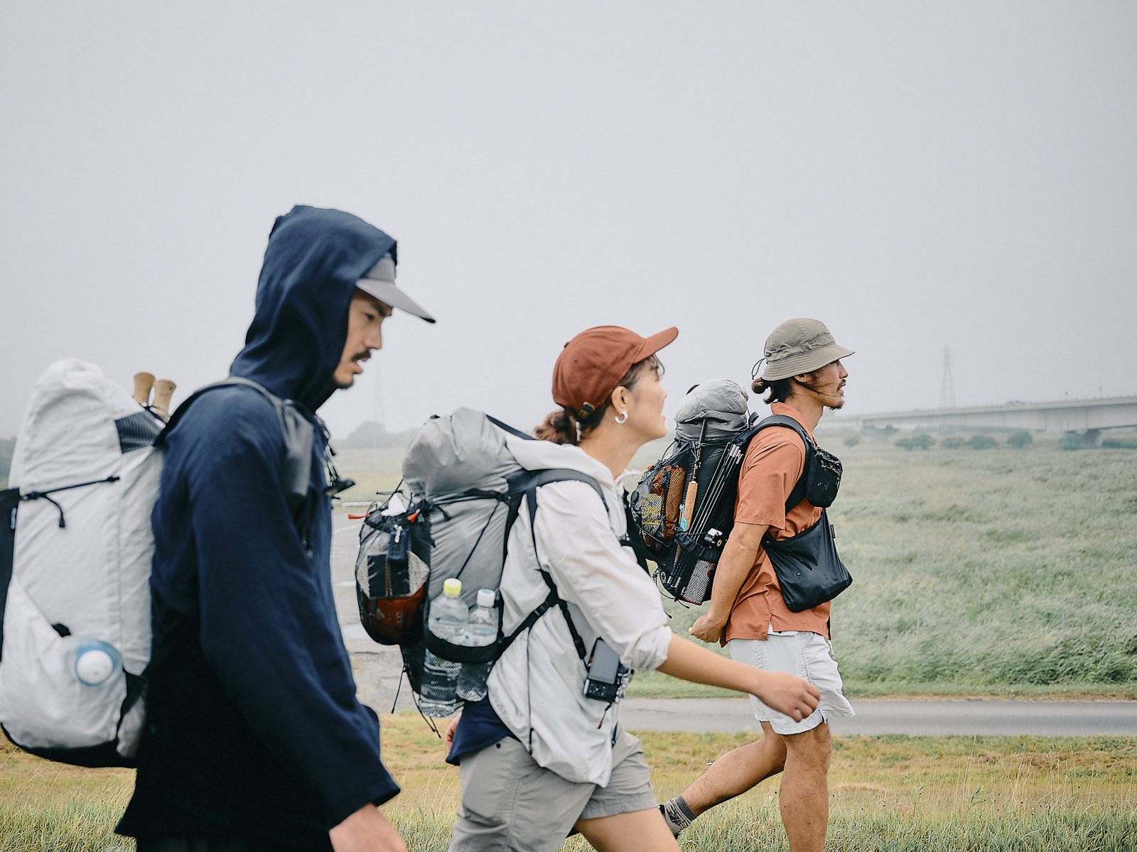
Naoki (Left) and Rie (Center) keep us company.
They’re among the friends in Hokkaido whom I’d contacted after we had decided to tackle the long trail in eastern Hokkaido. I’d half-jokingly said, “Feel free to join us on the way!”
Hokkaido is vast. The island, which is shaped like a giant stingray, is roughly 430 kilometers (267 miles) wide and 630 kilometers (390 miles) long, top to bottom. Driving from Sapporo, in southwestern Hokkaido, to Kushiro at the extreme southeastern edge is a 400-kilometer, six-hour trip. It’s far enough that plenty of people who live in Sapporo or Hakodate have never set foot in eastern Hokkaido, where we would be.
Most of my friends in Hokkaido live near Sapporo or Niseko, in the western half of the island. Asking them to meet me would normally be an unreasonable request. It’s like someone asking me to make a trip from my home in Osaka to hang out with them in the Japan Alps, in a different prefecture. And yet, Rie and Naoki made the trip. Knowing how far they’d come, I had mixed feelings: joy but also a little guilt.
Heading north along the Shinkushiro River.
In Kushiro, fog is not unusual. It forms over the ocean and flows inland, particularly during the summer months, and does so with such frequency ー nearly 97 days per year, on average, more than anywhere else in the country ー that Kushiro is known as Kiri-no-machi, Fog City. Locals call this sea fog jiri (海霧). We learned this at the local izakaya restaurant the night before when we ordered a jiri lemon sour, a refreshing cocktail made from shochu, lemon juice and soda water. Knowing this as I cut through the moist, white haze makes me think of our walk as an exploration of a local, natural phenomenon.
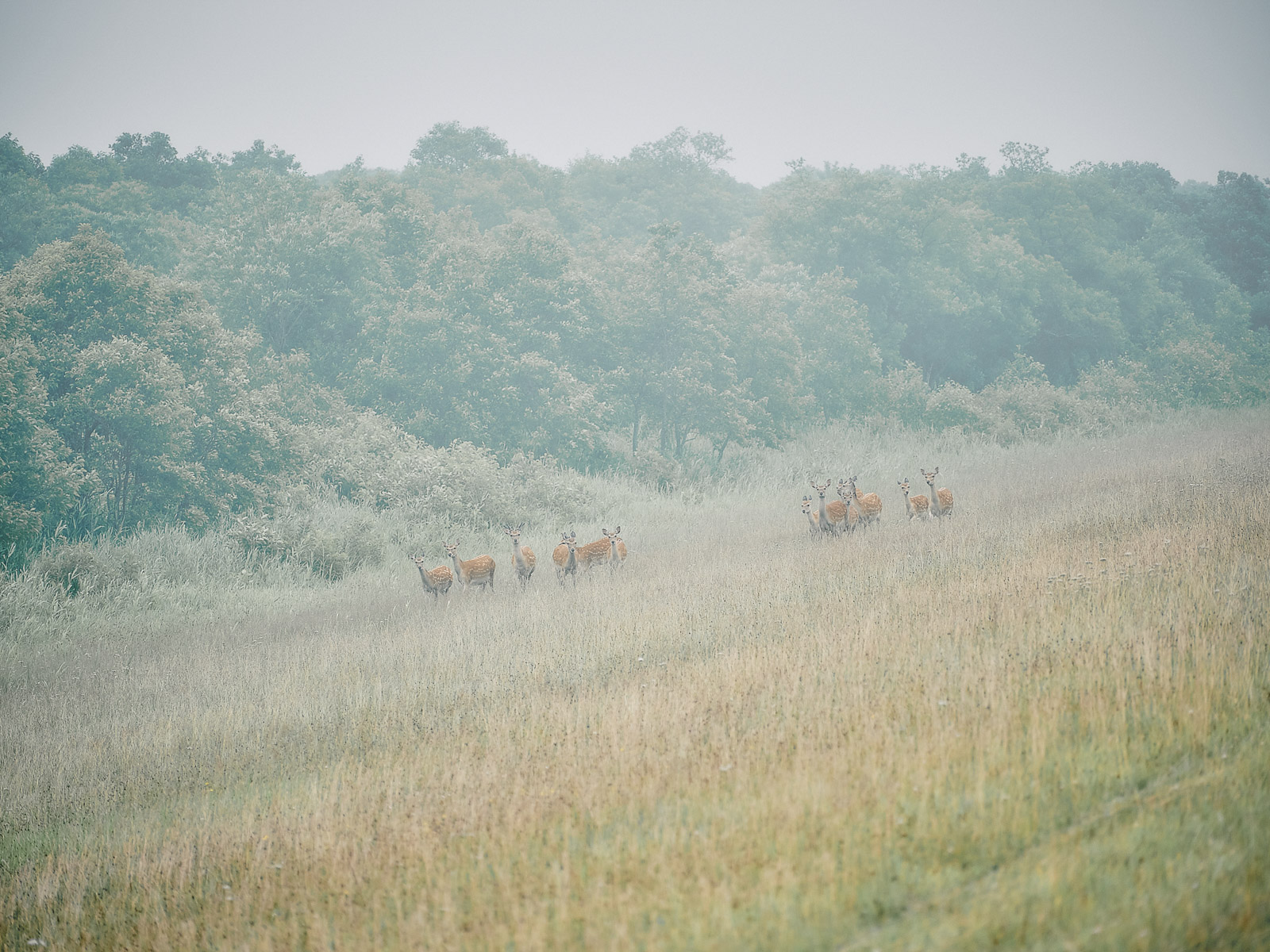
Ezo deer everywhere.
In the distance, we spot something brownish.
“What’s that?”
“Looks like an animal carcass.”
“Maybe just dead leaves?”
“Or wind-blown trash.”
“Did I see it just move?”
When we are close enough, we realize that the brownish clump is a fox, lying limp in the middle of the paved road. Is it injured? I have an urge to help it, but I know better. Foxes in Hokkaido are often infected with the larva of a parasite ー Echinococcus multilocularis, a tapeworm. (Ingesting the tapeworm’s eggs can be fatal.)
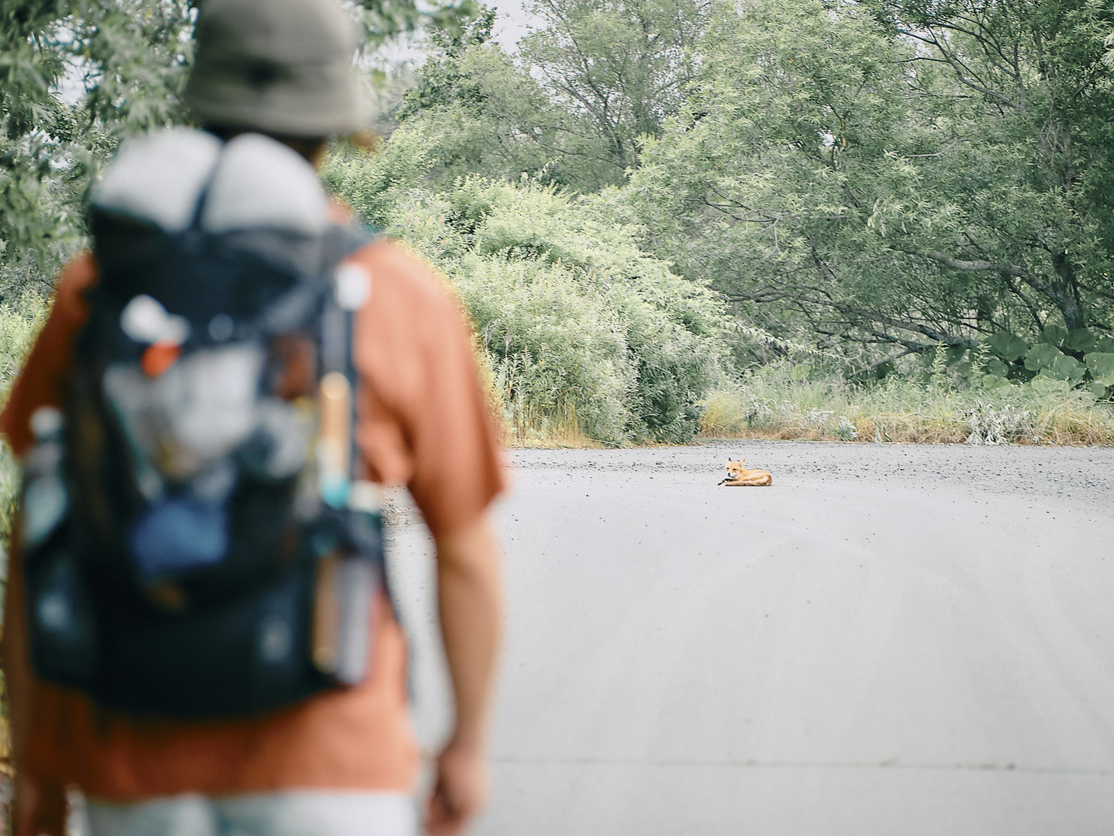
Fox in the road.
“Foxes don’t sleep in places like this, do they?”
“Not in the middle of a road.”
When we are close, the fox lifts and swivels its head to look at us. Thinking it might be injured, I crouch to watch. Soon, it gets to its feet and calmly trots away. We’d come across a sleeping fox, a very Hokkaido experience. It’s a promising start to our journey.
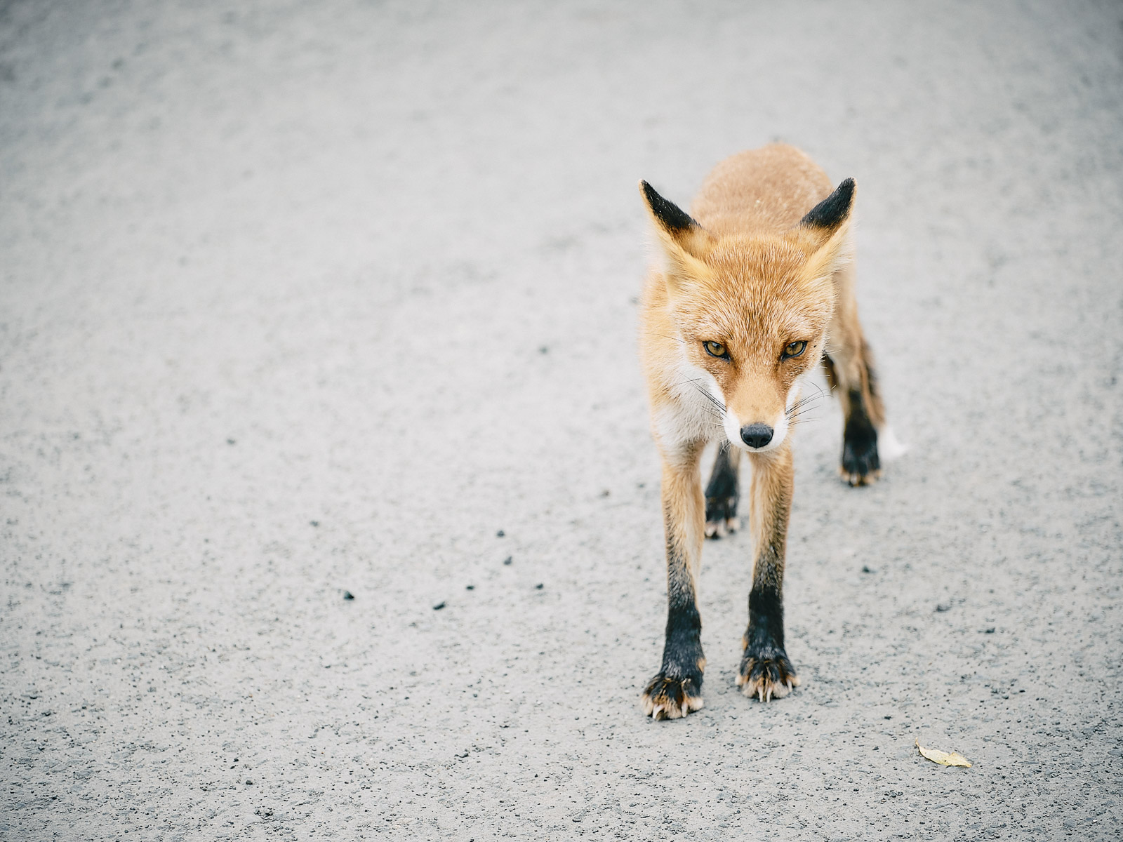
Black socks on the fox.
What does it mean to travel? Is it about getting away from a routine? Is it about spending time in a place that’s unfamiliar? For me, it’s simply about being somewhere that isn’t home. Walking through fog, coming upon a napping fox ー these, for me, were indications that I was far from home.
As the fog lifts, Kushiro River comes into view.
The scent of Eastern Hokkaido
The next day, we continue through the Kushiro Wetlands, the largest marshland in Japan. It’s impossible to walk across in a single day. In the morning, Rie and Naoki leave us and head to Kushiro by train on the Senmo Line. Though it may seem remote, the Hokkaido East Trail is surprisingly accessible by rail: It runs parallel to the Senmo Line, which connects Kushiro, on the Pacific Ocean, to Abashiri, on the Sea of Okhotsk. Eastern Hokkaido isn’t hard to get to from other parts of the country, either. From Kansai, Kushiro Airport is a two-hour flight away. There are also regular flights from Tokyo and Osaka to Memanbetsu and Nakashibetsu airports.
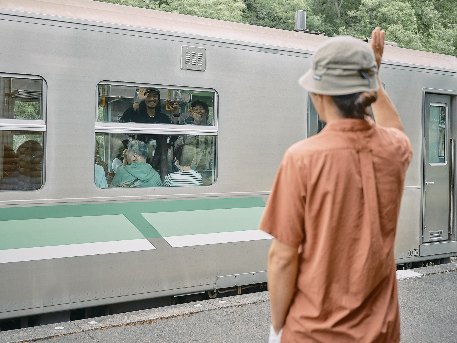
We see off Rie and Naoki at Hosooka Station, on the Senmo Main Line.
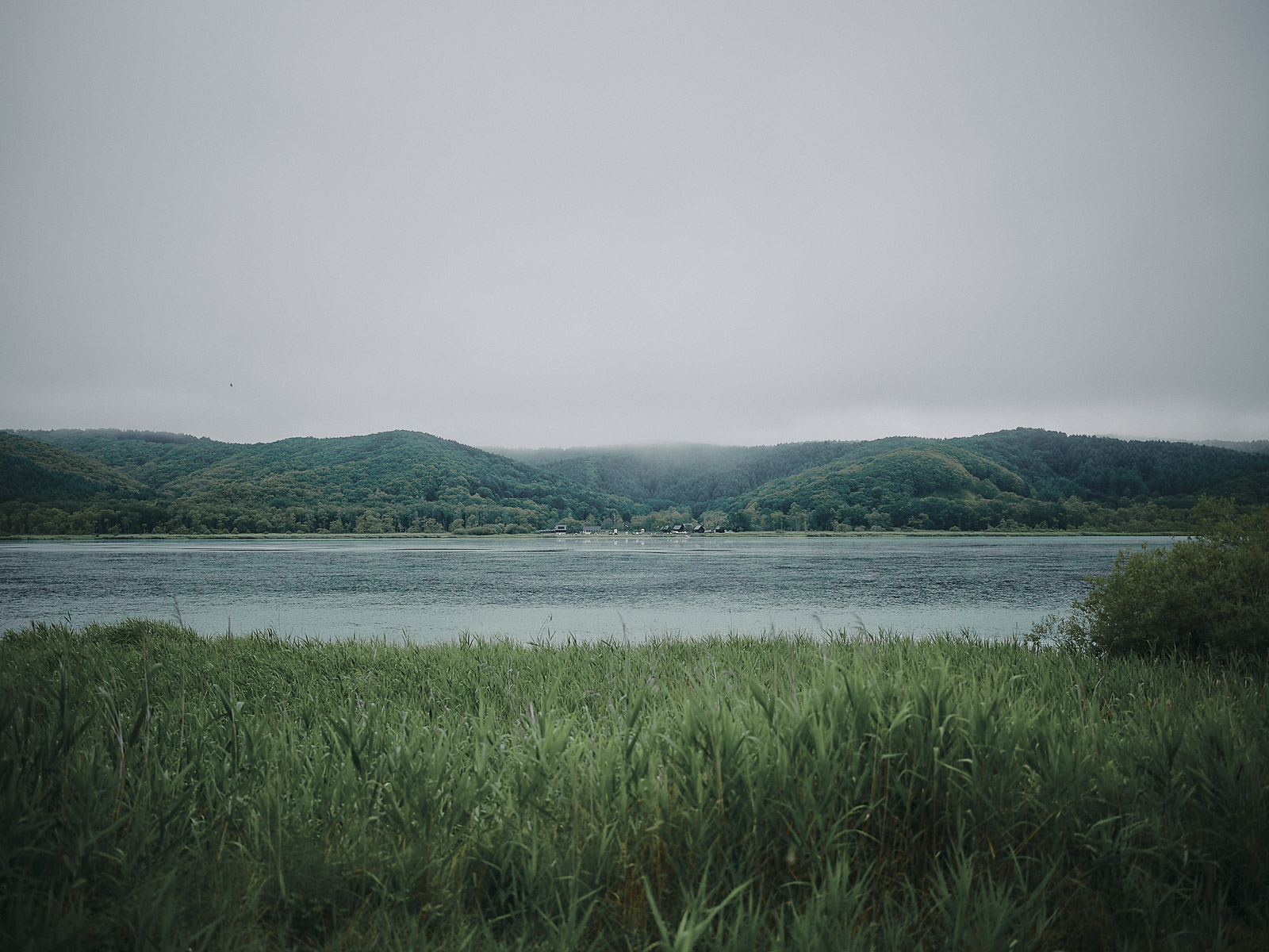
Lake Takkobu.
Rie and Naoki are gone but the fog remains. I’m sweating from the humidity. Hitoshi and I wonder if we’ll see red-crowned cranes, a protected bird that was once thought to have been extinct and designated National Special Natural Treasure in 1924 after its rediscovery. Thanks to local conservation efforts and a feeding program, there are now estimated to be more than 1,500 red-crowned cranes in Hokkaido.
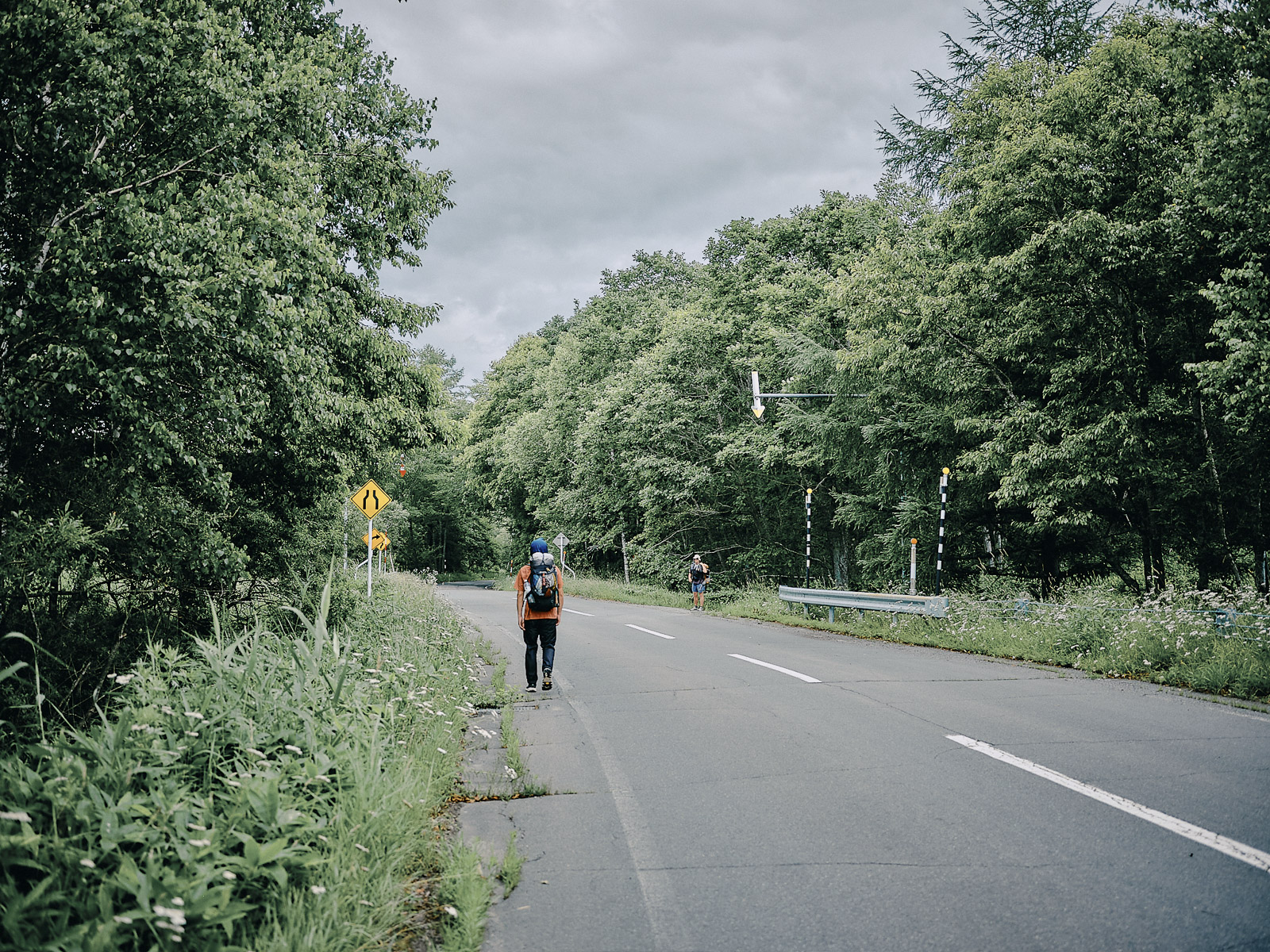
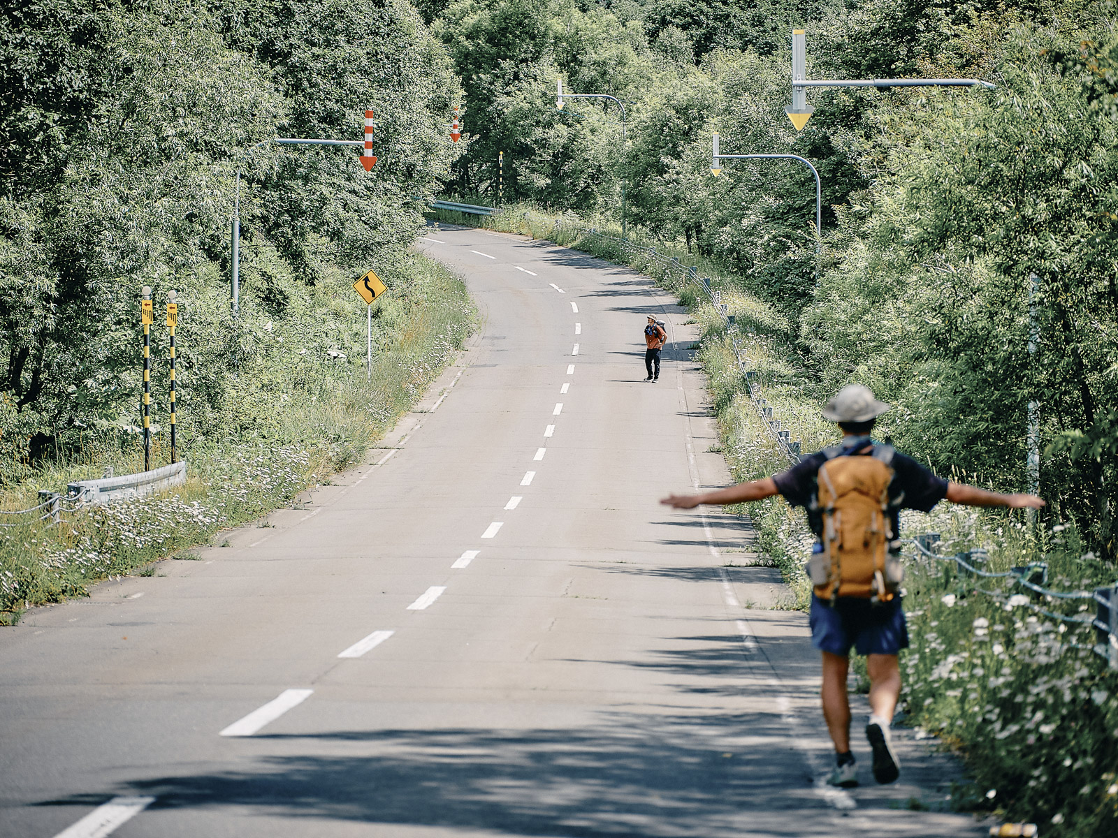
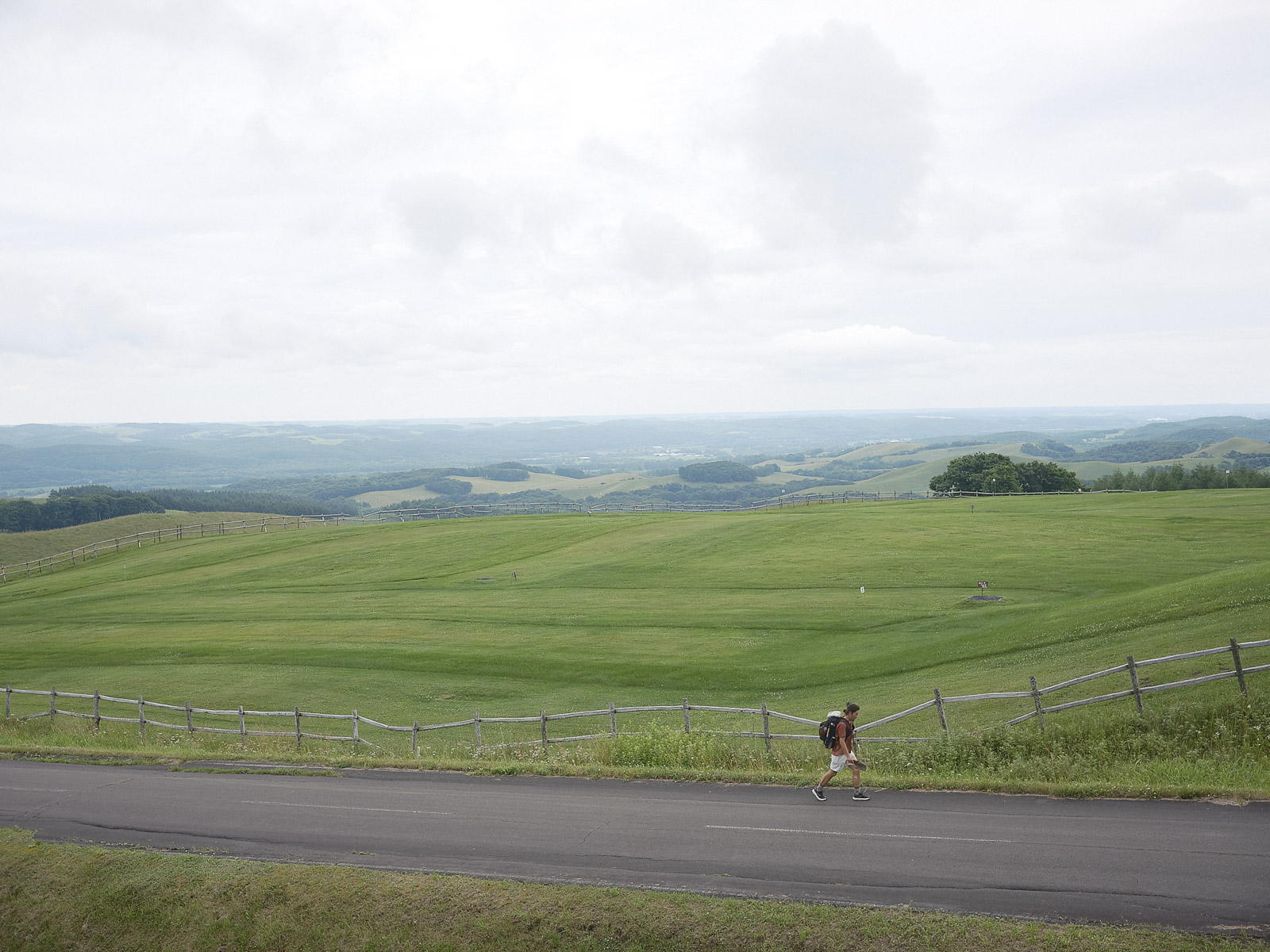
We are on National Route 391, halfway to where we want to be by day’s end. A car occasionally passes by. More than 70 percent of the Hokkaido East Trail is on paved roads, but traffic is lighter than on roads used by other domestic trails ー one of this trail’s defining features.
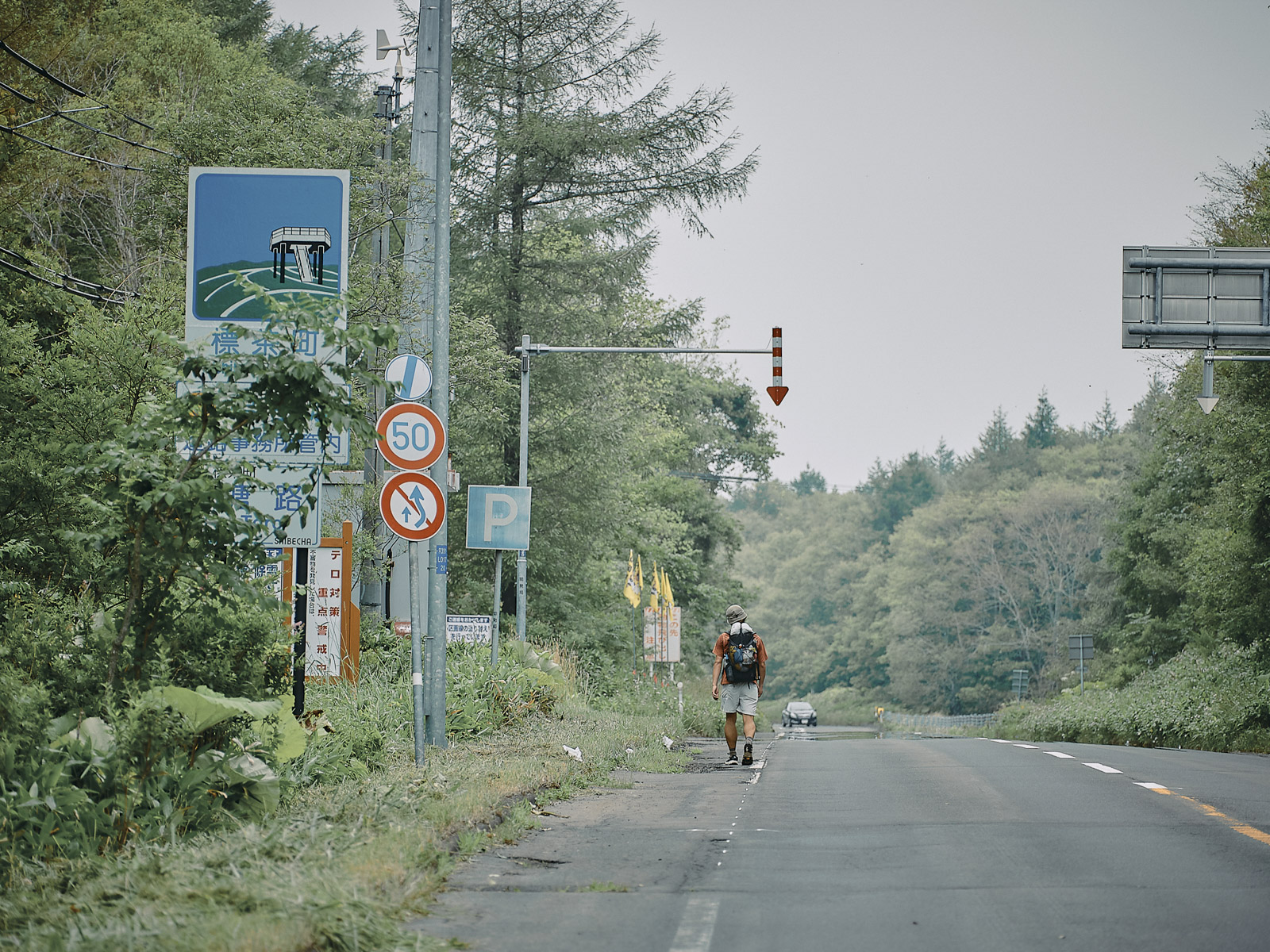
Entering Shibecha town.
We turn off the main road onto a gravel forest road heading to Toro Station. The roadside brush is thick enough to hide a bear. I’m keenly aware of the bear spray in my pack’s side pocket. A car horn sounds behind us, so we step to the side of the road.
As the car passes, we hear: “Hoooo!!!”
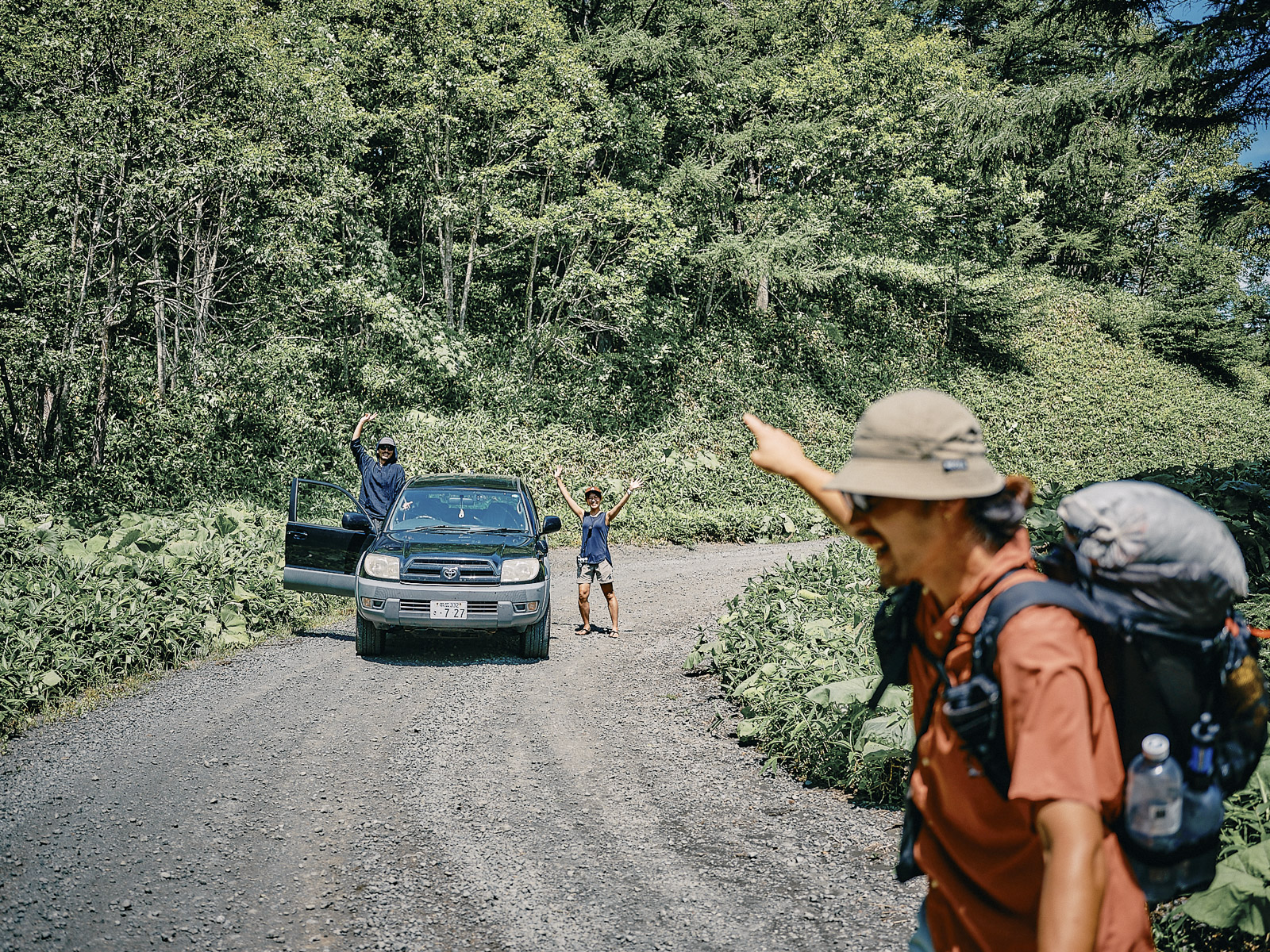
It’s Rie and Naoki. “You guys want beer?”
After retrieving their car in Kushiro, they are back with some trail magic, and I couldn’t be happier. This is one of those things that hikers who have experienced long trails in the US do for others. I always seem to be on the receiving end, but one of these days I hope to be the one giving to others.
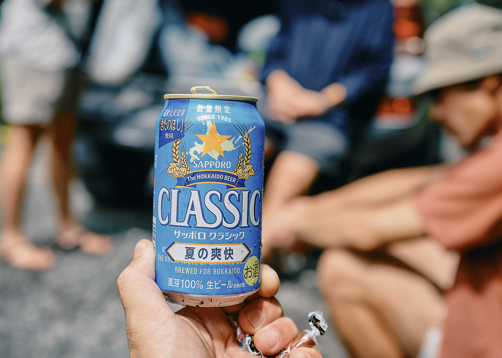
Trail magic!
Another hiker who started two days after us is apparently closing in on us. Other friends have been in touch. It feels like the first days of summer vacation when we were in school. At some point, the fog lifts. As the sky clears, the air fills with the scent of damp soil after a rainfall. Memories are tied to smell, and I imagine that in another place and another time, this scent will remind me of eastern Hokkaido.

Dog days of summer
This might be the most stressful hike of my life. Smack! Slap!
Around us swarm horseflies ー ushi-abu, in Japanese. About 2 centimeters long, they latch onto exposed skin and suck blood. Occasionally, red ushi-abu, nearly indistinguishable from hornets, torment us, too. We have two options: wear full rain gear for protection or attempt to swat each and every one of them.
Walking along the shoulder of the road as horseflies attack us.
Hitoshi’s legs are blanketed with bites. It’s hot but I decide to put on rain pants. So does Hitoshi. The pants are stifling but anything is better than getting eaten alive. I now know why the trail office recommended long sleeves and long pants: They’re the best defense against horseflies. Even so, I had imagined hiking in shorts and a T-shirt. Clearly, I’d underestimated our assailants.
Cooling off.
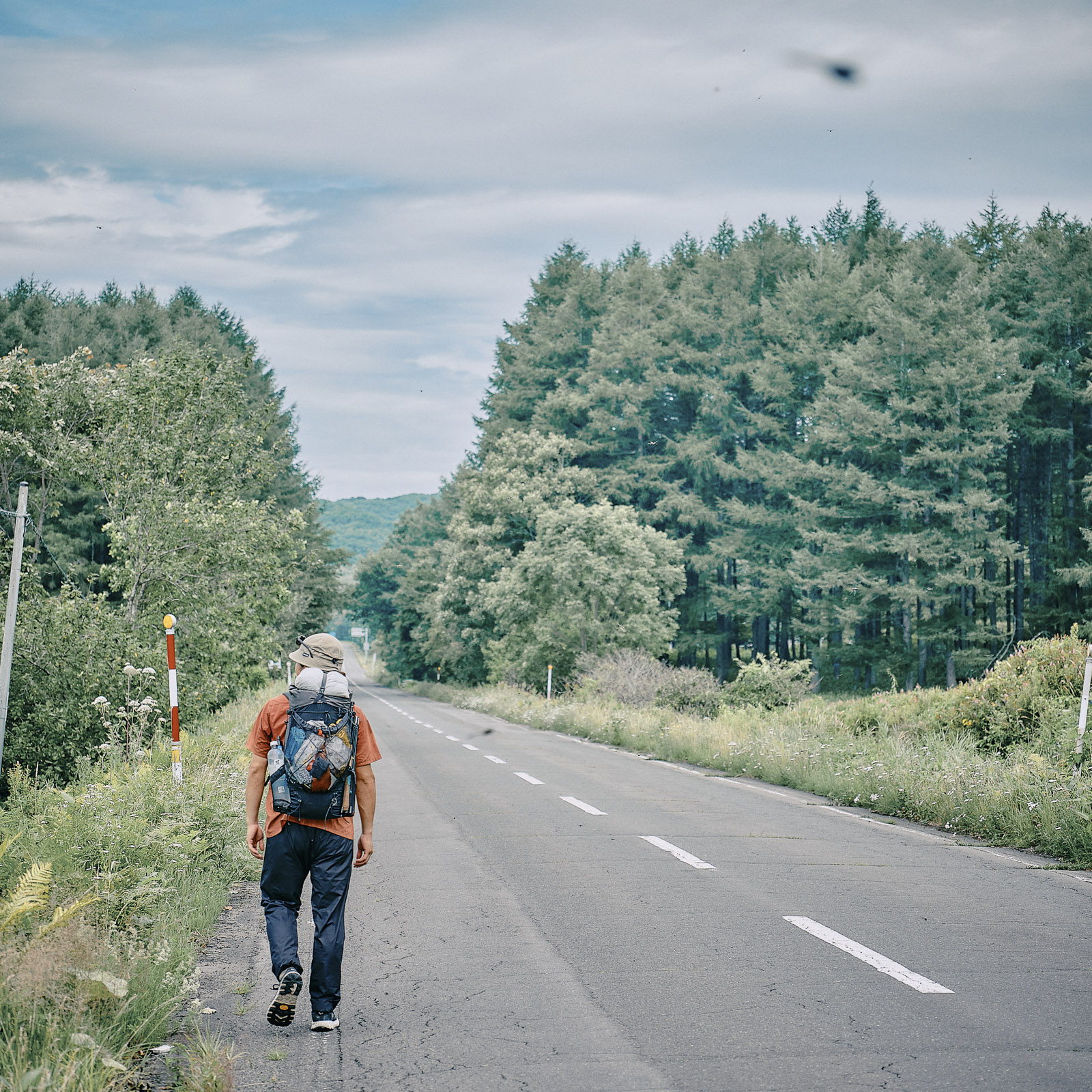
We’re now on Prefectural Road 243. It’s an unbearable 35 degrees C (95 degrees F), an unusual scorcher for Hokkaido. This is how it feels on a midsummer hike in the low-lying mountains closer to home, in the Kansai region, western Japan ー not what I’d imagined Hokkaido would be like. Bears are on my mind, so I whistle while swatting at horseflies. Ahead, someone toting a backpack waves at us.
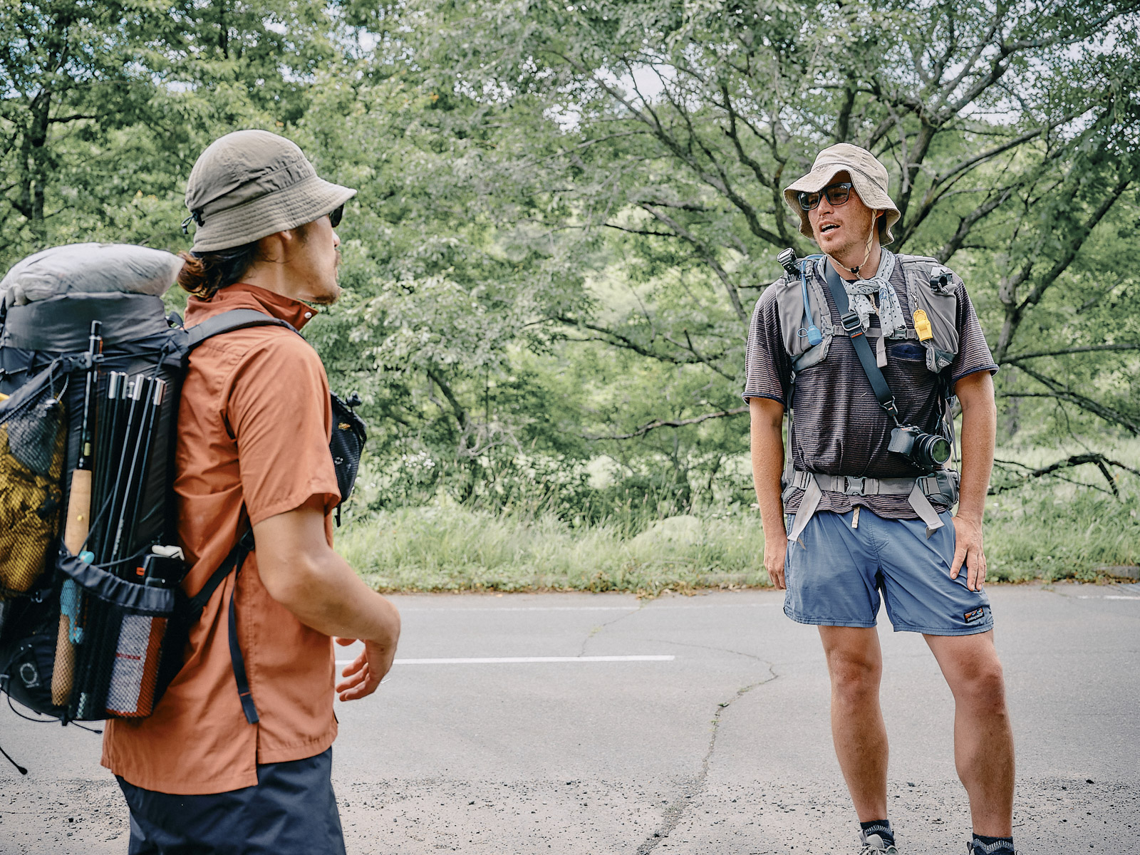
A lone hiker appears.
“Hello!”
It’s a lone hiker. He’s heard my whistle and has come to investigate. Like us, Joichi ー half Australian, half Japanese, born and raised in Japan, working as a hiking guide for foreign travelers ー is walking the Hokkaido East Trail, though he’s only going from Kushiro to Teshikaga, a town at the southern edge of Akan-Mashu National Park.
“How about walking together for a bit?”
“I’d love to!”
Meeting another hiker in a place as remote as this feels unreal. As we walk, we ask Joichi how he found the trail and why he became a guide. We pepper him with questions about his life, values and relationships. “Hiking is the best!” he says.
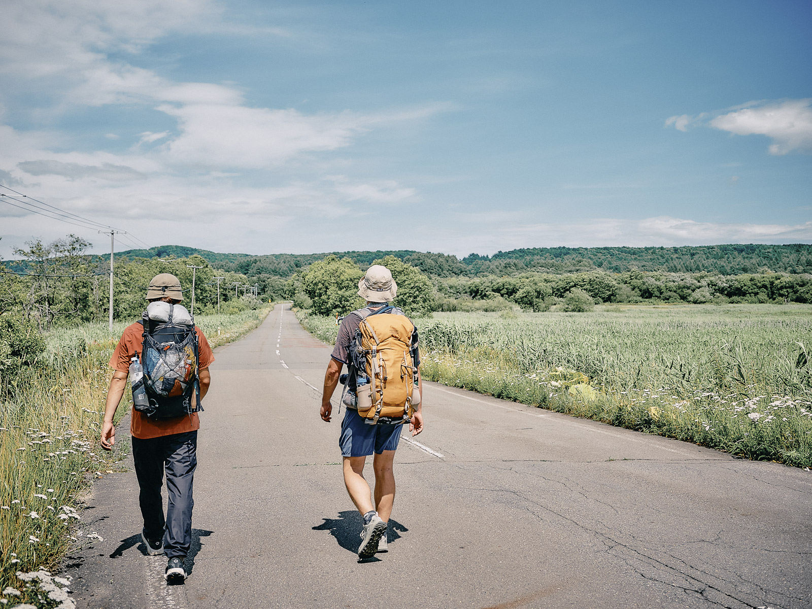
We pass pastureland.
Joichi guides foreigners but wants more Japanese people to explore the region. As tourists from overseas increase, so do services that cater to these visitors. Joichi, with his roots in Japan and Australia, is a bridge between cultures. That’s important. But it’s also vital for locals to take pride in what they have.
Eventually, Joichi decides to go at his own more leisurely pace. On Hokkaido’s long, straight roads, we don’t lose sight of him for a while. Every time we look back, he’s back there, peering through his camera lens, relying on nobody, enjoying himself.
Our destination, Shibecha, is less than 10 kilometers (6 miles) away. We can cover that in a couple of hours, but under the blazing sun, it feels endless. Hitoshi can’t stop sweating and seems to be wilting in the heat.
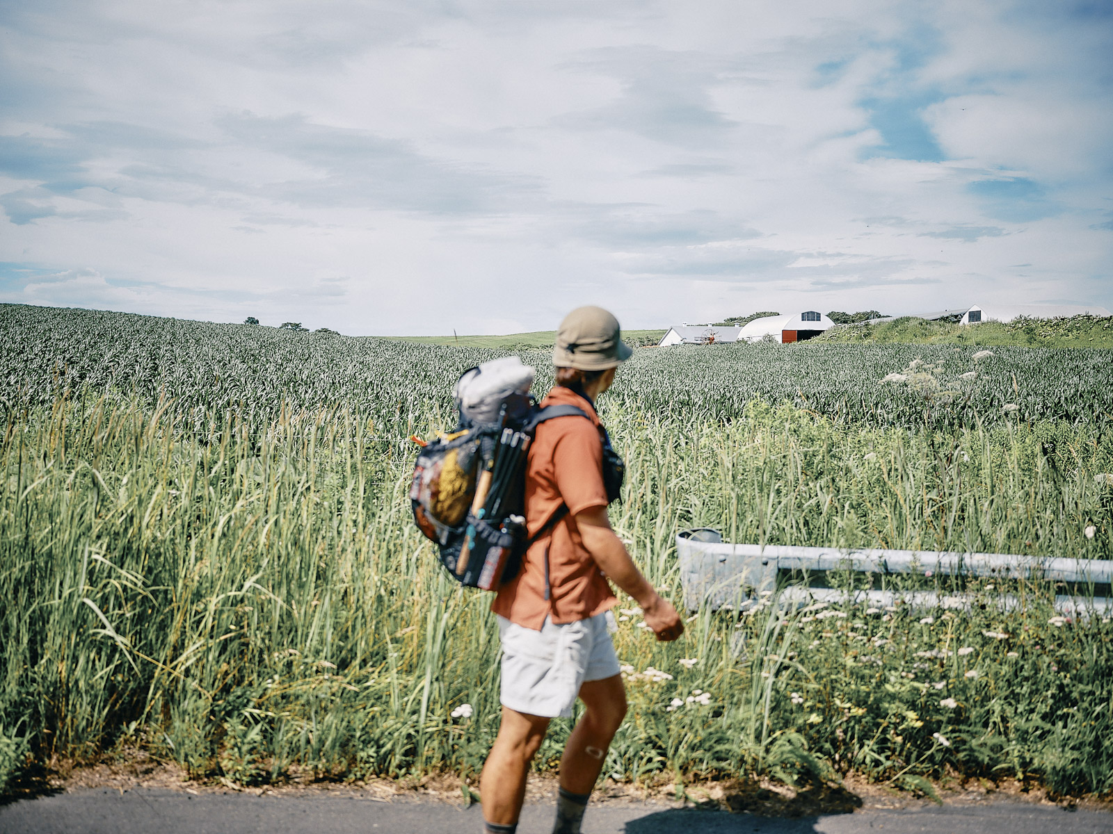
Farmland stretches in every direction but there’s no shade in sight.
We take frequent breaks whenever there’s shade. Five kilometers (3 miles) feels like forever in this heat. The horseflies are relentless. Joichi catches up again. Hitoshi is parched.
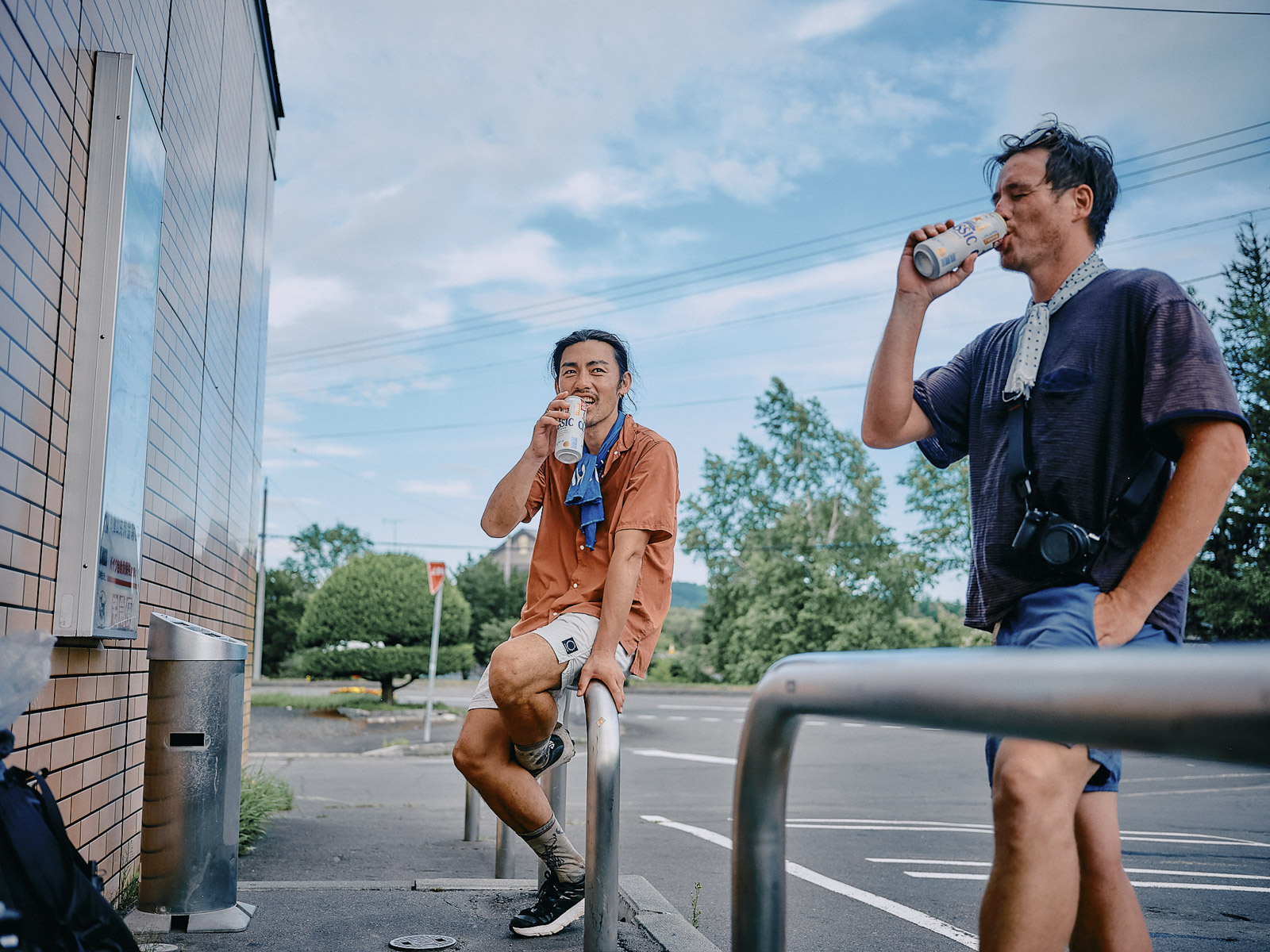
“There’s a convenience store in Shibecha. Let’s get some beers!”
For the next hour, imagining ourselves drinking beer is our biggest motivation.
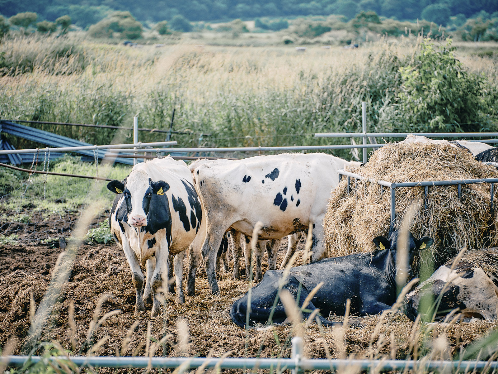
Even the cows can’t escape the horseflies.
Finally, Route 243 intersects Route 391. We head north, scanning the road until we spot what we’re looking for: a 7-Eleven sign. Our steps get noticeably lighter.
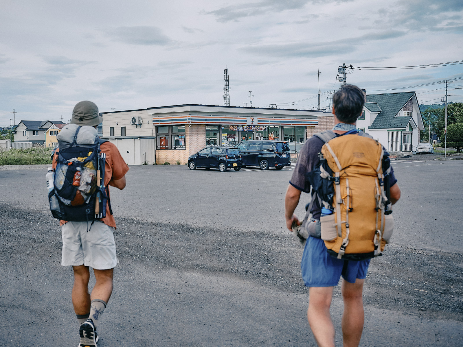
An ordinary convenience store is a beacon of hope.
Inside the convenience store, the air is cool. It has everything we want. Joichi insists on treating us to beers.
“Kampai!”
The blazing summer sun, the chilly beers ー this is what summer in Japan is all about.
More trail magic
A woman approaches, carrying a cooler with a sign: TRAIL MAGIC. Erisa has brought us watermelon and beer. I’d first met her in February 2024, at a hiking event at Sprout, a cafe in Kutchan, western Hokkaido. Back then, she told me that she was on her way to the US to walk the PCT. The walk has given her an aura of confidence that’s immediately noticeable.
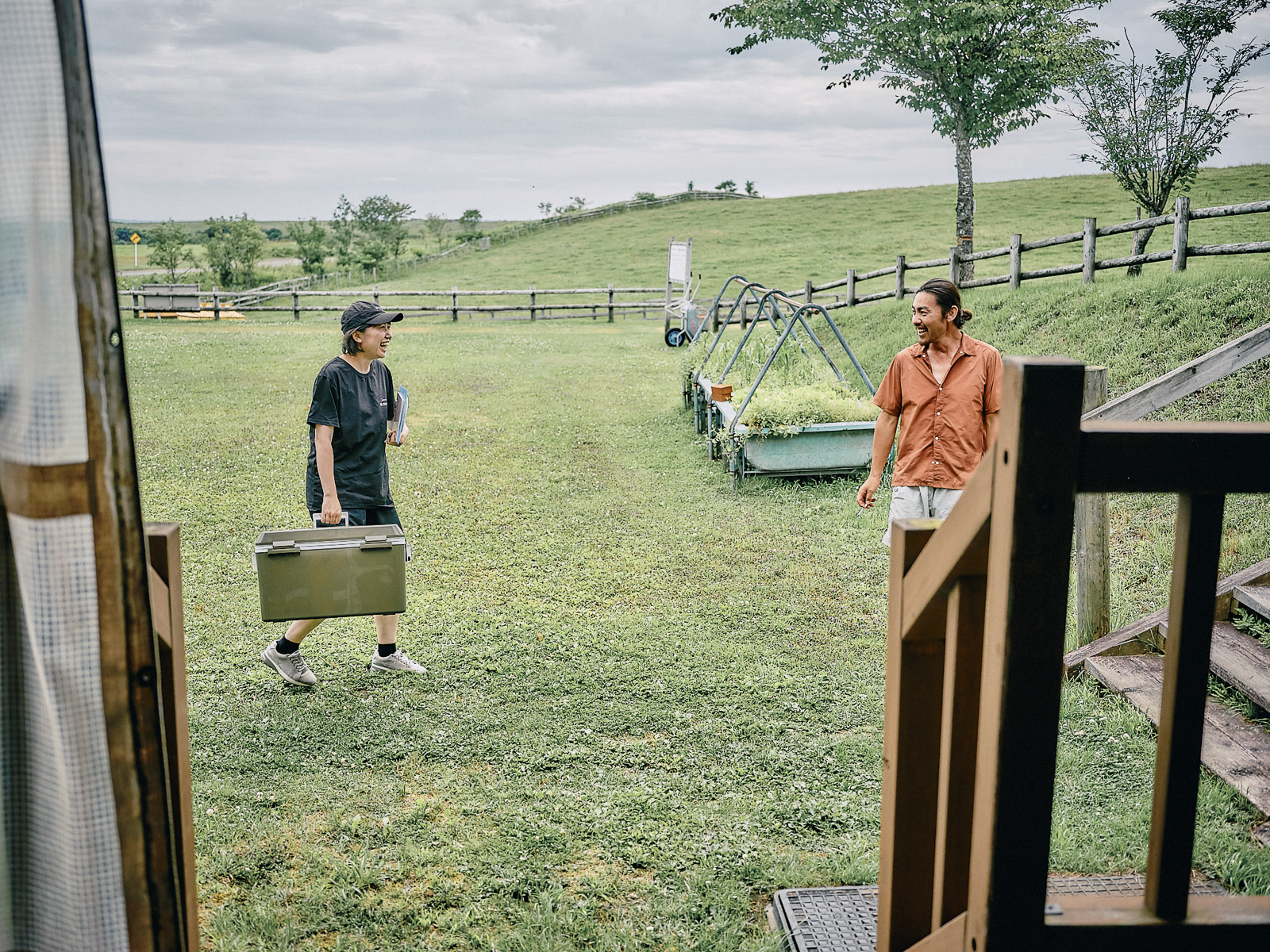
Erisa with more trail magic.
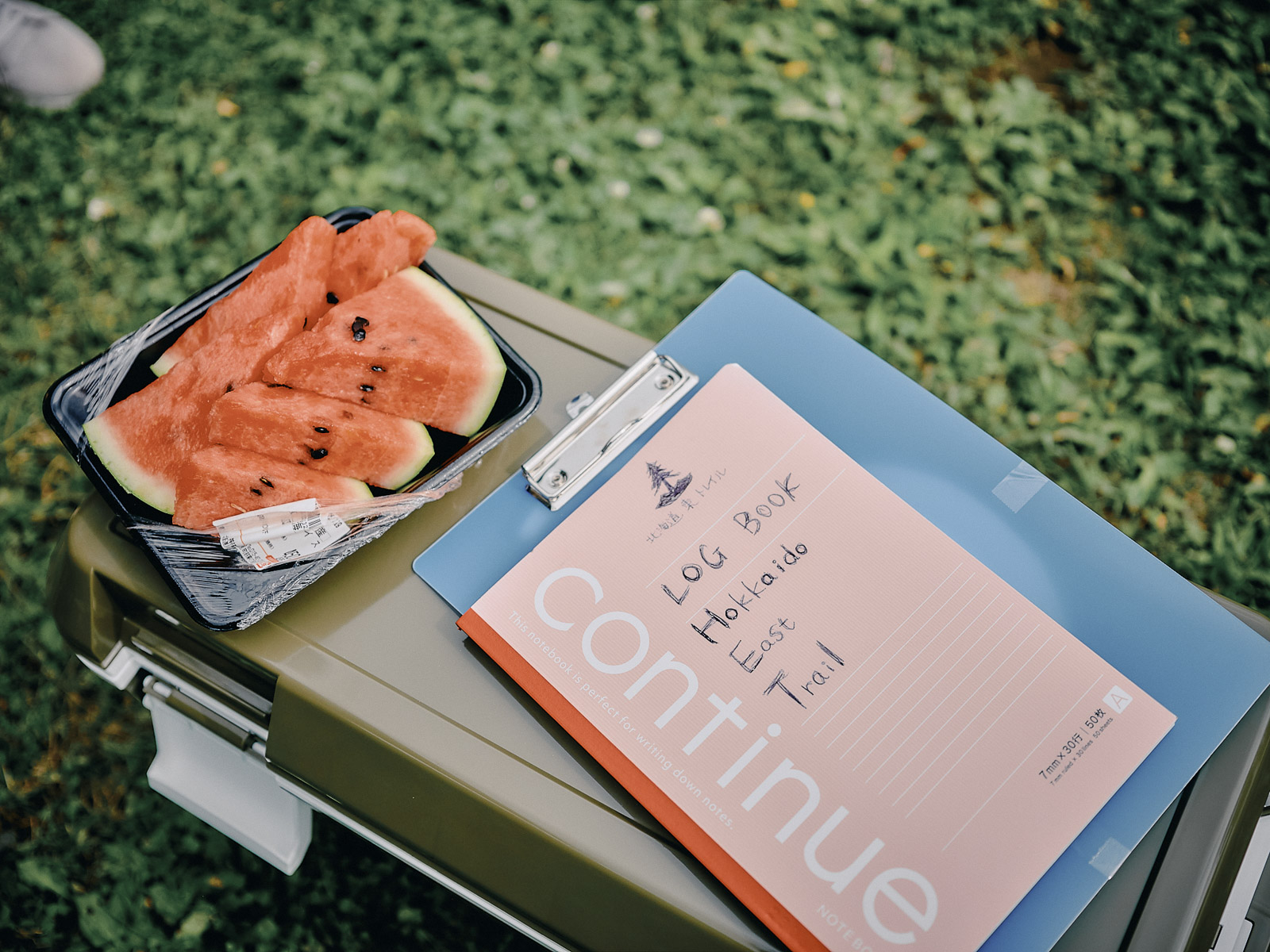
Watermelon, beer and trail notes.
We’d just eaten curry and drunk beer at Tappu no Heiwa campground, but we gladly accept her generosity. She’s come all the way here just to meet us. Why is that so uplifting? In no time, the six-pack she’s brought disappears, and the punishing heat gives way to a cool breeze.
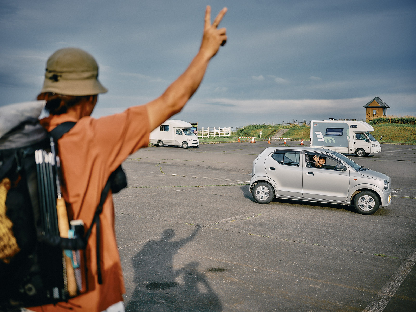
Parting ways with Erisa.
Tappu no Heiwa Campground.
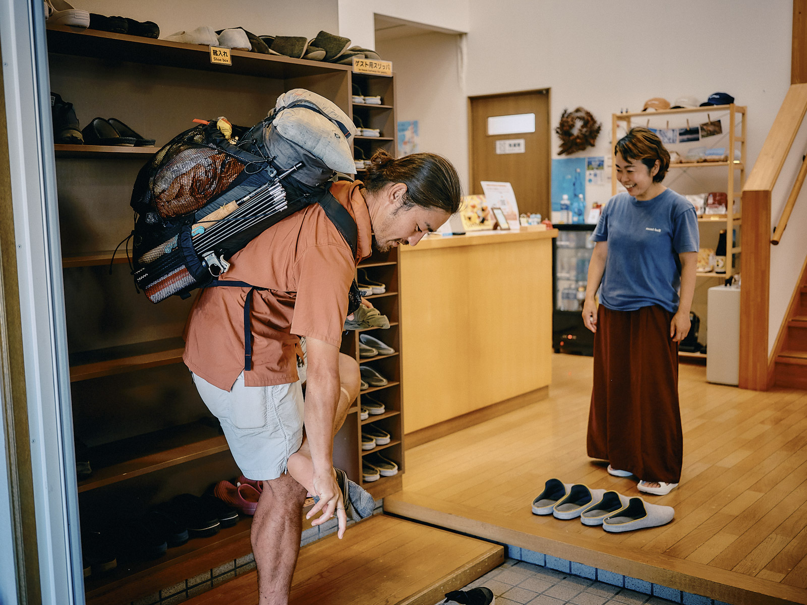
The next day, we head to Teshikaga, a small town of 6,600 residents. We need to find somewhere we can recharge our phones and camera and do laundry. There’s one guesthouse in town, Minshuku Misato, that has been following our journey on social media, so we call to ask about vacancies. There’s space for two tonight! We couldn’t have known at that time but our stay at Minshuku Misato would lead to more memorable encounters.
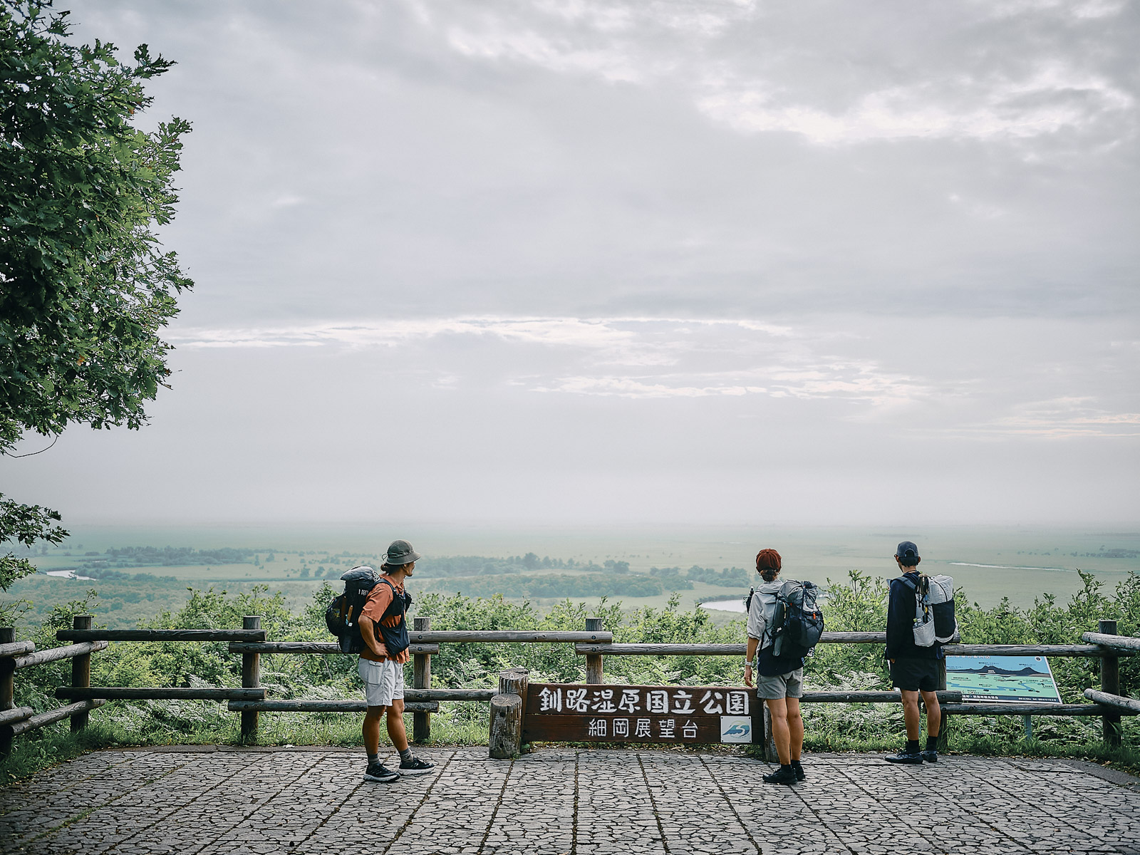
Heading toward the 900 Grassland viewpoint.
Pieces of a journey
We pass the 900 Grassland Observation Deck and make our way to Teshikaga. Today, the plan is to walk 24 kilometers (15 miles). We’re making good time and should arrive by early afternoon. The prospect of sleeping indoors for the first time on this trip has made us giddy. Once we’re in Teshikaga, we make a beeline for the Seicomart convenience store.
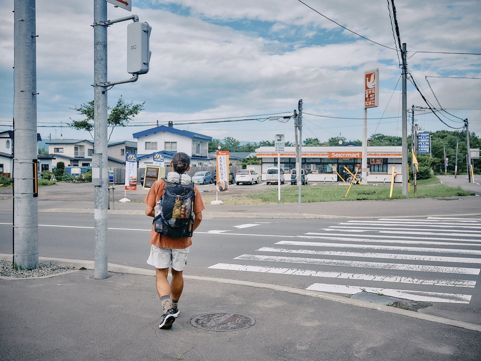
Arriving at a Seicomart convenience store.
What are we going to do about dinner? We head to the guesthouse, figuring that the owners might have a few suggestions. About a 10-minute walk from the convenience store, we spot the place: a charming, well-kept inn. The moment we set foot inside the entryway, Kaori, at the reception desk, welcomes us:
“You’re here! I’ve been following you on Instagram!”
There’s no better feeling than being welcomed like a regular by someone whom you’ve never met before. Inside, it’s cozy, with tables in the common area and a spacious kitchen. We tell Kaori about our journey so far, and she asks us about dinner.
“Do you know any good places around here?”
“Actually, some locals are gathering here to eat tonight. Why don’t you join us?”
No hiker in his right mind would turn down an invitation like that. Our dinner plans settled, we shower and spread our still-damp tents to dry.
We suddenly remember Tani, the hiker who was two days behind us when we first started walking. He’s from Kumamoto, on the southwest main island of Kyushu, and has hiked all three major long-distance trails in the US. He told us he was moving to Osaka this summer, and mentioned that he was thinking of walking the more than 500-kilometer (310-mile) distance from Kumamoto, visiting people along the way. Originally, we were supposed to meet up when he got to Osaka, but I would be in Hokkaido for this trip already. So Tani changed his plans: He decided to follow us to Hokkaido. We’d been tracking his movements on social media and he seemed close to catching up to us by the time we get to Teshikaga.
Knowing Tani, we figured he would just sleep somewhere outside without booking a place. He might even overtake us. So we contact him to see where he is.
“I’m in Teshikaga right now!”
“We’re staying at an inn tonight. Want to join us?”
“I’ll be right there!”
Tani soon turns up. He’s a dark shade from his Kumamoto-to-Osaka walk.
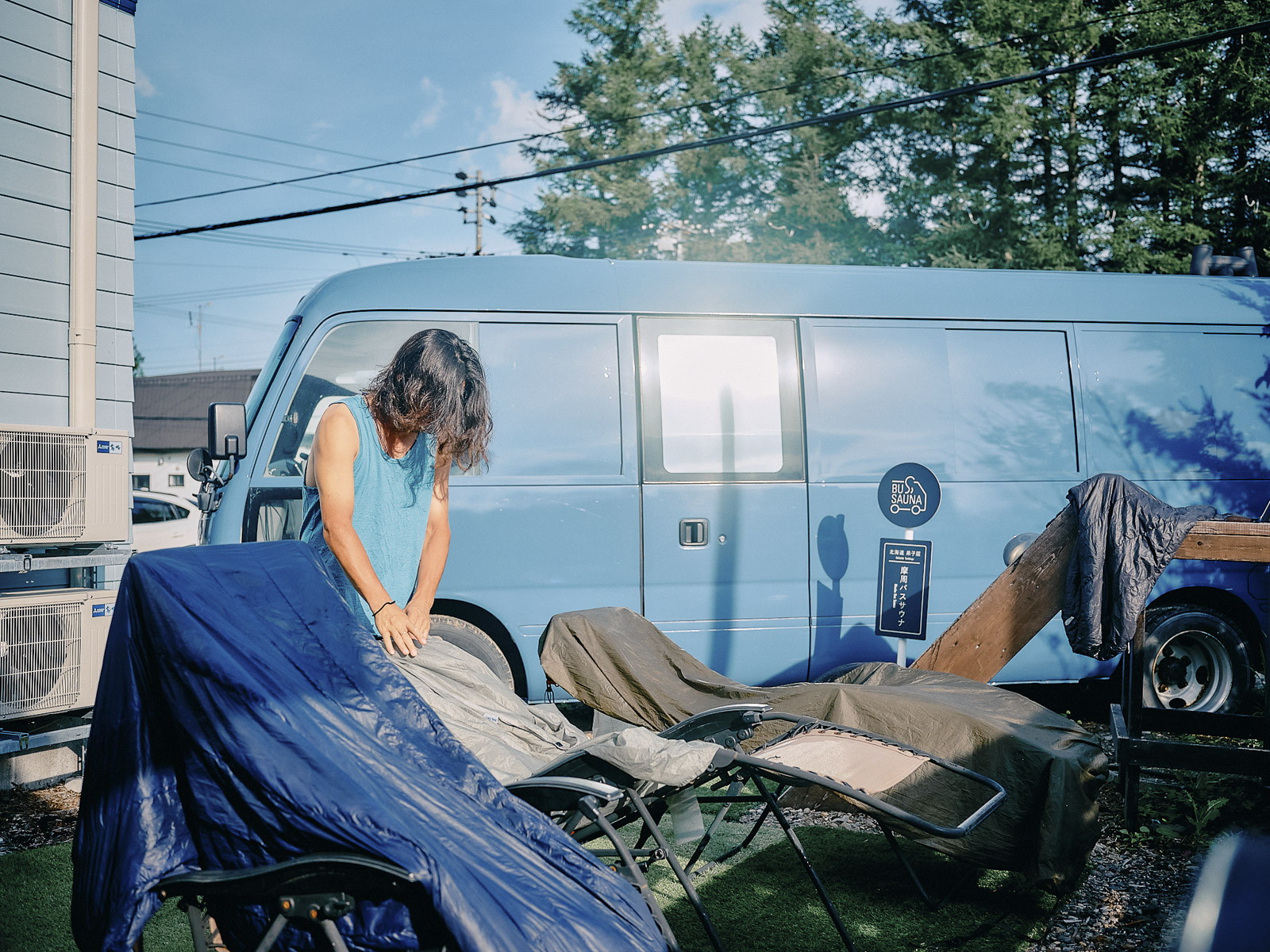
Drying our gear next to the minshuku’s “bus sauna”.
We finally meet up with Tani, who traveled all the way from Kumamoto, southwestern Japan.
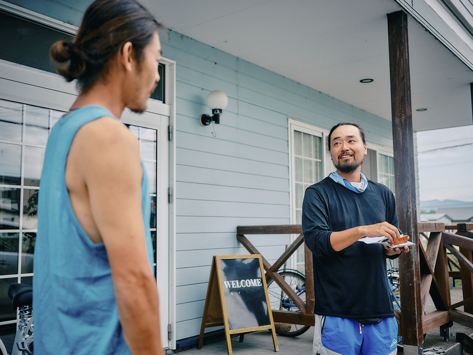
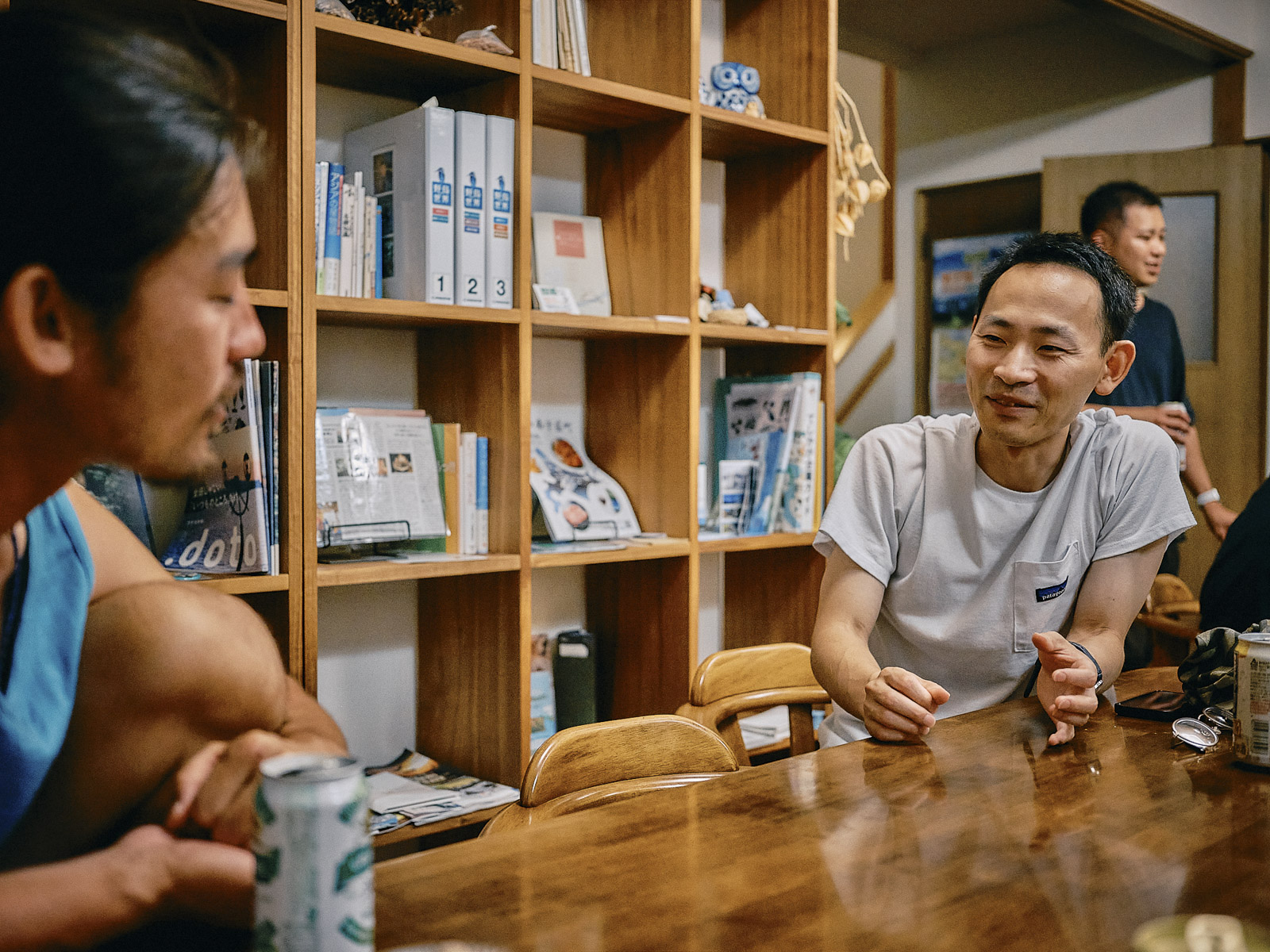
At dinnertime, we join our guesthouse host, Kaori, along with the other locals. Tani dines with us, too. By chance, Ogino, who runs the Hokkaido East Trail, drops by. We’ve been in constant contact with Ogino since planning this trip and we have a lot to talk about. Many of the Teshikaga locals aren’t from here; they’ve moved from somewhere else. Minshuku Misato is the kind of place that brings people together, and it feels as if we were meant to stay here.
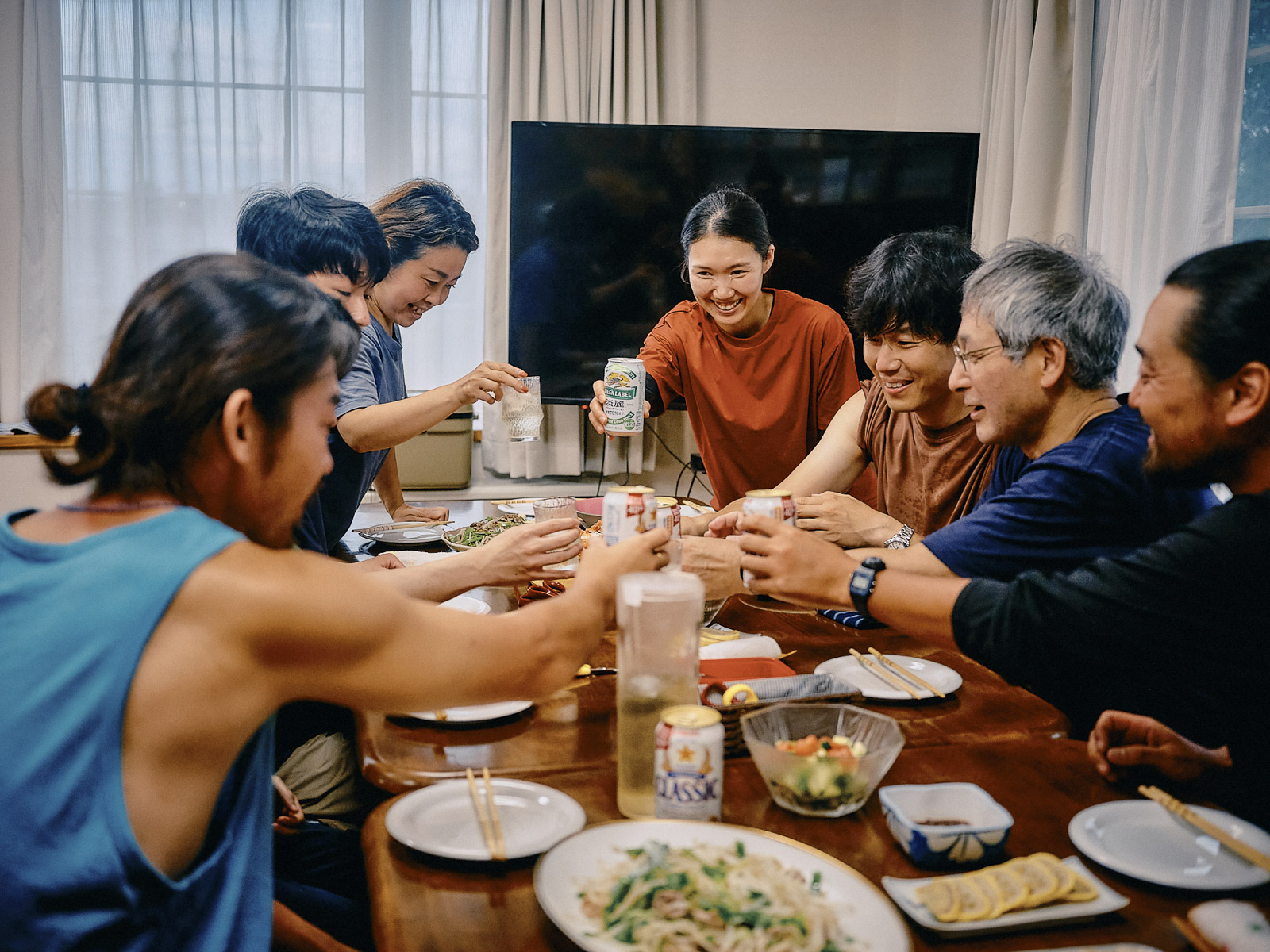
Nonstop conversations over a meal with people we’ve just met.
It’s been five days since we set off. Along the way we’ve had plenty of company: Rie and Naoki on the first two days; Joichi on the third day; Erisa on the fourth day; and now in Teshikaga, Tani, Kaori and this entire band of locals. How many people have we met? Thinking about it lifts my spirits. If you think of a journey as a collection of pieces, these encounters, landscapes and experiences are what makes this trip so worthwhile.
By chance, Ogino, director of the Hokkaido East Trail office, swings by the minshuku.
Masaru Kiyota
Masaru is the owner of café and bar peg. in Osaka. He shares the lessons he learns on his travels through social media and podcasts. Masaru cycled around Japan in 2013, spent a working holiday in Australia in 2014 and traveled around the world in 2015 and 2016. In 2017, he walked the entire 4,265-kilometer-long (2,650-mile-long) Pacific Crest Trail through California, Oregon, and Washington. He completed the 3,537-kilometer (2,198-mile) Appalachian Trail in 2018 and the 4,989-kilometer (3,100-mile) Continental Divide Trail in 2019. The next year, he walked the Michinoku Coastal Trail. In 2022, he walked over the mountains across the width of Japan, from the Pacific coast to the Sea of Japan. He hiked the Arizona Trail in 2023 and around Iceland in 2024.
Owner of café & bar peg.
2013: Cycled around Japan; 2014: Working holiday in Australia; 2015–16: Round-the-world trip; 2017: Pacific Crest Trail; 2018: Appalachian Trail; 2019: Continental Divide Trail; 2020: Michinoku Coastal Trail; 2022: Pacific Ocean → Sea of Japan; 2023: Arizona Trail; 2024: Iceland.
He shares what he’s learned from travel and nature mainly through audio media, including social platforms and podcasts.