


The Michinoku Coastal Trail, Part 1: What, Where and How-to
The Michinoku Coastal Trail, Part 1: What, Where and How-to
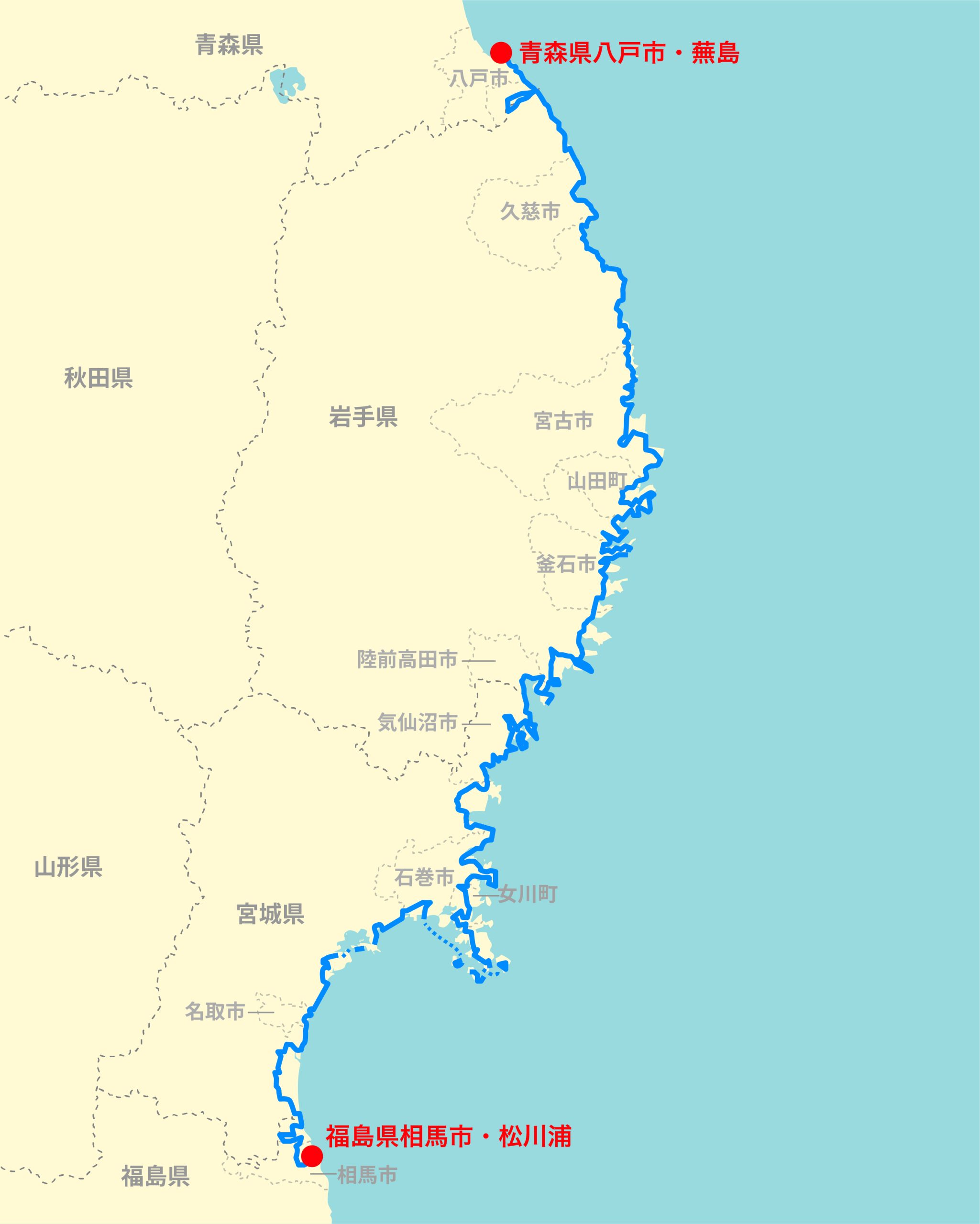
The Michinoku Coastal Trail (MCT) stretches for more than 1,000 kilometers, connecting 29 municipalities across four prefectures from Fukushima to Aomori. Since the trail was completed in 2019, it has become one of Japan’s premier long-distance trails and has helped to foster a thriving hiking culture.
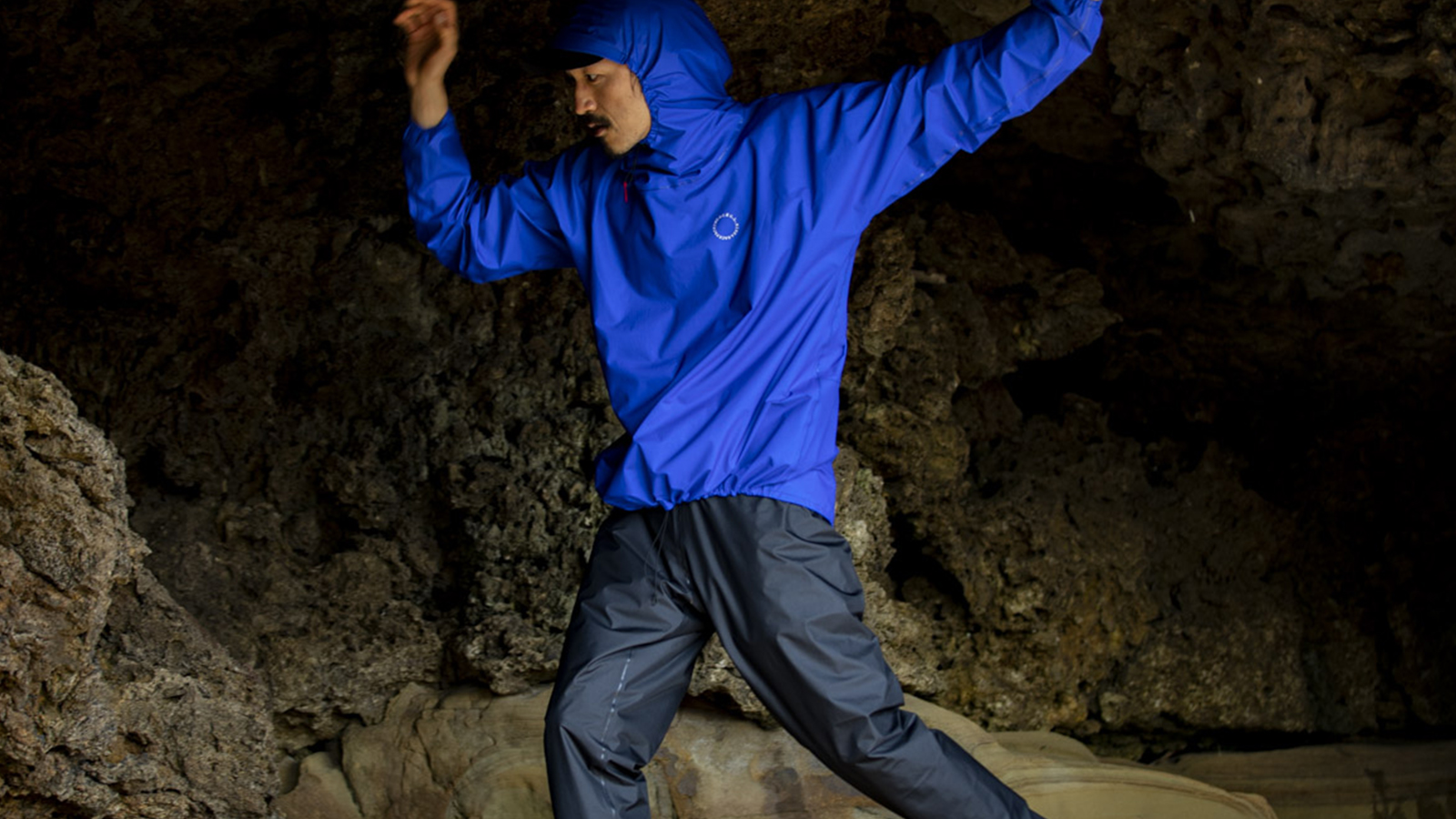
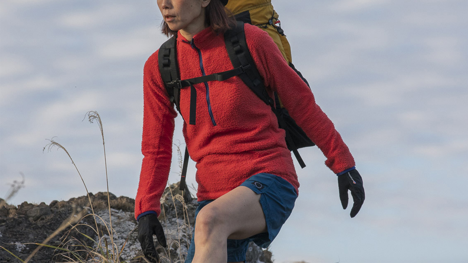
Daisuke Ito, of Yamatomichi Kyoto, hiked the trail in 2024. Drawing on that trip and his extensive experience hiking long trails overseas, Daisuke has compiled a hikers' handbook, filling it with practical tips and model itineraries, trail highlights and recommendations for shorter section hikes.
I arrived at the end of the trail, led onward by black-tailed gulls gliding on the currents overhead. At the beginning of my trip, a month earlier, the sun had scorched my skin. But now the air was crisp and cool. Over the course of my journey, I’d straddled seasons, moving through summer to autumn.
I’ve walked many long trails. This one, somehow, was different. I felt no clear-cut sense of achievement, no triumphant moment of crossing the finish line. It was a quieter denouement: an afterglow at the end of an ordinary day whose light continued beyond the horizon. Maybe it was that the landscapes ー the changing terrain underfoot, the constant Pacific Ocean to my right ー and local residents I’d met along my walk through Japan’s northeastern Tohoku region had seemingly become part of my everyday life. I promised myself that I would return someday.
How long did it take for the waves to carve this rugged coastline? (Ogatsu Coast, Ishinomaki city)
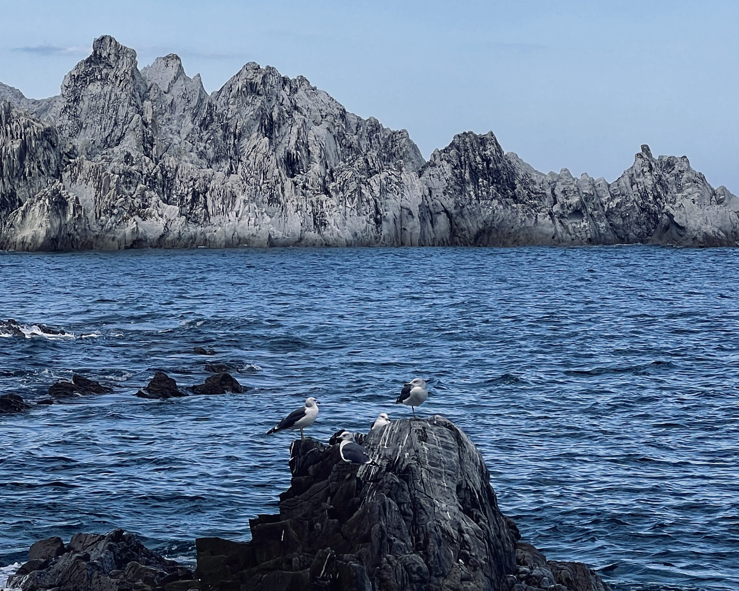
The Sanriku Coast is a breeding ground for black-tailed gulls. (Jodogahama, Miyako city)
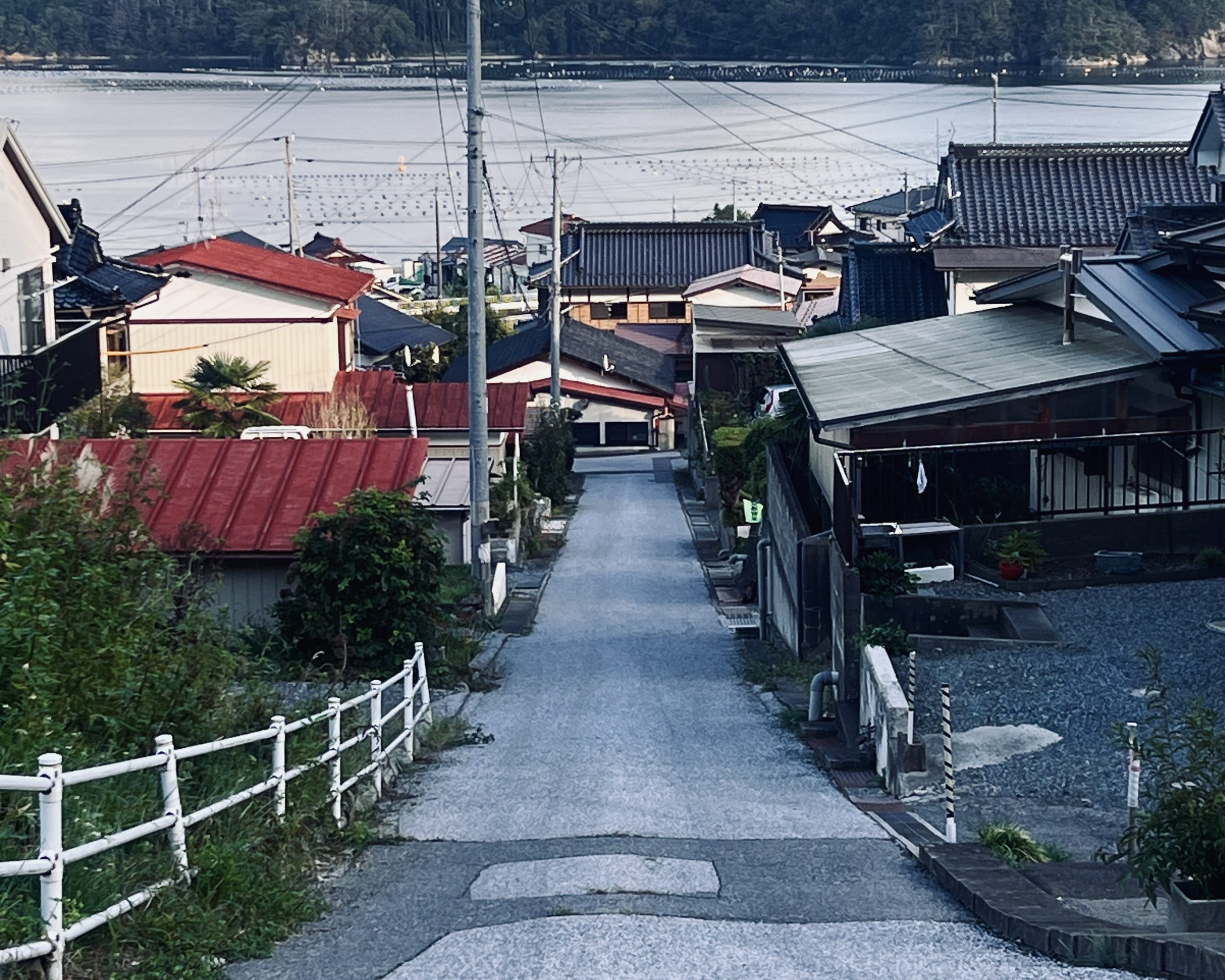
A snapshot of a seaside community that could have been the backdrop of a Hayao Miyazaki (Studio Ghibli) film. (Shimofunato, Ofunato city)
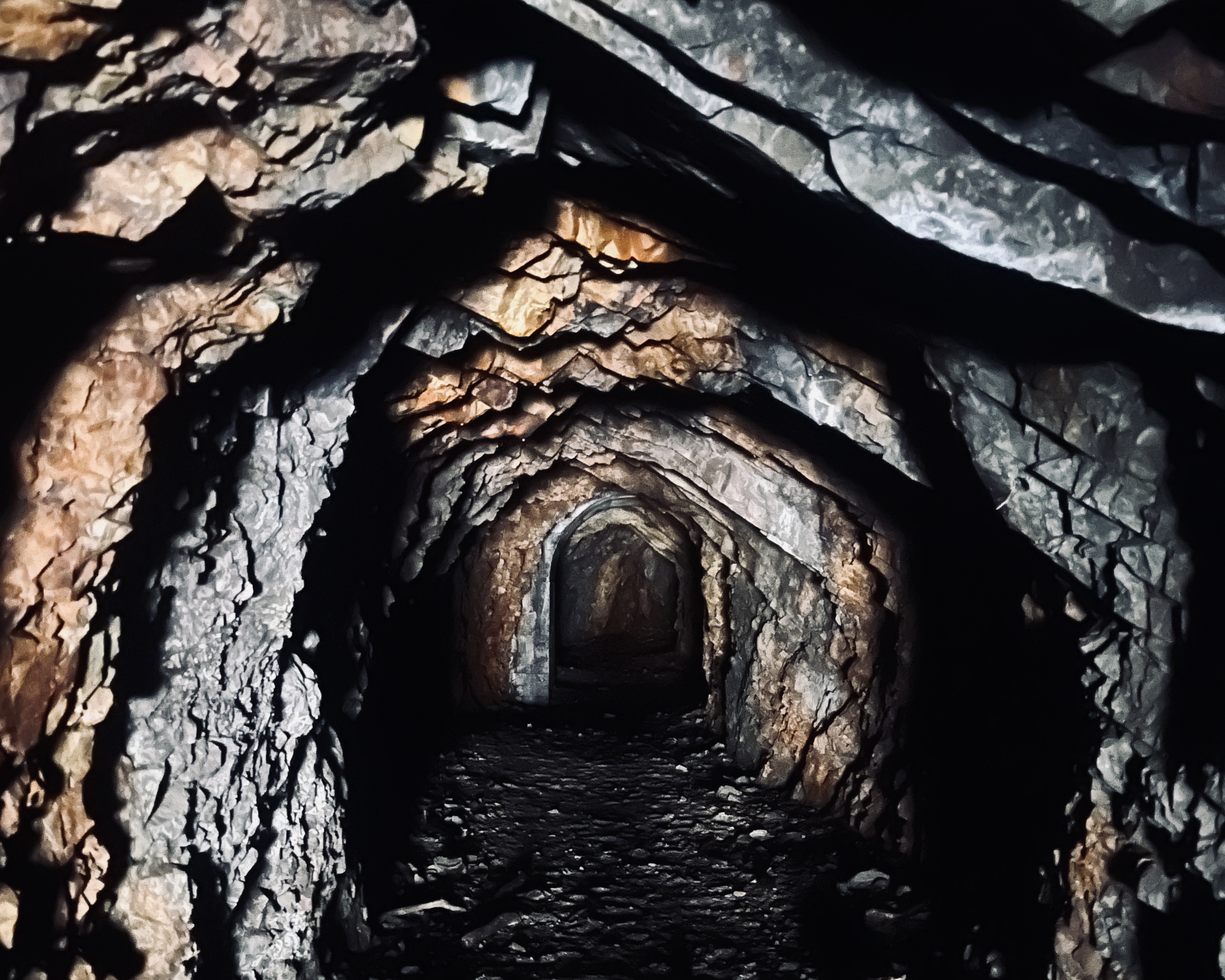
The complete darkness of a hand-dug tunnel. (Kitayamahama, Tanohata village)
Mountain passes link one rural community to another. (Hakozaki Peninsula, Kamaishi city)
Preface
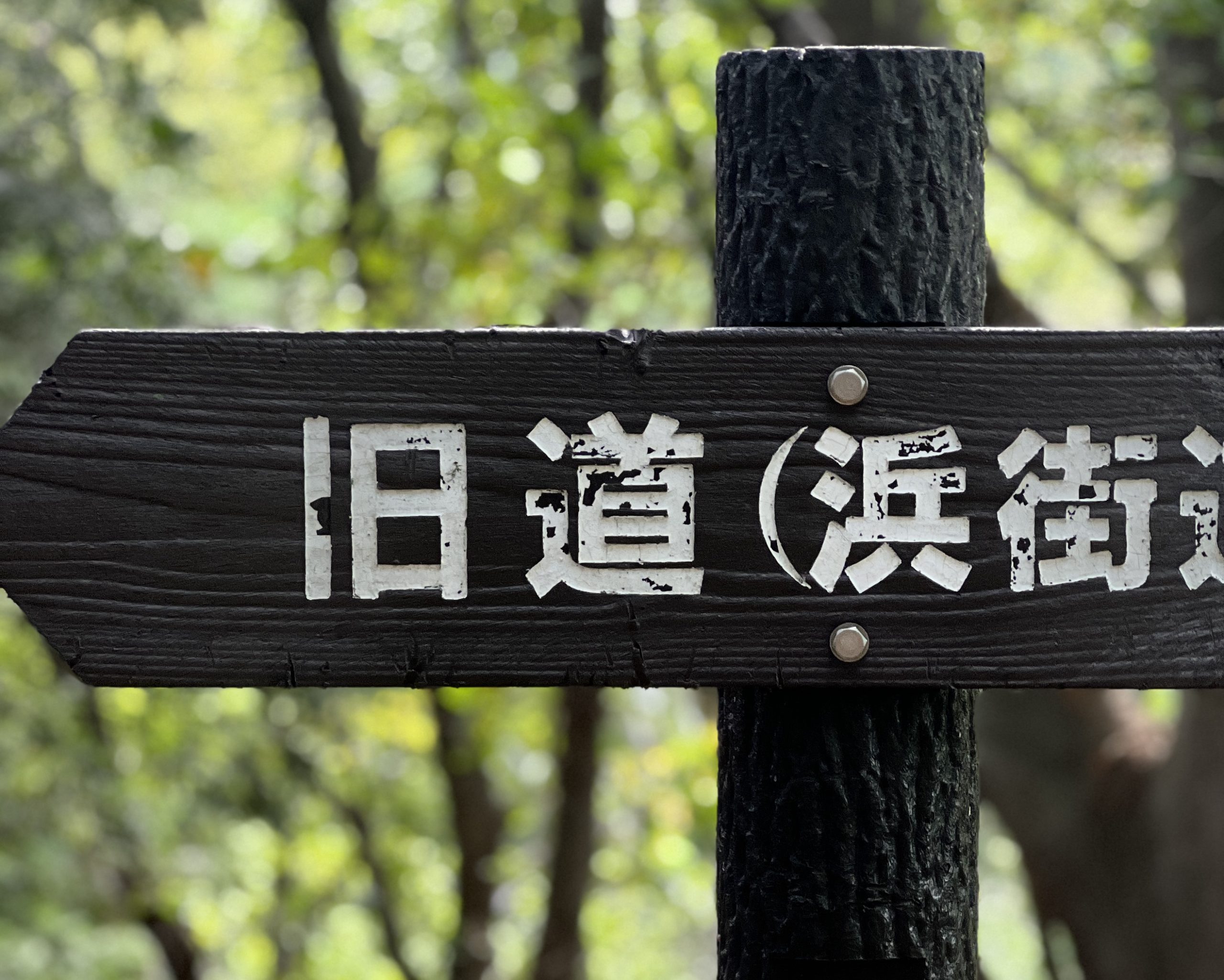
Ever heard of the Michinoku Coastal Trail (MCT)?
Stretching for more than 1,000 kilometers (600 miles) along the Pacific coast of the northeastern Tohoku region, the trail connects Hachinohe city, in Aomori prefecture, with Soma city, in Fukushima prefecture. I walked the trail, end to end, from September 7 to October 10, 2024.
I’ve hiked a lot of long-distance trails overseas, and the Michinoku Coastal Trail is every bit as appealing as those. The opportunity to deepen my understanding of the Tohoku region, the generosity and kindness of locals, the riches of my daily routines in an unfamiliar corner of my own country ー these are some of the things that I hope others will experience for themselves.
There’s uncertainty in traveling anywhere new. This MCT Hikers’ Handbook will highlight the trail’s attributes, offer practical tips ー and maybe even assuage jitters about hiking the trail. Think of it as a guidebook written by a hiker for his fellow hikers.
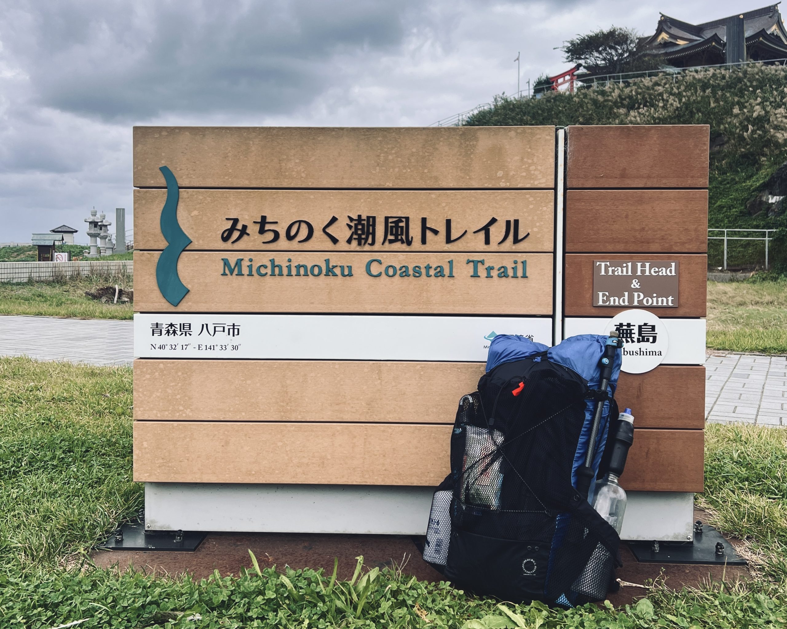
Kabushima, in Hachinohe (Aomori prefecture): the starting point of my journey.
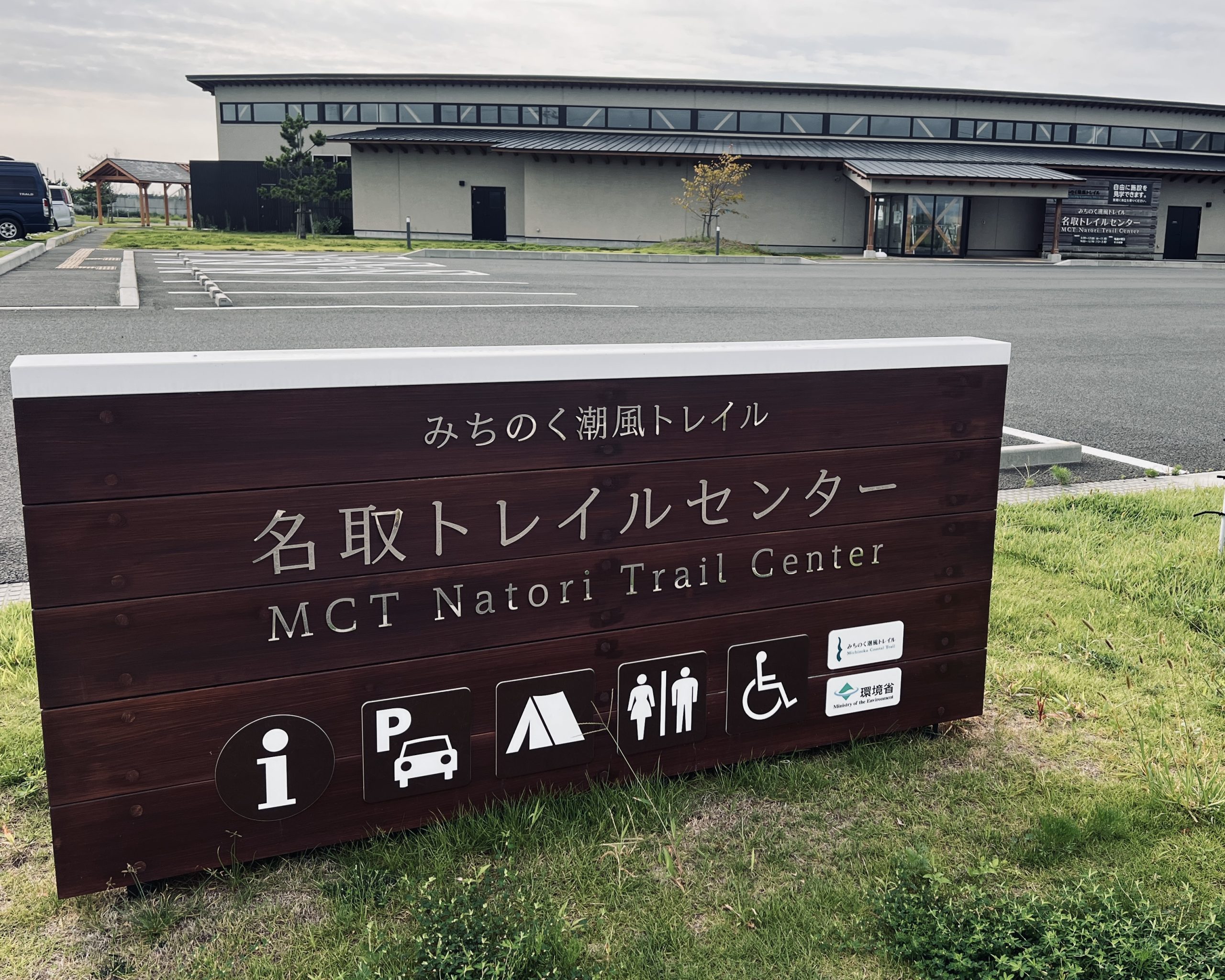
The Michinoku Coastal Trail’s Natori Trail Center in Natori (Miyagi prefecture) has trail information, long-distance hiking books and a campground.
What is the Michinoku Coastal Trail?
Overview
A long-distance trail stretching along the Pacific coast, from Kabushima in Hachinohe city (Aomori prefecture) to Matsukawaura in Soma city (Fukushima prefecture), connecting 29 municipalities across the four prefectures of Aomori, Iwate, Miyagi and Fukushima.
Distance
1,059 kilometers (658 miles)
Cumulative elevation gain
Around 38,000 meters
Highest point
740 meters above sea level (Hashikami-dake, Hashikami town, Aomori prefecture)
Origins of the Michinoku Coastal Trail
The creation of the Michinoku Coastal Trail was part of the reconstruction and recovery initiatives in the Tohoku region, following the devastating earthquake and tsunami that struck in March 2011. Under the Environment Ministry’s Green Reconstruction Project, the trail was built by local governments, private organizations and residents in four prefectures, Aomori, Iwate, Miyagi and Fukushima. The first sections of the trail opened in 2013, and the entire route was completed in 2019.
Tourism and recreation weren’t the only objectives. The trail was designed to be an opportunity: Hikers would visit local communities, experience a mix of nature and culture, and contribute in some way to the recovery efforts through their interactions with residents. The Michinoku Coastal Trail Charter outlines the vision and aspirations for the project.
Views of the Pacific coastline, one of the defining features of the Michinoku Coastal Trail. (Funakoshi Peninsula, Yamada town)
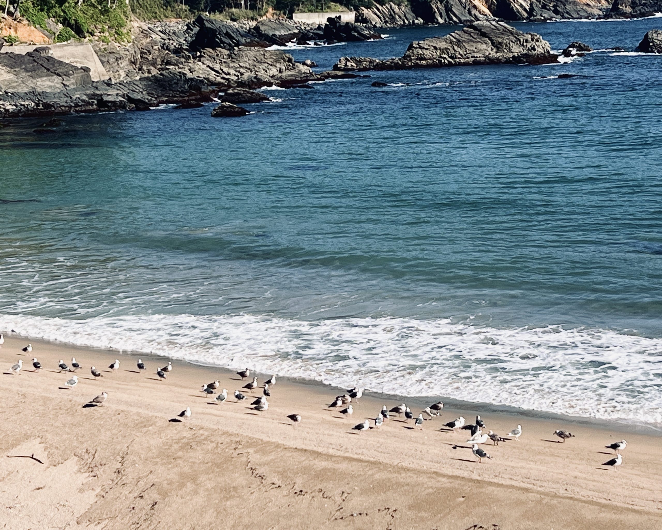
Black-tailed gulls stand along the shoreline. (Arahama beach, Ogatsu, Ishinomaki city)
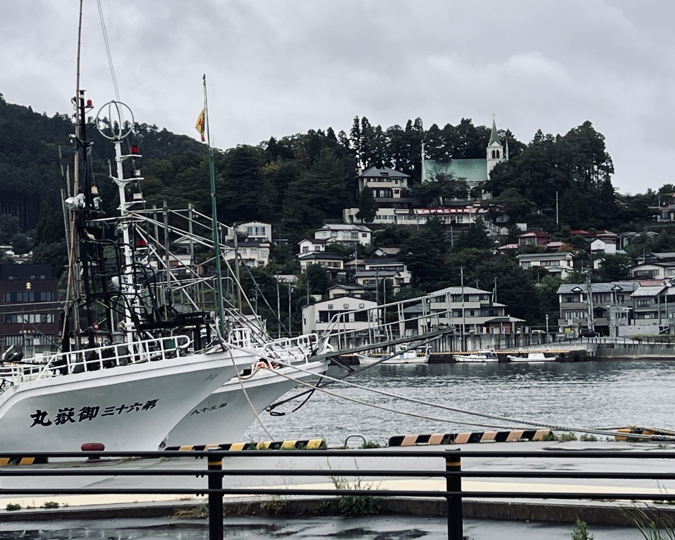
The trail passes through fishing ports and harbor towns of every size. (Kesennuma Fishing Port, Kesennuma city)
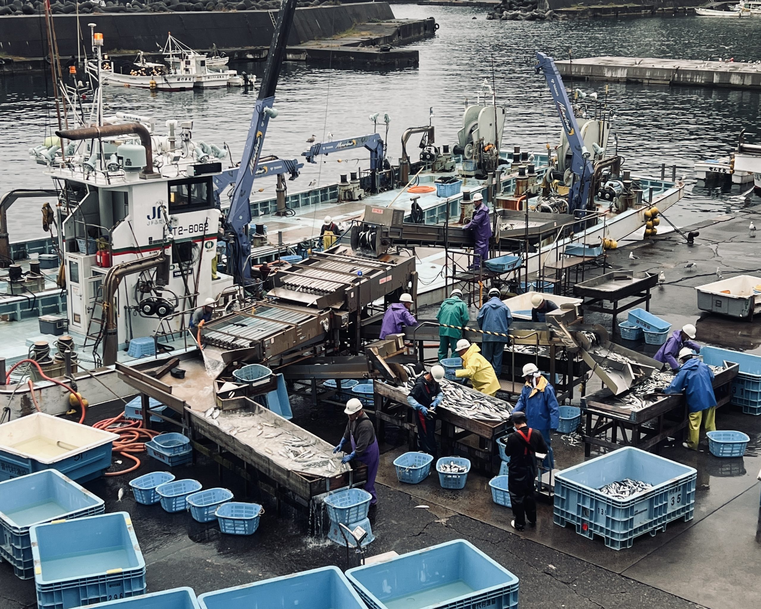
Everyday local scenes along the trail. (Otanabe Fishing Port, Fudai village)
Long trails versus long-distance nature trails
How to define a long trail?
The short answer is that it’s a walking route spanning a great distance. It might connect hiking trails, forest roads and paved streets, and ultimately represents a journey.
Typically, when we talk about long trails, the iconic ones in the US spring to mind ー the Appalachian Trail (or AT, roughly 3,500 kilometers long), completed in the 1930s, or the Pacific Crest Trail (or PCT, some 4,200 kilometers long), to name a couple.
But it can also include sacred routes that originally served religious purposes and are now popular with hikers: Japan’s 1,200-kilometer Shikoku Henro (pilgrimage) connecting 88 official Buddhist temples, or the Camino de Santiago, which ends at the Cathedral of Santiago de Compostela in Galicia, northwest Spain, thought to be the resting place of St. James the Apostle.
What many people may not realize is that Japan’s long trails have been around for some time. The Tokai Nature Trail, from Takao, in western Tokyo, to Minoh, in Osaka, was created in 1970 and inspired by the Appalachian Trail. Today, 10 long trails spanning 27,000 kilometers (16,700 miles) crisscross the archipelago. These routes are a reflection of Japan’s environment, history and culture, and can be thought of as a distinct offshoot of the US-centered long-trail concept.
The Pacific Crest Trail (US).
Camino de Santiago (Camino Francés, Spain).

Japan is home to around 27,000 kilometers (16,700 miles) of interconnected trails. (Source: Environment Ministry website)
Thru-hiking and long trails
How long does a route need to be before it qualifies as a long trail? There is no strict definition or specific distance that determines whether a trail deserves the “long” designation. Nor should there be one.
Even so, to help explain what the Michinoku Coastal Trail is, I would make the following distinction. A long trail connects mountains and communities. It’s a journey that encompasses more than just the physical distance that it spans. Contrast that with a long-distance mountain trail, which is fundamentally a route to reach a peak.
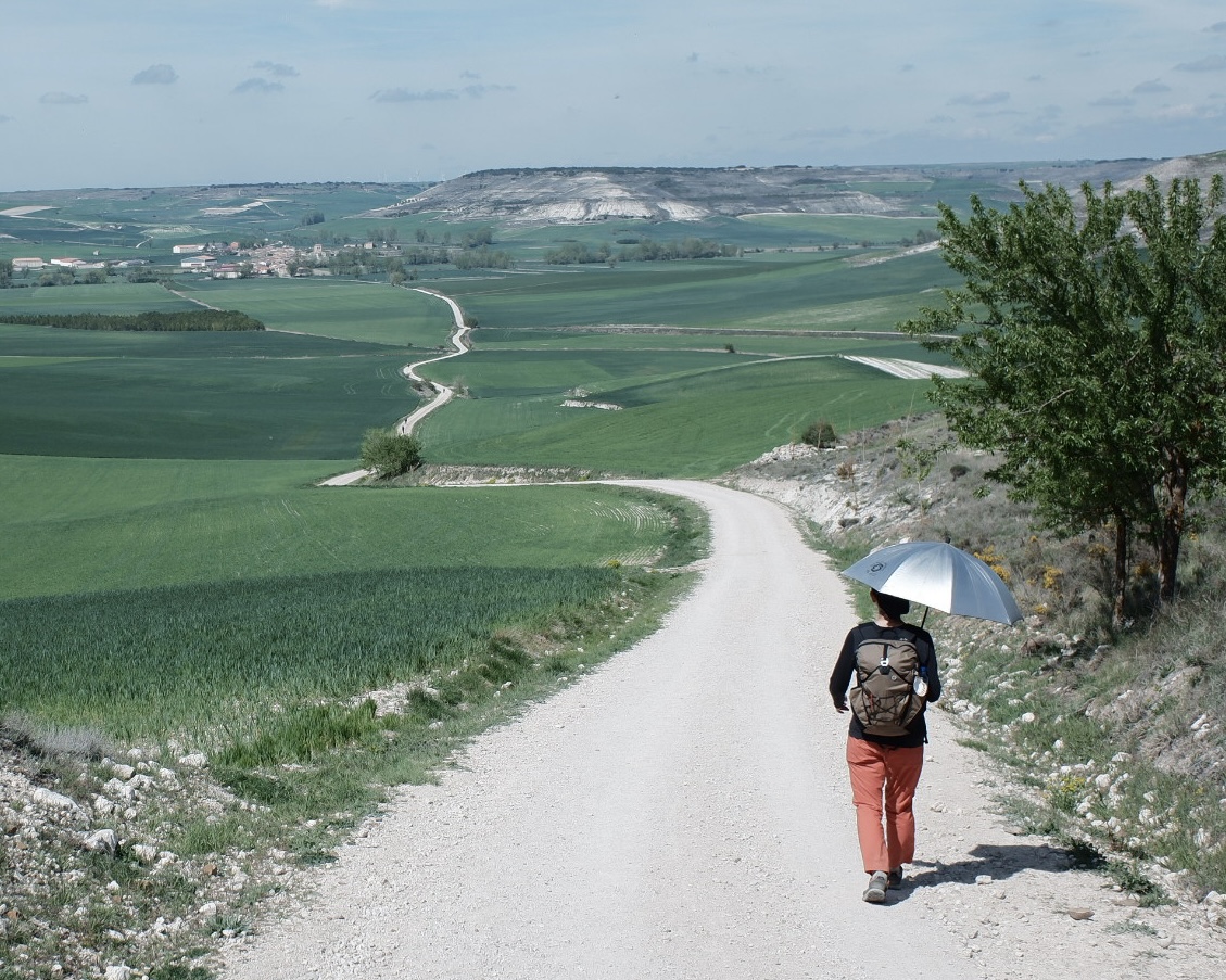
One of the defining experiences of long-distance hiking is meeting people who live along the route. Because these journeys unfold over vast distances and weeks or months, resupplying and recharging in towns along the way is essential ー stopping at supermarkets, eating in restaurants and even spending the night at inns or guesthouses.
These towns are where travelers passing through and residents going about their daily lives bump up against each other. These moments ー serendipitous, funny, out-of-the-ordinary and memorable ー are what a long-distance hiker lives for.
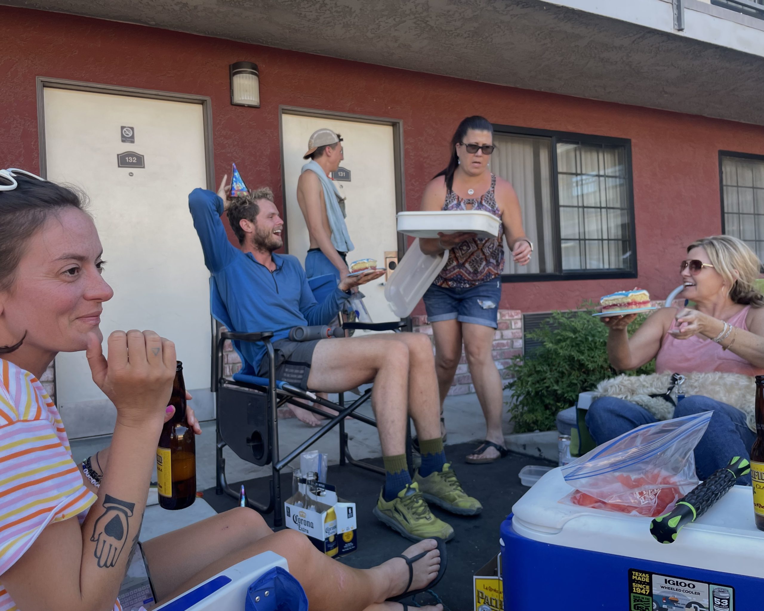
Hikers relax at a motel in town along the Pacific Coast Trail (US).
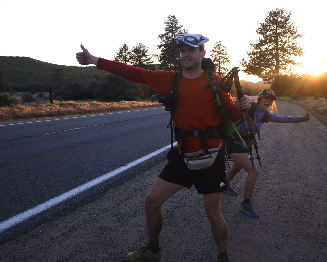
During long trail hikes in the US, getting off the trail and hitchhiking into town is standard practice. On the other hand, the Michinoku Coastal Trail passes directly through communities.
The Michinoku Coastal Trail's appeal
What makes the Michinoku Coastal Trail so special? Four unique features set it apart.
① This stunning, ever-changing scenery
For many hikers, scenery is a big part of the journey.
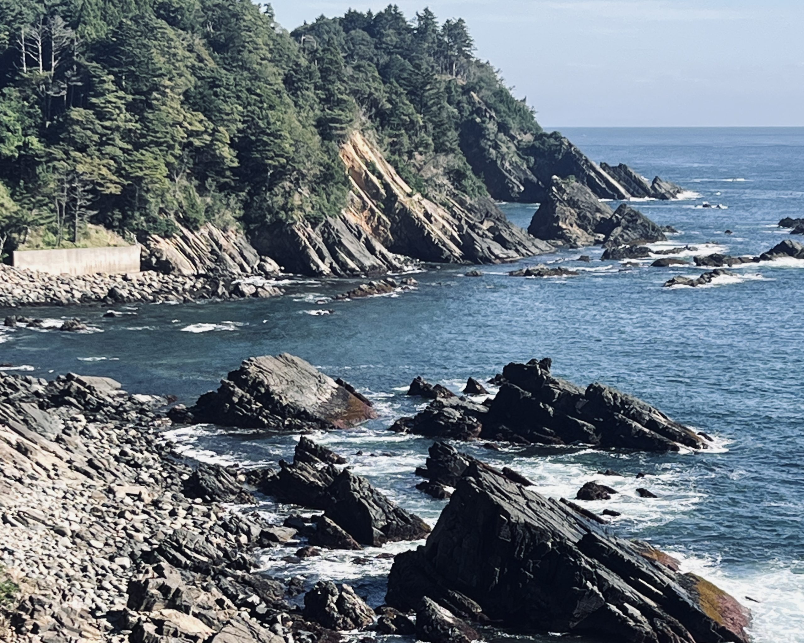
The Michinoku Coastal Trail traverses the Sanriku Geopark, encompassing roughly 220 kilometers (137 miles) from north to south and nearly 300 kilometers (186 miles) of coastline. (A geopark is a UNESCO designation aimed at attracting tourists who want to explore the links between geology, local communities, culture and nature of a place.)
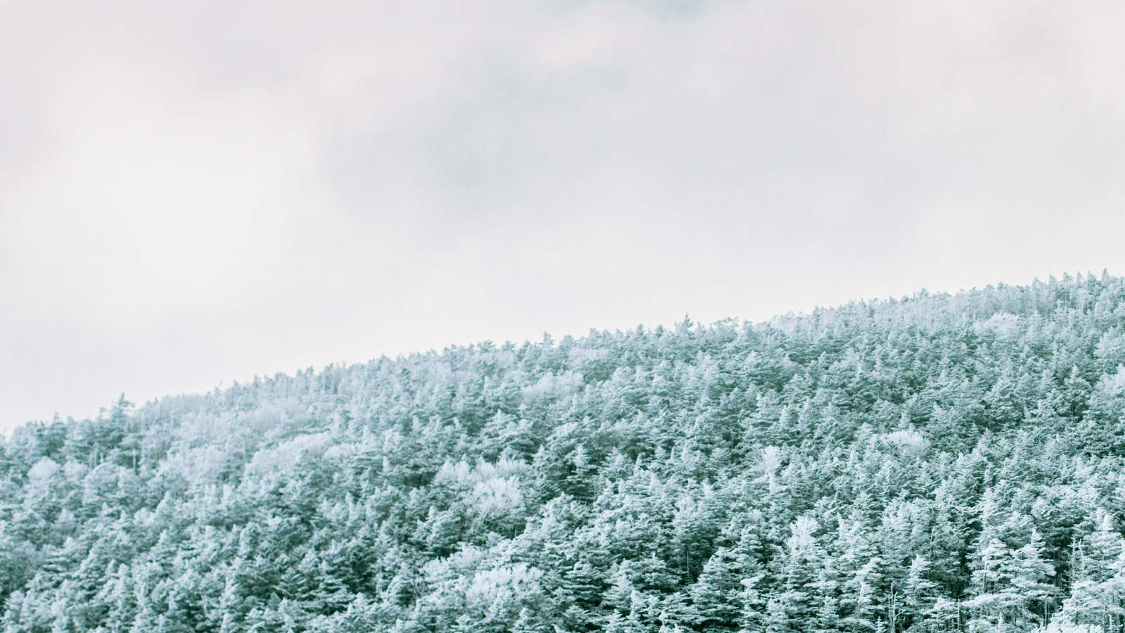
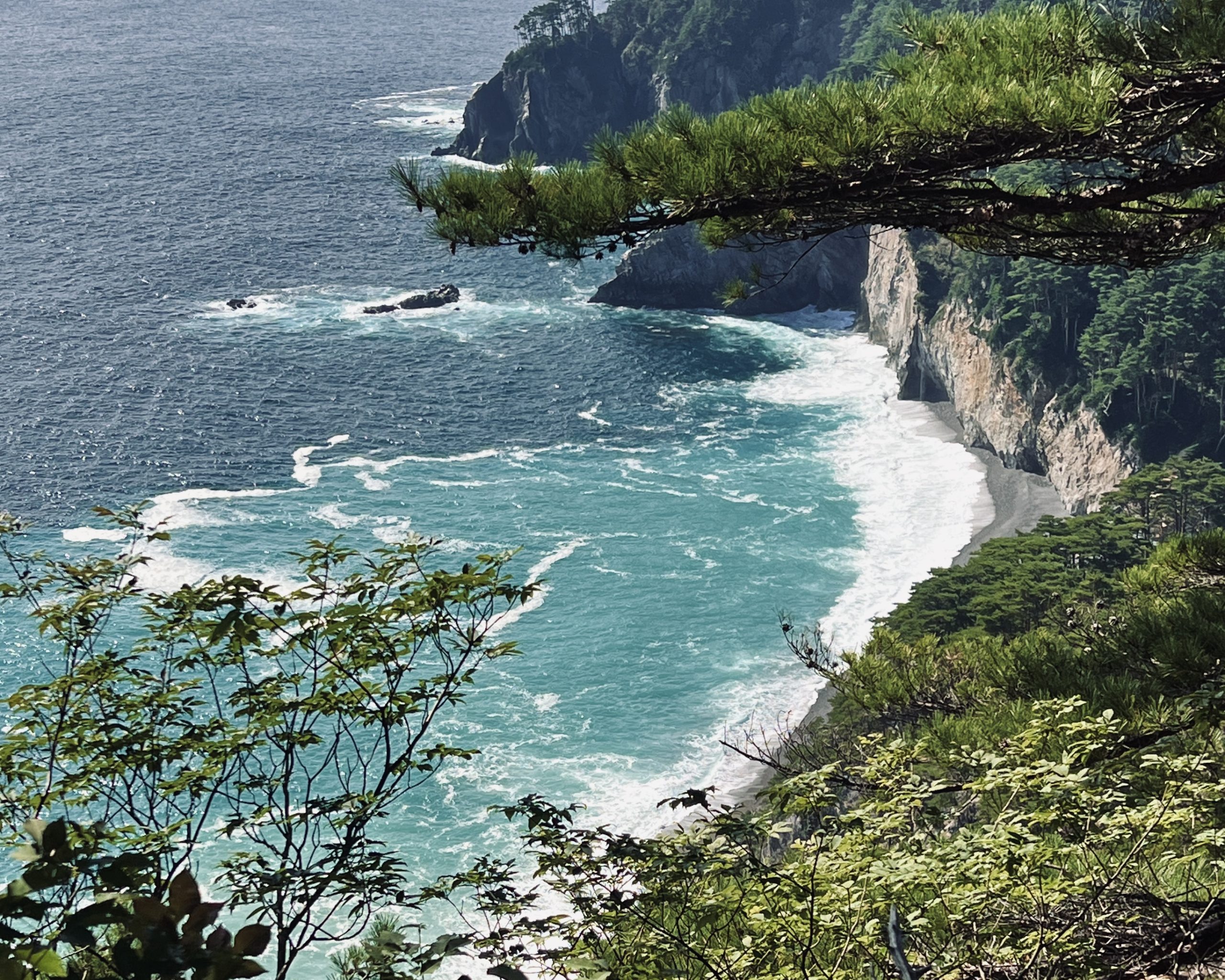
The trail features dramatic coastal landscapes: sunrises, rocky shorelines and towering cliffs. It’s an ever-changing backdrop. North of Miyako city, Iwate prefecture, you find marine terraces carved by erosion. To the south, you see a labyrinth of inlets and peninsulas of the ria coastline.
Within the geopark, the northern region consists largely of seabed sediments formed around 180 million years ago, while the southern region originated as part of a continent that moved from near the equator some 500 million years ago. The two landmasses collided against the Asian continent approximately 140 million years ago, shaping the Sanriku region we see today.
Learning that history transformed the landscape before my eyes. With each step, I felt a profound sense of wonder about the forces of that unimaginably distant ages.
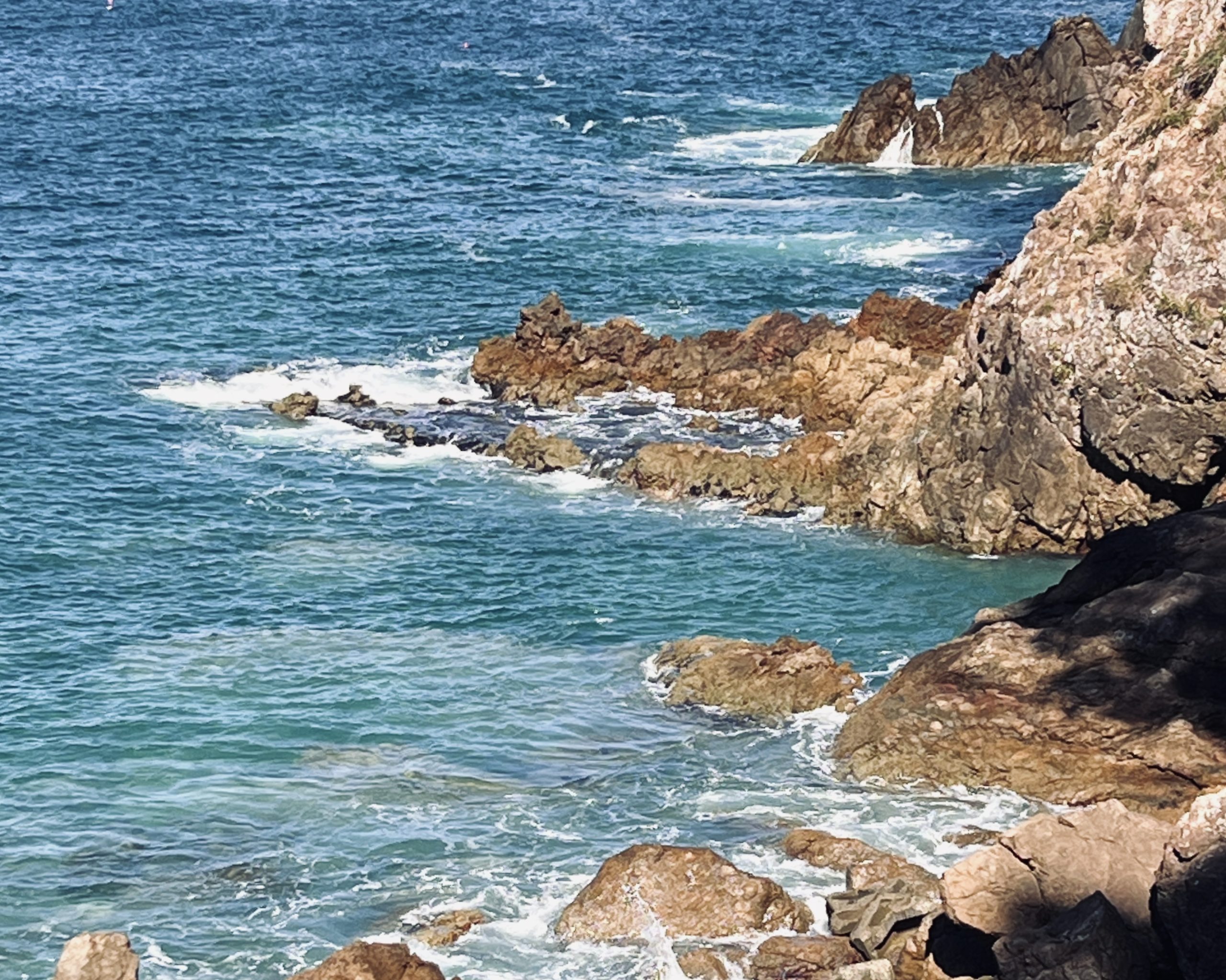
Contrasting coastal landscapes shaped over millions of years. (Omoe Peninsula, Miyako city)

The marine terraces of northern Iwate.(Kitayamazaki, Tanohata village)
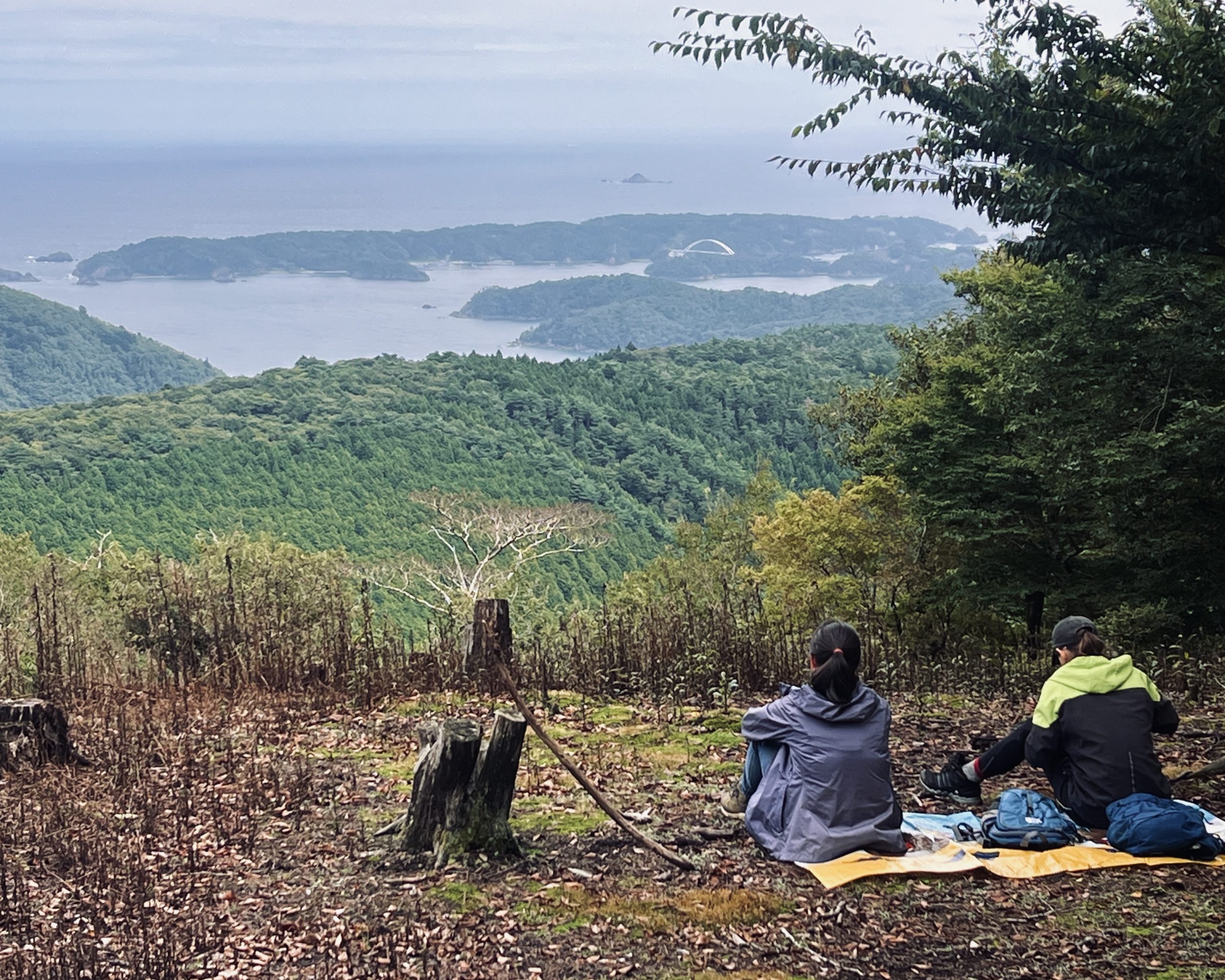
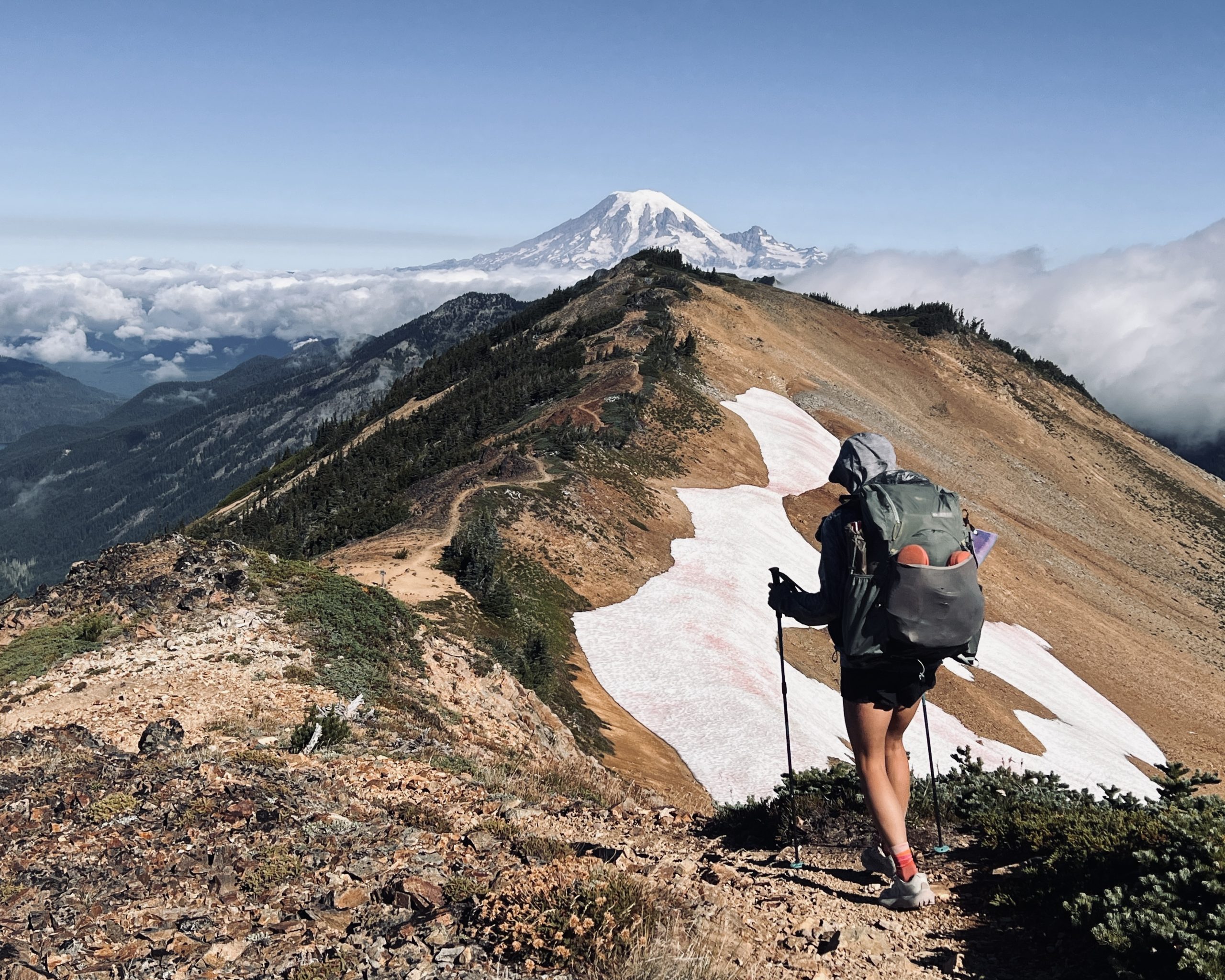
A hiker gazes out over the ria coastline from a mountaintop. (Ishinageyama, Onagawa town)
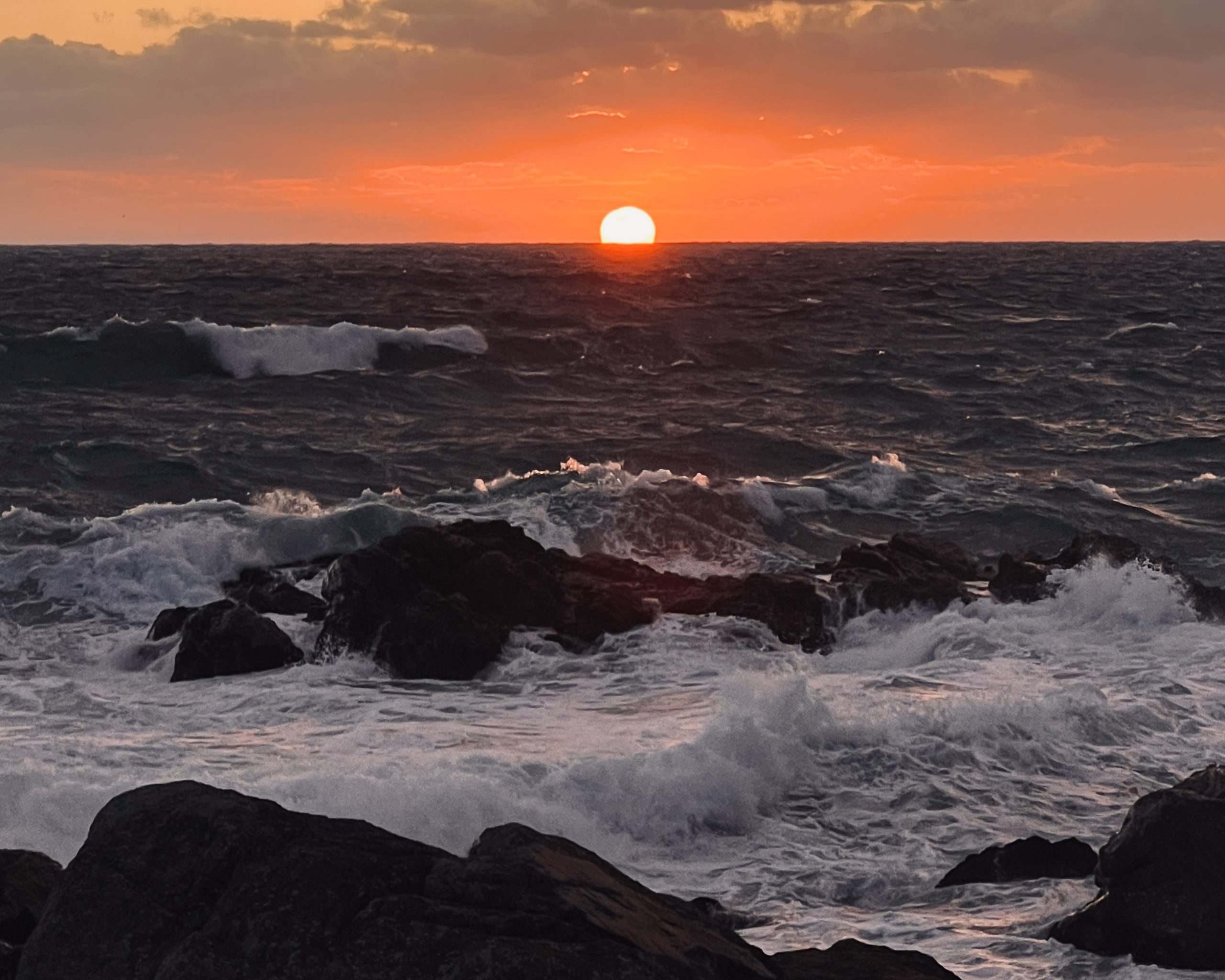
Sunrise over the Pacific Ocean at the end of the journey. (Tanesashi Coast, Hachinohe city)
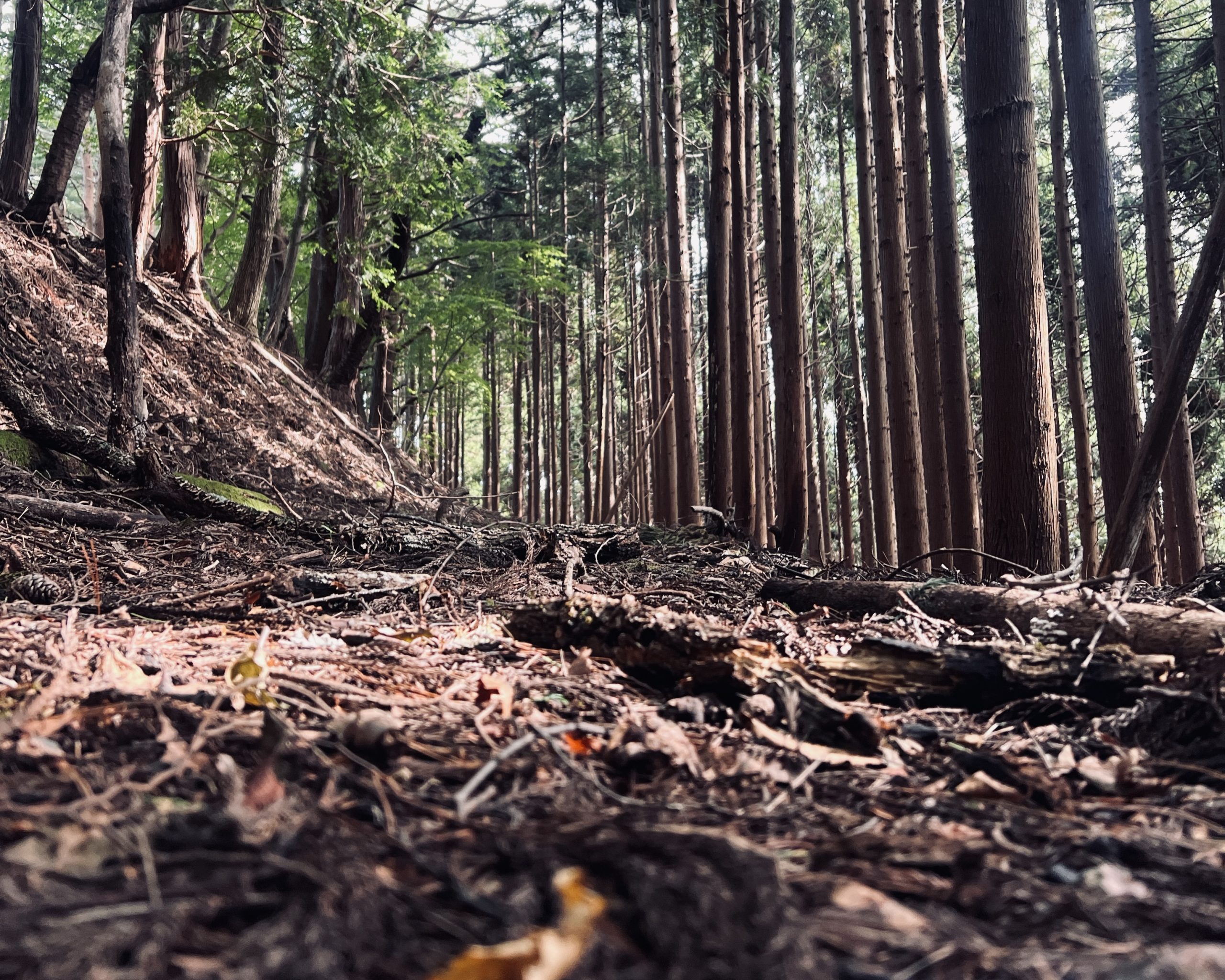
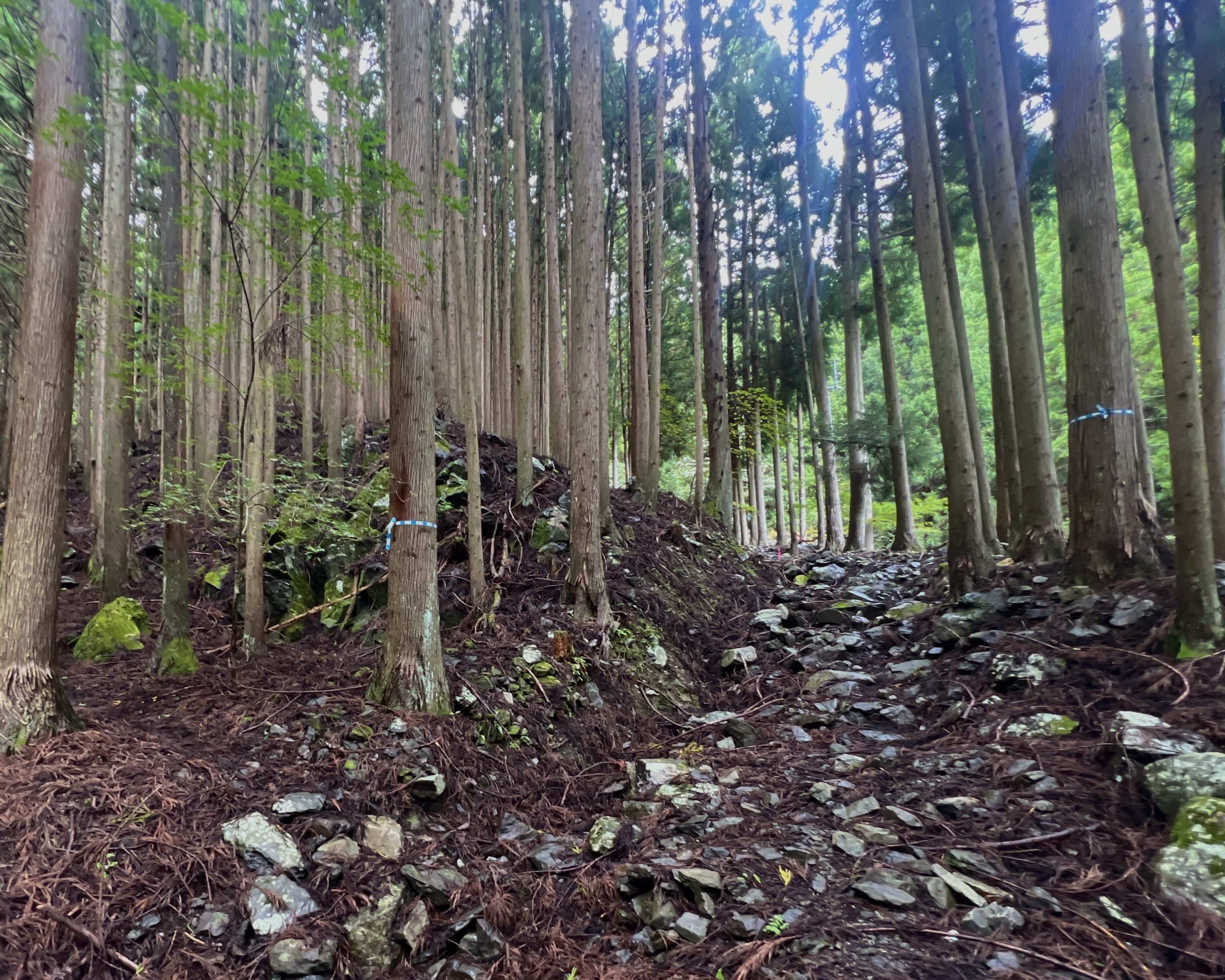
② Mountains, villages, ancient journeys
The coastline is hardly the trail’s only attraction.
The Michinoku Coastal Trail threads through villages and towns that are keepers of the history and culture of the region. Many of the paths trace the old mountain passes and vital highways that were once lifelines for these communities. The historic Sanriku Hama Kaido, which connected Hachinohe in Aomori with Kesennuma in Miyagi, was once an important trade corridor and is part of today’s trail.
Walking from one village to the next through the mountains is one of humankind’s most fundamental forms of travel. When you do this today, you’re retracing the steps of travelers from centuries past. You’re also reexamining the fragments of knowledge of a community’s history, culture, geography, geology, ecology and folk legends. I felt this deeply on the Michinoku Coastal Trail ー an experience that’s evaded me on long trails outside of Japan.
Something else dawned on me. As a child, I read stories of heroes leaving their villages on journeys across mountains toward distant lands. They said their goodbyes, carried their belongings along rugged paths, faced monsters along the way, hunted for food, gathered around campfires at night, and slept beneath the stars before arriving at their destination. I never imagined I would one day step into a world that felt so similar to those stories. It was thrilling.
A sign marking the historic Hama Kaido route that once connected Hachinohe and Kesennuma. (Sanriku Hama Kaido, Toriyasaka)
A mountain pass connecting villages. (Sanriku Hama Kaido, Toriyasaka)
Imagine how many generations have passed over these stone-paved paths. (Ishizuka Pass, Kamaishi city)

Moss-covered boardwalks. (Tasukuyama, Minamisanriku town)
③ Trail culture, community-supported
Meeting people is one of the joys of long-distance hiking.
On the Pacific Crest Trail ー a 4,265-kilometer (2,650-mile) route, from the Mexican border in California, to the Canadian border in Washington ー I experienced a trail culture that’s more than a half century old. There are trail angels, local volunteers who help hikers in countless ways, maintaining paths, giving rides into town, placing water caches in dry areas, and offering food and drinks at trailheads. These unsolicited acts of generosity are known as trail magic. Besides these, a simple smile and “Happy Trails!” was enough encouragement to keep moving forward.
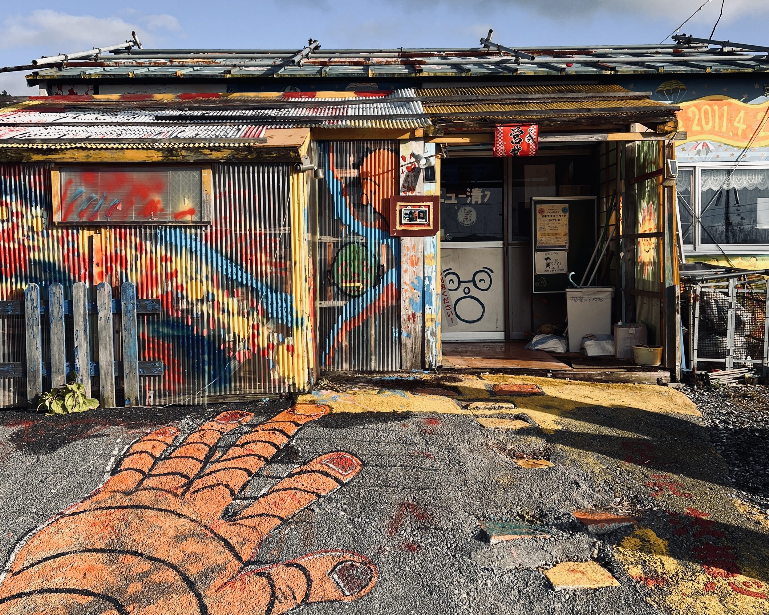
During my walk along the Michinoku Coastal Trail, I sensed the beginnings of a similar culture taking root. The entire trail has been open for only about six years, but I met many local residents who were familiar with the paths and eager to support hikers. Some shared information about trail conditions and campsites. Others offered food or water. A few even invited hikers into their homes. These gestures offer warmth to travelers during what can otherwise be a solitary journey.
Another pleasant surprise: the condition of the trail. Throughout my hike, I came upon remarkably few washouts, and almost never found sections overgrown with vegetation. It was consistently a joy to walk. Maintaining more than 1,000 kilometers (600 miles) of trail is no easy task. On long trails in the US, sections where the path had disappeared entirely were frequent enough. Without hikers and volunteers, nature trails go back to being nature. The Michinoku Coastal Trail’s accessibility is a credit to the nonprofit Michinoku Trail Club, Environment Ministry, local governments and numerous volunteer maintenance crews.
One day, after descending into a town along the route, someone unexpectedly called out to me: “You’re a hiker! That section up there was easy to walk, right? We just finished working on it last week!”
No single entity can realistically maintain such a vast trail network alone. Local volunteers play an indispensable role. The fact that, six years after the trail’s completion, so many people are already contributing time and energy to support hikers and maintain the route may be one of the clearest signs that a trail culture is taking shape along the Michinoku Coastal Trail.
Another important part of that support network is the Michinoku Coastal Trail Supporters program. Businesses ー shops, inns and campgrounds along the route ー that sign up offer an array of services, from water refills and charging facilities to toilets and camping space. Recognizing these contributions is essential to understanding that long-distance hiking is about more than reaching a destination.
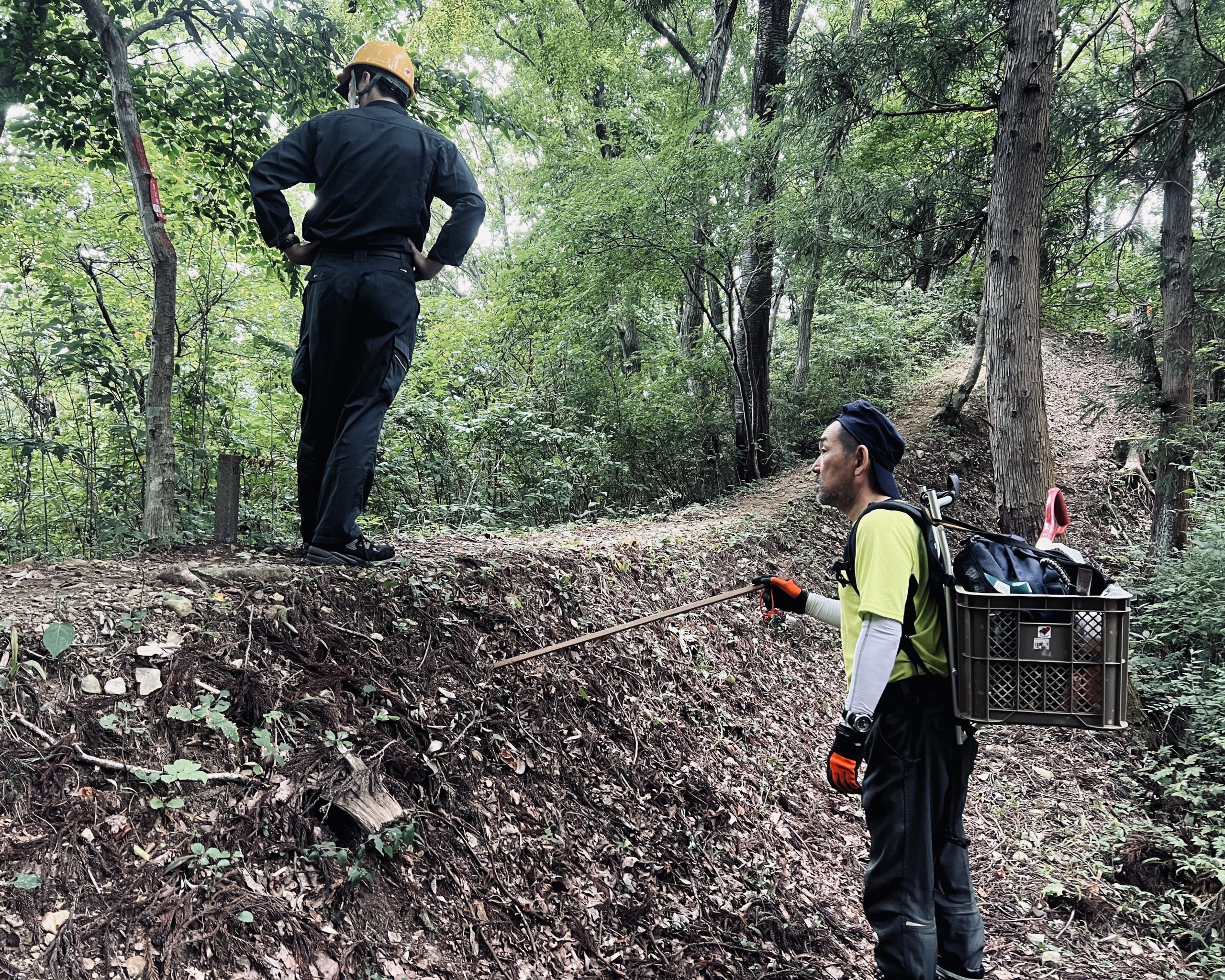
I happened to meet members of the Michinoku Trail Club as they worked on the trail.
Many hikers on the Michinoku Coastal Trail stop at Shiome. The staff also help maintain the surrounding trail.
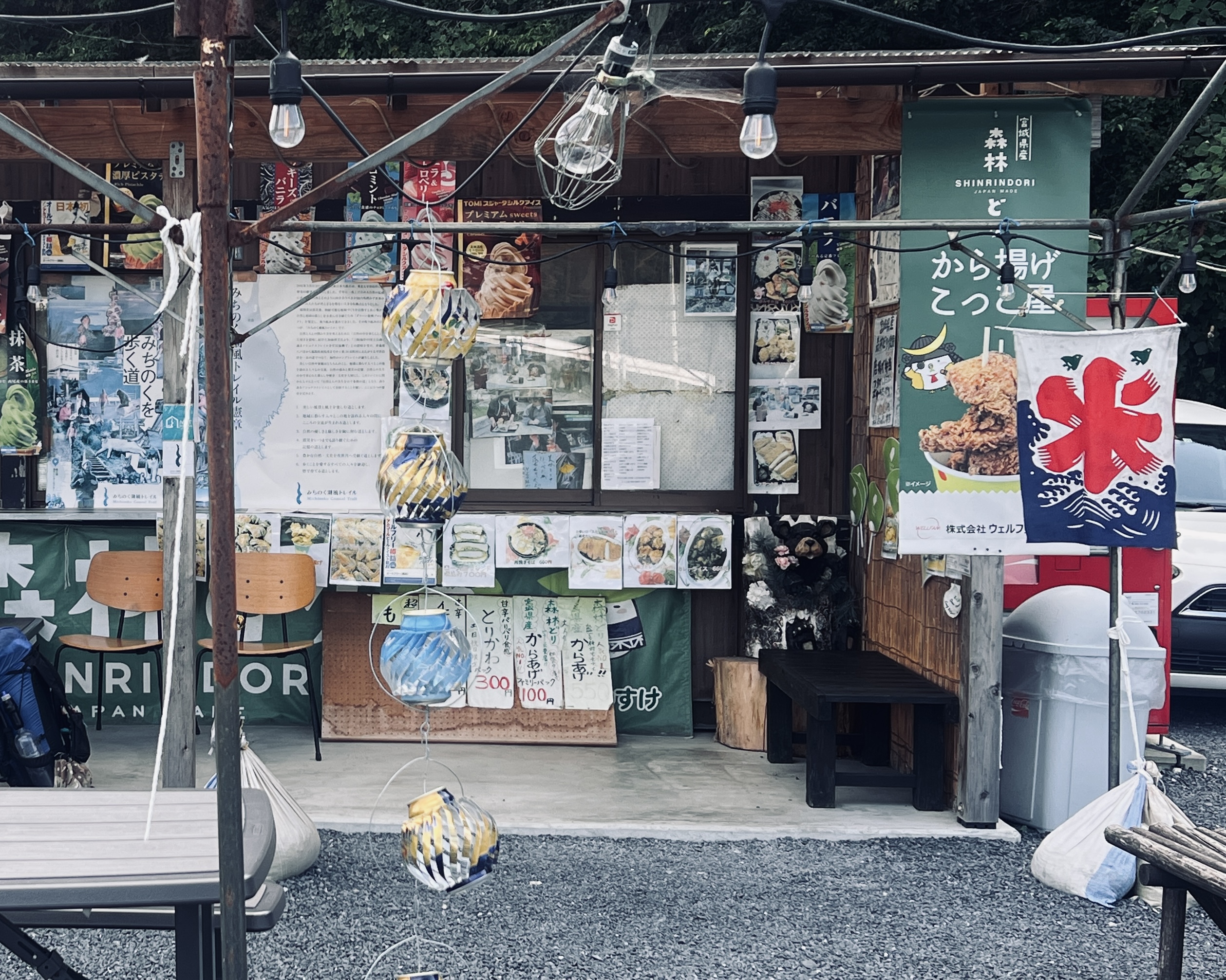
I am indebted to the owner of Kokkoya, who is known for her towering fried-chicken bento boxes. The generosity of locals in Tohoku made me want to return.
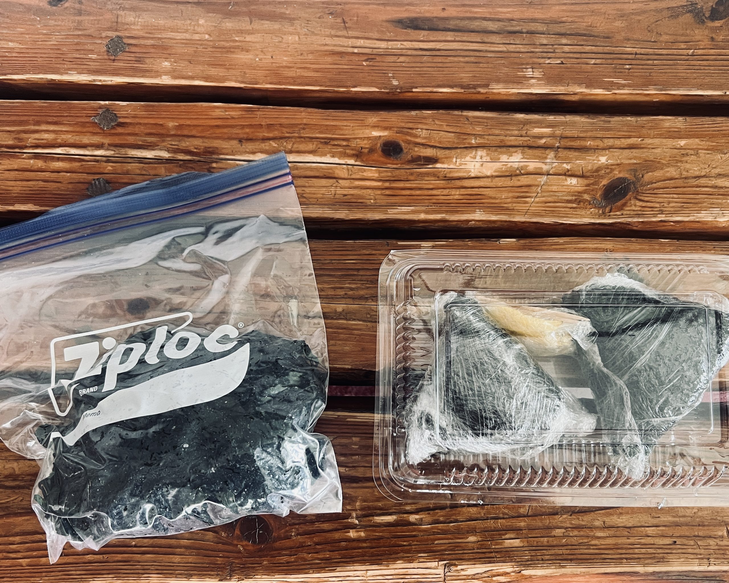
Breakfast at a small guesthouse: freshly harvested wakame seaweed and rice balls. The kindness we receive on the trail is something we should pass on to the next traveler.
④ Tohoku's disaster ruins
Painful traces of the devastation caused by the earthquake and tsunami in 2011 haven’t disappeared. They’ve been preserved as memorial museums and heritage sites that tell the stories to and offer lessons for future generations.
Rikuzentakata. Ishinomaki. Kesennuma. Ofunato. Onagawa.
I’d heard the names of these places on TV news broadcasts back then. At the time, I was looking for a job, and they seemed a distant historical event with little connection to my life.
It’s different when you’re standing in front of these ruins and forced to confront the reality of what happened. I bowed my head in prayer and stood there in silence, unable to think of something appropriate to say.
“May the victims rest in peace.”
“May we never forget the disaster. May we pass on its lessons to future generations.”
This is what you’re supposed to say. But I couldn’t bring myself to utter the words.
The people whose lives were suddenly taken away by the force of nature surely had dreams and hopes of their own; a desire to find happiness in this world.
There was little I could do. Realizing that did nothing to ease my frustration at my own helplessness. Walking the trail afterward, I carried that feeling with me. More than a year has passed since I completed my journey, and yet I haven’t fully processed those feelings. What stuck with me is a lesson: how precious it is to be alive, to be present in the moment. There’s no guarantee that we’ll get to see the future we imagine for ourselves. As someone who had only had this brief glimpse of the disaster’s aftermath, I struggled with whether to even include these thoughts here. But my hope was that others would walk the Michinoku Coastal Trail to see for themselves what I saw.
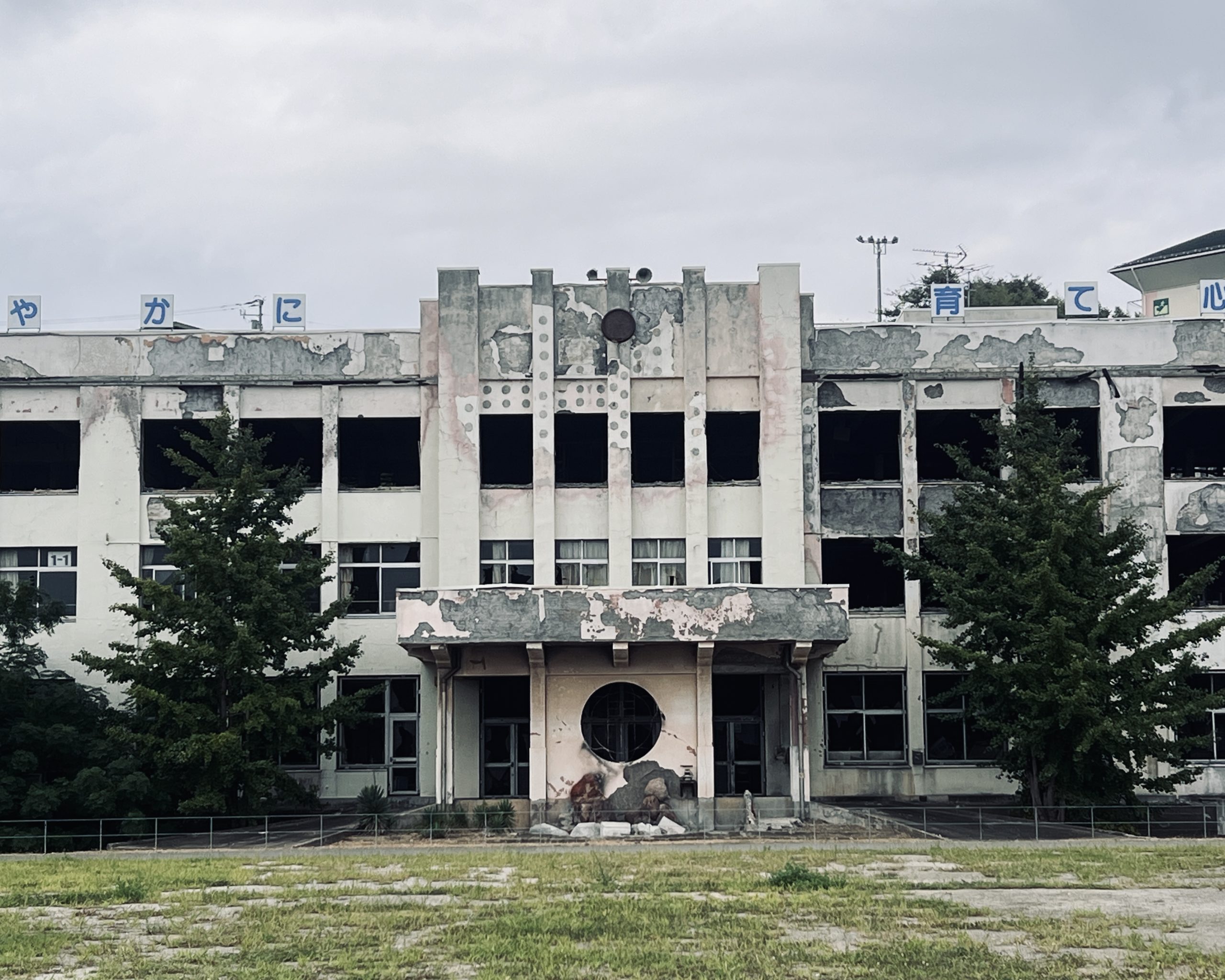
Former Kadonowaki Elementary School, a disaster memorial site, in Ishinomaki city.
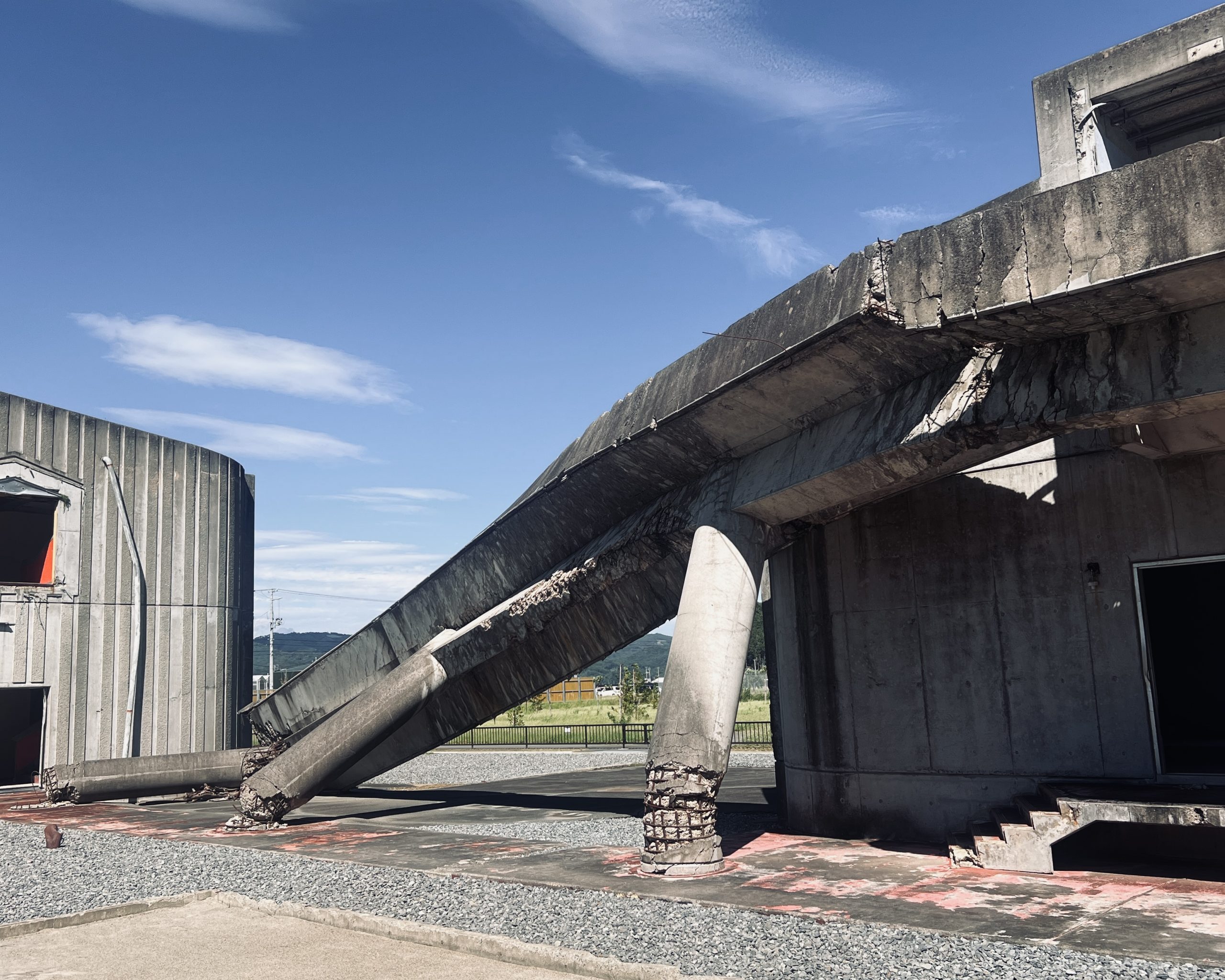
Former Okawa Elementary School, a disaster memorial site, in Ishinomaki city.
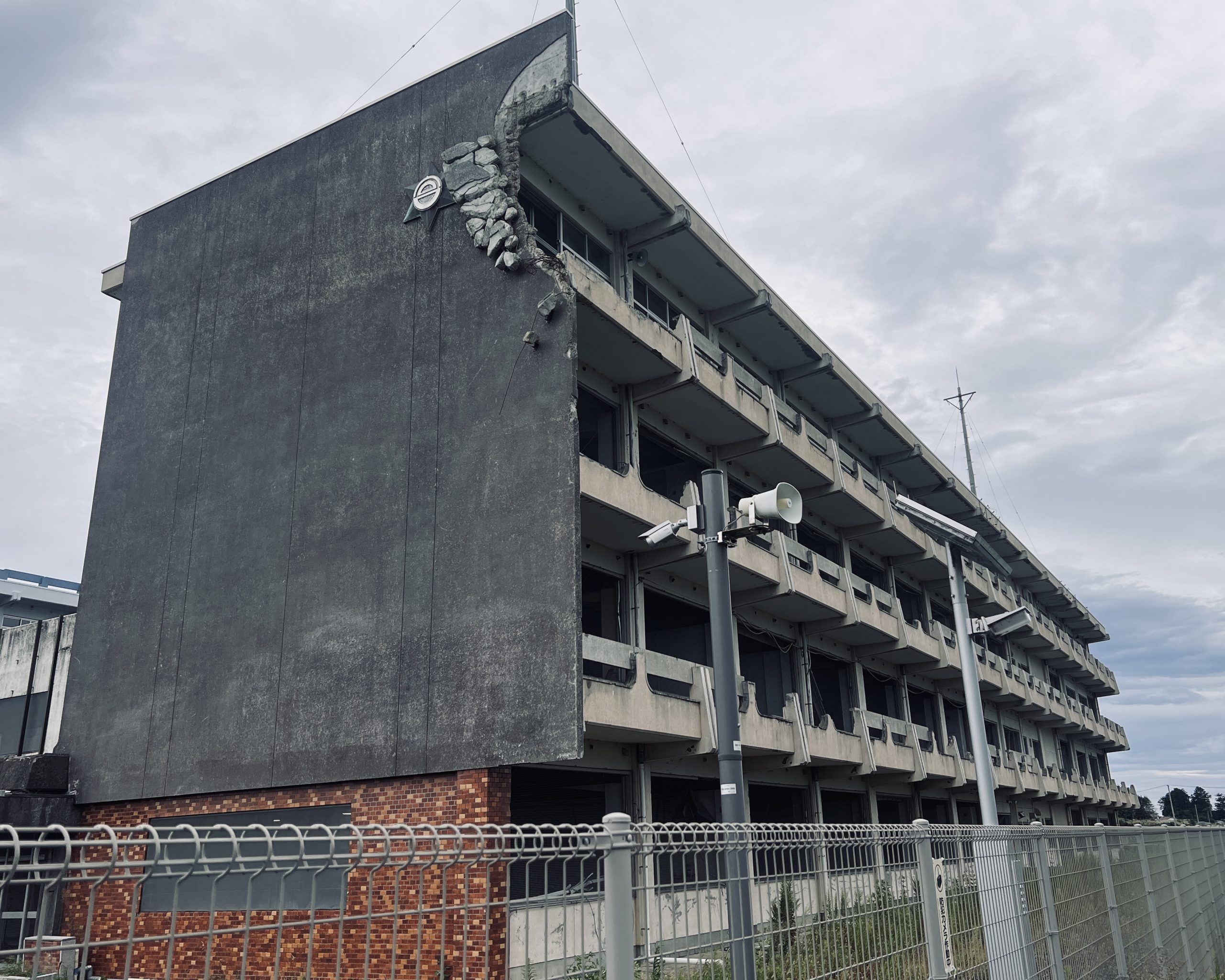
Great East Japan Earthquake Memorial and Museum, in Kesennuma city.

The ruins preserved, at the Great East Japan Earthquake Memorial and Museum, in Kesennuma city.
Daisuke Ito is a member of Yamatomichi Kyoto’s staff. Drawn to the idea of traveling abroad from an early age, Daisuke became interested in outdoor culture through encounters on the road. He’s been on canoe expeditions in Canada and treks in Alaska; hiked long-distance trails in the US, including the Pacific Crest Trail (PCT) in 2022 and the Continental Divide Trail (CDT) in 2023; and walked Spain’s Camino de Santiago pilgrimage route. Inspired by the ultralight hiking and trail culture he discovered on his travels, Daisuke joined Yamatomichi hoping to share his experiences with others. He continues to explore new forms of adventure and long-distance travel.
